SlideShare a Scribd company logo
1 of 35
Asami Minei
Minnesota State University Moorhead
Department of Anthropology and Earth Sciences
Advisor: David Kramar, Ph.D.
Classification and
Calculation of Vegetation
Indices from High
Resolution UAS Imagery
Regional Science
Center
(RSC)
▪ About 400 acres of tall grass
prairie
▪ Located 16 miles east of
Moorhead, MN
▪ 25 rare plants and animal
species
Research and Education at RSC
■ Prairie restoration project
– the Minnesota Environment and
Natural Resources Trust Fund (ENRTF)
■ Nutrient Network Project
– Collaboration with biology department
■ Conservation programs for over 7000
students every year
Interest in monitoring vegetation
changes in this area
Nutrient
Network
▪ Global, collaborative
project
▪ ~150 Sites
▪ Every continent
▪ Study effects of nutrient
deposition
Nutrient Network: Research Questions
■ How general is our current understanding of
productivity-diversity relationships?
■ To what extent are plant production and
diversity co-limited by nutrients in
grasslands?
■ Under what conditions does fertilization
control plant biomass, diversity, and
composition?
Project Purpose
1. Record Vegetation Change
2. Construct the Models
– Non-NIR Vegetation Indices
– Classification
3. Nutrient Network
– Total Biomass
– Plant Diversity/
Composition
Fly Drone
Georeferencing
Vegetation
Indices
Total Biomass
Classification
Plant Diversity
Process and the Focal Models
Fly Drone Georeferencing
Non-NIR
Vegetation Indices
Total Biomass
Classification Plant Diversity
Data
Collection
▪ DJI Phantom 4 Advanced
▪ Every two weeks from May
to Sept.
▪ At 70’ with 80% overlap
and 80% sidelap
Fly Drone Georeferencing
Vegetation
Indices
Classification
North Pond and Houston at RSC Fly Drone Georeferencing
Vegetation
Indices
Classification
Fly Drone Georeferencing
Vegetation
Indices
Classification
North Pond
▪ Post – georeferenced
▪ Cell size: Less than 5mm x
5mm
▪ Detailed enough to identify a
gopher mound or individual
plants
Fly Drone Georeferencing
Vegetation
Indices
Classification
NON-NIR VEGETATION
INDICES
Fly Drone Georeferencing
Vegetation
Indices
Classification
Vegetation
Indices
▪ Enhancing green vegetation
using mathematical equations
and transformations
▪ Indicate the AMOUNT of
vegetation
▪ Distinguish between soil and
vegetation
▪ This study only uses RGB
𝑁𝐷𝑉𝐼 =
𝑁𝐼𝑅 − 𝑅𝐸𝐷
𝑁𝐼𝑅 + 𝑅𝐸𝐷
𝐺𝑅𝑉𝐼 =
ρ𝐺𝑟𝑒𝑒𝑛 − 𝑝𝑅𝑒𝑑
ρ𝐺𝑟𝑒𝑒𝑛 + ρ𝑅𝑒𝑑
Fly Drone Georeferencing
Vegetation
Indices
Classification
Vegetation Indices
■ Put a imagery of the site here
Fly Drone Georeferencing
Vegetation
Indices
Classification
Vegetation Indices Equations
Modified Adjusted transformed
soil-adjusted VI
𝐴𝑇𝑆𝐴𝑉𝐼 = a ∗
𝐺REEN − 𝑎 ∗ 𝑅𝐸𝐷 − 𝑏
𝑎 ∗ 𝐺REEN + 𝑅𝐸𝐷 − 𝑎 ∗ 𝑏 + 𝑥(1 + 𝑎2)
x= 0.08, a = 1.22,b = 0.03
Modified Visible Vegetation
Index
𝑉𝑉𝐼 = 𝐿𝑜𝑔 10 1 −
𝑅 − 𝑅𝑜
𝑅 + 𝑅𝑜
+ 10 1 −
𝐺 − 𝐺𝑜
𝐺 + 𝐺𝑜
+ 10 1 −
𝐵 − 𝐵𝑜
𝐵 + 𝐵𝑜
+ 10
Modified Global Environmental
Monitoring Index
𝐺𝐸𝑀𝐼 = 𝑒𝑡𝑎 1 − 0.25 ∗ 𝑒𝑡𝑎 −
𝑝𝑅𝑒𝑑−0.125
1−𝑝𝑅𝑒𝑑
where 𝑒𝑡𝑎 =
2∗ 𝑝𝐺𝑟𝑒𝑒𝑛2−𝑝𝑅𝑒𝑑2 +1.5 ∗𝑝𝐺𝑟𝑒𝑒𝑛+0.5 ∗𝑝𝑅𝑒𝑑
𝑝𝐺𝑟𝑒𝑒𝑛+𝑝𝑅𝑒𝑑+0.5
Green Leaf Index GLI =
2 ∗ρ𝐺𝑟𝑒𝑒𝑛−𝑝𝑅𝑒𝑑 −ρ𝐵𝑙𝑢𝑒
2 ∗ρ𝐺𝑟𝑒𝑒𝑛+𝑝𝑅𝑒𝑑+ρ𝐵𝑙𝑢𝑒
VariGreen 𝑉𝐴𝑅𝐼 =
𝑝𝐺𝑟𝑒𝑒𝑛 − 𝑝𝑅𝑒𝑑
𝑝𝐺𝑟𝑒𝑒𝑛 + 𝑝𝑅𝑒𝑑 − 𝑝𝐵𝑙𝑢𝑒
Green-Red Vegetation Index 𝐺𝑅𝑉𝐼 =
ρ𝐺𝑟𝑒𝑒𝑛 − 𝑝𝑅𝑒𝑑
ρ𝐺𝑟𝑒𝑒𝑛 + ρ𝑅𝑒𝑑
Fly Drone Georeferencing
Vegetation
Indices
Classification
Fly Drone Georeferencing
Vegetation
Indices
Classification
Vegetation Indices: Outputs 2018
Fly Drone Georeferencing
Vegetation
Indices
Classification
Fly Drone Georeferencing
Vegetation
Indices
Classification
Fly Drone Georeferencing
Vegetation
Indices
Classification
Fly Drone Georeferencing
Vegetation
Indices
Classification
Comparison of VVI and GLI
VVI GLI
Fly Drone Georeferencing
Vegetation
Indices
Classification
UN/SUPERVISED
CLASSIFICATION
Fly Drone Georeferencing
Vegetation
Indices
Classification
Classification
▪ Process of sorting entities into
groups
▪ Groups
▪ Healthy Plant
▪ Unhealthy Plant
▪ Bare ground
Unhealthy Bare Ground Healthy
Fly Drone Georeferencing
Vegetation
Indices
Classification
Two Classifications
Classification Type Classification Tools
Unsupervised Classification
(Software Analysis)
Iterative Self-Organizing (ISO) cluster unsupervised
classification
Object-Oriented Supervised
Classifications (Training Samples)
Maximum likelihood classification
Fly Drone Georeferencing
Vegetation
Indices
Classification
True Color Mosaic/ Segment Mean Shift Before Reclassification
ISO North Pond, 2018
Fly Drone Georeferencing
Vegetation
Indices
Classification
ISO Houston, 2018
Fly Drone Georeferencing
Vegetation
Indices
Classification
ISO North Pond, 2019
Fly Drone Georeferencing
Vegetation
Indices
Classification
■ f
Fly Drone Georeferencing
Vegetation
Indices
Classification
ISO Houston, 2019
■ f
Fly Drone Georeferencing
Vegetation
Indices
Classification
True Color
Segment Mean Shift
True Color
Mosaic/ Segment Mean Shift
Less Heterogeneity More Heterogeneity
Future Project
■ Classify down to
Individuals
– Goldenrods
– Gopher mounts
– Possibly Anything!
Conclusion/ Discussion
■ Vegetation Indices
– Non-Nir Vegetation Indicies
– Availability of Drone work
– Total Biomass Estimation
■ Classification
– Unsupervised > Supervised
– Plant Diversity/ Composition
■ Regional Science Center and NutNet
– Continue Collecting Data for Monitoring
Acknowledgements
■ Department of Anthropology and Earth Sciences
– Dr. David Kramar
– Dr. Karl Lenard
– Yoko Kosugi
■ Department of Biological Sciences
– Dr. Alison Wallace
– Andie Wood
– Patrice Delaney
■ Casey Coombs
■ Nafisa Mahabub
Thank You for
Listening
Any
Questions?
Email: mineias@mnstate.edu

More Related Content

What's hot

Climate change and food systems: Global modeling to inform decision making
Climate change and food systems: Global modeling to inform decision makingClimate change and food systems: Global modeling to inform decision making
Climate change and food systems: Global modeling to inform decision makingCIFOR-ICRAF
 
Introduction to the Regional Launch Workshop of the Global Soil Partnership i...
Introduction to the Regional Launch Workshop of the Global Soil Partnership i...Introduction to the Regional Launch Workshop of the Global Soil Partnership i...
Introduction to the Regional Launch Workshop of the Global Soil Partnership i...FAO
 
Benefit transfer ecosystem services valuation of the mining area
Benefit transfer ecosystem services valuation of the mining areaBenefit transfer ecosystem services valuation of the mining area
Benefit transfer ecosystem services valuation of the mining areargponce
 
Links between land use and groundwater - governance provisions and management...
Links between land use and groundwater - governance provisions and management...Links between land use and groundwater - governance provisions and management...
Links between land use and groundwater - governance provisions and management...Global Water Partnership
 
Infrastructure Use Case: Water & Transportation
Infrastructure Use Case: Water & TransportationInfrastructure Use Case: Water & Transportation
Infrastructure Use Case: Water & TransportationOpenSpaceCouncil
 
Crop yield responses to Conservation Agriculture practices in sub Saharan Afr...
Crop yield responses to Conservation Agriculture practices in sub Saharan Afr...Crop yield responses to Conservation Agriculture practices in sub Saharan Afr...
Crop yield responses to Conservation Agriculture practices in sub Saharan Afr...African Conservation Tillage Network
 
Professor Barry Hart, Chair, Gippsland Lakes and Catchment Task Force
Professor Barry Hart, Chair, Gippsland Lakes and Catchment Task ForceProfessor Barry Hart, Chair, Gippsland Lakes and Catchment Task Force
Professor Barry Hart, Chair, Gippsland Lakes and Catchment Task Forcehneg
 
Priority Conservation Areas (PCAs)
Priority Conservation Areas (PCAs)Priority Conservation Areas (PCAs)
Priority Conservation Areas (PCAs)OpenSpaceCouncil
 
Asia Regional Program Planning Meeting- Climate Change Impacts in Asia
Asia Regional Program Planning Meeting- Climate Change Impacts in AsiaAsia Regional Program Planning Meeting- Climate Change Impacts in Asia
Asia Regional Program Planning Meeting- Climate Change Impacts in AsiaICRISAT
 
Ecoagriculture Landscapes to Manage Risks to Land & Ecosystems
Ecoagriculture Landscapes to  Manage Risks to Land & EcosystemsEcoagriculture Landscapes to  Manage Risks to Land & Ecosystems
Ecoagriculture Landscapes to Manage Risks to Land & EcosystemsEcoAgriculture Partners
 
The ecosystem service approach to make protection goals operational
The ecosystem service approach to make protection goals operationalThe ecosystem service approach to make protection goals operational
The ecosystem service approach to make protection goals operationalEFSA EU
 
Livestock-Climate Change Annual Meeting 2011: REMM Project Update (R. Reid)
Livestock-Climate Change Annual Meeting 2011: REMM Project Update (R. Reid)Livestock-Climate Change Annual Meeting 2011: REMM Project Update (R. Reid)
Livestock-Climate Change Annual Meeting 2011: REMM Project Update (R. Reid)Colorado State University
 

What's hot (20)

Will climate change negate better farm management for improving water quality...
Will climate change negate better farm management for improving water quality...Will climate change negate better farm management for improving water quality...
Will climate change negate better farm management for improving water quality...
 
Climate change and food systems: Global modeling to inform decision making
Climate change and food systems: Global modeling to inform decision makingClimate change and food systems: Global modeling to inform decision making
Climate change and food systems: Global modeling to inform decision making
 
Introduction to the Regional Launch Workshop of the Global Soil Partnership i...
Introduction to the Regional Launch Workshop of the Global Soil Partnership i...Introduction to the Regional Launch Workshop of the Global Soil Partnership i...
Introduction to the Regional Launch Workshop of the Global Soil Partnership i...
 
Benefit transfer ecosystem services valuation of the mining area
Benefit transfer ecosystem services valuation of the mining areaBenefit transfer ecosystem services valuation of the mining area
Benefit transfer ecosystem services valuation of the mining area
 
JRV – Towards a groundnut genotypic adaptation strategy
JRV – Towards a groundnut genotypic adaptation strategyJRV – Towards a groundnut genotypic adaptation strategy
JRV – Towards a groundnut genotypic adaptation strategy
 
JRV – CGRA talk on variability and extremes
JRV – CGRA talk on variability and extremesJRV – CGRA talk on variability and extremes
JRV – CGRA talk on variability and extremes
 
Links between land use and groundwater - governance provisions and management...
Links between land use and groundwater - governance provisions and management...Links between land use and groundwater - governance provisions and management...
Links between land use and groundwater - governance provisions and management...
 
Infrastructure Use Case: Water & Transportation
Infrastructure Use Case: Water & TransportationInfrastructure Use Case: Water & Transportation
Infrastructure Use Case: Water & Transportation
 
Crop yield responses to Conservation Agriculture practices in sub Saharan Afr...
Crop yield responses to Conservation Agriculture practices in sub Saharan Afr...Crop yield responses to Conservation Agriculture practices in sub Saharan Afr...
Crop yield responses to Conservation Agriculture practices in sub Saharan Afr...
 
Professor Barry Hart, Chair, Gippsland Lakes and Catchment Task Force
Professor Barry Hart, Chair, Gippsland Lakes and Catchment Task ForceProfessor Barry Hart, Chair, Gippsland Lakes and Catchment Task Force
Professor Barry Hart, Chair, Gippsland Lakes and Catchment Task Force
 
Making trees count
Making trees countMaking trees count
Making trees count
 
Priority Conservation Areas (PCAs)
Priority Conservation Areas (PCAs)Priority Conservation Areas (PCAs)
Priority Conservation Areas (PCAs)
 
Asia Regional Program Planning Meeting- Climate Change Impacts in Asia
Asia Regional Program Planning Meeting- Climate Change Impacts in AsiaAsia Regional Program Planning Meeting- Climate Change Impacts in Asia
Asia Regional Program Planning Meeting- Climate Change Impacts in Asia
 
Overcoming barriers through intergovernmental dialogue on silvopastoral syste...
Overcoming barriers through intergovernmental dialogue on silvopastoral syste...Overcoming barriers through intergovernmental dialogue on silvopastoral syste...
Overcoming barriers through intergovernmental dialogue on silvopastoral syste...
 
Ecoagriculture Landscapes to Manage Risks to Land & Ecosystems
Ecoagriculture Landscapes to  Manage Risks to Land & EcosystemsEcoagriculture Landscapes to  Manage Risks to Land & Ecosystems
Ecoagriculture Landscapes to Manage Risks to Land & Ecosystems
 
The ecosystem service approach to make protection goals operational
The ecosystem service approach to make protection goals operationalThe ecosystem service approach to make protection goals operational
The ecosystem service approach to make protection goals operational
 
Climate Smart Agriculture: State of research and development
Climate Smart Agriculture: State of research and developmentClimate Smart Agriculture: State of research and development
Climate Smart Agriculture: State of research and development
 
JRV – CCAFS Science seminar on climate services
JRV – CCAFS Science seminar on climate servicesJRV – CCAFS Science seminar on climate services
JRV – CCAFS Science seminar on climate services
 
JRV adapting cropping systems variability APEC Piura Sept 2016
JRV adapting cropping systems variability APEC Piura Sept 2016JRV adapting cropping systems variability APEC Piura Sept 2016
JRV adapting cropping systems variability APEC Piura Sept 2016
 
Livestock-Climate Change Annual Meeting 2011: REMM Project Update (R. Reid)
Livestock-Climate Change Annual Meeting 2011: REMM Project Update (R. Reid)Livestock-Climate Change Annual Meeting 2011: REMM Project Update (R. Reid)
Livestock-Climate Change Annual Meeting 2011: REMM Project Update (R. Reid)
 

Similar to Monitoring Vegetation Changes Using UAS Imagery

Systems analysis in nutrition sensitive landscapes by Jeroen Groot et al
Systems analysis in nutrition sensitive landscapes by Jeroen Groot et alSystems analysis in nutrition sensitive landscapes by Jeroen Groot et al
Systems analysis in nutrition sensitive landscapes by Jeroen Groot et alHumidtropics, a CGIAR Research Program
 
Advancing Climate-Adaptive Decision Tools To Reduce Nutrient Pollution From A...
Advancing Climate-Adaptive Decision Tools To Reduce Nutrient Pollution From A...Advancing Climate-Adaptive Decision Tools To Reduce Nutrient Pollution From A...
Advancing Climate-Adaptive Decision Tools To Reduce Nutrient Pollution From A...National Institute of Food and Agriculture
 
Goetz Richter - Integrating biodiversity effects in the whole system's analys...
Goetz Richter - Integrating biodiversity effects in the whole system's analys...Goetz Richter - Integrating biodiversity effects in the whole system's analys...
Goetz Richter - Integrating biodiversity effects in the whole system's analys...SIANI
 
Climate/weather patterns in Malawi & determinants of adoption of CSA
Climate/weather patterns in Malawi & determinants of adoption of CSAClimate/weather patterns in Malawi & determinants of adoption of CSA
Climate/weather patterns in Malawi & determinants of adoption of CSAFAO
 
GreenSeeker - a modern tool for nitrogen management
GreenSeeker - a modern tool for nitrogen managementGreenSeeker - a modern tool for nitrogen management
GreenSeeker - a modern tool for nitrogen managementTanmoy Paik
 
TSBF Institute of CIAT: Sustainable Land Management for Eco-efficient Agricul...
TSBF Institute of CIAT: Sustainable Land Management for Eco-efficient Agricul...TSBF Institute of CIAT: Sustainable Land Management for Eco-efficient Agricul...
TSBF Institute of CIAT: Sustainable Land Management for Eco-efficient Agricul...CIAT
 
Ms. Brenna Grant - Assessing the Sustainability of the Canadian Beef Industry
Ms. Brenna Grant - Assessing the Sustainability of the Canadian Beef IndustryMs. Brenna Grant - Assessing the Sustainability of the Canadian Beef Industry
Ms. Brenna Grant - Assessing the Sustainability of the Canadian Beef IndustryJohn Blue
 
Sustainability and Environmental Metrics
Sustainability and Environmental MetricsSustainability and Environmental Metrics
Sustainability and Environmental Metricsriatenorio
 
Organic Farming.ppt
Organic Farming.pptOrganic Farming.ppt
Organic Farming.pptRohitKarde2
 
Research needs for the advancement of integrated crop-livestock-tree uses
Research needs for the advancement of integrated crop-livestock-tree usesResearch needs for the advancement of integrated crop-livestock-tree uses
Research needs for the advancement of integrated crop-livestock-tree usesWorld Agroforestry (ICRAF)
 
THEME – 1 Geoinformatics and Genetic Resources under Changing Climate
THEME – 1 Geoinformatics and Genetic Resources under Changing ClimateTHEME – 1 Geoinformatics and Genetic Resources under Changing Climate
THEME – 1 Geoinformatics and Genetic Resources under Changing ClimateICARDA
 
Testing the CLEANED framework in Lushoto, Tanzania
Testing the CLEANED framework in Lushoto, TanzaniaTesting the CLEANED framework in Lushoto, Tanzania
Testing the CLEANED framework in Lushoto, TanzaniaILRI
 
“Predicting the impacts of genetic improvements and climate change on GA-FL-A...
“Predicting the impacts of genetic improvements and climate change on GA-FL-A...“Predicting the impacts of genetic improvements and climate change on GA-FL-A...
“Predicting the impacts of genetic improvements and climate change on GA-FL-A...Forest Landowners Association
 
Monitoring Global Biome Dynamics from Space
Monitoring Global Biome Dynamics from Space Monitoring Global Biome Dynamics from Space
Monitoring Global Biome Dynamics from Space Cassidy Rankine
 

Similar to Monitoring Vegetation Changes Using UAS Imagery (20)

Systems analysis in nutrition sensitive landscapes by Jeroen Groot et al
Systems analysis in nutrition sensitive landscapes by Jeroen Groot et alSystems analysis in nutrition sensitive landscapes by Jeroen Groot et al
Systems analysis in nutrition sensitive landscapes by Jeroen Groot et al
 
American Farmland Trust Soil Health Case Studies
American Farmland Trust Soil Health Case StudiesAmerican Farmland Trust Soil Health Case Studies
American Farmland Trust Soil Health Case Studies
 
Advancing Climate-Adaptive Decision Tools To Reduce Nutrient Pollution From A...
Advancing Climate-Adaptive Decision Tools To Reduce Nutrient Pollution From A...Advancing Climate-Adaptive Decision Tools To Reduce Nutrient Pollution From A...
Advancing Climate-Adaptive Decision Tools To Reduce Nutrient Pollution From A...
 
Goetz Richter - Integrating biodiversity effects in the whole system's analys...
Goetz Richter - Integrating biodiversity effects in the whole system's analys...Goetz Richter - Integrating biodiversity effects in the whole system's analys...
Goetz Richter - Integrating biodiversity effects in the whole system's analys...
 
Climate/weather patterns in Malawi & determinants of adoption of CSA
Climate/weather patterns in Malawi & determinants of adoption of CSAClimate/weather patterns in Malawi & determinants of adoption of CSA
Climate/weather patterns in Malawi & determinants of adoption of CSA
 
GreenSeeker - a modern tool for nitrogen management
GreenSeeker - a modern tool for nitrogen managementGreenSeeker - a modern tool for nitrogen management
GreenSeeker - a modern tool for nitrogen management
 
TSBF Institute of CIAT: Sustainable Land Management for Eco-efficient Agricul...
TSBF Institute of CIAT: Sustainable Land Management for Eco-efficient Agricul...TSBF Institute of CIAT: Sustainable Land Management for Eco-efficient Agricul...
TSBF Institute of CIAT: Sustainable Land Management for Eco-efficient Agricul...
 
Ms. Brenna Grant - Assessing the Sustainability of the Canadian Beef Industry
Ms. Brenna Grant - Assessing the Sustainability of the Canadian Beef IndustryMs. Brenna Grant - Assessing the Sustainability of the Canadian Beef Industry
Ms. Brenna Grant - Assessing the Sustainability of the Canadian Beef Industry
 
NUTRIENT MANAGEMENT ASPECTS UNDER CLIMATE CHANGE SITUATION BY MAHENDRA WAIRAGADE
NUTRIENT MANAGEMENT ASPECTS UNDER CLIMATE CHANGE SITUATION BY MAHENDRA WAIRAGADENUTRIENT MANAGEMENT ASPECTS UNDER CLIMATE CHANGE SITUATION BY MAHENDRA WAIRAGADE
NUTRIENT MANAGEMENT ASPECTS UNDER CLIMATE CHANGE SITUATION BY MAHENDRA WAIRAGADE
 
Sustainability and Environmental Metrics
Sustainability and Environmental MetricsSustainability and Environmental Metrics
Sustainability and Environmental Metrics
 
Jordan morocco sept by Hichem Bn SAlem2014
Jordan morocco sept by Hichem Bn SAlem2014Jordan morocco sept by Hichem Bn SAlem2014
Jordan morocco sept by Hichem Bn SAlem2014
 
Dryland Systems Action Points
Dryland Systems Action PointsDryland Systems Action Points
Dryland Systems Action Points
 
Organic Farming.ppt
Organic Farming.pptOrganic Farming.ppt
Organic Farming.ppt
 
Research needs for the advancement of integrated crop-livestock-tree uses
Research needs for the advancement of integrated crop-livestock-tree usesResearch needs for the advancement of integrated crop-livestock-tree uses
Research needs for the advancement of integrated crop-livestock-tree uses
 
Targeting for diverse ecosystem zimmerman
Targeting for diverse ecosystem   zimmermanTargeting for diverse ecosystem   zimmerman
Targeting for diverse ecosystem zimmerman
 
Impact of government policies,programs on climate change adaptation, mitigati...
Impact of government policies,programs on climate change adaptation, mitigati...Impact of government policies,programs on climate change adaptation, mitigati...
Impact of government policies,programs on climate change adaptation, mitigati...
 
THEME – 1 Geoinformatics and Genetic Resources under Changing Climate
THEME – 1 Geoinformatics and Genetic Resources under Changing ClimateTHEME – 1 Geoinformatics and Genetic Resources under Changing Climate
THEME – 1 Geoinformatics and Genetic Resources under Changing Climate
 
Testing the CLEANED framework in Lushoto, Tanzania
Testing the CLEANED framework in Lushoto, TanzaniaTesting the CLEANED framework in Lushoto, Tanzania
Testing the CLEANED framework in Lushoto, Tanzania
 
“Predicting the impacts of genetic improvements and climate change on GA-FL-A...
“Predicting the impacts of genetic improvements and climate change on GA-FL-A...“Predicting the impacts of genetic improvements and climate change on GA-FL-A...
“Predicting the impacts of genetic improvements and climate change on GA-FL-A...
 
Monitoring Global Biome Dynamics from Space
Monitoring Global Biome Dynamics from Space Monitoring Global Biome Dynamics from Space
Monitoring Global Biome Dynamics from Space
 

More from North Dakota GIS Hub

NDGeospatialSummit2022 - ArcGIS Solutions: A tour for Water Utilities
NDGeospatialSummit2022 - ArcGIS Solutions: A tour for Water UtilitiesNDGeospatialSummit2022 - ArcGIS Solutions: A tour for Water Utilities
NDGeospatialSummit2022 - ArcGIS Solutions: A tour for Water UtilitiesNorth Dakota GIS Hub
 
NDGeospatialSummit2022 - SaaS GIS for Local Government
NDGeospatialSummit2022 - SaaS GIS for Local GovernmentNDGeospatialSummit2022 - SaaS GIS for Local Government
NDGeospatialSummit2022 - SaaS GIS for Local GovernmentNorth Dakota GIS Hub
 
NDGeospatialSummit2022 - Carpe Geo A Field Guide To Enjoying Your Career Journey
NDGeospatialSummit2022 - Carpe Geo A Field Guide To Enjoying Your Career JourneyNDGeospatialSummit2022 - Carpe Geo A Field Guide To Enjoying Your Career Journey
NDGeospatialSummit2022 - Carpe Geo A Field Guide To Enjoying Your Career JourneyNorth Dakota GIS Hub
 
NDGeospatialSummit2022 - STARK COUNTY, ND: POWERING PROCESSES WITH MODERN GIS
NDGeospatialSummit2022 - STARK COUNTY, ND: POWERING PROCESSES WITH MODERN GISNDGeospatialSummit2022 - STARK COUNTY, ND: POWERING PROCESSES WITH MODERN GIS
NDGeospatialSummit2022 - STARK COUNTY, ND: POWERING PROCESSES WITH MODERN GISNorth Dakota GIS Hub
 
NDGeospatialSummit2022 - USGS The National Map
NDGeospatialSummit2022 - USGS The National MapNDGeospatialSummit2022 - USGS The National Map
NDGeospatialSummit2022 - USGS The National MapNorth Dakota GIS Hub
 
NDGeospatialSummit2022 - Geospatial Program Update
NDGeospatialSummit2022 - Geospatial Program UpdateNDGeospatialSummit2022 - Geospatial Program Update
NDGeospatialSummit2022 - Geospatial Program UpdateNorth Dakota GIS Hub
 
NDGeospatialSummit2022 - The North Dakota Parcel Program
NDGeospatialSummit2022 - The North Dakota Parcel ProgramNDGeospatialSummit2022 - The North Dakota Parcel Program
NDGeospatialSummit2022 - The North Dakota Parcel ProgramNorth Dakota GIS Hub
 
NDGeospatialSummit2022 - GIS FOR NEXT GENERATION 9-1-1 The Value Add Proposition
NDGeospatialSummit2022 - GIS FOR NEXT GENERATION 9-1-1 The Value Add PropositionNDGeospatialSummit2022 - GIS FOR NEXT GENERATION 9-1-1 The Value Add Proposition
NDGeospatialSummit2022 - GIS FOR NEXT GENERATION 9-1-1 The Value Add PropositionNorth Dakota GIS Hub
 
NDGeospatialSummit2022 - UAS Lidar Mission Planning and Applications
NDGeospatialSummit2022 - UAS Lidar Mission Planning and ApplicationsNDGeospatialSummit2022 - UAS Lidar Mission Planning and Applications
NDGeospatialSummit2022 - UAS Lidar Mission Planning and ApplicationsNorth Dakota GIS Hub
 
NDGeospatialSummit2022 - StoryMaps : Let’s Talk About Science!
NDGeospatialSummit2022 - StoryMaps : Let’s Talk About Science!NDGeospatialSummit2022 - StoryMaps : Let’s Talk About Science!
NDGeospatialSummit2022 - StoryMaps : Let’s Talk About Science!North Dakota GIS Hub
 
NDGeospatialSummit2022 - Learning on the Fly: The MN GIS Response to Bird Flu...
NDGeospatialSummit2022 - Learning on the Fly: The MN GIS Response to Bird Flu...NDGeospatialSummit2022 - Learning on the Fly: The MN GIS Response to Bird Flu...
NDGeospatialSummit2022 - Learning on the Fly: The MN GIS Response to Bird Flu...North Dakota GIS Hub
 
NDGeospatialSummit2022 - GIS Applications in Right of Way: A Case Study on th...
NDGeospatialSummit2022 - GIS Applications in Right of Way: A Case Study on th...NDGeospatialSummit2022 - GIS Applications in Right of Way: A Case Study on th...
NDGeospatialSummit2022 - GIS Applications in Right of Way: A Case Study on th...North Dakota GIS Hub
 
NDGeospatialSummit2022 - Soil carbon in the Red River Valley: towards precisi...
NDGeospatialSummit2022 - Soil carbon in the Red River Valley: towards precisi...NDGeospatialSummit2022 - Soil carbon in the Red River Valley: towards precisi...
NDGeospatialSummit2022 - Soil carbon in the Red River Valley: towards precisi...North Dakota GIS Hub
 
NDGeospatialSummit2022 - Well Rounded with GIS Managing the Flow of Informati...
NDGeospatialSummit2022 - Well Rounded with GIS Managing the Flow of Informati...NDGeospatialSummit2022 - Well Rounded with GIS Managing the Flow of Informati...
NDGeospatialSummit2022 - Well Rounded with GIS Managing the Flow of Informati...North Dakota GIS Hub
 
NDGeospatialSummit2022 - KEEPING IT FRESH: ASSET COLLECTOR FOR ND STATE PARKS
NDGeospatialSummit2022 - KEEPING IT FRESH: ASSET COLLECTOR FOR ND STATE PARKSNDGeospatialSummit2022 - KEEPING IT FRESH: ASSET COLLECTOR FOR ND STATE PARKS
NDGeospatialSummit2022 - KEEPING IT FRESH: ASSET COLLECTOR FOR ND STATE PARKSNorth Dakota GIS Hub
 
NDGeospatialSummit2022 - A Geospatial Analysis of the Association Between Chr...
NDGeospatialSummit2022 - A Geospatial Analysis of the Association Between Chr...NDGeospatialSummit2022 - A Geospatial Analysis of the Association Between Chr...
NDGeospatialSummit2022 - A Geospatial Analysis of the Association Between Chr...North Dakota GIS Hub
 
NDGeospatialSummit2022 - Using Machine Learning and Quasi Binomial Model to P...
NDGeospatialSummit2022 - Using Machine Learning and Quasi Binomial Model to P...NDGeospatialSummit2022 - Using Machine Learning and Quasi Binomial Model to P...
NDGeospatialSummit2022 - Using Machine Learning and Quasi Binomial Model to P...North Dakota GIS Hub
 
NDGeospatialSummit2022 - Replacing the Clipboard with ESRI’s Survey123
NDGeospatialSummit2022 - Replacing the Clipboard with ESRI’s Survey123NDGeospatialSummit2022 - Replacing the Clipboard with ESRI’s Survey123
NDGeospatialSummit2022 - Replacing the Clipboard with ESRI’s Survey123North Dakota GIS Hub
 
NDGeospatialSummit2022 - A Look Underneath the Climax Slump
NDGeospatialSummit2022 - A Look Underneath the Climax SlumpNDGeospatialSummit2022 - A Look Underneath the Climax Slump
NDGeospatialSummit2022 - A Look Underneath the Climax SlumpNorth Dakota GIS Hub
 
NDGeospatialSummit2022 - NDDOT ROADWAY DATA FROM PAST TO PRESENT A TALE OF IN...
NDGeospatialSummit2022 - NDDOT ROADWAY DATA FROM PAST TO PRESENT A TALE OF IN...NDGeospatialSummit2022 - NDDOT ROADWAY DATA FROM PAST TO PRESENT A TALE OF IN...
NDGeospatialSummit2022 - NDDOT ROADWAY DATA FROM PAST TO PRESENT A TALE OF IN...North Dakota GIS Hub
 

More from North Dakota GIS Hub (20)

NDGeospatialSummit2022 - ArcGIS Solutions: A tour for Water Utilities
NDGeospatialSummit2022 - ArcGIS Solutions: A tour for Water UtilitiesNDGeospatialSummit2022 - ArcGIS Solutions: A tour for Water Utilities
NDGeospatialSummit2022 - ArcGIS Solutions: A tour for Water Utilities
 
NDGeospatialSummit2022 - SaaS GIS for Local Government
NDGeospatialSummit2022 - SaaS GIS for Local GovernmentNDGeospatialSummit2022 - SaaS GIS for Local Government
NDGeospatialSummit2022 - SaaS GIS for Local Government
 
NDGeospatialSummit2022 - Carpe Geo A Field Guide To Enjoying Your Career Journey
NDGeospatialSummit2022 - Carpe Geo A Field Guide To Enjoying Your Career JourneyNDGeospatialSummit2022 - Carpe Geo A Field Guide To Enjoying Your Career Journey
NDGeospatialSummit2022 - Carpe Geo A Field Guide To Enjoying Your Career Journey
 
NDGeospatialSummit2022 - STARK COUNTY, ND: POWERING PROCESSES WITH MODERN GIS
NDGeospatialSummit2022 - STARK COUNTY, ND: POWERING PROCESSES WITH MODERN GISNDGeospatialSummit2022 - STARK COUNTY, ND: POWERING PROCESSES WITH MODERN GIS
NDGeospatialSummit2022 - STARK COUNTY, ND: POWERING PROCESSES WITH MODERN GIS
 
NDGeospatialSummit2022 - USGS The National Map
NDGeospatialSummit2022 - USGS The National MapNDGeospatialSummit2022 - USGS The National Map
NDGeospatialSummit2022 - USGS The National Map
 
NDGeospatialSummit2022 - Geospatial Program Update
NDGeospatialSummit2022 - Geospatial Program UpdateNDGeospatialSummit2022 - Geospatial Program Update
NDGeospatialSummit2022 - Geospatial Program Update
 
NDGeospatialSummit2022 - The North Dakota Parcel Program
NDGeospatialSummit2022 - The North Dakota Parcel ProgramNDGeospatialSummit2022 - The North Dakota Parcel Program
NDGeospatialSummit2022 - The North Dakota Parcel Program
 
NDGeospatialSummit2022 - GIS FOR NEXT GENERATION 9-1-1 The Value Add Proposition
NDGeospatialSummit2022 - GIS FOR NEXT GENERATION 9-1-1 The Value Add PropositionNDGeospatialSummit2022 - GIS FOR NEXT GENERATION 9-1-1 The Value Add Proposition
NDGeospatialSummit2022 - GIS FOR NEXT GENERATION 9-1-1 The Value Add Proposition
 
NDGeospatialSummit2022 - UAS Lidar Mission Planning and Applications
NDGeospatialSummit2022 - UAS Lidar Mission Planning and ApplicationsNDGeospatialSummit2022 - UAS Lidar Mission Planning and Applications
NDGeospatialSummit2022 - UAS Lidar Mission Planning and Applications
 
NDGeospatialSummit2022 - StoryMaps : Let’s Talk About Science!
NDGeospatialSummit2022 - StoryMaps : Let’s Talk About Science!NDGeospatialSummit2022 - StoryMaps : Let’s Talk About Science!
NDGeospatialSummit2022 - StoryMaps : Let’s Talk About Science!
 
NDGeospatialSummit2022 - Learning on the Fly: The MN GIS Response to Bird Flu...
NDGeospatialSummit2022 - Learning on the Fly: The MN GIS Response to Bird Flu...NDGeospatialSummit2022 - Learning on the Fly: The MN GIS Response to Bird Flu...
NDGeospatialSummit2022 - Learning on the Fly: The MN GIS Response to Bird Flu...
 
NDGeospatialSummit2022 - GIS Applications in Right of Way: A Case Study on th...
NDGeospatialSummit2022 - GIS Applications in Right of Way: A Case Study on th...NDGeospatialSummit2022 - GIS Applications in Right of Way: A Case Study on th...
NDGeospatialSummit2022 - GIS Applications in Right of Way: A Case Study on th...
 
NDGeospatialSummit2022 - Soil carbon in the Red River Valley: towards precisi...
NDGeospatialSummit2022 - Soil carbon in the Red River Valley: towards precisi...NDGeospatialSummit2022 - Soil carbon in the Red River Valley: towards precisi...
NDGeospatialSummit2022 - Soil carbon in the Red River Valley: towards precisi...
 
NDGeospatialSummit2022 - Well Rounded with GIS Managing the Flow of Informati...
NDGeospatialSummit2022 - Well Rounded with GIS Managing the Flow of Informati...NDGeospatialSummit2022 - Well Rounded with GIS Managing the Flow of Informati...
NDGeospatialSummit2022 - Well Rounded with GIS Managing the Flow of Informati...
 
NDGeospatialSummit2022 - KEEPING IT FRESH: ASSET COLLECTOR FOR ND STATE PARKS
NDGeospatialSummit2022 - KEEPING IT FRESH: ASSET COLLECTOR FOR ND STATE PARKSNDGeospatialSummit2022 - KEEPING IT FRESH: ASSET COLLECTOR FOR ND STATE PARKS
NDGeospatialSummit2022 - KEEPING IT FRESH: ASSET COLLECTOR FOR ND STATE PARKS
 
NDGeospatialSummit2022 - A Geospatial Analysis of the Association Between Chr...
NDGeospatialSummit2022 - A Geospatial Analysis of the Association Between Chr...NDGeospatialSummit2022 - A Geospatial Analysis of the Association Between Chr...
NDGeospatialSummit2022 - A Geospatial Analysis of the Association Between Chr...
 
NDGeospatialSummit2022 - Using Machine Learning and Quasi Binomial Model to P...
NDGeospatialSummit2022 - Using Machine Learning and Quasi Binomial Model to P...NDGeospatialSummit2022 - Using Machine Learning and Quasi Binomial Model to P...
NDGeospatialSummit2022 - Using Machine Learning and Quasi Binomial Model to P...
 
NDGeospatialSummit2022 - Replacing the Clipboard with ESRI’s Survey123
NDGeospatialSummit2022 - Replacing the Clipboard with ESRI’s Survey123NDGeospatialSummit2022 - Replacing the Clipboard with ESRI’s Survey123
NDGeospatialSummit2022 - Replacing the Clipboard with ESRI’s Survey123
 
NDGeospatialSummit2022 - A Look Underneath the Climax Slump
NDGeospatialSummit2022 - A Look Underneath the Climax SlumpNDGeospatialSummit2022 - A Look Underneath the Climax Slump
NDGeospatialSummit2022 - A Look Underneath the Climax Slump
 
NDGeospatialSummit2022 - NDDOT ROADWAY DATA FROM PAST TO PRESENT A TALE OF IN...
NDGeospatialSummit2022 - NDDOT ROADWAY DATA FROM PAST TO PRESENT A TALE OF IN...NDGeospatialSummit2022 - NDDOT ROADWAY DATA FROM PAST TO PRESENT A TALE OF IN...
NDGeospatialSummit2022 - NDDOT ROADWAY DATA FROM PAST TO PRESENT A TALE OF IN...
 

Recently uploaded

Leverage Zilliz Serverless - Up to 50X Saving for Your Vector Storage Cost
Leverage Zilliz Serverless - Up to 50X Saving for Your Vector Storage CostLeverage Zilliz Serverless - Up to 50X Saving for Your Vector Storage Cost
Leverage Zilliz Serverless - Up to 50X Saving for Your Vector Storage CostZilliz
 
Hyperautomation and AI/ML: A Strategy for Digital Transformation Success.pdf
Hyperautomation and AI/ML: A Strategy for Digital Transformation Success.pdfHyperautomation and AI/ML: A Strategy for Digital Transformation Success.pdf
Hyperautomation and AI/ML: A Strategy for Digital Transformation Success.pdfPrecisely
 
"Debugging python applications inside k8s environment", Andrii Soldatenko
"Debugging python applications inside k8s environment", Andrii Soldatenko"Debugging python applications inside k8s environment", Andrii Soldatenko
"Debugging python applications inside k8s environment", Andrii SoldatenkoFwdays
 
Story boards and shot lists for my a level piece
Story boards and shot lists for my a level pieceStory boards and shot lists for my a level piece
Story boards and shot lists for my a level piececharlottematthew16
 
Nell’iperspazio con Rocket: il Framework Web di Rust!
Nell’iperspazio con Rocket: il Framework Web di Rust!Nell’iperspazio con Rocket: il Framework Web di Rust!
Nell’iperspazio con Rocket: il Framework Web di Rust!Commit University
 
"ML in Production",Oleksandr Bagan
"ML in Production",Oleksandr Bagan"ML in Production",Oleksandr Bagan
"ML in Production",Oleksandr BaganFwdays
 
Commit 2024 - Secret Management made easy
Commit 2024 - Secret Management made easyCommit 2024 - Secret Management made easy
Commit 2024 - Secret Management made easyAlfredo García Lavilla
 
Unleash Your Potential - Namagunga Girls Coding Club
Unleash Your Potential - Namagunga Girls Coding ClubUnleash Your Potential - Namagunga Girls Coding Club
Unleash Your Potential - Namagunga Girls Coding ClubKalema Edgar
 
SAP Build Work Zone - Overview L2-L3.pptx
SAP Build Work Zone - Overview L2-L3.pptxSAP Build Work Zone - Overview L2-L3.pptx
SAP Build Work Zone - Overview L2-L3.pptxNavinnSomaal
 
Transcript: New from BookNet Canada for 2024: BNC CataList - Tech Forum 2024
Transcript: New from BookNet Canada for 2024: BNC CataList - Tech Forum 2024Transcript: New from BookNet Canada for 2024: BNC CataList - Tech Forum 2024
Transcript: New from BookNet Canada for 2024: BNC CataList - Tech Forum 2024BookNet Canada
 
WordPress Websites for Engineers: Elevate Your Brand
WordPress Websites for Engineers: Elevate Your BrandWordPress Websites for Engineers: Elevate Your Brand
WordPress Websites for Engineers: Elevate Your Brandgvaughan
 
Are Multi-Cloud and Serverless Good or Bad?
Are Multi-Cloud and Serverless Good or Bad?Are Multi-Cloud and Serverless Good or Bad?
Are Multi-Cloud and Serverless Good or Bad?Mattias Andersson
 
Merck Moving Beyond Passwords: FIDO Paris Seminar.pptx
Merck Moving Beyond Passwords: FIDO Paris Seminar.pptxMerck Moving Beyond Passwords: FIDO Paris Seminar.pptx
Merck Moving Beyond Passwords: FIDO Paris Seminar.pptxLoriGlavin3
 
The Ultimate Guide to Choosing WordPress Pros and Cons
The Ultimate Guide to Choosing WordPress Pros and ConsThe Ultimate Guide to Choosing WordPress Pros and Cons
The Ultimate Guide to Choosing WordPress Pros and ConsPixlogix Infotech
 
Artificial intelligence in cctv survelliance.pptx
Artificial intelligence in cctv survelliance.pptxArtificial intelligence in cctv survelliance.pptx
Artificial intelligence in cctv survelliance.pptxhariprasad279825
 
DSPy a system for AI to Write Prompts and Do Fine Tuning
DSPy a system for AI to Write Prompts and Do Fine TuningDSPy a system for AI to Write Prompts and Do Fine Tuning
DSPy a system for AI to Write Prompts and Do Fine TuningLars Bell
 
Human Factors of XR: Using Human Factors to Design XR Systems
Human Factors of XR: Using Human Factors to Design XR SystemsHuman Factors of XR: Using Human Factors to Design XR Systems
Human Factors of XR: Using Human Factors to Design XR SystemsMark Billinghurst
 
DevEX - reference for building teams, processes, and platforms
DevEX - reference for building teams, processes, and platformsDevEX - reference for building teams, processes, and platforms
DevEX - reference for building teams, processes, and platformsSergiu Bodiu
 
Dev Dives: Streamline document processing with UiPath Studio Web
Dev Dives: Streamline document processing with UiPath Studio WebDev Dives: Streamline document processing with UiPath Studio Web
Dev Dives: Streamline document processing with UiPath Studio WebUiPathCommunity
 

Recently uploaded (20)

Leverage Zilliz Serverless - Up to 50X Saving for Your Vector Storage Cost
Leverage Zilliz Serverless - Up to 50X Saving for Your Vector Storage CostLeverage Zilliz Serverless - Up to 50X Saving for Your Vector Storage Cost
Leverage Zilliz Serverless - Up to 50X Saving for Your Vector Storage Cost
 
Hyperautomation and AI/ML: A Strategy for Digital Transformation Success.pdf
Hyperautomation and AI/ML: A Strategy for Digital Transformation Success.pdfHyperautomation and AI/ML: A Strategy for Digital Transformation Success.pdf
Hyperautomation and AI/ML: A Strategy for Digital Transformation Success.pdf
 
"Debugging python applications inside k8s environment", Andrii Soldatenko
"Debugging python applications inside k8s environment", Andrii Soldatenko"Debugging python applications inside k8s environment", Andrii Soldatenko
"Debugging python applications inside k8s environment", Andrii Soldatenko
 
Story boards and shot lists for my a level piece
Story boards and shot lists for my a level pieceStory boards and shot lists for my a level piece
Story boards and shot lists for my a level piece
 
Nell’iperspazio con Rocket: il Framework Web di Rust!
Nell’iperspazio con Rocket: il Framework Web di Rust!Nell’iperspazio con Rocket: il Framework Web di Rust!
Nell’iperspazio con Rocket: il Framework Web di Rust!
 
"ML in Production",Oleksandr Bagan
"ML in Production",Oleksandr Bagan"ML in Production",Oleksandr Bagan
"ML in Production",Oleksandr Bagan
 
Commit 2024 - Secret Management made easy
Commit 2024 - Secret Management made easyCommit 2024 - Secret Management made easy
Commit 2024 - Secret Management made easy
 
Unleash Your Potential - Namagunga Girls Coding Club
Unleash Your Potential - Namagunga Girls Coding ClubUnleash Your Potential - Namagunga Girls Coding Club
Unleash Your Potential - Namagunga Girls Coding Club
 
SAP Build Work Zone - Overview L2-L3.pptx
SAP Build Work Zone - Overview L2-L3.pptxSAP Build Work Zone - Overview L2-L3.pptx
SAP Build Work Zone - Overview L2-L3.pptx
 
Transcript: New from BookNet Canada for 2024: BNC CataList - Tech Forum 2024
Transcript: New from BookNet Canada for 2024: BNC CataList - Tech Forum 2024Transcript: New from BookNet Canada for 2024: BNC CataList - Tech Forum 2024
Transcript: New from BookNet Canada for 2024: BNC CataList - Tech Forum 2024
 
DMCC Future of Trade Web3 - Special Edition
DMCC Future of Trade Web3 - Special EditionDMCC Future of Trade Web3 - Special Edition
DMCC Future of Trade Web3 - Special Edition
 
WordPress Websites for Engineers: Elevate Your Brand
WordPress Websites for Engineers: Elevate Your BrandWordPress Websites for Engineers: Elevate Your Brand
WordPress Websites for Engineers: Elevate Your Brand
 
Are Multi-Cloud and Serverless Good or Bad?
Are Multi-Cloud and Serverless Good or Bad?Are Multi-Cloud and Serverless Good or Bad?
Are Multi-Cloud and Serverless Good or Bad?
 
Merck Moving Beyond Passwords: FIDO Paris Seminar.pptx
Merck Moving Beyond Passwords: FIDO Paris Seminar.pptxMerck Moving Beyond Passwords: FIDO Paris Seminar.pptx
Merck Moving Beyond Passwords: FIDO Paris Seminar.pptx
 
The Ultimate Guide to Choosing WordPress Pros and Cons
The Ultimate Guide to Choosing WordPress Pros and ConsThe Ultimate Guide to Choosing WordPress Pros and Cons
The Ultimate Guide to Choosing WordPress Pros and Cons
 
Artificial intelligence in cctv survelliance.pptx
Artificial intelligence in cctv survelliance.pptxArtificial intelligence in cctv survelliance.pptx
Artificial intelligence in cctv survelliance.pptx
 
DSPy a system for AI to Write Prompts and Do Fine Tuning
DSPy a system for AI to Write Prompts and Do Fine TuningDSPy a system for AI to Write Prompts and Do Fine Tuning
DSPy a system for AI to Write Prompts and Do Fine Tuning
 
Human Factors of XR: Using Human Factors to Design XR Systems
Human Factors of XR: Using Human Factors to Design XR SystemsHuman Factors of XR: Using Human Factors to Design XR Systems
Human Factors of XR: Using Human Factors to Design XR Systems
 
DevEX - reference for building teams, processes, and platforms
DevEX - reference for building teams, processes, and platformsDevEX - reference for building teams, processes, and platforms
DevEX - reference for building teams, processes, and platforms
 
Dev Dives: Streamline document processing with UiPath Studio Web
Dev Dives: Streamline document processing with UiPath Studio WebDev Dives: Streamline document processing with UiPath Studio Web
Dev Dives: Streamline document processing with UiPath Studio Web
 

Monitoring Vegetation Changes Using UAS Imagery

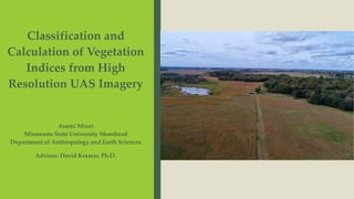
  • 1. Asami Minei Minnesota State University Moorhead Department of Anthropology and Earth Sciences Advisor: David Kramar, Ph.D. Classification and Calculation of Vegetation Indices from High Resolution UAS Imagery
  • 2. Regional Science Center (RSC) ▪ About 400 acres of tall grass prairie ▪ Located 16 miles east of Moorhead, MN ▪ 25 rare plants and animal species
  • 3. Research and Education at RSC ■ Prairie restoration project – the Minnesota Environment and Natural Resources Trust Fund (ENRTF) ■ Nutrient Network Project – Collaboration with biology department ■ Conservation programs for over 7000 students every year Interest in monitoring vegetation changes in this area
  • 4. Nutrient Network ▪ Global, collaborative project ▪ ~150 Sites ▪ Every continent ▪ Study effects of nutrient deposition
  • 5. Nutrient Network: Research Questions ■ How general is our current understanding of productivity-diversity relationships? ■ To what extent are plant production and diversity co-limited by nutrients in grasslands? ■ Under what conditions does fertilization control plant biomass, diversity, and composition?
  • 6. Project Purpose 1. Record Vegetation Change 2. Construct the Models – Non-NIR Vegetation Indices – Classification 3. Nutrient Network – Total Biomass – Plant Diversity/ Composition Fly Drone Georeferencing Vegetation Indices Total Biomass Classification Plant Diversity
  • 7. Process and the Focal Models Fly Drone Georeferencing Non-NIR Vegetation Indices Total Biomass Classification Plant Diversity
  • 8. Data Collection ▪ DJI Phantom 4 Advanced ▪ Every two weeks from May to Sept. ▪ At 70’ with 80% overlap and 80% sidelap Fly Drone Georeferencing Vegetation Indices Classification
  • 9. North Pond and Houston at RSC Fly Drone Georeferencing Vegetation Indices Classification
  • 11. North Pond ▪ Post – georeferenced ▪ Cell size: Less than 5mm x 5mm ▪ Detailed enough to identify a gopher mound or individual plants Fly Drone Georeferencing Vegetation Indices Classification
  • 12. NON-NIR VEGETATION INDICES Fly Drone Georeferencing Vegetation Indices Classification
  • 13. Vegetation Indices ▪ Enhancing green vegetation using mathematical equations and transformations ▪ Indicate the AMOUNT of vegetation ▪ Distinguish between soil and vegetation ▪ This study only uses RGB 𝑁𝐷𝑉𝐼 = 𝑁𝐼𝑅 − 𝑅𝐸𝐷 𝑁𝐼𝑅 + 𝑅𝐸𝐷 𝐺𝑅𝑉𝐼 = ρ𝐺𝑟𝑒𝑒𝑛 − 𝑝𝑅𝑒𝑑 ρ𝐺𝑟𝑒𝑒𝑛 + ρ𝑅𝑒𝑑 Fly Drone Georeferencing Vegetation Indices Classification
  • 14. Vegetation Indices ■ Put a imagery of the site here Fly Drone Georeferencing Vegetation Indices Classification Vegetation Indices Equations Modified Adjusted transformed soil-adjusted VI 𝐴𝑇𝑆𝐴𝑉𝐼 = a ∗ 𝐺REEN − 𝑎 ∗ 𝑅𝐸𝐷 − 𝑏 𝑎 ∗ 𝐺REEN + 𝑅𝐸𝐷 − 𝑎 ∗ 𝑏 + 𝑥(1 + 𝑎2) x= 0.08, a = 1.22,b = 0.03 Modified Visible Vegetation Index 𝑉𝑉𝐼 = 𝐿𝑜𝑔 10 1 − 𝑅 − 𝑅𝑜 𝑅 + 𝑅𝑜 + 10 1 − 𝐺 − 𝐺𝑜 𝐺 + 𝐺𝑜 + 10 1 − 𝐵 − 𝐵𝑜 𝐵 + 𝐵𝑜 + 10 Modified Global Environmental Monitoring Index 𝐺𝐸𝑀𝐼 = 𝑒𝑡𝑎 1 − 0.25 ∗ 𝑒𝑡𝑎 − 𝑝𝑅𝑒𝑑−0.125 1−𝑝𝑅𝑒𝑑 where 𝑒𝑡𝑎 = 2∗ 𝑝𝐺𝑟𝑒𝑒𝑛2−𝑝𝑅𝑒𝑑2 +1.5 ∗𝑝𝐺𝑟𝑒𝑒𝑛+0.5 ∗𝑝𝑅𝑒𝑑 𝑝𝐺𝑟𝑒𝑒𝑛+𝑝𝑅𝑒𝑑+0.5 Green Leaf Index GLI = 2 ∗ρ𝐺𝑟𝑒𝑒𝑛−𝑝𝑅𝑒𝑑 −ρ𝐵𝑙𝑢𝑒 2 ∗ρ𝐺𝑟𝑒𝑒𝑛+𝑝𝑅𝑒𝑑+ρ𝐵𝑙𝑢𝑒 VariGreen 𝑉𝐴𝑅𝐼 = 𝑝𝐺𝑟𝑒𝑒𝑛 − 𝑝𝑅𝑒𝑑 𝑝𝐺𝑟𝑒𝑒𝑛 + 𝑝𝑅𝑒𝑑 − 𝑝𝐵𝑙𝑢𝑒 Green-Red Vegetation Index 𝐺𝑅𝑉𝐼 = ρ𝐺𝑟𝑒𝑒𝑛 − 𝑝𝑅𝑒𝑑 ρ𝐺𝑟𝑒𝑒𝑛 + ρ𝑅𝑒𝑑
  • 17. Vegetation Indices: Outputs 2018 Fly Drone Georeferencing Vegetation Indices Classification
  • 21. Comparison of VVI and GLI VVI GLI
  • 24. Classification ▪ Process of sorting entities into groups ▪ Groups ▪ Healthy Plant ▪ Unhealthy Plant ▪ Bare ground Unhealthy Bare Ground Healthy Fly Drone Georeferencing Vegetation Indices Classification
  • 25. Two Classifications Classification Type Classification Tools Unsupervised Classification (Software Analysis) Iterative Self-Organizing (ISO) cluster unsupervised classification Object-Oriented Supervised Classifications (Training Samples) Maximum likelihood classification Fly Drone Georeferencing Vegetation Indices Classification True Color Mosaic/ Segment Mean Shift Before Reclassification
  • 26. ISO North Pond, 2018 Fly Drone Georeferencing Vegetation Indices Classification
  • 27. ISO Houston, 2018 Fly Drone Georeferencing Vegetation Indices Classification
  • 28. ISO North Pond, 2019 Fly Drone Georeferencing Vegetation Indices Classification
  • 29. ■ f Fly Drone Georeferencing Vegetation Indices Classification
  • 30. ISO Houston, 2019 ■ f Fly Drone Georeferencing Vegetation Indices Classification
  • 31. True Color Segment Mean Shift True Color Mosaic/ Segment Mean Shift Less Heterogeneity More Heterogeneity
  • 32. Future Project ■ Classify down to Individuals – Goldenrods – Gopher mounts – Possibly Anything!
  • 33. Conclusion/ Discussion ■ Vegetation Indices – Non-Nir Vegetation Indicies – Availability of Drone work – Total Biomass Estimation ■ Classification – Unsupervised > Supervised – Plant Diversity/ Composition ■ Regional Science Center and NutNet – Continue Collecting Data for Monitoring
  • 34. Acknowledgements ■ Department of Anthropology and Earth Sciences – Dr. David Kramar – Dr. Karl Lenard – Yoko Kosugi ■ Department of Biological Sciences – Dr. Alison Wallace – Andie Wood – Patrice Delaney ■ Casey Coombs ■ Nafisa Mahabub