News Release: Lakeland Resources Reports Uranium Values at the Gibbons Creek Property, Athabasca Basin, Saskatchewan, Canada
•
0 likes•428 views

Lakeland Resources Inc. (TSXv: LK) provides an exploration update for its Phase 1 drill program at the Gibbons Creek / Star Properties in the Athabasca Basin in northern Saskatchewan.

Recommended
Recommended
More Related Content
What's hot
What's hot (20)
Viewers also liked
Viewers also liked (12)
Similar to News Release: Lakeland Resources Reports Uranium Values at the Gibbons Creek Property, Athabasca Basin, Saskatchewan, Canada
Similar to News Release: Lakeland Resources Reports Uranium Values at the Gibbons Creek Property, Athabasca Basin, Saskatchewan, Canada (20)
More from Lakeland Resources Inc. (TSXv: LK)
More from Lakeland Resources Inc. (TSXv: LK) (20)
Recently uploaded
Recently uploaded (20)
News Release: Lakeland Resources Reports Uranium Values at the Gibbons Creek Property, Athabasca Basin, Saskatchewan, Canada
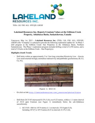
- 1. TSXv: LK FSE: 6LL OTCQX: LRESF Lakeland Resources Inc. Reports Uranium Values at the Gibbons Creek Property, Athabasca Basin, Saskatchewan, Canada Vancouver, May 1st, 2015 – Lakeland Resources Inc. (TSXv: LK; FSE: 6LL; OTCQX: LRESF) (the “Company”) is pleased to provide the following exploration update for its Phase 1 drill program at the Gibbons Creek/ Star Properties in the Athabasca Basin, Northern Saskatchewan. The Phase 1 exploration program included drilling a total of 2,550 metres, and a total of 14 holes at the Gibbons Creek – Star Property(s). Highlights (South Trend): - Drill holes within an approximately 2 to 3 km long coincident Resistivity Low – Gravity Low trend returned strongly anomalous radioactivity and pathfinder geochemistry (B, Co, Cu, Ni); Figure 1: GC15-03 - Or click on link http://lakelandresources.com/_resources/photos/figure - Drill Hole GC15-03 intersected 0.13% U3O8 over 0.23 metres, within a 1.1 metre interval of 333.8 ppm Uranium (see Figure 1) immediately below the sub-Athabasca unconformity. o GC15-03: 106.8 to 107.9 metres (1.1 m interval): 333.8 ppm U3O8 Including 107.67 to 107.9 metres (0.23 m interval): 0.13% U3O8
- 2. TSXv: LK FSE: 6LL OTCQX: LRESF o Uranium enrichment, strong hydrothermal alteration and pathfinder geochemistry (B, Co, Ni) was noted lower in hole GC15-03, between 106.8 m to 133.0 m depth; - Two holes were completed to the north and south of hole GC15-03, in order to follow up on the promising results, both returned anomalous uranium within basement lithologies: o GC15-04: 114.2 to 115.2 metres (1.0 m interval): 86.7 ppm U3O8 o GC15-11: 103.4 to 105.5 metres (2.1 m interval): 123.3 ppm U3O8 - Drill Hole GC15-02, collared near historic drill hole GC-15 (0.18% U3O8 over 0.13 metres) returned: o GC15-02: 101.0 to 102.0 metres (1.0 m interval): 120.3 ppm U3O8 - Drill hole GC15-10, at the eastern end of the South Zone, returned a strong illite clay alteration assemblage from the unconformity (80.9 m) to 148 metres depth. This interval corresponds to a zone of strong ductile shearing and local brittle-ductile cataclastic brecciation. Highlights (Center Zone): - One drill hole was completed at the center zone where a recent Radon-Ex Survey showed some of the strongest land-based radon values (9.93 pCi/m2/sec) known from the Athabasca Basin; - Drill hole GC15-06 encountered strongly altered basement lithologies (see Figure 2) including strongly hematized-quartz-carbonate-chlorite alteration / brecciation. Highly anomalous geochemical pathfinders were noted throughout the hole, including a zone of uranium enrichment from approximately 41 m to 109.5 m depth. Elevated Boron approximately 6 metres below the unconformity: 52.8 to 56.7 metres (3.9 m interval) of 1,213 ppm B; was noted within a wider zone of anomalous Boron from 41 to 72.8 m. Highly anomalous Ni (up to 0.19%) and Co were noted within this hole.
- 3. TSXv: LK FSE: 6LL OTCQX: LRESF Figure 2: GC15-06 Or click on link http://lakelandresources.com/_resources/photos/figure2 “Given the early stage of exploration at Gibbons Creek, results obtained from this first round of drilling are very encouraging. The geochemical, clay and alteration results are suggestive of a nearby basement hosted or unconformity hosted uranium occurrence. As such, we are in the process of planning follow-up exploration, which will include further drilling in the vicinity of the South Trend and proximal to Hole GC15-06. Lakeland will have multiple exploration programs ongoing in and around the Athabasca Basin this summer and fall, which should provide for an exciting year.” Stated Jonathan Armes, President of Lakeland Resources. Within the vicinity of hole GC15-06 only limited historic electromagnetic data and modern ground gravity and IP Resistivity data was available for assisting in drill hole selection. As such, the company is in the process of contracting an airborne EM survey near the eastern margins of the Gibbons and Star properties. Concurrent with the airborne work, a program of ground gravity will be completed to expand the existing survey at the South Trend, and which will be utilized to identify areas of strong basement alteration. Further Radon-Ex work is also planned
- 4. TSXv: LK FSE: 6LL OTCQX: LRESF to follow up on the anomalous values from the 2013 survey. Further information will be forth coming as the work progresses. Star Drill holes: No significant gold or PGE elements were recovered from any of the three drill holes on the target. All intersections are down-hole, core interval measurements and true thickness is yet to be determined. The uranium values above, where reported, are by the ICP-MS (partial digestion) method. Split core samples were recovered though intervals of anomalous radioactivity or sulphide content, and were submitted to Activation Laboratories Ltd. (“Actlabs”) of Ancaster, Ontario. Composite samples were collected systematically throughout the sandstone in order to assess the geochemical profile above the sub-Athabasca unconformity. Actlabs is an ISO Certified Laboratory, and independent of the issuer. All samples were analyzed with a 39-element “partial digestion” with ICP-MS/ICP-OES analysis; and a 49-element “total digestion” with ICP- MS/ICP-OES analysis; and boron. Basement samples were tested for Au, Pt, Pd with the 1C- OES-Exploration method Fire Assay. PIMA samples were also collected systematically throughout the sandstone and basement in order to assess the clay alteration minerals. Updated maps and photos can be found on the Company's website at: http://lakelandresources.com/projects/gibbons-creek/
- 5. TSXv: LK FSE: 6LL OTCQX: LRESF Or click on link http://lakelandresources.com/_resources/photos/gibbonsmap NI 43-101 Disclosure The technical information above has been prepared in accordance with the Canadian regulatory requirements set out in National Instrument 43-101 and reviewed on behalf of the company by Neil McCallum, P.Geo., of Dahrouge Geological Consulting Ltd., a qualified person. Historic drill hole GC-15 results were disclosed by Eldorado Nuclear and are considered to be reliable by management; that information is publicly available. A qualified person has not done sufficient work to directly verify the historic results.
- 6. TSXv: LK FSE: 6LL OTCQX: LRESF About Lakeland Resources Inc. Lakeland Resources Inc. is a uranium and mineral exploration company focused on the Athabasca Basin in Saskatchewan, Canada, home to some of the world’s largest and richest high- grade uranium deposits. The Company is well funded to carry out its near term exploration programs. For more information, please visit the corporate website at http://www.lakelandresources.com or contact Roger Leschuk, Corporate Communications at Ph: 604.681.1568 or TF: 1.877.377.6222 or email: roger@lakelandresources.com On Behalf of the Board of Directors LAKELAND RESOURCES INC. “Jonathan Armes” Jonathan Armes President, CEO and Director Cell: 416.708.0243 Ph: 604.681.1568 TF: 1.877.377.6222 Email: jarmes@lakelandresources.com Web: http://www.lakelandresources.com Neither TSX Venture Exchange nor its Regulation Services Provider (as that term is defined in the policies of theTSX Venture Exchange) accepts responsibility for the adequacy or accuracy of this release. Statements in this document which are not purely historical are forward-looking statements, including any statements regarding beliefs, plans, expectations or intentions of our management. Forward looking statements in this news release include, but are not limited to all references to follow-up exploration such as future drilling, EM surveys and ground gravity surveys; suggestions of a nearby basement hosted or unconformity hosted uranium occurrence and references to multiple exploration programs. It is important to note that actual outcomes and the Company's actual results could differ materially from those in such forward- looking statements. Risks and uncertainties include economic, competitive, governmental, environmental and technological factors that may affect the Company's operations, markets, products and prices. Factors that could cause actual results to differ materially may include misinterpretation of data; we may not be able to get equipment or labour as we need it; we may not be able to raise sufficient funds to complete our intended exploration and development; our applications to drill may be denied; weather, logistical problems or hazards may prevent us from exploration; equipment may not work as well as expected; analysis of data may not be possible accurately and at depth; results which we or others have found in any particular location are not necessarily indicative of larger areas of our properties; we may not complete environmental programs in a timely manner or at all; market prices may not justify commercial production costs; and that despite encouraging data there may be no commercially exploitable mineralization on our properties. We assume no responsibility to update these forward looking statements except as required by law.