
Recommended
Recommended
More Related Content
What's hot
What's hot (19)
Viewers also liked
Viewers also liked (18)
Similar to Group Project to Design Water Infrastructure for a Theoretical Small Town.
Similar to Group Project to Design Water Infrastructure for a Theoretical Small Town. (20)
Recently uploaded
Recently uploaded (20)
Group Project to Design Water Infrastructure for a Theoretical Small Town.
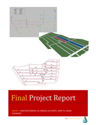
- 1. JAG – Water & Sewage Inc. GROUP E - JONATHAN DAMORA, JAY JIMENEZ, ALEX WAITE, JENNY YU, GANAA ZAGDBAZAR Final Project Report
- 2. TABLE OF CONTENTS JAG – Water & Sewage Inc. Acknowledgement Although this project required good amount of hard work, research, and dedication, it has given us a great opportunity to apply our technical knowledge to practical scenario. We believe we have completed the given assignments correctly to best of our abilities. Still, the project would not have been possible if we did not have the support of our Professor and fellow students of CE 465. First of all, we are thankful to Professor Chun Wang for providing us with the necessary background and guidance concerning the assignment. We are also grateful to our fellow students who are working on the same project. Their effort motivated us to work even harder. ACKNOWLEDGEMENT
- 3. TABLE OF CONTENTS JAG – Water & Sewage Inc. Contents Table of Figures: __________________________________________________________________________________ 1 Table of Tables: ___________________________________________________________________________________ 2 Section 1 - Executive Summary____________________________________________________________________ 3 Section 2 - Background____________________________________________________________________________ 4 Section 3 - Project Site Analysis ___________________________________________________________________ 5 Section 4 - Water Distribution System Design _____________________________________________________12 Sanitary Sewer Design ____________________________________________Error!Bookmarknotdefined. __________________________________________________________________________________________________27 Section 6 - Storm Drain Design ___________________________________________________________________30 Section 7 - References____________________________________________________________________________33 __________________________________________________________________________________________________35 Name of Section (If needed)______________________________________________________________________37
- 4. TABLE OF CONTENTS JAG – Water & Sewage Inc.
- 5. TABLE OF FIGURES5 Page 1 JAG – Water & Sewage Inc. Table of Figures Figure 1. Dimensions of Each Block........................................................................................................................................5 Figure 2. Square footage of each block...................................................................................................................................6 Figure 3. Potable pipeline length and name .........................................................................................................................7 Figure 4. Complete flow network as drawn in EPANET 2.0 for model small community ..................................... 12 Figure 5. Water Distribution System, Scenario 1 Results with Color Coding............................................................ 17 Figure 6. Water Distribution System, Scenario 2 Results with Color Coding............................................................ 21 Figure 7. Scenario 3 pump curve .......................................................................................................................................... 22 Figure 8. Water Distribution System, Scenario 3 Results with Color Coding............................................................ 25 Figure 9. Sanitary Sewer System Map and Labels, Blue dots are manholes, dashed lines are pipes.................. 27
- 6. TABLE OF TABLES:5 Page 2 JAG – Water & Sewage Inc. Table of Tables: Table 1. Areas and Populations of each Section...................................................................................................................9 Table 2. Commercial Zone B Establishments and Flow Demands ............................................................................... 10 Table 3. Commercial Zone C Establishments and Flow Demands ............................................................................... 10 Table 4. Industrial Zone A establishment and flow demands ....................................................................................... 11 Table 5. Scenario 1 Node Network Table............................................................................................................................ 15 Table 6. Scenario 1 Link Network Table ............................................................................................................................. 16 Table 7. Scenario 2 Node Network Table............................................................................................................................ 19 Table 8. Scenario 2 Link Network Table ............................................................................................................................. 21 Table 9. Scenario 3 Node Network Table............................................................................................................................ 23 Table 10. Scenario 3 Link Network Table........................................................................................................................... 25 Table 11. Important Design Information for the Sanitary Sewer System. ................................................................. 29 .
- 7. SECTION 1 - EXECUTIVE SUMMARY5 Page 3 JAG – Water & Sewage Inc. Section 1 - Executive Summary Water conveyance, sanitary sewer, and storm drain systems are essential systems required in modern cities. Clean, potable water delivered directly to consumers’ homes and businesses is not only a necessity but is expected to be consistently reliable. In the same way, waste water must be conveyed away from consumers to treatment plants, and storm drains must protect cities from flooding without fail. These three systems, when designed correctly, facilitate a healthy living environment for people and businesses to thrive. The purpose of this project is to design water conveyance, sanitary sewer, and storm drain systems for the model small community shown in Figure 1. The designs are based on assumptions given in the project problem statement as well as general engineering practices as discussed in [***]. In order to design these systems, the demand was found for each block based on the population for the domestic areas or the type of commercial and industrial uses for zones A, B, and C. The basis for the demand calculations are discussed in Section ***. This demand is subsequently used in the water distribution design and sanitary sewer design. The storm drain system is designed using rainfall intensity analysis for the project area. The water distribution system design is shown in Section ***, sanitary sewer design in Section ***, and storm drain in Section ***. Methods for designing these systems are discussed in their respective sections.
- 8. SECTION 2 - BACKGROUND5 Page 4 JAG – Water & Sewage Inc. Section 2 - Background As shown in Figure *** and stated in [***], the river located in the most north-eastern section of the community serves as the community’s water source. The water from this river is treated by a water treatment plant previously designed and operating currently with sufficient capacity to meet the demand of the small community. The treatment plant treats the water to US EPA’s drinking water standards using standard treatment processes (i.e. aeration, sedimentation, filtration, and chlorination). Treated water is then distributed to two storage tanks (see Figure 4): an elevated storage tank located in the upper left area above Ash St. (⊗1) and an underground storage reservoir located in the upper right area above Highland St. (⊗2). These storage tanks serve as the sole distribution centers for the community.
- 9. SECTION 3 - PROJECTSITE ANALYSIS5 Page 5 JAG – Water & Sewage Inc. Section 3 - Project Site Analysis The distance of each block was obtain by scaling the map provided into AutoCad thus allowing for the length to be determine to accurate distance within 5 feet. These measurements are required, for later, to determine the number of fire hydrants, shutoff valves, etc. per block. Figure 1. Dimensions of Each Block
- 10. SECTION 3 - PROJECTSITE ANALYSIS5 Page 6 JAG – Water & Sewage Inc. Acreage and Population As shown in Section ***, the acreage for each residential, commercial, and industrial zone is estimated using CAD imaging software. Population for the residential zones is based on the assumption of 40 persons/acre for residential zones. Table *** displays the size of the residential zones is square feet and acres and tabulates the population by: Population = acres x 40 persons/acre This population is then used to determine the demand. Demand Daily Average, Daily Maximum, and Hourly Maximum Demand was calculated using several assumptions. The average daily unit consumption is 100 gpcd (gallons per capita per day). This assumption is exclusive to the residential areas. The maximum day’s consumption is 200% of average daily consumption, and the maximum hour’s consumption is 400% of average daily consumption. The industrial zone, Zone A, has a process consumption of 2000 gpm for 8 hours a day on working days, and no water consumption is Figure 2. Square footage of each block
- 11. SECTION 3 - PROJECTSITE ANALYSIS5 Page 7 JAG – Water & Sewage Inc. required for the remainder of the day. Peak hourly consumption for Zone A in any hour’s time is 3000 gpm. Using the assumptions and the population estimations for residential zones, the demand is tabulated in Table 1. The above figure shows the length and name of each pipeline. The pipelines will run parallel to the street and at the center of the street. Moreover, the water distribution pipeline will be placed above any sewage or storm water pipelines thus eliminating any cross contamination between the water distribution system and the sewage/storm water system. The offset will not only be in the vertical direction but also in the horizontal direction with a minimum of three feet. Figure 3. Potable pipeline length and name
- 12. SECTION 3 - PROJECTSITE ANALYSIS5 Page 8 JAG – Water & Sewage Inc. Given design criteria suggest we should use 40 persons per acre for domestic population density. Since we have the area, we can now calculate the population using following equation. Population=[persons/acre]*A[acre] where =40 persons/acre Keep in mind that the population density is given in acres and areas found in square feet, so Table 1: Area and Residential Population Area [sf] Area [acres] Population [persons] 1 195144 4.48 179 2 20521 0.471 19 3 2986 0.069 3 4 322453 7.403 296 5 178598 4.1 164 6 178009 4.087 163 7 326350 7.492 300 8 282199 6.478 259 9 293441 6.736 269 10 276223 6.341 254 11 109273 2.509 100 12 13079 0.3 12 13 30755 0.706 28 14 50103 1.15 46 15 103394 2.374 95 16 205108 4.709 188 17 94220 2.163 87 18 38826 0.891 36 19 137661 3.16 126 20 178451 4.097 164 21 145019 3.329 133
- 13. SECTION 3 - PROJECTSITE ANALYSIS5 Page 9 JAG – Water & Sewage Inc. 22 255279 5.86 234 23 21062 0.484 19 24 39618 0.91 36 25 41762 0.959 38 26 30445 0.699 28 27 55565 1.276 51 28 33972 0.78 31 A 165396 3.797 152 Sum 3824912 87.808 3512 Table 1. Areas and Populations of each Section Commercial and Industrial Zones Commercial Demand Commercial demand is based on a series of parameters based on the type of commercial use [http://buildingsdatabook.eren.doe.gov/TableView.aspx?table=8.3.2]. The following calculations for Zone B and C use several assumptions. The square footage of each establishment is arbitrarily determined, and the number of seats or rooms in the case of the restaurants and hotel are chosen relative to the square footage of the establishment. The gallon per parameter requirements are chosen from (http://buildingsdatabook.eren.doe.gov/TableView.aspx?table=8.3.2), the following commercial establishments have been chosen along with their respective daily flow rates. The water demands for these establishments in Zone B and Zone C along with the total demand for each zone is displayed in Table *** and ***, respectively: Zone B: Restaurant 1 - 6000 sq ft, 153 seats x 24 gal/seat/day = 3672 gpd Restaurant 2 - 3000 sq ft, 110 seats x 21 gal/seat/day = 2310 gpd Restaurant 3 - 9000 sq ft, 230 seats x 30 gal/seat/day = 6900 gpd Hotel - 100,000 sq ft, 180 rooms x 45,000 gal/room = 25400 gpd Supermarket - 66000 sq ft x 50.75gal/sq ft = 9176 gpd
- 14. SECTION 3 - PROJECTSITE ANALYSIS5 Page 10 JAG – Water & Sewage Inc. Establishment Average Daily Use (gpd) Max Daily Use (gpd) Fire Demand (gpm) Hrs for flow (hr) Fire Demand (mgd) Max Daily + Fire Demand (mgd) Max Hourly Use (mgd) Hotel 25400 50800 3500 3 5.04 5.09 0.102 Supermarket 9177 18353 2750 2 3.96 3.98 0.037 Restaurant 1 3672 7344 1500 2 2.16 2.17 0.015 Restaurant 2 2310 4620 1500 2 2.16 2.16 0.009 Restaurant 3 6900 13800 1500 2 2.16 2.17 0.028 Total: 47459 94917 10750 15.48 15.57 0.190 Table 2. Commercial Zone B Establishments and Flow Demands Zone C: Office building/warehouse - 45,460 sq ft x 35 gal/sq ft/year = 1.591 mgpy = 4359 gpd Hospital - 51 gal/sq ft x 75,369 sq ft = 10531 gpd Establishment Average Daily Use (gpd) Max Daily Use (gpd) Fire Demand (gpm) Hrs for flow (hr) Fire Demand (mgd) Max Daily + Fire Demand (mgd) Max Hourly Use (mgd) Hospital 10531 21062 3750 3 5.40 5.42 0.0421 Office Building / Warehouse 4359 8718 3750 3 5.40 5.41 0.0174 Total: 14890 29780 7500 10.8 10.83 0.0596 Table 3. Commercial Zone C Establishments and Flow Demands
- 15. SECTION 3 - PROJECTSITE ANALYSIS5 Page 11 JAG – Water & Sewage Inc. Industrial Demand Concrete and ceramic manufacturing and storage will be our choice of industry, as these have relatively low fire demands. The data for demand was calculated using the population density times per capita industrial usage plus the daily 8 hour demand of 2000 gpm avg. To calculate our required demand spread across all the nodes that feed the industrial area, we take that average demand plus 10 hrs of fire demand. The fire demand was calculated to be 6000 gpm, since our products are non-combustible and the buildings will be made of relatively non- combustible materials besides any offices present. The average daily demand is 0.9611 mgd. The max daily demand is 1.9222 mgd, and when added to the demand from a 10 hour fire at 6000 gpm equals 5.52 mgd. This is compared to a maximum daily demand of 4.32 mgd using the peak hourly rate of 3000 gpm. We must design for the highest value of 4.5617 million gallons per day. This will be spread across 6 nodes, 4 along Elm St. and 2 along Birch Ave. Leaving a demand for each node of 0.76 mgd. This is in addition to any residential areas served by these nodes. Establishment Average Daily Use (gpd) Max Daily Use (gpd) Fire Demand (gpm) Hrs for flow (hr) Fire Demand (mgd) Max Daily + Fire Demand (mgd) Max Hourly Use (mgd) Concrete Factory 960000 1920000 6000 4 8.64 10.56 4.32 Table 4. Industrial Zone A establishment and flow demands Fire Demand Fire demands are calculated using [http://ecodes.biz/ecodes_support/free_resources/idaho09/PDFs/Appendix%20B%20-%20Fire- Flow%20Requirements.pdf]. The highest fire demand comes from the industrial zone so the fire demand is based off of this value. Table *** displays the total demands for the residential and commercial zones and the industrial zone. As shown in the table, the maximum daily demand plus fire demand is greater than the maximum hourly demand. Therefore the maximum daily demand plus fire demand is used in the water distribution and sanitary sewer designs.
- 16. SECTION 4 - WATER DISTRIBUTIONSYSTEM DESIGN5 Page 12 JAG – Water & Sewage Inc. Section 4 - Water Distribution System Design Using the demand calculated in Section *** and as shown in Table *** for maximum day and fire flow, a water distribution system was designed. The demand for each block is separated into the demand for each node. First, using Figure 3, the number of nodes serving each block is entered into Column 6. The demand per node is entered into Col. 7 by dividing Col. 4 by Col. 6. The node number is entered into Col. 8, and the blocks that node services is entered into Col. 9. The serviced blocks are chosen by the blocks surrounding that node. The demand on each node is then entered into Col. 10 by adding the demand per node in Col. 7 based on the blocks serviced by that node in Col. 9. The demand is then converted to gpm (gallons per minute) and entered into Col. 11. The flow network is then created from the demand per node. Figure 4. Complete flow network as drawn in EPANET 2.0 for model small community The free software EPANET 2.0 is used to create the flow network as shown in Figure 4. The software utilizes the Hazen-Williams Formula coupled with the Hardy Cross method to determine the flow and velocity in each pipe and the pressure at each node. The Hazen- Williams Formula is as follows: Q = 0.432CD2.63S0.54 (flowing full equation) o where Q = flow (gpm)
- 17. SECTION 4 - WATER DISTRIBUTIONSYSTEM DESIGN5 Page 13 JAG – Water & Sewage Inc. D = pipe diameter (ft) S = slope (ft/ft) C = pipe roughness coefficient Pipe Pressure Requirements As part of the requirements, the pipe network must be closed. The maximum permissible pressure is 70 psi, minimum permissible pressure is 20 psi, and the minimum on average day is 35 psi. Pipe Materials and Roughness Pipe materials are determined based on required diameter. For pipe diameters of 14” thru 36” in diameter, polyvinyl chloride (PVC) pipe per AWWA C-905, DR-18, is used. For pipe diameters of 4” thru 12” in diameter, polyvinyl chloride (PVC) pipe, Class 150 or 200 per AWWA C-900, is used. The Hazen-Williams roughness coefficient for these pipes is C = 140. This value is used in the equation discussed in Section ***. Flow Network Scenario - Background To determine the best design based on the worst case scenario indicating the least available storage and flow distribution, three different scenarios are run for the flow network. First, the elevated storage acts as the only source of water in the network due to an offline pump. The second scenario is the line connected to the elevated storage is disconnected, and the underground reservoir connected to the pumping station is sole water source. The third scenario consists of both the elevated and underground reservoirs acting as the water sources. The scenario exhibiting the worst results (i.e. the worst case scenario) is chosen as the design system. Results for the three scenarios can be found in Appendix A. Scenario 1 In Scenario 1, the pump connected to the underground reservoir is offline, and the elevated storage acts as the sole water source. Using Figure 5 as a reference, the height and volume for the elevated storage is calculated as follows using the demand found in Table 5. Design Requirements For a given velocity range of V = 8-10 fps, the nomograph gives a diameter D = 20 – 26” for line RR and a max headloss of hL= 20 ft/1000 ft. Minimum pressure at Node 29 = 35 psi. Therefore, minimum pressure head at Node 29 = 35 psi * 2.31 ft/psi = 80.9 ft. Minimum elevation head at elevated storage tower 34 using a pipe length of 175 ft for line RR is: ( 𝑦−80.9) 0.175 = 20 𝑓𝑡 gives y = 84.4 ft. To ensure a design pressure at all nodes of 50 psi, the height of the elevated storage is calculated as: 50 psi * 2.31 ft/psi = 115.5 ft
- 18. SECTION 4 - WATER DISTRIBUTIONSYSTEM DESIGN5 Page 14 JAG – Water & Sewage Inc. ( 𝑦−115.5) 0.175 = 20 𝑓𝑡 gives y = 119 ≈ 120 ft. Storage Dimensions For a given daily demand of 11.4 MGD, the volume of the elevated storage reservoir is calculated as follows: 𝑉𝑜𝑙𝑢𝑚𝑒 ( 𝑀𝐺) = 11.4 𝑀𝐺𝐷 ∗ 24 24 ℎ𝑟𝑠 𝑜𝑓 𝑜𝑝𝑒𝑟𝑎𝑡𝑖𝑜𝑛 𝑎 𝑑𝑎𝑦 = 11.4 𝑀𝐺 𝑉𝑜𝑙𝑢𝑚𝑒 ( 𝑓𝑡3) = 11.4 𝑀𝐺 ∗ 0.1337 𝑓𝑡3 1 𝑔𝑎𝑙 = 1.524 ∗ 106 𝑓𝑡3 For a standard storage height of 130 ft [*****]: 𝐷𝑖𝑎𝑚𝑒𝑡𝑒𝑟 ( 𝑓𝑡) = √(1.524 ∗ 106 𝑓𝑡3) ∗ ( 4 𝜋 )/130𝑓𝑡 = 122 𝑓𝑡 Scenario 1 - Results Results from EPANET 2.0 after running the flow analysis are shown for the nodes in Table 5 and for the pipes in Table 6. A color coded display of the flow network is shown in Figure 5 which shows the pressures at each node and flows in each pipe. Scenario 1 Network Table - Nodes Demand Head Pressure Node ID GPM ft psi Junc 29 23.24 119.44 51.75 Junc 28 14.07 118.95 51.54 Junc 27 15.46 118.91 51.52 Junc 19 19.92 118.69 51.43 Junc 18 35.69 118.68 51.43 Junc 26 36.44 118.07 51.16 Junc 30 29.25 118.11 51.18 Junc 25 1482.21 118.01 51.14 Junc 31 1475.76 117.94 51.1 Junc 23 1474.69 117.92 51.1 Junc 22 13.97 117.91 51.09 Junc 33 16.51 117.75 51.02 Junc 32 25.37 117.77 51.03 Junc 3 9.01 117.74 51.02 Junc 8 8.26 117.74 51.02 Junc 7 23.18 117.74 51.02 Junc 12 1488.51 117.74 51.02
- 19. SECTION 4 - WATER DISTRIBUTIONSYSTEM DESIGN5 Page 15 JAG – Water & Sewage Inc. Junc 24 1471.46 117.75 51.02 Junc 21 10.74 117.78 51.04 Junc 20 10.95 117.78 51.04 Junc 11 1476.06 117.73 51.01 Junc 16 17.78 117.84 51.06 Junc 15 23.98 117.93 51.1 Junc 17 28.61 117.99 51.12 Junc 4 18.21 117.74 51.01 Junc 1 23.8 117.74 51.02 Junc 2 8.2 117.74 51.02 Junc 5 8.29 117.74 51.02 Junc 6 14.4 117.74 51.02 Junc 9 15.85 117.74 51.02 Junc 10 10.83 117.74 51.02 Junc 13 14.12 117.83 51.06 Junc 14 9.87 117.84 51.06 Resvr 34 -9354.69 120 0 Tank 35 0 120 43.33 Table 5. Scenario 1 Node Network Table Scenario 1 Network Table - Links Length Diameter Roughness Flow Velocity Unit Headloss Friction FactorLink ID ft in GPM fps ft/Kft Pipe SS 262 18 140 2639.18 3.33 1.85 0.016 Pipe TT 303 18 140 695.52 0.88 0.16 0.02 Pipe UU 276 12 140 564.9 1.6 0.77 0.019 Pipe VV 259 12 140 106.84 0.3 0.04 0.025 Pipe JJ 110 12 140 -376.69 1.07 0.36 0.02 Pipe KK 91 28 140 6286.33 3.28 1.07 0.015 Pipe LL 124 24 140 2999.51 2.13 0.58 0.016 Pipe MM 59 28 140 3453.34 1.8 0.35 0.016 Pipe NN 191 12 140 147.34 0.42 0.06 0.023 Pipe OO 1101 28 140 6692.27 3.49 1.2 0.015 Pipe PP 976 18 140 1929.59 2.43 1.04 0.017 Pipe QQ 844 6 140 -115.16 1.31 1.18 0.022 Pipe XX 290 12 140 -128.3 0.36 0.05 0.024 Pipe AA 250 12 140 186.58 0.53 0.1 0.023
- 20. SECTION 4 - WATER DISTRIBUTIONSYSTEM DESIGN5 Page 16 JAG – Water & Sewage Inc. Pipe S 93 12 140 -6.94 0.02 0 0.027 Pipe R 183 12 140 -18.88 0.05 0 0.032 Pipe Z 264 12 140 -111.79 0.32 0.04 0.024 Pipe T 196 18 140 147.52 0.19 0.01 0.025 Pipe II 1020 12 140 340.25 0.97 0.3 0.021 Pipe BB 1219 24 140 1804.61 1.28 0.23 0.018 Pipe EE 750 24 140 1831.3 1.3 0.23 0.018 Pipe CC 405 24 140 632.65 0.45 0.03 0.021 Pipe FF 747 12 140 248.53 0.71 0.17 0.022 Pipe DD 222 12 140 -35.02 0.1 0 0.029 Pipe YY 181.69 12 140 -272.81 0.77 0.2 0.021 Pipe V 205 12 140 305.21 0.87 0.25 0.021 Pipe W 185 12 140 -351.19 1 0.32 0.021 Pipe X 181 12 140 -428.74 1.22 0.46 0.02 Pipe GG 1600 12 140 438.14 1.24 0.48 0.02 Pipe Y 312 6 140 -42.54 0.48 0.19 0.026 Pipe HH 1445 6 140 -71.15 0.81 0.48 0.024 Pipe U 219 24 140 -498.14 0.35 0.02 0.021 Pipe P 1031 6 140 27.96 0.32 0.09 0.027 Pipe O 1034 12 140 59.78 0.17 0.01 0.027 Pipe H 189 6 140 -18.09 0.21 0.04 0.029 Pipe G 233 6 140 63.75 0.72 0.39 0.024 Pipe F 218 12 140 12.86 0.04 0 0.034 Pipe E 198 28 140 -37.5 0.02 0 0.03 Pipe L 840 12 140 -22.83 0.06 0 0.03 Pipe M 840 28 140 -34.52 0.02 0 0.034 Pipe N 834 12 140 -40.05 0.11 0.01 0.028 Pipe K 840 6 140 3.68 0.04 0 0.037 Pipe D 93 28 140 29.08 0.02 0 0.054 Pipe C 132 28 140 -33.69 0.02 0 0.028 Pipe B 290 28 140 29.52 0.02 0 0.033 Pipe I 833 6 140 5.72 0.06 0 0.035 Pipe Q 297 6 140 -12.49 0.14 0.02 0.031 Pipe J 834 18 140 71.41 0.09 0 0.027 Pipe RR 175 26 140 -9354.69 5.65 3.21 0.014 Pump 1 #N/A #N/A #N/A 0 0 0 0 Table 6. Scenario 1 Link Network Table
- 21. SECTION 4 - WATER DISTRIBUTIONSYSTEM DESIGN5 Page 17 JAG – Water & Sewage Inc. Figure 5. Water Distribution System, Scenario 1 Results with Color Coding Scenario 2 In Scenario 2, the line connected to the elevated storage is disconnected, and the pump connected to the underground reservoir acts as the sole water source for the community. The reservoir volume and pump gpm, TDH, and BHP are calculated as follows: Design Requirements Variable Speed Pump Using a variable speed pump, which allows for the pump to deliver the full flow for the town as well as any load less than such, the total dynamic head (TDH) for the pump is equivalent to the head required for the elevated storage tower. Therefore, TDH = 120 ft. The pump curve is shown in Figure 6.
- 22. SECTION 4 - WATER DISTRIBUTIONSYSTEM DESIGN5 Page 18 JAG – Water & Sewage Inc. Figure 6. Scenario 2 Pump Curve Brake horsepower is calculated as follows assuming pump efficiency of η = 0.75: 𝐵𝐻𝑃 = 100𝑄( 𝑇𝐷𝐻)∗𝑆.𝐺. 3960 ∗𝜂 = 100 ∗9355 𝑔𝑝𝑚 ∗120𝑓𝑡∗1.0 3960 ∗0.75 = 37800 𝐵𝐻𝑃 . Watts required and the KWh for this pump for a 24 hr day is then calculated as: 𝑊𝑎𝑡𝑡𝑠 = 𝐵𝐻𝑃 ∗ 746 = 37800 ∗ 746 = 28200𝐾𝑊 𝐾𝑊ℎ = 28200𝐾𝑊 ∗ 24 ℎ𝑟 = 677000 𝐾𝑊ℎ Assuming a rate of $0.05/KWh, the total cost per day, month and year of pump operation is as follows: 𝐶𝑜𝑠𝑡 ($) = 677000𝐾𝑊ℎ ∗ $0.05 𝐾𝑊ℎ = $33,850.00 𝑑𝑎𝑦 = $1,015,500 𝑚𝑜𝑛𝑡ℎ = $12,186,000 𝑦𝑒𝑎𝑟 Storage Dimensions The underground reservoir’s bottom sits at 120 ft bgs (below ground surface) with a maximum height of 140 ft and a diameter of 130 ft. The necessary volume for the reservoir is equal to the necessary volume of the elevated storage as shown in Section ***. Scenario 2 - Results Results from EPANET 2.0 after running the flow analysis are shown for the nodes in Table 7 and for the pipes in Table 8. A color coded display of the flow network is shown in Figure 7 which shows the pressures at each node and in each pipe. Scenario 2 Network Table - Nodes Demand Head Pressure Node ID GPM ft psi Junc 29 23.24 117.48 50.9 Junc 28 14.07 117.48 50.9 Junc 27 15.46 117.48 50.9 Junc 19 19.92 117.49 50.91 Junc 18 35.69 117.49 50.91 Junc 26 36.44 117.54 50.93 Junc 30 29.25 117.48 50.9
- 23. SECTION 4 - WATER DISTRIBUTIONSYSTEM DESIGN5 Page 19 JAG – Water & Sewage Inc. Junc 25 1482.21 117.48 50.9 Junc 31 1475.76 117.46 50.9 Junc 23 1474.69 117.46 50.9 Junc 22 13.97 117.48 50.9 Junc 33 16.51 118.47 51.33 Junc 32 25.37 118.16 51.2 Junc 3 9.01 118.77 51.46 Junc 8 8.26 118.38 51.29 Junc 7 23.18 118.14 51.19 Junc 12 1488.51 117.95 51.11 Junc 24 1471.46 117.56 50.94 Junc 21 10.74 117.57 50.94 Junc 20 10.95 117.64 50.97 Junc 11 1476.06 117.74 51.02 Junc 16 17.78 117.64 50.97 Junc 15 23.98 117.61 50.96 Junc 17 28.61 117.54 50.93 Junc 4 18.21 119.02 51.57 Junc 1 23.8 120 52 Junc 2 8.2 119.37 51.72 Junc 5 8.29 119.17 51.63 Junc 6 14.4 119.03 51.57 Junc 9 15.85 118.78 51.47 Junc 10 10.83 118.45 51.33 Junc 13 14.12 117.7 51 Junc 14 9.87 117.68 50.99 Resvr 34 0 120 0 Tank 35 -9354.69 0 52 Table 7. Scenario 2 Node Network Table Scenario 2 Network Table - Links Lengt h Diameter Roughness Flow Velocity Unit Headlos s Frictio n Factor Link ID ft in GPM fps ft/Kft Pipe SS 262 18 140 86.1 0.11 0 0.027 Pipe TT 303 18 140 -115.25 0.15 0.01 0.026 Pipe UU 276 12 140 -125.51 0.36 0.05 0.024
- 24. SECTION 4 - WATER DISTRIBUTIONSYSTEM DESIGN5 Page 20 JAG – Water & Sewage Inc. Pipe VV 259 12 140 17.75 0.05 0 0.032 Pipe JJ 110 12 140 463.7 1.32 0.53 0.02 Pipe KK 91 28 140 325.11 0.17 0 0.023 Pipe LL 124 24 140 1268.71 0.9 0.12 0.019 Pipe MM 59 28 140 -19.77 0.01 0 0 Pipe NN 191 12 140 -183.76 0.52 0.1 0.023 Pipe OO 1101 28 140 -109.34 0.06 0 0.028 Pipe PP 976 18 140 187.28 0.24 0.01 0.024 Pipe QQ 844 6 140 5.2 0.06 0 0.035 Pipe XX 290 12 140 676.88 1.92 1.07 0.019 Pipe AA 250 12 140 151.36 0.43 0.07 0.023 Pipe S 93 12 140 -1073.48 3.05 2.52 0.017 Pipe R 183 12 140 -980.02 2.78 2.13 0.018 Pipe Z 264 12 140 693.39 1.97 1.12 0.019 Pipe T 196 18 140 1871.36 2.36 0.98 0.017 Pipe II 1020 12 140 -500.14 1.42 0.61 0.02 Pipe BB 1219 24 140 -2425.81 1.72 0.39 0.017 Pipe EE 750 24 140 -1310.69 0.93 0.12 0.019 Pipe CC 405 24 140 -2639.41 1.87 0.46 0.017 Pipe FF 747 12 140 -202.93 0.58 0.12 0.022 Pipe DD 222 12 140 -356.41 1.01 0.33 0.021 Pipe YY 181.69 12 140 -142.74 0.4 0.06 0.024 Pipe V 205 12 140 -444.81 1.26 0.49 0.02 Pipe W 185 12 140 77.44 0.22 0.02 0.026 Pipe X 181 12 140 209.65 0.59 0.12 0.022 Pipe GG 1600 12 140 -163.18 0.46 0.08 0.023 Pipe Y 312 6 140 46.55 0.53 0.22 0.025 Pipe HH 1445 6 140 17.94 0.2 0.04 0.029 Pipe U 219 24 140 -3960.79 2.81 0.97 0.016 Pipe P 1031 6 140 -24.06 0.27 0.06 0.028 Pipe O 1034 12 140 -149.99 0.43 0.07 0.023 Pipe H 189 6 140 33.93 0.39 0.12 0.027 Pipe G 233 6 140 -198.04 2.25 3.22 0.021 Pipe F 218 12 140 -808.36 2.29 1.49 0.018 Pipe E 198 28 140 -6827.95 3.56 1.25 0.015 Pipe L 840 12 140 669.7 1.9 1.05 0.019 Pipe M 840 28 140 -6003.75 3.13 0.99 0.015 Pipe N 834 12 140 -599.48 1.7 0.86 0.019
- 25. SECTION 4 - WATER DISTRIBUTIONSYSTEM DESIGN5 Page 21 JAG – Water & Sewage Inc. Pipe K 840 6 140 -101.72 1.15 0.94 0.023 Pipe D 93 28 140 7512.06 3.91 1.49 0.015 Pipe C 132 28 140 -7622.06 3.97 1.53 0.015 Pipe B 290 28 140 -9216.02 4.8 2.18 0.014 Pipe I 833 6 140 114.87 1.3 1.18 0.022 Pipe Q 297 6 140 96.66 1.1 0.85 0.023 Pipe J 834 18 140 -1585.76 2 0.72 0.017 Pipe RR 175 26 140 0 0 0 0 Pump 1 #N/A #N/A #N/A 9354.69 0 -120 0 Table 8. Scenario 2 Link Network Table Figure7. Water DistributionSystem, Scenario 2 Results with Color Coding Scenario 3 In Scenario 3, both the elevated storage and the underground reservoir serve as water sources for the community. For this scenario, the elevated storage and the reservoir are splitting the demand for the small community: the elevated storage supplies 4677.5 gpm and the reservoir/pump station supplies 4677.5 gpm. Elevated Storage and Reservoir Dimensions
- 26. SECTION 4 - WATER DISTRIBUTIONSYSTEM DESIGN5 Page 22 JAG – Water & Sewage Inc. The dimensions for the elevated storage are consistent with the dimensions obtained in Section ***, and the dimensions of the underground reservoir are the same as obtained in Section ***. Pump Characteristics The TDH for the variable pump is maintained at 120 ft to supply a minimum pressure of 50 psi throughout the community. For a flow of 4677.5 gpm, the pump curve then takes the form seen in Figure 8. Figure 8. Scenario 3 pump curve Brake horsepower is calculated as follows assuming pump efficiency of η = 0.75: 𝐵𝐻𝑃 = 100𝑄( 𝑇𝐷𝐻)∗𝑆.𝐺. 3960 ∗𝜂 = 100 ∗4677.5 𝑔𝑝𝑚∗120𝑓𝑡∗1.0 3960∗0.75 = 18900 𝐵𝐻𝑃 . Watts required and the KWh for this pump for a 24 hr day is then calculated as: 𝑊𝑎𝑡𝑡𝑠 = 𝐵𝐻𝑃 ∗ 746 = 18900 ∗ 746 = 14099𝐾𝑊 𝐾𝑊ℎ = 14099𝐾𝑊 ∗ 24 ℎ𝑟 = 338400 𝐾𝑊ℎ Assuming a rate of $0.05/KWh, the total cost per day, month and year of pump operation is as follows: 𝐶𝑜𝑠𝑡 ($) = 338400𝐾𝑊ℎ ∗ $0.05 𝐾𝑊ℎ = $16,920.00 𝑑𝑎𝑦 = $507,600 𝑚𝑜𝑛𝑡ℎ = $6,091,200 𝑦𝑒𝑎𝑟 Scenario 3 - Results Results from EPANET 2.0 after running the flow analysis are shown for the nodes in Table 9 and for the pipes in Table 10. A color coded display of the flow network is shown in Figure 9 which shows the pressures at each node and in each pipe. Scenario 3 Network Table - Nodes Demand Head Pressure Node ID GPM ft psi Junc 29 23.24 119.84 51.93 Junc 28 14.07 119.7 51.87 Junc 27 15.46 119.69 51.86
- 27. SECTION 4 - WATER DISTRIBUTIONSYSTEM DESIGN5 Page 23 JAG – Water & Sewage Inc. Junc 19 19.92 119.63 51.84 Junc 18 35.69 119.63 51.83 Junc 26 36.44 119.49 51.78 Junc 30 29.25 119.49 51.77 Junc 25 1482.21 119.46 51.76 Junc 31 1475.76 119.41 51.74 Junc 23 1474.69 119.4 51.74 Junc 22 13.97 119.4 51.74 Junc 33 16.51 119.63 51.83 Junc 32 25.37 119.55 51.8 Junc 3 9.01 119.7 51.87 Junc 8 8.26 119.6 51.82 Junc 7 23.18 119.54 51.79 Junc 12 1488.51 119.48 51.77 Junc 24 1471.46 119.39 51.73 Junc 21 10.74 119.4 51.74 Junc 20 10.95 119.42 51.74 Junc 11 1476.06 119.42 51.74 Junc 16 17.78 119.44 51.75 Junc 15 23.98 119.46 51.76 Junc 17 28.61 119.46 51.76 Junc 4 18.21 119.75 51.89 Junc 1 23.8 120.04 52.01 Junc 2 8.2 119.87 51.94 Junc 5 8.29 119.81 51.91 Junc 6 14.4 119.77 51.9 Junc 9 15.85 119.7 51.87 Junc 10 10.83 119.62 51.83 Junc 13 14.12 119.46 51.76 Junc 14 9.87 119.46 51.76 Resvr 34 -4679.67 120 0 Tank 35 -4675.02 0 52 Table 9. Scenario 3 Node Network Table Scenario 3 Network Table - Links Lengt h Diamete r Roughnes s Flow Velocit y Unit Headloss Friction Factor Link ID ft in GPM fps ft/Kft
- 28. SECTION 4 - WATER DISTRIBUTIONSYSTEM DESIGN5 Page 24 JAG – Water & Sewage Inc. Pipe SS 262 18 140 1358.71 1.71 0.54 0.018 Pipe TT 303 18 140 357.13 0.45 0.05 0.022 Pipe UU 276 12 140 283.16 0.8 0.21 0.021 Pipe VV 259 12 140 68.43 0.19 0.02 0.026 Pipe JJ 110 12 140 106.01 0.3 0.03 0.025 Pipe KK 91 28 140 3374.48 1.76 0.34 0.016 Pipe LL 124 24 140 2351.39 1.67 0.37 0.017 Pipe MM 59 28 140 1863.15 0.97 0.11 0.018 Pipe NN 191 12 140 -35.15 0.1 0 0.029 Pipe OO 1101 28 140 3297.72 1.72 0.32 0.017 Pipe PP 976 18 140 987.51 1.25 0.3 0.019 Pipe QQ 844 6 140 -58.51 0.66 0.34 0.025 Pipe XX 290 12 140 315.89 0.9 0.26 0.021 Pipe AA 250 12 140 148.07 0.42 0.06 0.023 Pipe S 93 12 140 -525.56 1.49 0.67 0.019 Pipe R 183 12 140 -483.68 1.37 0.58 0.02 Pipe Z 264 12 140 332.4 0.94 0.29 0.021 Pipe T 196 18 140 979.5 1.23 0.3 0.019 Pipe II 1020 12 140 -142.45 0.4 0.06 0.024 Pipe BB 1219 24 140 -459.12 0.33 0.02 0.022 Pipe EE 750 24 140 423.6 0.3 0.02 0.022 Pipe CC 405 24 140 -896.89 0.64 0.06 0.02 Pipe FF 747 12 140 9.39 0.03 0 0.035 Pipe DD 222 12 140 -152.32 0.43 0.07 0.023 Pipe YY 181.69 12 140 -150.97 0.43 0.07 0.023 Pipe V 205 12 140 55.51 0.16 0.01 0.027 Pipe W 185 12 140 -218.78 0.62 0.13 0.022 Pipe X 181 12 140 -171.5 0.49 0.08 0.023 Pipe GG 1600 12 140 194.8 0.55 0.11 0.023 Pipe Y 312 6 140 -4.13 0.05 0 0.037 Pipe HH 1445 6 140 -32.74 0.37 0.11 0.027 Pipe U 219 24 140 - 2016.01 1.43 0.28 0.017 Pipe P 1031 6 140 3.46 0.04 0 0.037 Pipe O 1034 12 140 -65.06 0.18 0.01 0.026 Pipe H 189 6 140 6.41 0.07 0.01 0.034 Pipe G 233 6 140 -85.6 0.97 0.68 0.023
- 29. SECTION 4 - WATER DISTRIBUTIONSYSTEM DESIGN5 Page 25 JAG – Water & Sewage Inc. Pipe F 218 12 140 -397.85 1.13 0.4 0.02 Pipe E 198 28 140 - 3397.84 1.77 0.34 0.016 Pipe L 840 12 140 329.05 0.93 0.28 0.021 Pipe M 840 28 140 - 2984.14 1.55 0.27 0.017 Pipe N 834 12 140 -301.42 0.86 0.24 0.021 Pipe K 840 6 140 -50.14 0.57 0.25 0.025 Pipe D 93 28 140 3741.29 1.95 0.41 0.016 Pipe C 132 28 140 - 3799.71 1.98 0.42 0.016 Pipe B 290 28 140 - 4592.16 2.39 0.6 0.016 Pipe I 833 6 140 59.05 0.67 0.34 0.025 Pipe Q 297 6 140 40.84 0.46 0.17 0.026 Pipe J 834 18 140 -784.25 0.99 0.2 0.019 Pipe RR 175 26 140 - 4679.67 2.83 0.89 0.016 Pump 1 #N/A #N/A #N/A 4675.02 0 -120.04 0 Table 10. Scenario 3 Link Network Table Figure9. Water DistributionSystem, Scenario 3 Results with Color Coding
- 30. SECTION 4 - WATER DISTRIBUTIONSYSTEM DESIGN5 Page 26 JAG – Water & Sewage Inc. Conclusion of Water Distribution System Using the data found in Sections ***, ***, ***, the worst case scenario for this water distribution system is Scenario 2. This scenario requires the most amount of energy and money to operate, produces the highest flows throughout the system’s pipes, and exhibits the lowest pressures at all of the nodes.
- 31. SECTION 4 - WATER DISTRIBUTIONSYSTEM DESIGN5 Page 27 JAG – Water & Sewage Inc. Section 5 – Sanitary Sewer Design Figure10. Sanitary Sewer System Map and Labels, Blue dots are manholes, dashed lines are pipes See Figure 10 for system design: The lines shown are the proposed sewer pipes layout serving their adjacent blocks. The sewage flows toward Center Street in every pipe, until reaching the main trunk, where all pipes converge and flow toward the WWTP/River. The larger dots indicate the location of all manholes, which are roughly located between 250 ft to 300 ft. The service areas for each line are estimated using the water supplied to each area, and assuming water in is equal to water out. Table 11 contains most relevant data for the sanitary sewer system. The sanitary sewer system lies a minimum of five feet below the pressurized water distribution piping system, and maintains a maximum distance of 13.6 ft from the ground level elevation. This limits the possibilities for contaminants to enter the potable water distribution system. The sanitary sewer system runs parallel with the streets and connects to the main trunkline which runs northeast on Center St up to the river (see Figure 10). Preliminary data of the area was observed to determine all requirements and assumptions needed it. This data included: Map of the area.
- 32. SECTION 4 - WATER DISTRIBUTIONSYSTEM DESIGN5 Page 28 JAG – Water & Sewage Inc. Locations of streets, buildings (i.e. commercial, industrial, or household) which may impact the sewer system. Contour, high and low point and changes of surface slope. Furthermore, the design involves estimating the waste flow rates for the assume data with local conditions given by the map. These factors may affect the hydraulic operation of the system; the hydraulic-design, sewer pipe materials, minimum and maximum sizes (i.e. diameter), minimum and maximum velocity and slopes of the system. The design of a sanitary sewer system may be essentially broken down into four steps: Sewer material and size: This is important to facilitate velocities that prevent solids deposition/buildup, ensure minimal corrosion effects from wastewater, and avoid clogging of the system. Design flow: The important factors here are the peak flow of the service area. Peak Factor: PF = 15.05 x Q-0.167 Hydraulic Design equation: Manning equation, and Modified Manning equation. 𝑉 = 𝑄 𝐴 = 1.49 𝑛 ∗ √ 𝑅23 ∗ √ 𝑆 𝑄 = 𝐾̀ 𝑛 ∗ √ 𝐷83 ∗ √ 𝑆 Where K prime is equal to 0.463 for flowing Half full Minimum and Maximum Velocity: In practice, these values are determine to get a minimum velocity as the sewer system is half-full and full. The importance of this is to ensure that there is no deposition of solids along the pipe. Moreover, this helps with corrosion prevention for the system, although that is already minimal due to the use of PVC piping. The modified manning eqn was used to obtain a minimum diameter for each pipe when flowing half full, then we adjusted the slope in order to accommodate topography as well as pipe intersections. This caused a large amount of work to balance out slope vs diameter, while maintaining all design parameter ranges. The required flows were determined using the known supply across the service areas of the sewer pipe, assuming water in is equal to water out. This causes problems though, since not all the water will need to be transported to the WWTP. For example, a large portion of the fire flows will not become waste water, even if the industrial park uses an extensive drainage system. We have decided to err on the side of caution, since the purpose of this design is to ensure the system does not exceed capacity and become pressurized, which could cause the hydraulic gradient to rise above the surface of the ground, creating a huge health concern and causing environmental damages. Important things to notice below are the minimal depth below ground that is maintained throughout the system. The elevations labeled on the right are the starting and ending elevations for each pipe length, the color coding indicates which pipes meet and ensure they are at the same invert elevation. The system is also design so that no large pipe feeds into a smaller pipe, and minimum pipe size is maintained whenever possible. See appendix for the full sanitary sewer design table.
- 33. SECTION 4 - WATER DISTRIBUTIONSYSTEM DESIGN5 Page 29 JAG – Water & Sewage Inc. Table 11. Important Design Information for the Sanitary Sewer System. Pipe Required Peak Q (cfs) Actual Q (cfs) V Max (fps) Slope Length (ft) Actual D (inches) Invert Depth at end of pipe (ft) Approx. excavati on (ft^3) starting pipe Invert elevation (ft) ending invert elevation (ft) 1A 0.052 1.116 6.393 1.6258% 1101 8 11.7 11,418.4 217.33 199.43 1B 3.419 4.033 6.129 0.5930% 1310 16 12.5 29,193.3 199.43 191.67 2A 0.031 0.850 3.884 0.6000% 976 8 8.3 7,221.0 206.33 200.48 2B 6.605 9.017 8.267 0.8012% 809 20 8.9 16,008.1 200.48 194.00 2C 9.883 13.284 5.872 0.2849% 405 26 8.8 10,247.5 194.00 192.84 3A 0.034 0.610 3.495 0.4858% 844 8 8.7 6,502.6 201.43 197.33 3B 0.066 0.555 3.177 0.4016% 747 8 8.7 5,755.3 197.33 194.33 3C 0.090 0.717 4.109 0.6718% 222 8 8.8 1,728.9 194.33 192.84 4A 0.044 0.474 2.715 0.2932% 1600 8 8.8 12,456.5 199.53 194.84 5A 0.080 0.349 2.002 0.1595% 1261 8 9.9 11,128.8 198.43 196.42 5B 0.080 0.438 2.507 0.2500% 263 8 9.1 2,122.0 197.68 197.03 6A 0.053 1.184 6.625 1.7457% 833 8 10.5 7,781.3 202.53 187.99 7A 0.018 0.877 5.244 1.0940% 834 8 12.8 9,483.1 198.33 189.21 8A 0.018 0.586 3.358 0.4486% 840 8 13.6 10,181.5 194.63 190.87 9A 0.032 0.719 4.119 0.6748% 840 8 12.5 9,360.1 196.53 190.87 10A 0.035 0.706 4.045 0.6510% 840 8 12.5 9,360.1 197.13 191.67 11A 0.024 0.573 3.282 0.4285% 834 8 11.0 8,185.0 196.33 192.76 12A 0.031 0.516 2.955 0.3473% 1034 8 8.8 8,050.2 197.13 193.54 13A 0.022 0.509 2.918 0.3386% 1031 8 9.0 8,210.2 198.33 194.84 14A 6.627 8.622 7.975 0.7455% 1270 20 12.5 35,377.2 200.33 190.87 M1 0.143 0.732 4.195 0.7000% 312 8 8.8 2,429.6 197.03 194.84 M2 0.263 0.742 4.249 0.7182% 181 8 8.8 1,409.8 194.84 193.54 M3 0.334 0.538 3.084 0.3784% 185 8 8.8 1,440.9 193.54 192.84 M4 0.448 7.056 2.200 0.0400% 205 26 11.0 6,538.9 192.84 192.76 M5 13.644 24.948 7.779 0.5000% 219 26 12.5 7,931.2 192.76 191.66 M6 20.415 30.858 8.072 0.4082% 196 32 12.5 8,736.3 191.66 190.86 M7 27.126 47.100 9.786 0.6000% 276 32 13.3 13,043.7 190.86 189.21 M8 27.201 78.248 10.000 0.4097% 297 44 10.5 15,258.4 189.21 187.99 Sum 276560
- 34. SECTION 6 - STORM DRAINDESIGN5 Page 30 JAG – Water & Sewage Inc. Section 6 - Storm Drain Design Figure 11. Storm Drain Design Map Designed storm drain system lies 5 ft. below and ** feet parallel to the sanitary sewer system. Inlets are located at the indicated location on Figure 11 represented by a dot. Dots indicate two parallel curbe inlets that are located either side of the road. Inlets are joined into a single underground line below road surface and flows downstream by gravity. The overall layout of the system is similar to the sanitary design with few minor differences. Unlike sanitary system that has one main line, storm drains have two larger pipes that carries the cumulated runoffs from upstream. The vertical line starting on Ashmount Street runs along Acorn until Forrest collecting runoffs from Ash and Sycmore streets on the way, and ends at Forrest. The pipe diameter is calculated to be 22 inches, and the line is indicated as line (4) in Figure 11. The same main line with same diameter, then, continues horizontally downward on Forrest streets as a line (5) also collecting cumulative runoffs from line (3) and line (4). The other main line is parallel to Center St, like a sanitary design, and it has a diameter of 30 inches. It is slightly bigger than line (4) and (5) because it essentially carries the total runoffs of the community. Rest of the lines are uniform in their pipe diameters with 16 inches, and majority of them have same ground slope. Our storm drain system lies directly ** ft. above and parallel to our sewer design minimizing the excavation expenses. Thus, it follows same outline as the sewer system. We calculated necessary quantities including flow and concentration time based on following assumptions. Assumptions: ti=5 min (inlet time) C=0.70 (commercial) C=0.40 (residential) C=0.80 (industrial)
- 35. SECTION 6 - STORM DRAINDESIGN5 Page 31 JAG – Water & Sewage Inc. 5 year return period V=3 ft/s n=0.013 The assumptions and given data help us to find desired design values. Table 12 shows the obtained data for each specified location. Columns (1) through (3) describe the layout and starting point of each pipe and columns (4) through (6) show the given values that will be used to calculate the subsequent data. Column (7) displays the assumed C values differing residential, commercial, and industrial zones. Assuming an inlet time of 5 min, time of concentration was calculated using the following equations: 𝑡𝑡 = 𝐿 𝑉 where L=length of pipe V=velocity 𝑡𝑡 = 𝑡𝑖𝑚𝑒 𝑜𝑓 𝑡𝑟𝑎𝑣𝑒𝑙 𝑡 𝑐 = 𝑡𝑖 + 𝑡𝑡 where 𝑡 𝑐=time of concentration From there, intensity was obtained using a 5 year intensity-duration curve. Then Q was calculated using Q=CIA where C= runoff coefficient [runoff/rainfall] I= rainfall intensity [in/hr] A=drainage area [acres] and was then used to find the slope and diameter with assumed velocity on the Nomograph (n=0.013). Diameter was adjusted to standard pipe sizes in column (16). Velocity flowing full was calculated using the following equation and displayed on column (17): 𝑉𝑓𝑢𝑙𝑙 = ( 1.486 𝑛 ) 𝑅 2 3 ∗ 𝑆 1 2 where n= Manning’s constant (0.013) R= hydraulic radius (Π/4) S=slope Capacity of the storm sewer in column (18) was obtained multiplying the area and the velocity flowing full using the equation Q=VA. Given ground elevation is tabulated in column (19) and (20) and inlet elevation is calculated by deducting assumed 5 feet depth. Storm drain layout can be seen in Figure 11 with lines and inlets are labeled.
- 36. SECTION 6 - STORM DRAINDESIGN5 Page 32 JAG – Water & Sewage Inc. CIQS Line no.(1) Inlet Name (2) Length (4)ft Increme ntof area [acre] (5) Increme ntofA, 10^6 [sqft](6)-7 10^6 100%(8) Total, 10^6 [sqft](9) Inlet Time [min] (10) Timeof Concentrati on [min](11) Intensity [in/hr] (12)[cfs](13) [ft/ft] (14) Calculat ed[in] (15) Design [in](16) Velocity flowingfull [ft/s] (17) Capacityof sewer,(18) Upper end(19) Lower end(20) Upper end(21) Lower end(22) Ash1 --1.70.074050.40.0296210.029621555.50.16291440.001514.56163.648028775.09102681218215213210 Ash23602.50.10890.40.043560.073181575.20.38054020.001514.56163.648028775.09102681215211210206 Ash33702.60.113260.40.0453020.11848359.0555555650.5924160.001514.56163.648028775.09102681211206 Sycamor e13552.10.091480.40.036590.03659555.50.20124720.001514.56163.648028775.09102681212209207204 Sycamor e23152.10.091480.40.036590.07318156.755.40.39517630.001514.56163.648028775.09102681209206204201 Sycamor e33152.20.095830.40.0383330.11151458.55.10.56871940.001514.56163.648028775.09102681206201 Forest1 4202.90.126320.40.050530.05053555.50.27791280.001514.56163.648028775.09102681209206204201 Forest24202.50.10890.40.043560.0940957.333333335.20.48926590.001514.56163.648028775.09102681206201 Acorn14002.50.10890.40.043560.04356555.50.239580.001520.35224.5108673211.9017981213211.1208206.1 Acorn22000.80.034850.40.0139390.16204356.111111115.30.8588290.001520.35224.5108673211.9017981211.1209.7206.1204.7 Acorn31900.400.27355757.166666675.21.42249540.001520.35224.5108673211.9017981209.7206204.7201 Acorn41950.400.36764658.255.11.87499660.001520.35224.5108673211.9017981206201 Forest33703.10.135040.40.0540140.461736510.30555564.82.21633280.001520.35224.5108673211.9017981206204201199 Forest43702.40.104540.40.0418180.503554512.36111114.52.26599120.001520.35224.5108673211.9017981204202199197 Forest531910.043560.40.0174240.520978514.13333334.22.18810590.001520.35224.5108673211.9017981202201197196 Oak14002.50.10890.40.043560.04356555.50.239580.001514.56163.648028775.09102681206204201199 Oak24002.40.104540.70.0731810.11674157.222222225.20.60705220.001514.56163.648028775.09102681204203.6199198.6 Oak34002.50.10890.40.043560.16030159.444444444.90.78547390.001514.56163.648028775.09102681203.6203198.6198 Oak44002.80.121970.40.0487870.209088511.66666674.60.96180480.001514.56163.648028775.09102681203198 Maple13752.30.100190.40.0400750.040075555.50.22041360.001514.56163.648028775.09102681209208204203 Maple23752.40.104540.40.0418180.08189357.083333335.20.42584260.001514.56163.648028775.09102681208207.5203202.5 Maple33752.20.095830.40.0383330.12022659.166666674.90.58910540.001514.56163.648028775.09102681207.5207.5202.5202.5 Redwoo d11101.50.065340.40.0261360.14636259.777777784.80.70253570.001514.56163.648028775.09102681207.5205202.5200 Redwoo d23152.20.095830.40.0383330.184694511.52777784.60.84959420.001514.56163.648028775.09102681205203.5200198.5 Ashmont 16003.50.152460.40.0609840.060984555.50.3354120.001514.56163.648028775.09102681206204201199 Ashmont 24502.20.095830.40.0383330.09931757.55.10.50651570.001514.56163.648028775.09102681204201.5199196.5 Ashmont 33502.10.091480.40.036590.13590759.444444444.90.66594530.001514.56163.648028775.09102681201.5196.5 Cedar132020.087120.40.0348480.034848555.50.1916640.001514.56163.648028775.09102681210.6206205.6201 Cedar23202.50.10890.40.043560.07840856.777777785.30.41556240.001514.56163.648028775.09102681206204201199 Cedar33202.20.095830.40.0383330.11674158.5555555650.5837040.001514.56163.648028775.09102681204203.4199198.4 Cedar43202.90.126320.40.050530.16727510.33333334.80.80289790.001514.56163.648028775.09102681203.4198.4 Birch140520.087120.70.0609840.060984555.50.3354120.001514.56163.648028775.09102681206204.2201199.2 Birch24102.20.095830.70.0670820.12806657.277777785.20.66594530.001514.56163.648028775.09102681204.2204.2199.2199.2 Birch34051.90.082760.70.0579350.18600159.527777784.90.91140590.001514.56163.648028775.09102681204.2199.2 Elm13501.60.06970.80.0557570.055757555.50.30666240.001514.56163.648028775.09102681205203200198 Elm24201.70.074050.80.0592420.11499857.333333335.20.59799170.001514.56163.648028775.09102681203202198197 Elm32841.40.060980.80.0487870.16378658.9111111150.8189280.001514.56163.648028775.09102681202197 Highland 14182.10.091480.40.036590.03659555.50.20124720.001514.56163.648028775.09102681208198.5203193.5 Highland 241820.087120.40.0348480.07143857.322222225.20.37147970.001514.56163.648028775.09102681198.5193.5 Ashmont 44182.20.095830.40.0383330.038333555.50.21083040.001514.56163.648028775.09102681208.9202203.9197 Ashmont 54181.80.078410.40.0313630.06969657.322222225.20.36241920.001514.56163.648028775.09102681202197 Aspen1 4251.10.047920.40.0191660.019166555.50.10541520.001514.56163.648028775.09102681206.3203.4201.3198.4 Aspen2 4201.80.078410.40.0313630.0505357.333333335.20.26275390.001514.56163.648028775.09102681203.4198.4 Cedar54251.60.06970.40.0278780.027878555.50.15333120.001514.56163.648028775.09102681205203.4200198.4 Cedar64201.60.06970.40.0278780.05575757.333333335.20.28993540.001514.56163.648028775.09102681203.4198.4 Birch442520.087120.70.0609840.060984555.50.3354120.001514.56163.648028775.09102681205204.2200199.2 Birch54202.30.100190.70.0701320.13111657.333333335.20.68180110.001514.56163.648028775.09102681204.2199.2 Forrest64902.20.095830.40.0383330.169448555.50.93196620.001514.56163.648028775.09102681206.5203.5201.5198.5 Forrest74801.80.078410.40.0313630.20081257.666666675.11.02413920.001514.56163.648028775.09102681203.5198.5 Walnut15152.70.117610.40.0470450.047045555.50.25874640.001514.56163.648028775.09102681204.2202.3199.2197.3 Walnut252030.130680.40.0522720.09931757.888888895.10.50651570.001514.56163.648028775.09102681202.3197.3 Alpine15153.40.14810.40.0592420.059242555.50.32582880.001514.56163.648028775.09102681205203.6200198.6 Alpine25202.60.113260.40.0453020.10454457.888888895.10.53317440.001514.56163.648028775.09102681203.6198.6 Center13503.10.135040.40.0540140.238709555.51.31289840.00129.26304.529116322.2209768203.6202.3198.6197.3 Center216000.400.55234155.888888895.22.87217220.00129.26304.529116322.2209768202.3201.8197.3196.8 Center316000.400.65165856.777777785.33.45378530.00129.26304.529116322.2209768201.8203.6196.8198.6 Center420000.401.17263557.888888895.15.98043950.00129.26304.529116322.2209768203.6204.2198.6199.2 Center52501.50.065340.40.0261361.53723259.277777784.97.53243880.00129.26304.529116322.2209768204.2203.4199.2198.4 Center625000.401.854349510.66666674.78.71544120.00129.26304.529116322.2209768203.4202198.4197 Center7/ Ashmoun t320000.402.077376511.77777784.59.34819380.00129.26304.529116322.2209768202198.5197193.5 Center83001.40.060980.40.0243942.28298513.44444444.39.81681230.00129.26304.529116322.2209768198.5193.5 20LincolnCenter 21 (vertical ) Redwoo d Highland 18LincolnCenter 19LincolnCenter 16LincolnCenter 17LincolnCenter 14LincolnCenter 15LincolnCenter 12 Acorn Center 13LincolnCenter 10 Acorn Center 11 Acorn Center 8MapleCenter 9 Acorn Center 6MainStCenterSt 7MainSt Redwoo d 4 (vertical ) AshmontForest 5 Acorn Center St. 2MainStAcorn 3MainStAcorn GroundelevationsInvertelevations LocatedBetween (3) 1MainStAcorn Description ParametersCATimeDiameterFlowingFull Table 12. Design of Storm Drains
- 37. SECTION 7 - REFERENCES5 Page 33 JAG – Water & Sewage Inc. Section 7 - References I. GIVEN DESIGN CRITERIA A. WATER DISTRIBUTION SYSTEM DESIGN Important Parameters: The system must be looped Elevated storage is located at X1 Underground storage is located at X2 The system will serve: 1) domestic demand (industrial and commercial) 2) fire protection fighting purposes DesignParameters: Domestic water demand parameters (exclusive of industrial and commercial uses) o Average population density=40 persons/acre o Average unit consumption=100 gpcpd (gallons per capita per day) o Maximum day's consumption=200% of average daily consumption o Maximum hour's consumption=400% of average daily consumption Industrial park area water demand o Population density = 20 persons/acre o Process consumption = 2,000 gpm for 8 hours a day on working days. No water consumption is required for the remainder of the day. Peak hourly consumption in any hour's time is 3000 gpm. o Select the type of industrial park that you are familiar withfor your system design. Commercial zone water demand o You can design the system based on the type of commercial units you proposed to have in this commercial zones. Fire demand To be computed in accordance with standard procedures. For the industrial park and commercial areas, fire demand is to be based on the types of industry and commercial that you selected. Line pressure o Maximum permissible: 70 psi o Minimum permissible: 20 psi o Minimum on average day: 35 psi Land use o Industrial zone : Block A o Commercial zone: Block B and C
- 38. SECTION 7 - REFERENCES5 Page 34 JAG – Water & Sewage Inc. o Residential areas: All remaining blocks B. SEWAGE COLLECTION SYSTEM Based on the same sketch, and the pertinent information provided for water supply design case, a storm drain and sanitary sewage system should also be designed. A separate drainage system (separate storm drain and sanitary sewage system) shall be designed.
- 39. APPENDIXA SANITARYSEWER FULL5 Page 35 JAG – Water & Sewage Inc. Appendix A Sanitary Sewer full PipeNodesRequiredPeak Q Required PeakQft3/s Length(ft)ZinitialZfinalTopograp hydelta Z actualSlopeSlopeactual deltaZ endingstarting pipe Invert elevation ending invert elevation Depthat end Cubicfeet tobe excavated Crown depth actualDFtDiameter requiredfor HalfFull ActualD inches AreaofFlow (HalfFull) PVMax(fps)ActualQ (cfs) Required PeakQ ft3/s 1A2923.24159950.051782341101229211.117.90.016257950.01625794717.91B217.333199.43311.666711418.444110.666666672.8730721880.174532931.047197556.393064921.115800320.05178 1B29,30,251534.6995763.419314221310211.1204.26.90.005267180.0059300257.76833Main199.433191.66512.53529193.28911.2016671.3333333316.7063764160.69813172.09439516.129022294.278864763.41931 2A2814.073844510.03135656976218208.89.20.009426230.0065.8562B206.333200.4778.322677221.04247.6560.666666672.8696109780.174532931.047197553.883755520.677843210.03136 2B28,31,23,2964.5280656.60497542809209.7202.96.80.008405440.0080115376.481332C200.477193.9968.90416008.087.23733331.6666666720.2119503201.090830782.617993888.266611279.017474046.60498 2C28,31,23,244435.9863249.88338784405202.9201.60.80.001975310.0028493831.154Main193.996192.8428.75810247.5276.59133332.1666666728.538238261.843504023.403392045.8722863610.82558359.88339 3A2715.464241990.03445437844210.12064.10.004857820.004857824.13B201.433197.3338.666676502.592680.666666673.0928729380.174532931.047197553.494595910.609922050.03445 3B27,2229.434943770.0655811274720620330.004016060.00401606433C197.333194.3338.666675755.333380.666666674.0802115880.174532931.047197553.177434340.554566910.06558 3C27,22,2140.17254010.08950451222203201.61.40.006306310.0067177181.49133Main194.333192.8428.7581728.9128.09133330.666666674.1633316680.174532931.047197554.109482490.717240.0895 4A1919.921433860.0443851600208.2203.64.60.0028750.0029320834.69133Main199.533194.8428.75812456.4898.09133330.666666673.7387055980.174532931.047197552.714966110.473850980.04439 5A1835.685905770.079508281261207.1206.350.750.000594770.0015952.01135B198.433196.4229.9279611128.8099.2612950.666666675.2148310880.174532931.047197552.002426580.349489370.07951 5B35.685905770.07950828263206.35206.10.250.000950570.00250.6575Main197.683197.0269.074172122.00528.40750.666666674.7934049880.174532931.047197552.506953410.437545911.07951 6A123.799612280.05302559833211.2198.512.70.01524610.01745658314.5413Main202.533187.99210.5087781.25699.84133330.666666672.8603419380.174532931.047197556.624542231.156200730.05303 7A28.1995247080.0182685683421020280.009592330.0109404489.12433Main198.333189.20912.7919483.061312.1243330.666666672.0937425480.174532931.047197555.24437580.915316250.01827 8A58.2903211410.01847085840206.3204.51.80.002142860.0044861113.76833Main194.633190.86513.63510181.46712.9683330.666666672.4849075280.174532931.047197553.358236450.586122830.01847 9A614.397014120.03207658840208.2203.44.80.005714290.0067480165.66833Main196.533190.86512.5359360.133311.8683330.666666672.831087280.174532931.047197554.118739330.718855620.03208 10A915.847525120.03530832840208.8204.24.60.005476190.0065099215.46833Main197.133191.66512.5359360.133311.8683330.666666672.9546885180.174532931.047197554.045424550.706059780.03531 11A1010.83314840.02413628834208203.84.20.005035970.0042845723.57333Main196.333192.7611.048184.986710.3733330.666666672.7709070680.174532931.047197553.281935180.572805750.02414 12A1314.116805680.031452281034206.8202.34.50.004352030.0034732433.59133Main197.133193.5428.7588050.24188.09133330.666666673.1829874180.174532931.047197552.954907210.51572860.03145 13A149.8688803010.021987891031207203.83.20.003103780.0033863563.49133Main198.333194.8428.9588210.1768.29133330.666666672.7963864380.174532931.047197552.917713090.5092370.02199 14A26,32,332974.4813316.627151321270213203.49.60.007559060.0074553819.46833Main200.333190.86512.53535377.22210.8683331.6666666720.512223201.090830782.617993887.974519188.698850996.62715 M15A,1764.291522120.14324166312206.1203.62.50.008012820.0072.184M2197.026194.8428.758172429.59828.09150.666666674.928030280.174532931.047197554.194935410.732154350.14324 M2M1,4A,13A,15118.06046030.26303898181203.6202.31.30.007182320.007182321.3M3194.842193.5428.758171409.75848.09150.666666676.1597223180.174532931.047197554.249214430.741627820.26304 M3M2,12A,16149.96180050.33411524185202.3201.60.70.003783780.0037837840.7M4193.542192.8428.758171440.89858.09150.666666677.5980677580.174532931.047197553.084177860.538290580.33412 M4M3,3C,20201.08690860.4480221205201.6203.8-2.2-0.010731710.00040.082M5192.842192.7611.04026538.89878.87352.1666666712.9257061261.843504023.403392042.200198324.056074450.44802 M5M4,2C,11A,116123.96195513.6442015219203.6204.2-0.6-0.002739730.0051.095M6192.76191.66512.53527931.248810.36852.1666666728.983572261.843504023.403392047.7788757514.340388713.6442 M6M5,1B,10A,129163.02156320.4152333196204.2203.40.80.004081630.0040816330.8M7191.665190.86512.53528736.2859.86852.6666666735.0190822322.79252684.18879028.0717284722.540518120.4152 M7M6,14A,9A,712175.0825127.1261121276203.4202.50.90.003260870.0061.656M8190.865189.20913.291213043.73210.62452.6666666736.2426722322.79252684.18879029.7864506727.328925827.1261 M8M7,8A,7A,8,312208.8463427.201338297202.5198.540.013468010.0040972921.2169WTP189.209187.99210.508115258.3736.84139583.6666666738.9700905445.279620995.759586539.9999965352.796191527.2013 116.5122.84276559.99 Table 13. Complete Sanitary Sewer Design Table
- 40. APPENDIXA SANITARYSEWER FULL5 Page 36 JAG – Water & Sewage Inc.
- 41. AME OF SECTION (IF NEEDED)5 Page 37 JAG – Water & Sewage Inc. ame of Section (If needed)