
Recommended
More Related Content
Viewers also liked
Viewers also liked (19)
Similar to Interactive WebMap Dundee Vineyards, Oregon
Similar to Interactive WebMap Dundee Vineyards, Oregon (20)
More from Donnych Diaz
More from Donnych Diaz (10)
Interactive WebMap Dundee Vineyards, Oregon
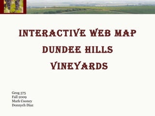
- 1. INTERACTIVE WEB MAP DUNDEE HILLS VINEYARDS Geog 575 Fall 2009 Mark Cooney Donnych Diaz
- 2. Project Scope Create a database of vineyard attributes from scratch by gathering data from vineyard managers/owners and merging the data with the geometry/polygons from Yamhill County tax lots. The data and associated vineyard polygons are then shown on a Web based interactive Map.
- 3. Project Background Currently there are no combined tax lot data for the Dundee AVA vineyards (vineyards are not identified on tax lot database only owners are). The GIS application and database will enable the identification of tax lots for each vineyard. The American Viticulture Area boundary has been added as well to overlay with tax lots and apply proper attribute identification by AVA vineyard boundary. The addition of soil data has been combined to allow for a generalization of soil types by vineyard.
- 6. Geographic Extents Geographic extent is the Dundee Hills American Viticulture Area in the Oregon Willamette Valley. Each Vineyard is defined by a specific polygon that is comprised of tax lot polygons. Data Layer Specifications Feature Type Description AVA Boundary Polygon The Dundee area AVA boundary Tax Lots Polygon County Tax lots Soil Polygon Yamhill County soils Aerial Photo Raster Yamhill County AVA Vineyards Polygon AVA vineyard boundaries Combined Feature class Polygon All attributes for AVA vineyards
- 14. Web Map
- 15. QUESTIONS?
- 17. THANK yOU!