SlideShare a Scribd company logo
1 of 356
MENLO PARK EL CAMINO REAL/
DOWNTOWN SPECIFIC PLAN
CITY OF MENLO PARK, CALIFORNIA
July 12, 2012
PREPARED BY:
PERKINS+WILL
IN ASSOCIATION WITH
STRATEGIC ECONOMICS | FEHR & PEERS | BKF | HDR/THE HOYT COMPANY | ESA
CITY OF MENLO PARK, CALIFORNIA
July 12, 2012
MENLO PARK EL CAMINO REAL/
DOWNTOWN SPECIFIC PLAN
ACKNOWLEDGMENTS
CITY OF MENLO PARK
CITY COUNCIL
Richard Cline
Andrew Cohen
Kelly Fergusson
Kirsten Keith
Peter Ohtaki
John Boyle (Council Member 2006-2010)
Heyward Robinson (Council Member 2006-2010)
CITY COUNCIL SUBCOMMITTEE
Richard Cline
Kirsten Keith
John Boyle (Council Member 2006-2010)
KEY CITY PERSONNEL
Thomas Rogers, Project Manager and Associate
Planner
Arlinda Heineck, Community Development Director
Vanh Malathong, Technical Service Coordinator
Alex D. McIntyre, City Manager
Glen Rojas (former City Manager)
Starla Jerome-Robinson, Assistant City Manager
Cherise Brandell, Community Services Director
Carol Augustine, Finance Director
Chip Taylor, Public Works Director
Atul Patel, Senior Transportation Engineer
Kent Steffens (former Public Works Director)
David Johnson (former Business Development
Manager)
Many others on staff contributed to the success of the
community workshops, review and refinement of draft
concepts, and the production of documents.
CONTRACT ATTORNEY
Barbara Kautz, Goldfarb Lipman, Attorneys
PLANNING COMMISSION
Vincent Bressler
Ben Eiref
Katie Ferrick
John Kadvany
John O’Malley
Henry Riggs
Peipei Yu
Kirsten Keith (former Commissioner)
Melody Pagee (former Commissioner)
CITY COMMISSIONS
Bicycle Commission
Environmental Quality Commission
Finance and Audit Committee
Housing Commission
Parks and Recreation Commission
Transportation Commission
OVERSIGHT/OUTREACH COMMITTEE
Charlie Bourne
Patty Boyle
Kristi Breisch
Vincent Bressler
Charles Catalano
Rick Ciardella
Ben Eiref
Steve Elliott
John Fox
Bill Frimel
J. Michael Gullard
Tom Hilligoss
Clark Kepler
Bud Kohn
Elizabeth Lazensky
Reginald Rice
Henry Riggs
Douglas Scott
Todd Temple
Jeff Warmouth
Elizabeth Weiss
…And the thousands of community members who did
the real work of the Specific Plan by providing direction
for their community for the next 20 to 30 years. Their
dedication to working in a constructive, collaborative way
to create a plan that will make our community the best it
can be is an admirable testament to our ability to achieve
the vision set forth in the Specific Plan.
CONSULTANT TEAM
PERKINS+WILL
Prakash Printo, Principal-in-Charge
Mark Hoffheimer, Project Manager and Senior Planner
Karen Alschuler, Participating Principal
Geeti Silwal, Urban Designer
Patrick Vaucheret, Urban Designer
Saba Ghole, Urban Planner
Poonam Narkar, Urban Planner
STRATEGIC ECONOMICS
Nadine Fogarty, Principal
Sujata Srivastava, Principal
Sarah Graham, Senior Associate
Derek Braun, Associate
FEHR & PEERS
Jane Bierstedt, Principal-in-Charge
Joe Fernandez, Project Manager
Nicole Nagaya, Project Planner
Gregory Ripa, Project Engineer
Ian Moore, Senior Bicycle Planner
Carrie Nielson, Bicycle Planner
Katherine Spencer, Graphic Artist and GIS Analyst
BKF ENGINEERS
Daniel Schaefer, Principal
Eric Girod, Associate/Project Manager
HDR/THE HOYT COMPANY
Peter Castles, Outreach Project Manager
Tammy Nguyen, Community Relations Coordinator
CONTENTS
A PLAN OVERVIEW
B PLAN CONTEXT
C PLAN PRINCIPLES, FRAMEWORK + PROGRAM
D PUBLIC SPACE
E LAND USE + BUILDING CHARACTER
F CIRCULATION
G IMPLEMENTATION
H APPENDIX
LIST OF FIGURES
A. PLAN OVERVIEW
Fig. A1 Illustrative Site Plan ....................................................................................................... A3
Fig. A2 Regional Map ................................................................................................................. A6
Fig. A3 Plan Area Map ............................................................................................................... A7
Fig. A4 “Project North” ............................................................................................................... A10
Fig. A5 Types of Information Found in Specific Plan .................................................................. A11
B. PLAN CONTEXT
Fig. B1 Site Context ................................................................................................................... B4
Fig. B2 Site Character ............................................................................................................... B5
Fig. B3 Opportunities and Constraints ....................................................................................... B9
Fig. B4 Peak Period Intersection Level of Service in Plan Area ................................................ B17
Fig. B5 Pedestrian Facilities in Plan Area .................................................................................. B18
Fig. B6 Bicycle Facilities in Plan Area ........................................................................................ B19
Fig. B7 Transit Service in Plan Area .......................................................................................... B21
C. PLAN PRINCIPLES, FRAMEWORK + PROGRAM
Fig. C1 Concept Diagram ........................................................................................................... C7
Fig. C2 El Camino Real South ................................................................................................... C11
Fig. C3 Opportunities and Constraints ....................................................................................... C15
Fig. C4 Detail of Downtown Public Space Program ................................................................... C16
Fig. C5 Downtown ...................................................................................................................... C17
Fig. C6 Illustrative Plan .............................................................................................................. C21
D. PUBLIC SPACE
Fig. D1 Public Space Framework ............................................................................................... D3
Fig. D2 Connected + Walkable Downtown and Station Area Concept ....................................... D4
Fig. D3 Green + Shaded Downtown and Station Area Concept .................................................. D5
Fig. D4 Bicycle Network + Access Downtown and Station Area Concept ................................... D6
Fig. D5 El Camino Real South Concept ..................................................................................... D7
Fig. D6 Downtown Public Space Plan with Major Public Space Improvements ......................... D8
Fig. D7 Concept Plan of Key Public Spaces Downtown ............................................................. D9
Fig. D8 Sidewalk Section ........................................................................................................... D12
Fig. D9 Section through Santa Cruz Avenue ............................................................................. D13
Fig. D10 Concept Plan of Santa Cruz Avenue with Major Streetscape Improvements .............. D13
Fig. D11 Section through Santa Cruz Ave Central Plaza, with Median Trees Preserved ............ D17
Fig. D12 Concept Plan of the Santa Cruz Avenue Central Plaza ................................................ D17
Fig. D13 Concept Plan of Santa Cruz Avenue Central Plaza and the Chestnut Paseo .............. D19
Fig. D14 Concept Plan of South Parking Plazas Pedestrian Link .............................................. D23
Fig. D15 Concept Plan of Station Area ...................................................................................... D29
Fig. D16 Concept Plan of Ravenswood Gateway ...................................................................... D35
Fig. D17 Typical Section / Plan at El Camino Real North between Valparaiso
and Oak Grove Avenues ............................................................................................................. D39
Fig. D18 Typical Section / Plan at El Camino Real Downtown between Oak Grove
and Menlo Avenues ....................................................................................................................... D40
Fig. D19 Typical Section / Plan at El Camino Real South of Roble Avenue ................................ D41
Fig. D20 Typical Intersection Improvement .................................................................................. D43
E. LAND USE + BUILDING CHARACTER
Fig. E1 Land Use Designations .................................................................................................. E3
Fig. E2 Development Intensity / Density ....................................................................................... E14
Fig. E3 Maximum Building Height and Maximum Façade Height ............................................... E19
Fig. E4 Heights, Setbacks and Building Profile ........................................................................... E20
Fig. E5 Building and Architectural Projections ............................................................................ E22
Fig. E6 Building and Architectural Projection Standards ............................................................ E22
Fig. E7 Building Front and Corner Side Setbacks ...................................................................... E23
Fig. E8 Allowable Building Projection Area ................................................................................. E24
Fig. E9 Minimum Building Break Requirements in El Camino Real (ECR) SE District .............. E27
Fig. E10 Vertical Façade Modulation and Upper Floor Façade Length ...................................... E29
Fig. E11 45-Degree Building Profile for Floors Above the Maximum Allowable Façade Height ... E29
Fig. E12 45-Degree Building Profile Set at Minimum Setback Line ............................................ E29
Fig. E13 Raised Residential Unit Entries .................................................................................... E31
Fig. E14 Clearly Articulated Ground-Floor Bays ......................................................................... E33
Fig. E15 Retail Entries at a Maximum of Every 50-Feet ............................................................. E34
Fig. E16 Key Map of Zoning Districts .......................................................................................... E45
Fig. E17 Mixed Use Residential Projects in El Camino Real North-East (ECR NE-L) District ..... E47
Fig. E18 Mixed Use Commercial Projects in El Camino Real North-East – Low Density
(ECR NE-L) District ....................................................................................................................... E48
Fig. E19 El Camino Real North-East (ECR NE) District Required Setback ................................. E51
Fig. E20 Mixed Use Residential Projects in El Camino Real North-East (ECR NE) District ........ E52
Fig. E21 Mixed Use Commercial Projects in El Camino Real North-East (ECR NE) District ....... E53
Fig. E22 El Camino Real North East (ECR NE-R) District Required Setback ............................... E56
Fig. E23 Mixed Use Residential Projects in El Camino Real North East (ECR NE-R) District E57
Fig. E24Mixed Use Commercial Projects in El Camino Real North-East – Residential Emphasis
(ECR NE-R) District ..................................................................................................................... E58
Fig. E25 El Camino Real South-East (ECR SE) District Required Setback ................................. E61
Fig. E26 Mixed Use Residential Projects in El Camino Real South-East (ECR SE) District ......... E62
Fig. E27 Mixed Use Commercial Projects in El Camino Real South-East (ECR SE) District ....... E63
Fig. E28 Mixed Use Residential Projects in El Camino Real North-West (ECR NW) District ...... E67
Fig. E29 Mixed Use Commercial Projects in El Camino Real North-West (ECR NW) District ..... E68
Fig. E30 El Camino Real South-West (ECR SW) District Required Setback ............................... E71
Fig. E31 Mixed Use Residential Projects in El Camino Real South-West (ECR SW) District ..... E72
Fig. E32 Mixed Use Commercial Projects in El Camino Real South-West (ECR SW) District ..... E73
Fig. E33 Mixed Use Residential Projects in Station Area East (SA E) District ............................. E77
Fig. E34 Mixed Use Commercial Projects in Station Area East (SA E) District ........................... E78
Fig. E35 Mixed Use Residential Projects in Station Area East (SA E) District – Alma Street East E79
Fig. E36 Mixed Use Residential Projects in Station Area West (SA W) District ............................ E83
Fig. E37 Mixed Use Commercial Projects in Station Area West (SA W) District ........................... E84
LIST OF FIGURES (continued)
Fig. E38 Mixed Use Residential Projects in Downtown (D) District .............................................. E88
Fig. E39 Mixed Use Commercial Projects in Downtown (D) District ............................................. E89
Fig. E40 Parking Garage Project in Downtown (D) District ......................................................... E90
Fig. E41 Downtown Adjacent (DA) District Required Setback ...................................................... E93
Fig. E42 Mixed Use Residential Projects in Downtown Adjacent (DA) District ............................ E94
Fig. E43 Mixed Use Commercial Projects in Downtown Adjacent (DA) District ........................... E95
F. CIRCULATION
Fig. F1 Vehicular Circulation ...................................................................................................... . F3
Fig. F2 Pedestrian Improvements .............................................................................................. F5
Fig. F3 Bicycle Facilities ............................................................................................................. F11
Fig. F4 Transit Service ................................................................................................................ F15
Fig. F5 Parking Areas ................................................................................................................. F21
Fig. F6 Proposed Public Parking Downtown .............................................................................. F25
G. IMPLEMENTATION
Fig. G1 Proposed Public Improvements .................................................................................... G18
Fig. G2 Storm Drainage ............................................................................................................. G29
Fig. G3 Sanitary Sewer .............................................................................................................. G31
Fig. G4 Water Supply and Delivery ............................................................................................ G33
LIST OF FIGURES (continued)
LIST OF TABLES
C. PLAN PRINCIPLES, FRAMEWORK + PROGRAM
Table C1 Guiding Principles Matrix ............................................................................................. C3
E. LAND USE + BUILDING CHARACTER
Table E1 Land Use Designations and Allowable Uses ............................................................... E6-7
Table E2 Development Standards by Zoning Districts ................................................................. E15
Table E3 Required Building Breaks in the Zoning Districts ......................................................... E26
Table E4 Required Building Breaks in the El Camino Real South-East (ECR SE) Zoning District E26
Table E5 Summary of Green Building Requirements .................................................................. E41
Table E6 Development Standards for El Camino Real North East–Low Density
(ECR NE-L) District ....................................................................................................................... E49-50
Table E7 Development Standards for El Camino Real North-East (ECR NE) District.................. E54-55
Table E8 Development Standards for El Camino Real North-East–Residential
Emphasis (ECR NE-R) District .................................................................................................... E59-60
Table E9 Development Standards for El Camino Real South-East (ECR SE) District ................ E64-65
Table E10 Development Standards for El Camino Real North-West (ECR NW) District ............ E69-70
Table E11 Development Standards for El Camino Real South-West (ECR SW) District ............ E74-75
Table E12 Development Standards for Station Area East (SA E) District ................................... E80-81
Table E13 Development Standards for Station Area West (SA W) District ................................ E85-86
Table E14 Development Standards for Downtown (D) District .................................................. E91-92
Table E15 Development Standards for Downtown Adjacent (DA) District ................................. E96-97
F. CIRCULATION
Table F1 Bicycle Parking Requirements ....................................................................................... F13
Table F2 Parking Rates ................................................................................................................ F19
Table E3 Existing and Future Downtown Parking Supply ............................................................. F24
G. IMPLEMENTATION
Table G1 El Camino Real/Downtown Specific Plan/City of Menlo Park General Plan
Consistency Analysis ..................................................................................................................... G4-13
Table G2 Potential Funding Sources, Financing Alternatives and Participating Parties ............... G19
Table G3 Potential Funding Strategies ......................................................................................... G20
Table G4 Public Space Improvements and Public Parking Spaces Displaced ............................. G27
PLAN OVERVIEW
A.
A.1 SUMMARY
A.2 SETTING AND BACKGROUND
A.3 SCOPE OF SPECIFIC PLAN
A.4 HOW TO USE THIS DOCUMENT
A.5 PLANNING PROCESS
A.6 VISION PLAN GOALS
A2
A5
A8
A10
A12
A17
A2
MENLO PARK EL CAMINO REAL AND DOWNTOWN SPECIFIC PLAN
A.1 SUMMARY
The El Camino Real/Downtown Specific Plan establishes
a framework for private and public improvements on El
Camino Real, in the Caltrain station area and in downtown
Menlo Park for the next several decades. The plan’s focus
is on the character and extent of enhanced public spaces,
the character and intensity of private infill development and
circulation and connectivity improvements. It includes a
strategy for implementation of public space improvements,
such as wider sidewalks and plazas, and other
infrastructure improvements.
The overall intent of the El Camino Real/Downtown Specific
Plan is to preserve and enhance community life, character
and vitality through public space improvements, mixed
use infill projects sensitive to the small-town character of
Menlo Park and improved connectivity. As discussed later
in more detail, the Specific Plan reflects the outcome of an
extensive community outreach and engagement process.
Illustrated in Figure A1, the El Camino Real/Downtown
Specific Plan:
 Encourages infill development of vacant and
under-utilized lots along El Camino Real through
increased intensities, coupled with strict building
modulation and ground-floor setback and building
profile requirements that both attenuate the mass
and scale of larger buildings and create wider
public sidewalks;
 Retains the existing “village” character downtown
by keeping buildings low and requiring varied
building massing, including through building profile
and façade modulation requirements;
 Increases downtown activity, foot traffic and transit
use through enhanced public spaces, mixed-use
infill projects (including residential uses) and higher
intensities of development near the commuter rail
station;
 Enhances community life through an integrated
network of widened sidewalks, promenades,
pocket parks and public gathering spaces; and
 Enhances east-west connectivity across El
Camino Real through crosswalk and sidewalk
improvements, while accommodating north-south
vehicular through-traffic, and across the railroad
tracks through grade-separated pedestrian and
bicycle connections.
“We need to do something.
”- Workshop #1 Participant
CaltrainParking
P P P
P
P
CaltrainParking
CCaCatalalttraiinPParkinltrainPaarkiinngngg
PPPP PPP PPP
PPPPP
PPPPP
PP
ALMA
MIDDLEFIELD
LAUREL
ELCAMINOREAL
ELCAMINOREAL
MIDDLE
OAK GROVE
ISABELLA
YALE
ENCINAL
PARK
WATKINS
SANTA CRUZ
VALPARAISO
COLLEGE
CREEK
ROBLE
EMILIE
MILLS
GLENWOOD
PINE
CAMBRIDGE
ARBOR
FREMONT
LIVE OAK
RAVENSWOOD
ALEJANDRA
ALTO
LINFIELD
FELTON
HARVARD
ARDEN
BURGESS
JOHNSON
PARTRIDGE
NOEL
ALLEY
GARWOOD
LENNOX
UNIVERSITY
PRINCETON
HOOVER
MERRILL
SPRUCE
EVELYN
ROSE
OAK
CRANE
VICTORIA
LEON
CLAIRE
LEE
MILLIE
LANE
ALICE
MARCUSSEN
STONE PINE
WERTH
FLORENCE
MAC BAIN
WAVERLEY
PRIOR
MCCORMICK
CORNELL
SANANTONIO
BAY LAUREL
BRITTON
MOREY
MENLO
DOUGLAS
MOULTON
BUCKTHORN
REBECCA
DOYLE
BLAKE
SHERWOOD
HOPKINS
CURTIS
WESTFIELD
MALONEY
BARRON
MICHAELS
NEALON PARK
JACK W. LYLE
MEMORIAL PARK
FREMONT PARK
BURGESS PARK
CIVIC CENTER
KENWOOD
KENT
SAXON
CASTLE
CLAREMONT
CHERRY
RYAN'S
FOREST
MALLET
TUDOR
HOMEWOOD
SURREY
HOWARD
ELIZABETH
CHATEAU
FENNWOOD
VERSAILLES
BASSETT
CREEKPL
SUSSEX
MANOR
BLAKE
CREEK
CURTIS
UNIVERSITY
CRANE
WAVERLEY
ARBOR
SHERWOOD
RAVENSWOOD
ROBLE
ARBOR
MENLO
CURTIS
Enhanced pedestrian crossings on El
Camino Real at Oak Grove, Santa
Cruz and Menlo Avenues
El Camino Real East Promenade
Civic Plaza / Entry Feature
Burgess Park Linkage /Open
Space Plaza / Retail Node
Enhanced
Streetscape on
Santa Cruz Avenue
Market Place
P
P
P
P
Parking / Flexible Space
Hotel
Downtown
El Camino Real
Station Area
Civic Center
Existing Buildings Not
Included in Opportunity Sites
Potential Opportunity Sites
Proposed / Approved Projects
Surface Parking Lot
Public Plazas / Open Space
Parks
Plan Area Boundary
Railroad
Menlo Park City Limit
P
0 200 400 Feet
A3
CHAPTER A PLAN OVERVIEW
Figure A1. Illustrative Site Plan
A4
MENLO PARK EL CAMINO REAL AND DOWNTOWN SPECIFIC PLAN
The illustrative plan, as shown in Figure A1, depicts how the
plan area could potentially build out over the next several
decades in conformance with the overall planning principles
and within the land use and development regulations and
design guidelines contained in subsequent chapters. It is
important to emphasize that the illustrative plan indicates
only one potential development concept and that the actual
build-out will likely vary from the initial projection.
As envisioned, the full build-out of the plan area could result
in up to approximately 330,000 square feet of additional
retail and commercial development, 680 new residential
units and 380 new hotel rooms, resulting in 1,357 new jobs
and 1,537 additional residents.
It is important to emphasize
that the illustrative plan
indicates only one potential
development concept and
that the actual build-out will
likely vary from the initial
projection.
Rendering of El Camino Real at Ravenswood, looking north
A5
CHAPTER A PLAN OVERVIEW
downtown’s main street, provide convenient parking for
downtown visitors and employees. Extensive streetscape
and sidewalk improvements on Santa Cruz Avenue,
constructed in the 1970’s, with additional improvements in
later decades, lend a distinct character and pleasant tree
cover to the street. The street’s sidewalks, however, tend
to be narrow and lack adequate social space and spill-out
space for adjacent retailers that many in the community
strongly desire.
The historic train station, currently providing commuter rail
service to San Francisco and San Jose, is one block off El
Camino Real opposite downtown. There is a relatively weak
connection between the train station area and downtown,
with limited foot traffic and activities that would otherwise
generate more vibrancy in the area. In addition, the rail
line, in combination with El Camino Real, run north-south,
making east-west connectivity for vehicular, pedestrian, and
bicycle movement challenging.
In 2007, the City initiated a two-phase planning process to
enhance and plan for the long-term success of El Camino
Real, the Caltrain station area and downtown. As discussed
in section A.5, Phase I established an overarching vision for
the project area (discussed below). Phase II, this Specific
Plan, refines the vision and establishes an implementation
framework for future improvements to the area.
Rendering of El Camino Real at Partridge, looking north
The City of Menlo Park is located approximately 30
miles south of San Francisco on the Peninsula. Home to
approximately 30,000 residents, Menlo Park is part of a
string of communities connected to San Francisco and
San Jose via El Camino Real (an historic road and State
Highway), Caltrain rail service and Interstates 101 and 280.
Figure A2 illustrates Menlo Park’s regional context.
El Camino Real, the Caltrain rail station, and downtown,
along with the nearby Civic Center, constitute the historic
core of Menlo Park. Figure A3 illustrates the Specific Plan’s
plan area, which encompasses El Camino Real, the rail
station area and downtown.
An historic route, El Camino Real is now State Highway 82,
an active arterial roadway and commercial corridor. It was
once home to a number of automobile dealerships, most
of which are vacant today. Stanford University, the largest
private land owner in the project area, owns 12.8 acres
on the east side of El Camino Real south of downtown,
encompassing most of the former automobile dealerships
and the active Stanford Park Hotel.
Menlo Park’s downtown includes relatively few historic
buildings but retains its historic fabric of small parcels and
local-serving, independent street-front retail businesses.
Surface parking lots behind Santa Cruz Avenue,
A.2 SETTING AND BACKGROUND
San Francisco
Sausalito
Daly City
South San Francisco
San Francisco Bay
Pacific
Ocean
San Bruno
Millbrae
Pacifica
Burlingame
San Mateo Foster City
Belmont
San Carlos
Redwood City
Half Moon Bay
Menlo Park
East Palo Alto
Palo Alto
Mountain View
Newark
Fremont
Union City
Hayward
San Lorenzo
Dublin
Pleasanton
San Ramon
San Leandro
Alameda
Piedmont
Berkeley
El Cerrito
Walnut Creek
Danville
Oakland
Castro Valley
Sunnyvale
Santa Clara
Cupertino
Saratoga
San Jose
Milpitas
80
880
580
580
680
880
680
280
280
280
1
1
101
101
280
1
82
82
El Camino
Real
101
El Camino
Real
Freeway / Highway
Railroad
El Camino Real
Figure A2. Regional Map
A6
MENLO PARK EL CAMINO REAL AND DOWNTOWN SPECIFIC PLAN
A7
CHAPTER A PLAN OVERVIEW
MIDDLEFIELD
LAUREL
LAUREL
MIDDLE
ISABELLA
YALE
ENCINAL
PARK
WATKINS
COLLEGE
CREEK
ROBLE
EMILIE
MILLS
PINE
CAMBRIDGE
ARBOR
FREMONT
LIVE OAK
RAVENSWOOD
ALEJANDRA
ALTO
LINFIELD
FELTON
HARVARD
ARDEN
BURGESS
JOHNSON
PARTRIDGE
NOEL
ALLEY
GARWOOD
LENNOX
PRINCETON
HOOVER
MERRILL
SPRUCE
EVELYN
ROSE
OAK
CRANE
VICTORIA
LEON
CLAIRE
LEE
MILLIE
LANE
ALICE
MARCUSSEN
STONE PINE
WERTH
FLORENCE
MAC BAIN
WAVERLEY
PRIOR
CORNELL
SANANTONIO
BAY LAUREL
BRITTON
MOREY
MENLO
DOUGLAS
MOULTON
BUCKTHORN
REBECCA
DOYLE
BLAKE
SHERWOOD
HOPKINS
CURTIS
WESTFIELD
MALONEY
BARRON
MICHAELS
KENWOOD
KENT
ON
TLE
CLAREMONT
CHERRY
RYAN'S
FOREST
MALLET
TUDOR
CHESTNUT
HOMEWOOD
SURREY
HOWARD
ELIZABETH
CHATEAU
FENNWOOD
VERSAILLES
BASSETT
EKPL
SUSSEX
MANOR
OAK GROVE PLAZA
BLAKE
CHESTNUT
CREEK
CURTIS
CRANE
WAVERLEY
ARBOR
SHERWOOD
WILLOW
JOHNSON
ROBLE
ARBOR
CURTIS
AlmaStreet
University
University
Oak Grove
GlenwoodValparaiso
Oak Grove
Santa Cruz Ave
Menlo
Ravenswood
ElCaminoReal
N
0 300 600 1200
Feet
Downtown Menlo Park
El Camino Real
Station Area
Stanford University Property
Santa Cruz Avenue
Caltrain
WAVERLEY
Plan Area
Civic Center
Figure A3. Plan Area Map
A8
MENLO PARK EL CAMINO REAL AND DOWNTOWN SPECIFIC PLAN
A.3 SCOPE OF SPECIFIC PLAN
The El Camino Real/Downtown Specific Plan establishes
the location and character of streetscape and public space
improvements; the character and intensity of commercial
and residential development; and the circulation pattern
(vehicular, pedestrian, bicycle and transit) and parking
strategy to support businesses and overall vitality, and
enhance east-west connectivity. The Specific Plan
includes standards and guidelines for public and private
enhancements to the area, and it offers strategies for
financing and implementing public improvements.
In general, a specific plan is a tool for the systematic
implementation of the general plan. It effectively establishes
a link between implementing policies of the general plan
and the individual development proposals in a defined
area. A specific plan may be as general as setting forth
broad policy concepts, or as detailed as providing direction
to every facet of development from the type, location and
intensity of uses to the design and capacity of infrastructure;
from the resources used to finance public improvements to
the design guidelines of a subdivision.
Rendering of Santa Cruz Avenue
A9
CHAPTER A PLAN OVERVIEW
According to California law, Section 65451 of the
Government Code mandates that a specific plan contain
the following:
(A) A specific plan shall include a text and a diagram or
diagrams which specify all of the following in detail:
(1) The distribution, location, and extent of the
uses of land, including open space, within the area
covered by the plan;
(2) The proposed distribution, location, and extent
and intensity of major components of public and
private transportation, sewage, water, drainage,
solid waste disposal, energy, and other essential
facilities proposed to be located within the area
covered by the plan and needed to support the
land uses described in the plan;
(3) Standards and criteria by which development
will proceed, and standards for the conservation,
development, and utilization of natural resources,
where applicable; and
(4) A program of implementation measures
including regulations, programs, public works
projects, and financing measures necessary to
carry out paragraphs (1), (2), and (3).
(B) The specific plan shall include a statement of the
relationship of the specific plan to the general plan.
The El Camino Real/Downtown Specific Plan builds upon
the El Camino Real/Downtown Vision Plan, unanimously
accepted by the Menlo Park City Council on July 15, 2008.
In addition to the Specific Plan, the planning effort includes
an associated Environmental Impact Report (EIR), fiscal
impact analysis (FIA) and revisions to the Menlo Park
General Plan and Zoning Ordinance to make this specific
plan fully operational.
The sketches and photographs in the El Camino Real/
Downtown Specific Plan are meant only to relay particular
concepts as described in the text or make reference to
pertinent precedents and should not be considered exact
models. Also, the Specific Plan provides standards and
guidelines for private and public development, but does not
include detailed plans.
The El Camino Real/
Downtown Specific Plan
builds upon the El Camino
Real/Downtown Vision Plan,
unanimously accepted by the
Menlo Park City Council on
July 15, 2008.
The sketches and
photographs in the El
Camino Real/Downtown
Specific Plan are meant only
to relay particular concepts
as described in the text or
make reference to pertinent
precedents and should
not be considered exact
models. Also, the Specific
Plan provides standards and
guidelines for private and
public development, but does
not include detailed plans.
A10
MENLO PARK EL CAMINO REAL AND DOWNTOWN SPECIFIC PLAN
A.4 HOW TO USE THIS DOCUMENT
The El Camino Real/Downtown Specific Plan conveys an
overarching vision for enhancements in the plan area for
community residents, business and property owners, City
staff and developers. It provides guidance for those making
public and private improvement in the plan area.
The Specific Plan includes the following chapters.
 A. Plan Overview
 B. Plan Context
 C. Plan Principles, Framework + Program
 D. Public Space
 E. Land Use + Building Character
 F. Circulation
 G. Implementation
 H. Appendix
The first three chapters provide an overview, context and
broad principles and concepts for the plan area, providing
all readers with a broad framework within which individual
improvements should be made. Chapters D, F and G
focus on public improvements, including their character,
associated standards and guidelines, and implementation
strategies. Chapter E provides the regulatory framework
for private development, including allowable building
heights, allowable development intensities, setback
requirements and other standards and guidelines. This
chapter is the major focus for property owners and private
developers, and it is used by City staff when reviewing
private development proposals. Note: building diagrams in
Chapter E are intended to illustrate how different standards
are measured, and are not intended to necessarily
dictate the placement of different uses or parking within a
development.
Although each chapter presents information differently
based on its focus, Figure A5 illustrates the types of
information found within this Specific Plan.
Figure A4. “Project North” - Although El Camino Real
and the Caltrain line do not run in a precisely north-south
direction within Menlo Park, they are overall north-south
corridors and are considered by the community as such.
Directional references in this document use this convention.
N
N
Project
North
View of Project Area
Oriented to Project North
True
North
N
N
N
Project
North
View of Project Area
Oriented to True North
True
North
D10
MENLO PARK EL CAMINO REAL AND DOWNTOWN SPECIFIC PLAN
Widened sidewalks providing ample space for sitting and
outdoor dining (City of Santa Cruz, California)
Santa Cruz Avenue Sidewalks
The Specific Plan calls for improving the pedestrian
realm on Santa Cruz Avenue, increasing street activity
and enhancing the image of downtown by widening
sidewalks, providing ample space for informal gathering,
sitting and outdoor dining and introducing new streetscape
improvements. The plan establishes sidewalk functional
zones, ensuring a pedestrian clear zone and more pleasant
and functional sidewalks. It redistributes the right-of-way
between traffic lanes, on-street parking and sidewalks in
order to focus on an enhanced pedestrian experience while
still accommodating vehicular circulation and on-street
parking.
Intent
Encourage walking and increase levels of street
activity with wider, more functional sidewalks.
Renew the image of downtown with updated
streetscape elements.
Character
Tree canopy with clear visibility to storefronts.
Median trees retained, which are iconic features of
downtown.
Improvements
Retain existing median trees and integrate them
into new streetscape design.
Replace diagonal parking with parallel parking, and
use reclaimed width to widen sidewalks.
On the side with diagonal parking, replace the
diagonal parking with parallel parking, narrow
travel lane and widen sidewalk.
On the side with parallel parking, retain parallel
parking, narrow travel lane and widen sidewalk.
Integrate street trees into on-street parking zones,
particularly where sidewalks are narrowest.
Upgrade streetscape elements, such as benches,
seating, trash receptacles, newspaper racks,
paving, and street lighting.
Existing Santa Cruz Avenue sidewalk (Menlo Park, California)
“Encourage restaurants and
shops to utilize sidewalks and
storefronts for public space
gathering, dining, resting
”- Workshop #1 Participant
“I would absolutely trade
parking spaces on Santa
Cruz and El Camino for
well-designed parking
garages with safe, pleasant
pedestrian paths!
”- Workshop #1 Participant
D11
CHAPTER D PUBLIC SPACE
12’ wide sidewalk (Palo Alto, California)
Illustration of 19’ wide sidewalk
Implement and evaluate Santa Cruz Avenue
sidewalk improvements on a trial basis, before
moving forward with a permanent installation. The
trial period shall be the basis for the review and
consideration of a permanent installation.
Standards
D.2.01 Streetscape improvements on Santa Cruz Avenue
shall retain existing median trees to the extent possible.
Guidelines
Streetscape improvements on Santa Cruz Avenue should
include the following:
D.2.02 Provide widest sidewalk possible while retaining on-
street parallel parking.
D.2.03 Introduce safe pedestrian crossings by using
elements such as marked crossings, clear signage,
supplementary lighting, and curb extensions.
D.2.04 Introduce street trees in parking zone to maximize
sidewalk width, particularly in those areas where a 12 foot
minimum sidewalk dimension cannot be achieved.
D.2.05 Coordinate with streetscape improvements in the
station area.
D.2.06 Consider the following as criteria for streetscape
furnishing selection: timeless, functional, easy maintenance,
durability and sustainability.
D.2.07 Achieve safe lighting for vehicular circulation and
comfortable lighting for pedestrians; consider additional
decorative lighting for nightscape.
“I like the wider sidewalks on
Santa Cruz
”- Workshop #3 Participant
Renewed/memorable image for downtown (San Jose,
California)
D13
CHAPTER D PUBLIC SPACE
Chestnut
SectionCut
Curtis
10’ 30’ 60’
Figure D10. Concept Plan of Santa Cruz Avenue with Major Streetscape Improvements. This plan does not feature the Central Plaza described in
the next section.
Figure D9. Section through Santa Cruz Avenue, showing two traffic lanes with parallel parking, median trees retained, diagonal parking removed,
one moderately-sized sidewalk and one wide sidewalk
75’
19’ 11’
12’ 5’
11’ 8’ 11’8’ 7’
Pedestrian Thru Zone
12’
Pedestrian Thru Zone
5’8’11’7’11’8’11’
A11
CHAPTER A PLAN OVERVIEW
A
B
F
C
D
E
A. OVERALL DESCRIPTION / INTENT: Each section /
sub-section typically begins with an overall description
that outlines the general objectives and intent.
B. QUOTES / COMMENTS: Quotes / comments from
the community workshops appear in the sidebar to
highlight the voices of the participants. The workshop
number indicates where the quote / comment was
collected. Occasionally, important points of emphasis
also appear in the sidebar.
C. PHOTO: Photos that appear in the sidebar are
intended to relay general principles and not serve as
exact models.
D. STANDARDS: These are the aspects that must
be implemented (strict requirements) for public and
private development.
E. GUIDELINES: These are the aspects that should
be implemented (not strict requirements) for public
and private development.
F. CONCEPT DRAWINGS: Conceptual drawings serve
as examples of one potential design, to be refined if
and when the improvement is to be built.
Figure A5. Types of Information Found in Specific Plan
A12
MENLO PARK EL CAMINO REAL AND DOWNTOWN SPECIFIC PLAN
A.5 PLANNING PROCESS
The El Camino Real/Downtown Specific Plan is the result
of a multi-year process designed to evolve a community
judgment about the future of the plan area. Community
judgment, as opposed to public opinion, is a shared
conclusion based on beliefs, values and factual information
that results in a legitimate, lasting and implementable
outcome. Community judgment consists of a shared and
common sense of public priorities but is not the same
thing as consensus. This public judgment emerged
through a two-phase process involving thousands of
community members (over 950 on the regular email update
list alone); representatives of key stakeholder groups
such as downtown and El Camino Real business and
property owners; an Oversight and Outreach Committee
that included representatives of important stakeholder
groups such as residents and business/property owners;
City Commissions; and the Menlo Park City Council.
The process was supported by an extensive community
outreach campaign through both phases that included
project newsletters and postcards to every Menlo Park
postal address (including both residential and commercial
properties); stories in the Menlo Park quarterly newsletter
that also went to all households and businesses; news
releases, posters, fliers and an extensive email update
system; and one-on-one outreach to stakeholders by
Council Members, Oversight and Outreach Committee
Members and staff.
“I think the emerging plan
strikes a good ‘reasonable’
balance between character
and progress…by allowing
reasonable development
”- Workshop #3 Participant
“I think the overall process
has been a very constructive
planning process!
”- Workshop #3 Participant
A13
CHAPTER A PLAN OVERVIEW
Phase I: Vision Plan
As is typical of planning processes designed to develop
community judgment, the El Camino Real/Downtown
Specific Plan began with a community visioning process
conducted in 2007 and 2008. This step included an
educational speaker series, walking tours, three community
workshops, one Planning Commission workshop and
two City Council meetings. The visioning process was
structured to gather together the core values, hopes and
dreams the community has for the area so that when more
specific decisions have been made later in the process,
they are grounded in the community’s decision about what
is most important for the future.
The visioning effort was promoted by five city-wide
mailings (including two return surveys), which were sent
to all residential and commercial properties and which
generated approximately 2,600 total returns. The outreach
effort also included one-on-one outreach by the Oversight
and Outreach Committee to members of their stakeholder
groups, such as downtown businesses and residents. The
City Council unanimously accepted the Vision Plan on July
15, 2008, and the Plan serves as the values base for the
Specific Plan. The following section, Section A.6, lists the
Vision Plan’s twelve principal goals.
Phase II: Specific Plan Process
As recommended in the Vision Plan, the City subsequently
commenced work on a Specific Plan, to contain elements
such as detailed land use regulations, design guidelines
and implementation measures. As was the case with Phase
I, the Phase II process has been a community-oriented
planning project, with unprecedented levels of public
outreach and participation. The Specific Plan process
has strived to result in a community judgment, as defined
earlier.
The Specific Plan process included meetings, work
sessions and workshops at critical project milestones:
 Interviews with Project Stakeholders at the
beginning of the project;
 Meetings with the Oversight and Outreach
Committee;
 Meetings/work sessions with the Planning
Commission;
 Meetings/work sessions with the City Council; and
 Three Community Workshops.
 Detailed review of the Draft Specific Plan and EIR
Community Workshops
Three community workshops, each attended by over 100
people, engaged members of the community in facilitated,
interactive activities designed to move from the values and
goals of the vision phase to an informed judgment about
the detailed elements of the Specific Plan. This required
workshop participants to learn about the current conditions
in the area, generate ideas about what could be done to
improve those conditions in order to realize the community
vision, understand and weigh the impacts of those ideas
and improvements, and make choices about which ideas
to include in the plan based on deliberation with other
community members.
Phase I visioning process
A14
MENLO PARK EL CAMINO REAL AND DOWNTOWN SPECIFIC PLAN
Workshop #1 on April 16, 2009.
The purpose of the first workshop was to help the
community confirm the Phase I vision and goals,
to understand existing conditions, constraints and
opportunities and to consider the primary issues and the
possible positive and negative outcomes related to future
potential changes in the plan area. The workshop was
organized around four subject areas: connectivity, vibrancy,
public space and character, all of which were based on the
approved vision.
Community Workshop #1
A15
CHAPTER A PLAN OVERVIEW
Workshop #2 on June 18, 2009
The purpose of the second workshop was to build upon
the discussion from the first workshop and to begin to
discuss the impacts of the various plan elements that
were emerging. The process involved a presentation and
discussion, in break-out sessions, of alternative concepts
for connectivity, vibrancy, public space and character, based
on comments from the first workshop, feedback from the
Oversight and Outreach Committee, Planning Commission
and City Council and analyses conducted by the consultant
team. The analyses included preliminary fiscal information,
diagrams of site character and opportunities/constraints and
a preliminary study of the impacts of potentially tunneling
El Camino Real. It included preparation and consideration
of various plan concepts, massing options and
photomontages, street sections, development scenarios
and public space improvements.
Community Workshop #2
A16
MENLO PARK EL CAMINO REAL AND DOWNTOWN SPECIFIC PLAN
Workshop #3 on September 17, 2009
The purpose of the third and final Community Workshop
was to present an Emerging Plan developed from
Community Workshops #1 and #2, to gain critical feedback
on the Emerging Plan and to help decide on revisions
to the Emerging Plan. Attendees were able to weigh in
on proposed public improvements, including expanded
public spaces, wider sidewalks on Santa Cruz Avenue
and enhanced crossings of El Camino Real. Attendees
also considered a preferred direction for the use, size and
character of private development, with its associated traffic
and fiscal implications and potential public benefits.
Draft Specific Plan and EIR
Following the Community Workshop process, the Draft
Specific Plan was published on April 7, 2010, and the Draft
EIR was published on April 29, 2011. Both documents were
released to strong community interest. Following the Draft
EIR comment period (discussed fully in the Final EIR),
the Planning Commission and City Council were originally
scheduled to hold one meeting each to provide direction on
the Draft Specific Plan. However, both bodies expressed an
interest and willingness to hold additional meetings in order
to more fully explore and address comments, questions,
and potential concerns, both from the Commission/Council
and the public. The aim of this detailed review was to
provide clear and specific direction on improvements and
refinements to the plan.
The Planning Commission held five meetings in July-
August 2011, and the City Council followed with four
meetings in August-October 2011. Concurrent with the
Planning Commission and City Council’s review, the
Housing, Transportation, and Bicycle Commissions
conducted sessions on the Draft Specific Plan. Each of
these Commissions recommended moving forward with
the El Camino Real/Downtown Specific Plan process,
subject to specific recommendations that were considered
by the Planning Commission and City Council. All of these
meetings benefited from diverse public input.
The City Council concluded its review on October 4, 2011
with direction for substantive improvements to the Draft
Specific Plan, which have been incorporated as appropriate
into this Final Specific Plan.
Community Workshop #3
A17
CHAPTER A PLAN OVERVIEW
A.6 VISION PLAN GOALS
The El Camino Real/Downtown Specific Plan builds upon
the Phase I Vision Plan, as unanimously accepted by the
City Council on July 15, 2008. The Vision Plan’s twelve
goals are:
Maintain a village character unique to Menlo Park.
Provide greater east-west, town-wide connectivity.
Improve circulation and streetscape conditions on El
Camino Real.
Ensure that El Camino Real development is sensitive to
and compatible with adjacent neighborhoods.
Revitalize underutilized parcels and buildings.
Activate the train station area.
Protect and enhance pedestrian amenities on Santa Cruz
Avenue.
Expand shopping, dining and neighborhood services to
ensure a vibrant downtown.
Provide residential opportunities in the Vision Plan Area.
Provide plaza and park spaces.
Provide an integrated, safe and well-designed pedestrian
and bicycle network.
Develop parking strategies and facilities that meet the
commercial and residential needs of the community.
Section C.1 of this plan further describes the relationship
between these goals and the guiding principles of the
Specific Plan.
Phase I visioning process
PLAN CONTEXT
B.
B.1 OVERVIEW
B.2 SITE CONTEXT AND CHARACTER 	
B.3 OPPORTUNITIES AND CONSTRAINTS	
B.4 CIRCULATION OVERVIEW	
B.5 MARKET OVERVIEW	
B2
B2
B8
B16
B23
B2
MENLO PARK EL CAMINO REAL AND DOWNTOWN SPECIFIC PLAN
B.1 OVERVIEW
Located on the Peninsula south of San Francisco, the plan
area for the El Camino Real/Downtown Specific Plan is the
historic center of Menlo Park. The plan area consists of an
arterial corridor, a pedestrian-scale downtown and a transit
center providing commuter rail service to San Francisco
and San Jose.
This chapter summarizes the following aspects of the plan
area:
•	 Site Context and Character;
•	 Opportunities and Constraints;
•	 Circulation Overview; and
•	 Market Overview.
B.2 SITE CONTEXT AND
CHARACTER
Figure B1 identifies major features of the area, including the
El Camino Real corridor, Caltrain station area, downtown
core, major roadways, the adjacent Civic Center and
major parks, schools and landmarks in the area. Feature
buildings, as shown, are those buildings that are highly
visible and memorable, have historic or cultural value or
contain uses that have large local and regional draws. Their
inclusion in the figure helps orient the reader.
Figure B2 illustrates some of the defining characteristics of
the El Camino Real corridor, station area and downtown. It
focuses on the visual quality and definition of the area by
the way buildings orient to the street, with varying building
setbacks; the effect of underutilized lots on street character;
the provision and location of public parking plazas; and the
area’s landscape character. It identifies familiar “landmark”
buildings, which help orient visitors to the area, and places
with a higher degree of activity, such as Draeger’s Market
and the public library.
In general, some of the most successful and memorable
streets, in terms of character and activity, are ones where
buildings address and frame the street with active ground
floor uses and articulated façades; where pedestrians have
a comfortable and welcoming place to walk; and where a
consistent use of landscape treatment, through street trees,
street lamps and other furnishings, create a welcome and
unifying image.
B3
CHAPTER B PLAN CONTEXT
Building Character
Buildings on El Camino Real vary in size and style, from
automobile showrooms (many empty) and car repair shops
to larger commercial buildings, office buildings up to four
stories tall and smaller scale commercial buildings closer
to downtown. Most buildings are one and two stories tall,
although others are taller.
El Camino Real, for the most part, lacks a clear definition
of a built edge due to inconsistent building setbacks and
numerous parking lots along the street. This detracts from
the visual appeal of the corridor. In some cases, buildings
with a strong built edge face away from the street and to
rear parking lots, thereby detracting from street character.
The stretch of El Camino Real between Valparaiso Avenue
and Roble Street exhibits a better definition because most
buildings have a consistent, minimum setback from the
street, consistent with the historic center of Menlo Park, and
because of the landscaped median.
Santa Cruz Avenue has a consistent building character
between El Camino Real and University Drive, with all
buildings aligned to the sidewalk/lot line and most buildings
along Santa Cruz Avenue being one and two stories tall.
This provides very clear street definition and strong visual
quality to the street by providing clear distinction of the
public and private realm with active edges of doors and
windows opening onto the street. The street consists of
small, distinct storefronts, creating a visual interest to
passersby.
Secondary street frontage on Oak Grove and Menlo
Avenues adjacent to Santa Cruz Avenue, and other
smaller streets perpendicular to it, play an important role
in providing uses and services that support the downtown.
The Oak Grove and Menlo Avenue corridors have a range
of existing building types, including some three-story
structures.
Menlo Center and the Caltrain Station are notable buildings
and function as local landmarks, with the Presbyterian
Church, Draeger’s Market, Trader Joe’s, Safeway, Burgess
Park and the public library serving as “activity nodes” or
places attracting significant numbers of people and creating
activity within the plan area.
Santa Cruz Avenue has a small-town character, with
storefronts that face the street and a median planted with
stately trees (Menlo Park, California)
Parking lot interfacing with El Camino Real, creating an edge
condition that lacks clear definition (Menlo Park, California)
Caltrain Station is a local landmark (Menlo Park, California)
B4
MENLO PARK EL CAMINO REAL AND DOWNTOWN SPECIFIC PLAN
Figure B1. Site Context
Menlo
College
Menlo School
Draeger’s
Safeway
Trader Joe’s
Theater
Civic Center
Burgess Park
Fremont Park
Theater
Nealon ParkJack W. Lyle
Memorial Park
Menlo Center
Encinal
Elementary
El Camino Park
St. Raymond’s
Catholic Church
and School
Sacred Heart
Schools
San Francisquito Creek
Holbrook Palmer Park
Menlo Park
Presbyterian
Church
Caltrain Station
Fig 5: Site Context
Railway
El Camino Real
Primary Streets in Plan
Area
Downtown Core
Schools and Religious
Institutions
Open Space
Civic Space
Caltrain Station
Feature Buildings
Plan Area Boundary
Menlo Park City Limit
Station Area
El Camino Real
El Camino Real
Downtown
ALMA
MIDDLEFIELD
LAUREL
ELCAMINOREAL
MIDDLE
OAK GROVE
YALE
ENCINAL
WATKINS
SANTA CRUZ
VALPARAISO
COLLEGE
CREEK
ROBLE
MILLS
GLENWOOD
PINE
CAMBRIDGE
ARBOR
FREMONT
LIVE OAK
ALEJANDRA
ALTO
LINFIELD
FELTON
HARVARD
ARDEN
BURGESS
JOHNSON
PARTRIDGE
NOEL
ALLEY
GARWOOD
LENNOX
UNIVERSITY
PRINCETON
HOOVER
MERRILL
SPRUCE
EVELYN
ROSE
OAK
CRANE
VICTORIA
LEON
CLAIRE
LEE
MILLIE
LANE
ALICE
MARCUSSEN
STONE PINE
WERTH
FLORENCE
WAVERLEY
PRIOR
CORNELL
SANANTONIO
BAY LAUREL
MOREY
MENLO
DOUGLAS
MOULTON
BUCKTHORN
REBECCA
DOYLE
BLAKE
SHERWOOD
HOPKINS
CURTIS
WESTFIELD
MALONEY
BARRON
KENWOOD
KENT
CLAREMONT
CHERRY
RYAN'S
FOREST
MALLET
TUDOR
CHESTNUT
HOMEWOOD
SURREY
ELIZABETH
CHATEAU
FENNWOOD
VERSAILLES
BASSETT
CREEKPL
SUSSEX
MANOR
OAK GROVE PLAZA
BLAKE
CHESTNUT
CREEK
CURTIS
UNIVERSITY
CRANE
WAVERLEY
ARBOR
SHERWOOD
RAVENSWOOD
JOHNSON
ROBLE
ARBOR
MENLO
CURTIS
WILLOW
El Camino Real/Downtown Specific Plan
City of Menlo Park
N
0 300 600 1200
Feet
18 June 2009
Fehr & Peers
Strategic Economics
BKF Engineers
ESA
HDR/The Hoyt Company
B5
CHAPTER B PLAN CONTEXT
ALMA
MIDDLEFIELD
LAUREL
ELCAMINOREAL
MIDDLE
OAK GROVE
YALE
ENCINAL
WATKINS
SANTA CRUZ
VALPARAISO
COLLEGE
CREEK
ROBLE
MILLS
GLENWOOD
PINE
CAMBRIDGE
ARBOR
FREMONT
LIVE OAK
ALEJANDRA
ALTO
LINFIELD
FELTON
HARVARD
ARDEN
BURGESS
JOHNSON
PARTRIDGE
NOEL
ALLEY
GARWOOD
LENNOX
UNIVERSITY
PRINCETON
HOOVER
MERRILL
SPRUCE
EVELYN
ROSE
OAK
CRANE
VICTORIA
LEON
CLAIRE
LEE
MILLIE
LANE
ALICE
MARCUSSEN
STONE PINE
WERTH
FLORENCE
WAVERLEY
PRIOR
CORNELL
SANANTONIO
BAY LAUREL
MOREY
MENLO
DOUGLAS
MOULTON
BUCKTHORN
REBECCA
DOYLE
BLAKE
SHERWOOD
HOPKINS
CURTIS
WESTFIELD
MALONEY
BARRON
KENWOOD
KENT
CLAREMONT
CHERRY
RYAN'S
FOREST
MALLET
TUDOR
CHESTNUT
HOMEWOOD
SURREY
ELIZABETH
CHATEAU
FENNWOOD
VERSAILLES
BASSETT
CREEKPL
SUSSEX
MANOR
OAK GROVE PLAZA
BLAKE
CHESTNUT
CREEK
CURTIS
UNIVERSITY
CRANE
WAVERLEY
ARBOR
SHERWOOD
RAVENSWOOD
JOHNSON
ROBLE
ARBOR
MENLO
CURTIS
WILLOW
LMA
Draeger’s
Safeway
Trader Joe’s
Theater
Civic Center
Public Library
Burgess Park
Fremont Park
Caltrain Station
Theater
Menlo Center
Presbyterian
Church
Oasis Beer
Garden
Site Character
Railway
Landmark
Activity Node
Parking Plaza
Landscape Buffer
Open Space
Street Defintion
El Camino Real
Crosstown Connector
Lack of Building Edge /
Unifying Character /
Consistent Building
Orientation
Project Area Boundary
Menlo Park City Limit
Median Street Trees
El Camino Real/Downtown Specific Plan
City of Menlo Park
N
0 300 600 1200
Feet
18 June 2009
Fehr & Peers
Strategic Economics
BKF Engineers
ESA
HDR/The Hoyt Company
Figure B2. Site Character
B6
MENLO PARK EL CAMINO REAL AND DOWNTOWN SPECIFIC PLAN
The plan area also includes a number of gateways, an
entrance “expression” that heralds the approach of new
landscape and defines the arrival point as a destination.
The minimum building setbacks and median trees, which
start at Valparaiso Avenue, create a sense of entry or
gateway to downtown heading south. Other gateways
include El Camino Real at the Menlo Park/Palo Alto city
limit, heading north, and Santa Cruz Avenue at El Camino
Real and at University Drive heading into the center of
downtown.
El Camino Real/Downtown Specific Plan
City of Menlo Park
29 April 2009
Fehr & Peers
Strategic Economics
BKF Engineers
ESA
Fig 24: Streetscape Study - Santa Cruz Avenue South (between El Camino Real and Evelyn)
RONIMACLE
RUZ
LIVE OAK
YTISREVINU
HOOVER
MERRILL
NYLEVE
ROSE
AK
NARC
MILLIE
NLO
ELYOD
SITRUC
YENOLAM
RYAN'S
TUNTSEHC
ELIZABETH
OAK GROVE PLAZA
EKALB
CHESTNUT
ENARC
JOHNSON
BLE
MENLO
SITRUC
Curtis
Chestnut
Chestnut
Crane
Doyle
Curtis
JohnsonLn.
ElCaminoReal
Doyle
Crane
Evelyn
Streetscape - Downtown (Menlo Park, California); Santa Cruz Avenue consists of small, distinct storefronts, in one- and two- story buildings, that
line and define the street
Peet’s Coffee at the corner of Santa Cruz Avenue and
University Drive (Menlo Park, California)
B7
CHAPTER B PLAN CONTEXT
s
MIL
N
ALLEY
RAVENSWOOD
Streetscape Character
Streetscape character is created by features such as
landscaping, sidewalk design and street furniture and
amenities. Along El Camino Real, the landscaping varies
in design, quality and maturity, resulting in a range of
experiences for pedestrians. Some areas such as the
section between Roble and Ravenswood Avenues include
mature street trees, providing a high quality experience for
pedestrians. Areas with less mature landscaping are not as
comfortable. Overall, the series of street trees and median
trees, especially ones that are more mature, help lessen
the impact of traffic along El Camino Real and make it more
comfortable for pedestrians.
The sidewalk dimension on El Camino Real varies in width
and in a few locations narrows down to a size that makes
it an uncomfortable pedestrian experience. In addition,
several intersections along El Camino Real have been
compromised by infrastructural elements (such as signage,
light posts and utility boxes) or restrict pedestrian circulation
in favor of vehicular circulation (especially in locations
where there is a high frequency of vehicular turning). The
existing intersections have been designed for vehicular
speeds and do little to provide assistance for pedestrians.
Typically Santa Cruz Avenue is comprised of a traffic lane in
each direction, parking on both sides (sometimes parallel,
sometimes angled), 10-foot sidewalk and one- to two- story
buildings that have no setback from the street. The street
is identifiable by a median planting of London Plane trees
that average 30 to 35 feet tall. Additionally, trees of varying
types and sizes are planted irregularly in the sidewalk and
planting areas.
Santa Cruz Avenue has been designed with a great deal
of emphasis on the pedestrian. A strong effort has been
made to separate pedestrian circulation from vehicular
traffic as well as provide street furnishings and amenities.
The existing streetscape design, built over the past
few decades, is intended to serve pedestrians, yet also
creates constraints by reducing the effective space for
circulation and social interaction and, at times, being
visually disruptive. In several locations, benches are fixed
in location back-to-back, limiting informal use by larger
groups. Much of the sidewalk space has been organized
using low concrete walls and planting areas, which provide
a perception of increased protection from vehicles, but limit
the usable space of the sidewalk.
Back-to-back benches (Menlo Park, California)
B8
MENLO PARK EL CAMINO REAL AND DOWNTOWN SPECIFIC PLAN
B.3 OPPORTUNITIES AND CONSTRAINTS
Draeger’s is a local activity node (Menlo Park, California)
The plan area offers ample opportunities and constraints
for improvements, particularly as they relate to the
community’s desires for enhanced pedestrian amenities
and public spaces, a revitalized El Camino Real, an active,
vibrant downtown and improved pedestrian and bicycle
connections. Illustrated in Figure B3, the following sections
describe the area’s opportunities and constraints.
“Improving conditions for both
(vehicles and pedestrians)
should be the goal through
wider sidewalks with green
areas between traffic and
sidewalks
”- Workshop #1 Participant
“Need for good streetscape
and ground floor design –
pedestrian friendly
”- Workshop #1 Participant
ALMA
MIDDLEFIELD
LAUREL
ELCAMINOREAL
MIDDLE
OAK GROVE
YALE
ENCINAL
WATKINS
SANTA CRUZ
VALPARAISO
COLLEGE
CREEK
ROBLE
MILLS
GLENWOOD
PINE
CAMBRIDGE
ARBOR
FREMONT
LIVE OAK
ALEJANDRA
ALTO
LINFIELD
FELTON
HARVARD
ARDEN
BURGESS
JOHNSON
PARTRIDGE
NOEL
ALLEY
GARWOOD
LENNOX
UNIVERSITY
PRINCETON
HOOVER
MERRILL
SPRUCE
EVELYN
ROSE
OAK
CRANE
VICTORIA
LEON
CLAIRE
LEE
MILLIE
LANE
ALICE
MARCUSSEN
STONE PINE
WERTH
FLORENCE
WAVERLEY
PRIOR
CORNELL
SANANTONIO
BAY LAUREL
MOREY
MENLO
DOUGLAS
MOULTON
BUCKTHORN
REBECCA
DOYLE
BLAKE
SHERWOOD
HOPKINS
CURTIS
WESTFIELD
MALONEY
BARRON
KENWOOD
KENT
CLAREMONT
CHERRY
RYAN'S
FOREST
MALLET
TUDOR
CHESTNUT
HOMEWOOD
SURREY
ELIZABETH
CHATEAU
FENNWOOD
VERSAILLES
BASSETT
CREEKPL
SUSSEX
MANOR
OAK GROVE PLAZA
BLAKE
CHESTNUT
CREEK
CURTIS
UNIVERSITY
CRANE
WAVERLEY
ARBOR
SHERWOOD
RAVENSWOOD
JOHNSON
ROBLE
ARBOR
MENLO
CURTIS
WILLOW
Menlo
College
Menlo High
School
Civic Center
Public Library
Burgess Park
Fremont
Park
Caltrain
Station
Nealon Park
Arbor Rd
Park
Encinal
Elementary
El Camino Park
St. Raymond’s
Elementary School
San Francisquito Creek
Holbrook Palmer Park
Presbyterian
Church Downtown
5
M
inu
te
W
alkingRadius
Project Area Boundary
School Area
Civic Area
Park Space
Menlo Park City Boundary
Downtown/Station Area
High Impacted /
High Traffic Volume Intersection
Caltrain Railway
(Limits E-W Connectivity)
Opportunities
Constraints
El Camino Real Corridor
(Limits E-W Connectivity)
Improve Pedestrian Routes -
Opportunity for connecting
existing and new civic uses
Improve Pedestrian/Bicycle
Connectivity
Underutilized and Vacant
Land
Stanford University Ownership
Enhance Gateways
Public Parking Plazas -
Opportunities for Improved
Parking Management
Intensify development near
downtown/train station
Site Opportunities and Constraints
El Camino Real/Downtown Specific Plan
City of Menlo Park
N
0 300 600 1200
Feet
29 April 2009
Fehr & Peers
Strategic Economics
BKF Engineers
ESA
HDR/The Hoyt Company
B9
CHAPTER B PLAN CONTEXT
Figure B3. Opportunities and Constraints
B10
MENLO PARK EL CAMINO REAL AND DOWNTOWN SPECIFIC PLAN
Opportunities
The Specific Plan recognizes opportunities for
enhancements within the plan area. The following sections
discuss these opportunities in more detail:
•	 Improve Underutilized and Vacant Lands.
•	 Improve Stanford University-Owned Property.
•	 Focus Higher Density Development in Proximity to
the Train Station Area.
•	 Build on Downtown Character.
•	 Improve and “Leverage” Existing Public Parking
Plazas.
•	 Improve Pedestrian Amenities and Overall Street
Character.
•	 Improve East/West Pedestrian and Bicycle
Connectively.
•	 Improve Linkages between Open Spaces and Civic
Uses.
Improve Underutilized and Vacant Parcels
Vacant and under-utilized parcels in the plan area
provide opportunities for mixed use development. New
development would also help transform the streetscape
character along El Camino Real by encouraging street level
activity and enhancing the pedestrian environment. Several
of the parcels have approved or pending projects that will
serve these purposes as well as provide the potential for
revenue generation and increase housing opportunities.
Additionally, hotel uses have the potential to generate
needed tax revenue for the city.
Improve Stanford University-Owned Property
Stanford University owns a large contiguous stretch of
land of approximately 12.8 acres on the eastern side of
El Camino Real just north of San Francisquito Creek. The
land is suitable for multi-family residential, commercial and
mixed use development. This single ownership allows for a
comprehensive approach to redevelopment of this portion
of El Camino Real, which is currently underutilized. It also
provides an opportunity for an east-west pedestrian and
bicycle linkage near Middle Avenue.
Vacant and under-utilized parcels along El Camino Real
(Menlo Park, California)
Large, contiguous stretches of land along El Camino Real
(Menlo Park, California)
“Let’s really plan for a 50-year
non-auto environment
”- Workshop #3 Participant
B11
CHAPTER B PLAN CONTEXT
Focus Higher Density Development in Proximity
to the Train Station Area
Vibrancy is achieved by a rich mix of uses, including
residential and public amenities, arranged in a compact
manner, in close proximity to transit. This mixed-use
pattern supports pedestrian circulation and transit use while
reducing relative vehicular trips in comparison to standalone
projects of the same size. Also, clustering development
near transit can potentially help justify improvements to
existing transit.
The intersection of Santa Cruz Avenue and El Camino Real
is the “center” of Menlo Park’s commercial and historic
core, the confluence of the city’s commercial corridor,
downtown “Main Street” and transit station area. This
central location is the logical place for increased intensity
of mixed-use development. As shown in Figure B3, there
is an opportunity to focus development within a five minute
walking radius from this “center”.
Build on Downtown Character
Downtown Menlo Park is a walkable district with small
blocks with most of the retail uses concentrated along
Santa Cruz Avenue. The buildings in downtown are one
or two stories with relatively small floor area. Enhancing
the walkability in downtown by improving pedestrian
movement along Santa Cruz Avenue and along the side-
streets perpendicular to Santa Cruz Avenue will reinforce
the village character. Opportunities exist to create limited
new social spaces in the public parking plazas and through
widening of sidewalks, which will further enhance the
downtown character. As discussed above, intensifying
mixed use development around the intersection of Santa
Cruz Avenue and El Camino Real will also contribute
to a vibrant downtown by increasing foot traffic and by
enhancing pedestrian orientation of downtown.
Existing downtown character consisting of small blocks,
mostly retail uses and one to two story buildings with small
floor areas (Menlo Park, California)
Existing mixed use activity at Menlo Center (Menlo Park,
California)
B12
MENLO PARK EL CAMINO REAL AND DOWNTOWN SPECIFIC PLAN
Improve and “Leverage” Existing Public
Parking Plazas
The downtown parking plazas provide needed parking
for downtown stores and services. However, their current
configuration is inefficient, with narrow drive aisles and
sub-standard spaces in some cases. The city-owned
parking plazas provide opportunities for possible limited
infill development including modest new retail/restaurant
uses, public open space and structured parking, enhancing
the vitality and vibrancy of downtown. Such changes
can enhance downtown character without reducing the
inventory of available parking spaces. The opportunities
listed will enhance foot traffic through increased patronage
and support of local retail businesses downtown, in turn
leading to increased sales. The parking plazas also provide
opportunities for improved parking management, such as
by relocating longer-term parking to garages and improving
short-term parking opportunities elsewhere.
Improve Pedestrian Amenities and Overall
Street Character
Opportunities exist to improve pedestrian amenities (street
furniture, widened sidewalks), and overall street character,
in downtown, particularly along Santa Cruz Avenue, the
north-south streets, and on downtown parking plazas. In
some places, on-street parking may be reconfigured and
accommodated elsewhere to provide room for pedestrian
improvements.
El Camino Real offers its own challenges, with the arterial
right-of-way needing to accommodate vehicular movement,
on-street parking in some places and pedestrian
movement. Buildings along the corridor are often built up to
the property lines and sidewalks tend to be narrow, placing
the pedestrian near fast-moving traffic. Opportunities, albeit
limited, exist to improve the pedestrian experience by
narrowing traffic lanes while maintaining the same number
of lanes and expanding the sidewalk and by introducing and
expanding sidewalks and publicly-accessible open space
on adjacent properties.
Opportunity to widen sidewalks along Santa Cruz Avenue
(Menlo Park, California)
Buildings along El Camino Real built up to the property lines
with narrow sidewalk condition (Menlo Park, California)
“We could walk more if we
had good parking structures
off downtown
”- Workshop #1 Participant
“If there were less parking and
more activity, I would walk to
downtown
”- Workshop #3 Participant
B13
CHAPTER B PLAN CONTEXT
Improve East/West Pedestrian and Bicycle
Connectivity
The El Camino Real corridor and parallel railroad tracks
impede safe and accessible east/west connections.
There are opportunities to improve existing connections,
particularly between downtown and the train station area,
through enhanced pedestrian and bicycle amenities
and managing traffic movements. Opportunities for new
pedestrian and bicycle connections under or over the
railroad tracks exist at the Caltrain station and at Middle
Avenue, connecting through to Burgess Park. There is also
an opportunity to improve existing pedestrian crossings at
Oak Grove, Santa Cruz, and Menlo Avenues for enhanced
east-west connectivity with high-visibility crosswalks with
enhanced pavement, median islands/pedestrian refuges
and other crossing improvements.
Improve Linkages between Open Spaces and
Civic Uses
Some notable civic uses and parks in the vicinity of
downtown include the Civic Center and Public Library,
Caltrain Station, Menlo Park Presbyterian Church,
Fremont Park, Nealon Park and Burgess Park. Improving
pedestrian and bicycle routes between these civic uses
provides an opportunity to create safe linkages and improve
accessibility.
Parallel railroad tracks impede safe and accessible east/west
connections (Menlo Park, California)
Poor accessibility and linkages between key spaces (Menlo
Park, California)
B14
MENLO PARK EL CAMINO REAL AND DOWNTOWN SPECIFIC PLAN
Constraints
The following sections discuss these constraints in the
project area in more detail:
•	 Railroad Line Limits East/West Connectivity
Opportunities.
•	 Arterial Function and Caltrans Jurisdiction of El
Camino Real Limits Improvement Opportunities.
•	 Ravenswood/Menlo/El Camino Real Intersection
Congestion.
•	 Funding for Public Improvements.
•	 Financing Given the Current Market Situation.
Railroad Line Limits East/West Connectivity
Opportunities
The railroad tracks are a barrier that limits east-west
connectivity, although they also buffer taller buildings on El
Camino Real from adjacent neighborhoods. Implementing
attractive and safe connections across the tracks remains a
real challenge in the project area. Future high speed rail is
also planned for the Peninsula, and it requires track grade-
separation. With high speed rail and its grade separations,
east-west transportation connections can be enhanced.
However, it will act as a visual barrier if the tracks are above
grade.
Arterial Function and Caltrans Jurisdiction of El
Camino Real Limits Improvement Opportunities
Under the California Department of Transportation
(Caltrans) jurisdiction, El Camino Real is a major arterial
roadway that must accommodate regional through
traffic. While there is potential to improve the pedestrian
environment, and street character, along the El Camino
Real right of way, Caltrans has final authority and decision
making power in this regard. Deviations from Caltrans
policy or standards to meet community requests may
require approval of an exception to a policy or nonstandard
feature.
Railroad line limiting east/west connectivity opportunities
(Menlo Park, California)
Arterial function of El Camino Real limiting improvement
opportunities (Menlo Park, California)
B15
CHAPTER B PLAN CONTEXT
Ravenswood/Menlo/El Camino Real Intersection
Congestion
This intersection is the only one in the project area that
currently operates at an unacceptable level of service for
vehicular traffic under existing conditions (discussed in
Section F.2 “Vehicular Circulation”). Accordingly, increased
development and improving pedestrian and bike crossings,
while accommodating traffic flows, remains a challenge in
the area.
Funding for Public Improvements
Due to fiscal constraints being experienced by all levels of
government, including the City of Menlo Park, the funding
available for public improvements is limited. It is unlikely
that the General Fund will be a significant source of funding
for public improvement projects. Therefore, the City will
need to identify other revenue sources to pay for proposed
improvements. A wide variety of other funding sources
and financing mechanisms, including Benefit Assessment
Districts, Grants, and Development Impact Fees, are
available for public improvements, but their applicability
to Menlo Park varies substantially because of statutory
constraints and political challenges, including the need for
voter approval in some cases. Development Impact Fees
and other contributions from developers will be limited by
the amount of new development allowed in the specific
plan area and, at least in the short-term, by the current
real estate market conditions. The ultimate mix of funding
sources and financing mechanisms for the proposed
improvements will be subject to the larger priorities of the
City. Please see Chapter G “Implementation” for more
information on specific funding sources.
Financing Given the Current Market Situation
The current market situation is characterized by constrained
credit markets and a broader economic downturn that has
impacted the potential for real estate development. While
current market conditions, wherein home prices and the
volume of sales have both declined, are not conducive to
real estate development at this time, the market for real
estate tends to be cyclical in nature. It is difficult to predict
when the market will improve; however it is unlikely that
new projects in the plan area will be constructed and
occupied until 2012–2013, at the earliest.
B16
MENLO PARK EL CAMINO REAL AND DOWNTOWN SPECIFIC PLAN
B.4 CIRCULATION OVERVIEW
The circulation system in the Specific Plan project area
accommodates, to varying degrees, vehicular movement,
pedestrian movement, bicycle circulation and transit use.
This section summarizes the following aspects of the
existing circulation system:
•	 Policy Context.
•	 Transportation Conditions.
•	 Opportunities.
More detailed discussion of the circulation system is
contained in Chapter F “Circulation”.
Policy Context
There are a number of agencies whose policies apply to
the Specific Plan area, including the City of Menlo Park,
the San Mateo City/County Association of Governments (C/
CAG), the Metropolitan Transportation Commission (MTC),
the California Department of Transportation (Caltrans), San
Mateo County Transit District (SamTrans) and the Town of
Atherton. Moreover, the City of Menlo Park’s General Plan
provides a blueprint for growth within the City, and sets the
goals, policies, and programs that apply to the Specific Plan
area.
The General Plan specifies that the minimum acceptable
level of service1
(LOS) for roadways is LOS D, and includes
policies supporting the development of an equitable
transportation network supporting transit, bicycles, and
pedestrians. Caltrans controls El Camino Real, where
it strives for operations at LOS C or better, but Caltrans
documents note that there is flexibility in the application of
its standards to accommodate community goals.
1
Level of Service (LOS) is a quantitative description of roadway opera-
tions from the perspective of a vehicle driver. The LOS of a roadway
facility can range from LOS A, with free-flow operations and little or no
delay, to LOS F where traffic volumes exceed roadway capacity result-
ing in stop-and-go operations and excessive delays. LOS E represents
at-capacity conditions, LOS D represents below-capacity conditions
where delays are tolerable for most drivers
Transportation Conditions
Roadway System
The roadway system in Menlo Park is comprised of
relatively short and discontinuous north-south and east-
west roadways. This layout limits the amount of regional
traffic on the roadways but creates circuitous traffic routings
for people who live, work, and visit Menlo Park. Traffic
congestion in the project area occurs primarily along
El Camino Real, which carries regional traffic, and its
intersections. The highest levels of congestion occur during
the morning and evening peak commute hours, causing
extensive queuing. About half of the traffic on El Camino
Real in the downtown area is regional in nature, with an
origin and destination outside of the project area.
Pedestrian and Bicycle Facilities
Pedestrian and bicycle facilities support attractive modes
of travel in Menlo Park as nearly six percent2 of work trips
are made by bicycle or on foot, well above both state and
national averages. Pedestrian and bicycle accommodations
are provided throughout much of the City. However, there
are many gaps and deficiencies. While sidewalks are
provided along most roadways in the plan area, El Camino
Real and the Caltrain tracks serve as a barrier to east-west
travel, and there are discontinuities in the sidewalk system
leading into the downtown area. El Camino Real and the
Caltrain tracks serve as a barrier to east-west bicycle travel
as well and there are discontinuities in the bicycle network
especially for north-south travel.
2
2000 Census journey to work data
Discontinuities in bicycle network for north-south
travel (Menlo Park, California)
B17
CHAPTER B PLAN CONTEXT
è
q
è
tq
è
tq
è
tq
è
tq
è
tq
è
tq
è
tq
è
tq
èè
tq
è
tq
Spruce Ave
Watkins Ave
Buckthorn Way
Partridge Ave
Roble Ave
CraneSt
VictoriaDr
AlmaLn
Middle Ave
Creek Dr
Oak Grove Plz
College Ave
UniversityDr
Cambridge Ave
Harvard Ave
Encinal Ave
Stone Pine Ln
Live Oak Ave
MillsSt
SanAntonioAve
Forest Ln
CornellRd
Menlo Ave
NoelDr
ChestnutSt
JohnsonLn
GarwoodWay
EvelynSt
CurtisSt
AltoLn
MaloneyLn
Oak Grove Ave
MerrillSt
ElCaminoReal
Valparaiso Ave Glenwood Ave
Santa Cruz Ave
AlmaSt
Oak Grove Ave
AlmaSt
Ravenswood Ave
0 250 500 750 1,000125
Feet
El Camino Real/Downtown Specific Plan
City of Menlo Park
14 April 2009
Source: City of Menlo Park Traffix model,
Fehr & Peers field observations (March & April, 2009)
N
·|}þ82
·|}þ82
Traffic Observations
Figure 9
PM congestion backs
up through Roble Ave,
but clears in one cycle.
AM and PM
congestion spills back
through Santa Cruz
Congestion observed,
but clears quickly
Minimal congestion
observed on Oak
Grove AM and PM
A number of vehicle
turning movement/
bicycle/pedestrian
conflicts at
Ravenswood/Alma
PM congestion on Menlo Ave
takes 2-3 cycles to clear
Congestion from
Ravenswood spills
back to Caltrain tracks
è
Emile
Plan Area
Caltrain
Menlo Park City Limits
AM PM
è
tq
= A-B
= C
= D
= E-F
è
tq
tq
è
tq
è
tq > 3000
2000 - 3000
1000 - 2000
500 - 1000
< 500
Level of Service: Average Peak Hour Volume
è
t
q
è
tq
q
è
tq
q
q
Cruz
Figure B4. Peak Period Intersection Level of Service in Plan Area
B18
MENLO PARK EL CAMINO REAL AND DOWNTOWN SPECIFIC PLAN
!!!!!!!!!!!!!!!!!!!!!!!!!!!!!!!!!!!!!!!!!!!!!!!!!!!!!!!!!!!!!!!!!!!!!!!!!!!!!!!!!!!!!!!!!!!!!!!!!!!!!!!!!!!!!!!!!!!!!!!!!!!!!!!!!!!!!!
ú
ú
ú
ú
Æý
Æý
Æý
Æý
Æý
Æý
Æý
Æý
Æý
Spruce Ave
Watkins Ave
Buckthorn Way
Partridge Ave
Roble Ave
College Ave
VictoriaDr
AlmaLn
Middle Ave
Creek Dr
Ryans Ln
Oak Grove Plz
Cambridge Ave
UniversityDr
Harvard Ave
MillsSt
Encinal Ave
Stone Pine Ln
Live Oak Ave
SanAntonioAve
Forest Ln
CornellRd
Menlo Ave
NoelDr
DoyleSt
ChestnutSt
JohnsonLn
GarwoodWay
EvelynSt
CurtisSt
Derry Ln
AltoLn
MaloneyLn
Oak Grove Ave
MerrillSt
CraneSt
Valparaiso Ave Glenwood Ave
Santa Cruz Ave
AlmaSt
Oak Grove Ave
Ravenswood Ave
AlmaSt
MiddlefieldAve
LaurelSt
ElCaminoReal
Legend
ú Bicycle & Pedestrian Bridge
ú Planned Bicycle &
Æý Pedestrian Signal
Complete Sidewalk on
Partial Sidewalk on at
! !! !! !! !! !! !! !!! !! Informal Path
Project Area
Caltrain
Menlo Park City Limits
0 250 500 750 1,000125
Feet
Pedestrian Facilities Inside Study Area
Figure 7
El Camino Real/Downtown Specific Plan
City of Menlo Park
15 April 2009
Source: City of Menlo Park Sidewalk Master Plan (August 11, 2008),
Fehr & Peers field observations (March 2009)
N
·|}þ82
·|}þ82
Pedestrian Tunnel*
Least One Side of Street
Both Sides of Street
Next to Rail Road Tracks
!!!!!!!!!!!!!!!!!!!!!
11
Average Pedestrian Crossing
Time in Seconds
¤¤¤¤¤¤ ¤¤¤¤¤
&
&
98 sec
* Exact Location Subject to Further
Review
Æý
Æý
Æý
Æý
Æý
Æý
Æý
Æý
Æý
Æý
Æý
Æý
ElCaminoReal
DoyleSt
JohnsonLn
MaloneyLn
MerrillSt
¤¤¤¤¤¤ ¤¤¤¤¤
&
&100 sec
¤¤¤¤¤¤ ¤¤¤¤¤
&
&
102 sec
¤¤¤¤¤¤ ¤¤¤¤¤
&
&
100 sec
¤¤¤¤¤¤¤¤¤¤¤
&
&
91sec
¤¤¤¤¤¤¤¤¤¤¤
&
&
92sec
¤¤¤¤¤¤¤¤¤¤¤
&
&
90sec
¤¤¤¤¤¤ ¤¤¤¤¤
&
&
99 sec
¤¤¤¤¤¤ ¤¤¤¤¤
&
&
98 sec
¤¤¤¤¤¤ ¤¤¤¤¤
&
&
90 sec
¤¤¤¤¤¤¤¤¤¤¤&
&
92sec
¤¤¤¤¤¤¤¤¤¤¤
&
&
91sec
¤¤¤¤¤¤¤¤¤¤¤
&
&
101sec
Inset 1
Average C rossing Times (Sum
of wait time plus walking time)
Wait Time = 0-150 seconds
for pedestrians during
AM & PM peak periods
Figure B5. Pedestrian Facilities in Plan Area, from Field Observations and the “Menlo Park Comprehensive Bicycle Development Plan, 2005”
B19
CHAPTER B PLAN CONTEXT
!!!!!!!!!!!!!!!!!!!!!!!!!!!!!!!!!!!!!!!!!!!!!!!!!!!!!!!!
ú
ú
ú
Glenwood Ave
Santa Cruz Ave
AlmaSt
Valparaiso Ave
Oak Grove Ave
Ravenswood Ave
l
LaurelSt
ElCaminoReal
Watkins Ave
Buckthorn Way
Partridge Ave
Roble Ave
VictoriaDr
AlmaLn
Middle Ave
Creek Dr
Ryans Ln
Oak Grove Plz
UniversityDr
Encinal Ave
Stone Pine Ln
Live Oak Ave
Forest Ln
CornellRd
Menlo Ave
NoelDr
Spruce Ave
DoyleSt
ChestnutSt
JohnsonLn
GarwoodWay
EvelynSt
CurtisSt Derry Ln
AltoLn
MaloneyLn
Oak Grove Ave
MerrillSt
CraneSt
College Ave
Cambridge Ave
Harvard Ave
MillsSt
SanAntonoiAve
!
0 260 520 780 1,040130
Feet
Bicycle Facilities
El Camino Real/Downtown Specific Plan
City of Menlo Park
14 April 2009
Source: Menlo Park Comprehensive Bicycle
Development Plan (January, 2005)
N
·|}þ82
·|}þ
!!!!!!!!!!!!!!!!!!!!!!!!!!!
!!!!!!!!!!!!!!!!!!!!!!!!!!!
!!!!!!!!!!!!!!!!!!!!!
82
AmaSt
ú
Isabella
Emile
Mac Bain
Britton
drawoH
Class II Bike Lane
Class III Bike Route
Planned Class III Bike Route
Planned Bicycle & Pedestrian
Tunnel *
Informal Path Next to Rail
Road Tracks
Planned Class II Bike Lane
Class I Bike Path
Bicycle & Pedestrian Bridge
Project Area
Caltrain
Menlo Park City Limits
* Exact Location Subject to further review
! !! !! !! !! !! !! !! !!
ú
ú
Figure B6. Bicycle Facilities in Plan Area, from Field Observations and the “Menlo Park Comprehensive Bicycle Development Plan, 2005”
B20
MENLO PARK EL CAMINO REAL AND DOWNTOWN SPECIFIC PLAN
Transit
Transit service is provided by San Mateo County Transit
District (SamTrans), Caltrain, and shuttles operated by the
City of Menlo Park. Caltrain daily boardings at the Menlo
Park station have increased steadily from under 900 in
1992 to over 1,400 in 20093
. Planning is currently underway
for a High Speed Rail (HSR) corridor connecting Los
Angeles with San Francisco, which is discussed in more
detail in Section D.3 “Station Area”. As planned, the HSR
would pass through Menlo Park along the Caltrain right-
of-way. All HSR crossings with roadways would be grade
separated. Figure B7 illustrates transit service in the plan
area.
Parking
Parking is provided in a mixture of on-street spaces and
both public and private lots. Over 1,500 public parking
spaces are provided downtown. Short-term parking is free,
but most of the public spaces have time restrictions of one
or two hours, with some 15-minute zones on Santa Cruz
Avenue. Parking Plazas 1 and 5 allow for longer-term paid
parking, with on-site meter payment. The peak parking
demand occurs mid-day on weekdays, when about 80%
of the available on- and off-street spaces are occupied,
according to the Downtown Menlo Park Parking Study
(May 2010).  The City’s Municipal Code specifies minimum
parking requirements, which are higher than average
for commercial uses when compared to neighboring
jurisdictions.
3
Caltrain ridership data posted on their website
Transit service provided by SamTrans, Caltrain and City of
Menlo Park shuttles at the Menlo Park station (Menlo Park,
California)
“Parking structures off of
Santa Cruz to remove cars
from walking areas makes
downtown more attractive.
”- Workshop #1 Participant
B21
CHAPTER B PLAN CONTEXT
h
Spruce Ave
Watkins Ave
Buckthorn Way
Partridge Ave
Roble Ave
CraneSt
VictoriaDr
AlmaLn
Middle Ave
Creek Dr
Ryans Ln
Oak Grove Plz
College Ave
UniversityDr
Cambridge Ave
Harvard Ave
Encinal Ave
Stone Pine Ln
Live Oak Ave
MillsSt
SanAntonioAve
Forest Ln
CornellRd
Menlo Ave
NoelDr
DoyleSt
ChestnutSt
JohnsonLn
GarwoodWay
EvelynSt
CurtisSt Derry Ln
AltoLn
MaloneyLn
Oak Grove Ave
MerrillSt
Valparaiso Ave Glenwood Ave
Santa Cruz Ave
AlmaSt
Oak Grove Ave
AlmaSt
Ravenswood Ave
LaurelSt
ElCaminoReal
0 250 500 750 1,000125
Feet
Transit Service
Figure 3
El Camino Real/Downtown Specific Plan
City of Menlo Park
14 April 2009
Source: SamTrans, Caltrain
N
·|}þ82
·|}þ82
Project Area
Caltrain
Menlo Park City Limits
Transit Station
Bus Stops
KX - SamTrans Express
83 - SamTrans
85 - SamTrans
295 - SamTrans
296 - SamTrans
390 - SamTrans
MP Midday Shuttle
Figure B7. Transit Service in Plan Area
B22
MENLO PARK EL CAMINO REAL AND DOWNTOWN SPECIFIC PLAN
Opportunities
A number of potential opportunities are apparent based
on this review of existing conditions. The plan area is
well served by transit, is pedestrian and bike friendly in
many places and enjoys a mix of uses in the downtown.
The proximity of the downtown to the Caltrain station and
the existing intensities in the plan area could allow for
increased intensity and infill development with less new
traffic compared to similar amounts of development in other
locations or areas not served by transit.
The City-owned parking plazas currently provide free
short-term parking for visitors and employees, along with
some options for longer-term paid parking. These plazas
constitute the largest City-owned parcels in the project area,
and could be converted to limited infill development, pocket
parks and/or parking garages. Parking garages would
consolidate parking to more central locations, reducing the
amount of “cruising” as people search for a parking space
and creating more orderly traffic patterns. If spread over two
plazas, the garages would also disperse garage traffic over
several locations versus one location. Parking garages can
also provide a concentrated location for all-day employee
parking for downtown businesses, helping free up spaces
in surface lots for retail customers. (See Chapter F, Section
F.9 “Downtown Parking” for more details).
“Allow super-high density near
train station
”- Workshop #1 Participant
“Need more housing on El
Camino Real. People bring
vibrancy.
”- Workshop #1 Participant
There is also an opportunity to reduce the minimum parking
requirements for some types of development to account
for the accessibility of the downtown to non-automobile
users and the potential for shared parking. Different uses
have different parking demand characteristics, with some
uses (like offices) peaking during the day on weekdays and
other uses (like housing) peaking in the evenings and on
weekends. Providing parking spaces that can be shared
between these uses is a more efficient usage of the limited
amount of available parking.
The plans for High Speed Rail (HSR) could also present
transportation opportunities for the plan area, particularly
by improving east-west connectivity. The grade separation
required for the HSR project would eliminate the at-grade
crossings that currently exist at four locations within
the project area. The removal of the railroad crossing
at Ravenswood Avenue near Alma Street would likely
benefit traffic operations at El Camino Real as well as the
pedestrian crossing at Alma Street. The reconstruction of
the railroad right-of-way could also provide an opportunity
for a bicycle/pedestrian path improving north-south
connectivity in the project area without forcing riders onto
El Camino Real. These potential benefits should be viewed
in concert with potential negative attributes of HSR, such
as creating a visual barrier through communities along the
Peninsula, construction impacts, noise and vibration, tree
removals, and property takings.
B23
CHAPTER B PLAN CONTEXT
B.5 MARKET OVERVIEW
Based on an examination of major demographic, economic
and market conditions, the market overview addresses
the mid- to long-term potential for residential, retail, office,
and hotel and conference space uses in the plan area.
The overview encompasses key findings by Strategic
Economics, which analyzed the economic and market
context for this Specific Plan study in May 2009.
This section briefly describes the major market findings for
residential, retail, office and hotel land uses.
B24
MENLO PARK EL CAMINO REAL AND DOWNTOWN SPECIFIC PLAN
Residential Market
The plan area is well positioned within the region to capture
housing demand from a variety of groups.
The plan area is located near employment centers, regional
transportation options, educational institutions, and
downtown’s walkable retail core. The availability of nearby
services and amenities are likely to attract a wide range of
households including single professionals, students, small
families, and seniors. These household types demand
a wide range of housing types, including small-lot single
family homes, townhouses, condominiums, and rental
apartments. Attached multi-family housing is likely to attract
seniors “downsizing” from larger single-family homes in
the Peninsula, single professionals, and families with no
children. Allowing for a variety of housing types will also
help to accommodate households at a range of income
levels.
While demand is strong for a variety of housing types,
what is marketable in any given location will depend on
site-specific characteristics. Within the project area, there
are different physical contexts that will determine the
housing types likely to be built. Properties fronting on El
Camino Real are better suited to higher-density housing,
while properties facing the residential streets parallel to El
Camino Real are better suited to townhouses and small-lot
single-family homes. Properties near the Caltrain station
are ideal locations for higher-density transit-oriented
development, and properties within downtown may be
suitable for medium-density apartments, condominiums,
and townhouses, at a scale that is sensitive to the
downtown village character.
B25
CHAPTER B PLAN CONTEXT
Existing multi-family housing and retail mixed-use
development near the Menlo Park station (Menlo Park,
California)
Key Residential Market Findings
•	 The plan area has a major opportunity to tap into
San Mateo County’s strong pent-up demand for
housing.
•	 The large number of jobs accessible at other transit
stations on the corridor enhances the desirability
of downtown Menlo Park as a place to live. New
housing in the station area will offer residents the
opportunity for a car-free commute to downtown
San Jose, San Francisco, Palo Alto, San Mateo,
or other major employment destinations within the
regional transit system.
•	 Demand for Menlo Park housing is primarily driven
by the highly regarded schools, robust public
amenities, sense of community, and proximity to
employment centers.
•	 The Menlo Park housing market experiences
strong demand for all types of residential units.
•	 Families drive the majority of housing demand with
secondary demand from empty-nesters.
B26
MENLO PARK EL CAMINO REAL AND DOWNTOWN SPECIFIC PLAN
Retail Market
The plan area is comprised of two distinct retail districts:
El Camino Real and downtown Menlo Park. El Camino
Real retail is geared toward more destination oriented
retailers that benefit from convenient auto access, such
as those at the Safeway shopping center and Staples and
Big 5 Sporting Goods at Menlo Station. El Camino Real
is also the location of one larger hotel and several smaller
hotels/motels that contribute to City revenue in the form of
transient occupancy taxes. El Camino Real’s advantages
for retailers are strong linkages to other communities on
the Peninsula, strong demographics, good visibility, and
high traffic counts, which are desirable to many national
and regional retailers. El Camino Real also contains a
number of key redevelopment opportunities on vacant
and underutilized sites. Nevertheless, many of the lot
dimensions on El Camino Real are challenging for standard
retail configuration and parking ratios.
Downtown Menlo Park is a pedestrian-oriented “Main
Street” shopping district that has evolved over time to
include a range of independent retailers, including grocery
stores, home furnishings stores, women’s apparel, specialty
retail stores and dining establishments. Downtown Menlo
Park has not traditionally attracted a great number of
national and regional retailers, in part because these
types of retailers are already located in Stanford Shopping
Center and University Avenue in Palo Alto, and franchise
agreements would typically not allow for another store
within such close proximity. Furthermore, downtown Menlo
Park is tucked away from major freeways, and does not
offer the type of direct regional automotive access found in
other Peninsula communities along the US-101 Highway.
If additional housing is developed in the project area,
downtown Menlo Park has the opportunity to attract stores
and restaurants targeting young people and families with
children, as well as senior households. Streetscape and
pedestrian improvements and additional downtown housing
or office uses would also enhance the success of project
area retail and draw shoppers and diners.
Flegel’s Home Furnishings, a major independent retailer
located downtown at the corner of Santa Cruz Avenue and
Evelyn Street (Menlo Park, California)
“Like to see more street fair-
type vendors on weekends
”- Workshop #3 Participant
B27
CHAPTER B PLAN CONTEXT
Based on comments from the three community workshops,
community preferences for types of retail uses include
independent, small retailers and those that invite more
activity in the evening hours, including restaurants and
cafes, particularly downtown. Community preferences also
include a concentration of stores, restaurants and cafes
along Santa Cruz Avenue, rather than financial and other
services, that are apt to be closed at night.
Key Retail Market Findings
•	 Retail sales in the project area remained relatively
steady from 2003 to 2007; however sales have
declined during the current economic downturn.
Neighborhood-serving retail generates the most
sales of all categories for both El Camino Real and
downtown. Neighborhood-serving retail includes
food and beverage stores, such as grocery stores,
hardware stores, and health and personal care
stores, such as pharmacies. These types of stores
are oriented toward nearby residents’ daily and
weekly needs.
•	 Although both areas have a high share of
neighborhood-serving retail sales, downtown
Menlo Park has a higher share of sales in specialty
retail and home furnishings, whereas El Camino
Real has a higher share of sales in restaurants and
dining. Specialty retail draws patrons from a wider
trade area and may include comparison shopping
for larger items like electronics. Other specialty
stores include book and music stores, sporting
goods, apparel stores, and gift stores.
•	 Even though most of the sales in the El Camino
Real corridor and in downtown are from
neighborhood-serving retail, specialty retail makes
up a larger share of total stores.
“Stores open in the evening to
invite post-dining patrons to
stay in the village
”- Workshop #3 Participant
“Entertainment and more
specialty retail would get me
downtown
”- Workshop #3 Participant
B28
MENLO PARK EL CAMINO REAL AND DOWNTOWN SPECIFIC PLAN
Office Market
Menlo Park is a desirable location for office uses due to
its central location on the Peninsula and good access
to major highways and bridges. Stanford University, the
venture capital industry, and the local residential population
base are the primary sources of demand for office space,
attracting small and mid-size companies in real estate,
venture capital, attorneys, and medical/dental, as well as
high-tech and internet companies.
In the short-term, there is demand for additional medical
office space in the project area. Brokers report that they
are seeing a high level of demand for medical space in the
project area because of plans to demolish some medical
buildings as part of the new Stanford Medical Center.
Demand for medical office space is slightly higher in the
downtown than on El Camino Real due to the high quality
pedestrian environment and retail amenities. However,
there is some community concern with medical office uses
in the project area since they tend to generate trips but not
revenue.
In the mid- to long-term there will likely be demand for
additional office space in the project area. Because of
the economic downturn, most office users are currently
not looking to relocate or expand. But as the economy
recovers, demand for office space in the project area
will likely be high, especially in downtown. Proximity to
Caltrain and the walkability and amenities of downtown are
significant draws for office tenants.
Construction of new office space in the project area is
constrained by difficulties in providing parking on typically-
small parcel sizes. Revision of the parking requirement,
particularly for non-medical office uses, may facilitate office
building development in the project area.
Existing 4-story office space along El Camino Real (Menlo
Park, California)
Existing office space at 1600 El Camino Real (Menlo Park,
California)
B29
CHAPTER B PLAN CONTEXT
Key Office Market Findings
•	 In both the plan area and the City of Menlo
Park the majority of office employment is in the
professional, scientific, and technical services
industries.
•	 The plan area attracts mostly small and mid-
size companies in real estate, venture capital,
attorneys, and medical/dental. Downtown
also attracts a small number of high-tech and
internet companies.
•	 The Menlo Park office market is stronger
than the Peninsula office market as a whole,
achieving higher rents and lower vacancy
rates.
Existing 3-story retail / office space along El Camino Real
(Menlo Park, California)
The Controversial Menlo Park New El Camino Downtown (aka Specific Plan)

More Related Content

What's hot

Ct3 steel space frame roof
Ct3 steel space frame roofCt3 steel space frame roof
Ct3 steel space frame roofMELVIN tan
 
International Convention Center in Katowice
International Convention Center in KatowiceInternational Convention Center in Katowice
International Convention Center in Katowicebelong2theCity
 
Housing case study(KAFCO housing,Aranya lowcost housing, TARA housing)
Housing case study(KAFCO housing,Aranya lowcost housing, TARA housing)Housing case study(KAFCO housing,Aranya lowcost housing, TARA housing)
Housing case study(KAFCO housing,Aranya lowcost housing, TARA housing)Sumaiya Islam
 
BSC (H) ARCHITECTURE DEGREE SEM 4.5 INTERNSHIP REPORT
BSC (H) ARCHITECTURE DEGREE SEM 4.5 INTERNSHIP REPORT BSC (H) ARCHITECTURE DEGREE SEM 4.5 INTERNSHIP REPORT
BSC (H) ARCHITECTURE DEGREE SEM 4.5 INTERNSHIP REPORT jolynnTJL
 
Sheikh sarai hosing, New Delhi.
Sheikh sarai hosing, New Delhi.Sheikh sarai hosing, New Delhi.
Sheikh sarai hosing, New Delhi.Mayur Waghulde
 
Gated community thesis
Gated community thesisGated community thesis
Gated community thesisGeeva Chandana
 
Martha schwartz ppt
Martha schwartz pptMartha schwartz ppt
Martha schwartz pptAlok Ranjan
 
thesis booklet edited for issuu
thesis booklet edited for issuuthesis booklet edited for issuu
thesis booklet edited for issuuCharlotte Choo
 
Adaptive Reuse Architecture
Adaptive Reuse ArchitectureAdaptive Reuse Architecture
Adaptive Reuse ArchitectureAkhil Thomas
 
George town as a core city
George town as a core cityGeorge town as a core city
George town as a core cityFarhana Farhath
 
Unit 03 History of Landscape Architecture
Unit 03 History of Landscape ArchitectureUnit 03 History of Landscape Architecture
Unit 03 History of Landscape ArchitectureGeeva Chandana
 
Ved tranzcube plaza, Vadodara
Ved tranzcube plaza, VadodaraVed tranzcube plaza, Vadodara
Ved tranzcube plaza, VadodaraPalak Khandelwal
 
Planning of lutyens' delhi
Planning of lutyens' delhiPlanning of lutyens' delhi
Planning of lutyens' delhiVedika Agrawal
 
high density forms in contemporary architecture
high density forms in contemporary architecturehigh density forms in contemporary architecture
high density forms in contemporary architectureMaja Baldea
 
BedZED-Zero Energy Housing
BedZED-Zero Energy HousingBedZED-Zero Energy Housing
BedZED-Zero Energy HousingYe Qianyi
 
A study of slum rehabilitation schemes and policies
A study of slum rehabilitation schemes and policiesA study of slum rehabilitation schemes and policies
A study of slum rehabilitation schemes and policiesCollege Of Engineering, Pune
 

What's hot (20)

Ct3 steel space frame roof
Ct3 steel space frame roofCt3 steel space frame roof
Ct3 steel space frame roof
 
International Convention Center in Katowice
International Convention Center in KatowiceInternational Convention Center in Katowice
International Convention Center in Katowice
 
Housing case study(KAFCO housing,Aranya lowcost housing, TARA housing)
Housing case study(KAFCO housing,Aranya lowcost housing, TARA housing)Housing case study(KAFCO housing,Aranya lowcost housing, TARA housing)
Housing case study(KAFCO housing,Aranya lowcost housing, TARA housing)
 
BSC (H) ARCHITECTURE DEGREE SEM 4.5 INTERNSHIP REPORT
BSC (H) ARCHITECTURE DEGREE SEM 4.5 INTERNSHIP REPORT BSC (H) ARCHITECTURE DEGREE SEM 4.5 INTERNSHIP REPORT
BSC (H) ARCHITECTURE DEGREE SEM 4.5 INTERNSHIP REPORT
 
Sheikh sarai hosing, New Delhi.
Sheikh sarai hosing, New Delhi.Sheikh sarai hosing, New Delhi.
Sheikh sarai hosing, New Delhi.
 
Gated community thesis
Gated community thesisGated community thesis
Gated community thesis
 
Martha schwartz ppt
Martha schwartz pptMartha schwartz ppt
Martha schwartz ppt
 
thesis booklet edited for issuu
thesis booklet edited for issuuthesis booklet edited for issuu
thesis booklet edited for issuu
 
Adaptive Reuse Architecture
Adaptive Reuse ArchitectureAdaptive Reuse Architecture
Adaptive Reuse Architecture
 
George town as a core city
George town as a core cityGeorge town as a core city
George town as a core city
 
Unit 03 History of Landscape Architecture
Unit 03 History of Landscape ArchitectureUnit 03 History of Landscape Architecture
Unit 03 History of Landscape Architecture
 
Ved tranzcube plaza, Vadodara
Ved tranzcube plaza, VadodaraVed tranzcube plaza, Vadodara
Ved tranzcube plaza, Vadodara
 
Adaptive reuse
Adaptive reuseAdaptive reuse
Adaptive reuse
 
BedZED
BedZEDBedZED
BedZED
 
Planning of lutyens' delhi
Planning of lutyens' delhiPlanning of lutyens' delhi
Planning of lutyens' delhi
 
CHANDNI CHOWK REDEVELOPMENT
CHANDNI CHOWK REDEVELOPMENTCHANDNI CHOWK REDEVELOPMENT
CHANDNI CHOWK REDEVELOPMENT
 
Transit hub
Transit hub Transit hub
Transit hub
 
high density forms in contemporary architecture
high density forms in contemporary architecturehigh density forms in contemporary architecture
high density forms in contemporary architecture
 
BedZED-Zero Energy Housing
BedZED-Zero Energy HousingBedZED-Zero Energy Housing
BedZED-Zero Energy Housing
 
A study of slum rehabilitation schemes and policies
A study of slum rehabilitation schemes and policiesA study of slum rehabilitation schemes and policies
A study of slum rehabilitation schemes and policies
 

Viewers also liked

Untitled Presentation
Untitled PresentationUntitled Presentation
Untitled Presentationrenopedia199
 
Turning Ad Formats Into App Features
Turning Ad Formats Into App FeaturesTurning Ad Formats Into App Features
Turning Ad Formats Into App FeaturesTerry Koh
 
Fantasy reality 1
Fantasy reality 1Fantasy reality 1
Fantasy reality 1lscott757
 
CLC - Diagonising the need to restructure
CLC - Diagonising the need to restructureCLC - Diagonising the need to restructure
CLC - Diagonising the need to restructureRCP Consulting
 
сера. ч.Ii. цепочки превращений
сера. ч.Ii. цепочки превращенийсера. ч.Ii. цепочки превращений
сера. ч.Ii. цепочки превращенийshuma010161
 
Future Starts Now - Global cons journey
Future Starts Now - Global cons journeyFuture Starts Now - Global cons journey
Future Starts Now - Global cons journeyRCP Consulting
 
Perancangan strategik g5 skm
Perancangan strategik g5 skmPerancangan strategik g5 skm
Perancangan strategik g5 skmTompok Manggis
 
Contoh template perancangan strategik
Contoh template perancangan strategikContoh template perancangan strategik
Contoh template perancangan strategikJa'far Ahman
 

Viewers also liked (12)

Untitled Presentation
Untitled PresentationUntitled Presentation
Untitled Presentation
 
Turning Ad Formats Into App Features
Turning Ad Formats Into App FeaturesTurning Ad Formats Into App Features
Turning Ad Formats Into App Features
 
MLB Free Agent Signings 2016
MLB Free Agent Signings 2016MLB Free Agent Signings 2016
MLB Free Agent Signings 2016
 
Sec1 chp 4 which hat do i wear
Sec1 chp 4 which hat do i wearSec1 chp 4 which hat do i wear
Sec1 chp 4 which hat do i wear
 
Wedding portfolio
Wedding portfolioWedding portfolio
Wedding portfolio
 
Fantasy reality 1
Fantasy reality 1Fantasy reality 1
Fantasy reality 1
 
ESTRATEGIAS
ESTRATEGIASESTRATEGIAS
ESTRATEGIAS
 
CLC - Diagonising the need to restructure
CLC - Diagonising the need to restructureCLC - Diagonising the need to restructure
CLC - Diagonising the need to restructure
 
сера. ч.Ii. цепочки превращений
сера. ч.Ii. цепочки превращенийсера. ч.Ii. цепочки превращений
сера. ч.Ii. цепочки превращений
 
Future Starts Now - Global cons journey
Future Starts Now - Global cons journeyFuture Starts Now - Global cons journey
Future Starts Now - Global cons journey
 
Perancangan strategik g5 skm
Perancangan strategik g5 skmPerancangan strategik g5 skm
Perancangan strategik g5 skm
 
Contoh template perancangan strategik
Contoh template perancangan strategikContoh template perancangan strategik
Contoh template perancangan strategik
 

Similar to The Controversial Menlo Park New El Camino Downtown (aka Specific Plan)

Dublin Crossing Specific Plan Draft June 2013
Dublin Crossing Specific Plan Draft June 2013Dublin Crossing Specific Plan Draft June 2013
Dublin Crossing Specific Plan Draft June 2013arounddublin
 
Town of Stony Plain - Municipal Development Plan (2005-2020)
Town of Stony Plain - Municipal Development Plan (2005-2020)Town of Stony Plain - Municipal Development Plan (2005-2020)
Town of Stony Plain - Municipal Development Plan (2005-2020)TownofStonyPlain
 
Volume 2 capital program and budget - fy 2012
Volume 2   capital program and budget - fy 2012Volume 2   capital program and budget - fy 2012
Volume 2 capital program and budget - fy 2012Honolulu Civil Beat
 
College Station Comprehensive Plan and Unified Development Ordinance Review
College Station Comprehensive Plan and Unified Development Ordinance ReviewCollege Station Comprehensive Plan and Unified Development Ordinance Review
College Station Comprehensive Plan and Unified Development Ordinance ReviewCity of College Station
 
City of Salina-Comprehensive Plan
City of Salina-Comprehensive PlanCity of Salina-Comprehensive Plan
City of Salina-Comprehensive PlanCity of Salina
 
Regional mps
Regional mpsRegional mps
Regional mpsAr Kumar
 
Planning proposal: 8-10 Martin Avenue, 9 Bidjigal Road and 47-49 Bonar Street...
Planning proposal: 8-10 Martin Avenue, 9 Bidjigal Road and 47-49 Bonar Street...Planning proposal: 8-10 Martin Avenue, 9 Bidjigal Road and 47-49 Bonar Street...
Planning proposal: 8-10 Martin Avenue, 9 Bidjigal Road and 47-49 Bonar Street...RockdaleCityNSW
 
2017-2018_DOP_CIP_FINAL_SUBMISSION
2017-2018_DOP_CIP_FINAL_SUBMISSION2017-2018_DOP_CIP_FINAL_SUBMISSION
2017-2018_DOP_CIP_FINAL_SUBMISSIONJason Vincent, AICP
 
Killeen Parks Master Plan
Killeen Parks Master PlanKilleen Parks Master Plan
Killeen Parks Master PlanCityofKilleen
 
City of Lakeland, FL Public Works Strategic Plan 2016 2017
City of Lakeland, FL Public Works Strategic Plan 2016 2017City of Lakeland, FL Public Works Strategic Plan 2016 2017
City of Lakeland, FL Public Works Strategic Plan 2016 2017Tracy Quintana
 
Gf scp final_wmaps[1]why and scp2
Gf scp final_wmaps[1]why and scp2Gf scp final_wmaps[1]why and scp2
Gf scp final_wmaps[1]why and scp2carrieriddle
 
Gf scp final_wmaps[1]
Gf scp final_wmaps[1]Gf scp final_wmaps[1]
Gf scp final_wmaps[1]carrieriddle
 
Gf scp final_wmaps[1]
Gf scp final_wmaps[1]Gf scp final_wmaps[1]
Gf scp final_wmaps[1]carrieriddle
 
Gf scp final_wmaps[1]
Gf scp final_wmaps[1]Gf scp final_wmaps[1]
Gf scp final_wmaps[1]carrieriddle
 
Town of Gibsons Harbour Area Plan
Town of Gibsons Harbour Area PlanTown of Gibsons Harbour Area Plan
Town of Gibsons Harbour Area PlanJennifer Mauel
 
Virtual Planning testimonials with images
Virtual Planning testimonials with imagesVirtual Planning testimonials with images
Virtual Planning testimonials with imagescircus3d
 

Similar to The Controversial Menlo Park New El Camino Downtown (aka Specific Plan) (20)

Dublin Crossing Specific Plan Draft June 2013
Dublin Crossing Specific Plan Draft June 2013Dublin Crossing Specific Plan Draft June 2013
Dublin Crossing Specific Plan Draft June 2013
 
Town of Stony Plain - Municipal Development Plan (2005-2020)
Town of Stony Plain - Municipal Development Plan (2005-2020)Town of Stony Plain - Municipal Development Plan (2005-2020)
Town of Stony Plain - Municipal Development Plan (2005-2020)
 
Volume 2 capital program and budget - fy 2012
Volume 2   capital program and budget - fy 2012Volume 2   capital program and budget - fy 2012
Volume 2 capital program and budget - fy 2012
 
College Station Comprehensive Plan and Unified Development Ordinance Review
College Station Comprehensive Plan and Unified Development Ordinance ReviewCollege Station Comprehensive Plan and Unified Development Ordinance Review
College Station Comprehensive Plan and Unified Development Ordinance Review
 
City of Salina-Comprehensive Plan
City of Salina-Comprehensive PlanCity of Salina-Comprehensive Plan
City of Salina-Comprehensive Plan
 
Regional mps
Regional mpsRegional mps
Regional mps
 
Planning proposal: 8-10 Martin Avenue, 9 Bidjigal Road and 47-49 Bonar Street...
Planning proposal: 8-10 Martin Avenue, 9 Bidjigal Road and 47-49 Bonar Street...Planning proposal: 8-10 Martin Avenue, 9 Bidjigal Road and 47-49 Bonar Street...
Planning proposal: 8-10 Martin Avenue, 9 Bidjigal Road and 47-49 Bonar Street...
 
2017-2018_DOP_CIP_FINAL_SUBMISSION
2017-2018_DOP_CIP_FINAL_SUBMISSION2017-2018_DOP_CIP_FINAL_SUBMISSION
2017-2018_DOP_CIP_FINAL_SUBMISSION
 
Killeen Parks Master Plan
Killeen Parks Master PlanKilleen Parks Master Plan
Killeen Parks Master Plan
 
City of Lakeland, FL Public Works Strategic Plan 2016 2017
City of Lakeland, FL Public Works Strategic Plan 2016 2017City of Lakeland, FL Public Works Strategic Plan 2016 2017
City of Lakeland, FL Public Works Strategic Plan 2016 2017
 
Gf scp final_wmaps[1]why and scp2
Gf scp final_wmaps[1]why and scp2Gf scp final_wmaps[1]why and scp2
Gf scp final_wmaps[1]why and scp2
 
Gf scp final_wmaps[1]
Gf scp final_wmaps[1]Gf scp final_wmaps[1]
Gf scp final_wmaps[1]
 
Gf scp final_wmaps[1]
Gf scp final_wmaps[1]Gf scp final_wmaps[1]
Gf scp final_wmaps[1]
 
Gf scp final_wmaps[1]
Gf scp final_wmaps[1]Gf scp final_wmaps[1]
Gf scp final_wmaps[1]
 
Town of Gibsons Harbour Area Plan
Town of Gibsons Harbour Area PlanTown of Gibsons Harbour Area Plan
Town of Gibsons Harbour Area Plan
 
RiverFirst Vision (Final 2012)
RiverFirst Vision (Final 2012)RiverFirst Vision (Final 2012)
RiverFirst Vision (Final 2012)
 
City of Beaufort Civic Master Plan - Adopted
City of Beaufort Civic Master Plan - AdoptedCity of Beaufort Civic Master Plan - Adopted
City of Beaufort Civic Master Plan - Adopted
 
Civic Master Plan - Oct. 3, 2013 Draft
Civic Master Plan - Oct. 3, 2013 DraftCivic Master Plan - Oct. 3, 2013 Draft
Civic Master Plan - Oct. 3, 2013 Draft
 
Civic Master Plan Draft - August 5, 2013
Civic Master Plan Draft - August 5, 2013Civic Master Plan Draft - August 5, 2013
Civic Master Plan Draft - August 5, 2013
 
Virtual Planning testimonials with images
Virtual Planning testimonials with imagesVirtual Planning testimonials with images
Virtual Planning testimonials with images
 

Recently uploaded

Connecting the Dots for Information Discovery.pdf
Connecting the Dots for Information Discovery.pdfConnecting the Dots for Information Discovery.pdf
Connecting the Dots for Information Discovery.pdfNeo4j
 
How to write a Business Continuity Plan
How to write a Business Continuity PlanHow to write a Business Continuity Plan
How to write a Business Continuity PlanDatabarracks
 
Arizona Broadband Policy Past, Present, and Future Presentation 3/25/24
Arizona Broadband Policy Past, Present, and Future Presentation 3/25/24Arizona Broadband Policy Past, Present, and Future Presentation 3/25/24
Arizona Broadband Policy Past, Present, and Future Presentation 3/25/24Mark Goldstein
 
TeamStation AI System Report LATAM IT Salaries 2024
TeamStation AI System Report LATAM IT Salaries 2024TeamStation AI System Report LATAM IT Salaries 2024
TeamStation AI System Report LATAM IT Salaries 2024Lonnie McRorey
 
Digital Identity is Under Attack: FIDO Paris Seminar.pptx
Digital Identity is Under Attack: FIDO Paris Seminar.pptxDigital Identity is Under Attack: FIDO Paris Seminar.pptx
Digital Identity is Under Attack: FIDO Paris Seminar.pptxLoriGlavin3
 
Testing tools and AI - ideas what to try with some tool examples
Testing tools and AI - ideas what to try with some tool examplesTesting tools and AI - ideas what to try with some tool examples
Testing tools and AI - ideas what to try with some tool examplesKari Kakkonen
 
A Deep Dive on Passkeys: FIDO Paris Seminar.pptx
A Deep Dive on Passkeys: FIDO Paris Seminar.pptxA Deep Dive on Passkeys: FIDO Paris Seminar.pptx
A Deep Dive on Passkeys: FIDO Paris Seminar.pptxLoriGlavin3
 
Enhancing User Experience - Exploring the Latest Features of Tallyman Axis Lo...
Enhancing User Experience - Exploring the Latest Features of Tallyman Axis Lo...Enhancing User Experience - Exploring the Latest Features of Tallyman Axis Lo...
Enhancing User Experience - Exploring the Latest Features of Tallyman Axis Lo...Scott Andery
 
Transcript: New from BookNet Canada for 2024: Loan Stars - Tech Forum 2024
Transcript: New from BookNet Canada for 2024: Loan Stars - Tech Forum 2024Transcript: New from BookNet Canada for 2024: Loan Stars - Tech Forum 2024
Transcript: New from BookNet Canada for 2024: Loan Stars - Tech Forum 2024BookNet Canada
 
New from BookNet Canada for 2024: Loan Stars - Tech Forum 2024
New from BookNet Canada for 2024: Loan Stars - Tech Forum 2024New from BookNet Canada for 2024: Loan Stars - Tech Forum 2024
New from BookNet Canada for 2024: Loan Stars - Tech Forum 2024BookNet Canada
 
Genislab builds better products and faster go-to-market with Lean project man...
Genislab builds better products and faster go-to-market with Lean project man...Genislab builds better products and faster go-to-market with Lean project man...
Genislab builds better products and faster go-to-market with Lean project man...Farhan Tariq
 
The Fit for Passkeys for Employee and Consumer Sign-ins: FIDO Paris Seminar.pptx
The Fit for Passkeys for Employee and Consumer Sign-ins: FIDO Paris Seminar.pptxThe Fit for Passkeys for Employee and Consumer Sign-ins: FIDO Paris Seminar.pptx
The Fit for Passkeys for Employee and Consumer Sign-ins: FIDO Paris Seminar.pptxLoriGlavin3
 
The Future Roadmap for the Composable Data Stack - Wes McKinney - Data Counci...
The Future Roadmap for the Composable Data Stack - Wes McKinney - Data Counci...The Future Roadmap for the Composable Data Stack - Wes McKinney - Data Counci...
The Future Roadmap for the Composable Data Stack - Wes McKinney - Data Counci...Wes McKinney
 
Long journey of Ruby standard library at RubyConf AU 2024
Long journey of Ruby standard library at RubyConf AU 2024Long journey of Ruby standard library at RubyConf AU 2024
Long journey of Ruby standard library at RubyConf AU 2024Hiroshi SHIBATA
 
Generative AI for Technical Writer or Information Developers
Generative AI for Technical Writer or Information DevelopersGenerative AI for Technical Writer or Information Developers
Generative AI for Technical Writer or Information DevelopersRaghuram Pandurangan
 
What is DBT - The Ultimate Data Build Tool.pdf
What is DBT - The Ultimate Data Build Tool.pdfWhat is DBT - The Ultimate Data Build Tool.pdf
What is DBT - The Ultimate Data Build Tool.pdfMounikaPolabathina
 
(How to Program) Paul Deitel, Harvey Deitel-Java How to Program, Early Object...
(How to Program) Paul Deitel, Harvey Deitel-Java How to Program, Early Object...(How to Program) Paul Deitel, Harvey Deitel-Java How to Program, Early Object...
(How to Program) Paul Deitel, Harvey Deitel-Java How to Program, Early Object...AliaaTarek5
 
Take control of your SAP testing with UiPath Test Suite
Take control of your SAP testing with UiPath Test SuiteTake control of your SAP testing with UiPath Test Suite
Take control of your SAP testing with UiPath Test SuiteDianaGray10
 
UiPath Community: Communication Mining from Zero to Hero
UiPath Community: Communication Mining from Zero to HeroUiPath Community: Communication Mining from Zero to Hero
UiPath Community: Communication Mining from Zero to HeroUiPathCommunity
 
How to Effectively Monitor SD-WAN and SASE Environments with ThousandEyes
How to Effectively Monitor SD-WAN and SASE Environments with ThousandEyesHow to Effectively Monitor SD-WAN and SASE Environments with ThousandEyes
How to Effectively Monitor SD-WAN and SASE Environments with ThousandEyesThousandEyes
 

Recently uploaded (20)

Connecting the Dots for Information Discovery.pdf
Connecting the Dots for Information Discovery.pdfConnecting the Dots for Information Discovery.pdf
Connecting the Dots for Information Discovery.pdf
 
How to write a Business Continuity Plan
How to write a Business Continuity PlanHow to write a Business Continuity Plan
How to write a Business Continuity Plan
 
Arizona Broadband Policy Past, Present, and Future Presentation 3/25/24
Arizona Broadband Policy Past, Present, and Future Presentation 3/25/24Arizona Broadband Policy Past, Present, and Future Presentation 3/25/24
Arizona Broadband Policy Past, Present, and Future Presentation 3/25/24
 
TeamStation AI System Report LATAM IT Salaries 2024
TeamStation AI System Report LATAM IT Salaries 2024TeamStation AI System Report LATAM IT Salaries 2024
TeamStation AI System Report LATAM IT Salaries 2024
 
Digital Identity is Under Attack: FIDO Paris Seminar.pptx
Digital Identity is Under Attack: FIDO Paris Seminar.pptxDigital Identity is Under Attack: FIDO Paris Seminar.pptx
Digital Identity is Under Attack: FIDO Paris Seminar.pptx
 
Testing tools and AI - ideas what to try with some tool examples
Testing tools and AI - ideas what to try with some tool examplesTesting tools and AI - ideas what to try with some tool examples
Testing tools and AI - ideas what to try with some tool examples
 
A Deep Dive on Passkeys: FIDO Paris Seminar.pptx
A Deep Dive on Passkeys: FIDO Paris Seminar.pptxA Deep Dive on Passkeys: FIDO Paris Seminar.pptx
A Deep Dive on Passkeys: FIDO Paris Seminar.pptx
 
Enhancing User Experience - Exploring the Latest Features of Tallyman Axis Lo...
Enhancing User Experience - Exploring the Latest Features of Tallyman Axis Lo...Enhancing User Experience - Exploring the Latest Features of Tallyman Axis Lo...
Enhancing User Experience - Exploring the Latest Features of Tallyman Axis Lo...
 
Transcript: New from BookNet Canada for 2024: Loan Stars - Tech Forum 2024
Transcript: New from BookNet Canada for 2024: Loan Stars - Tech Forum 2024Transcript: New from BookNet Canada for 2024: Loan Stars - Tech Forum 2024
Transcript: New from BookNet Canada for 2024: Loan Stars - Tech Forum 2024
 
New from BookNet Canada for 2024: Loan Stars - Tech Forum 2024
New from BookNet Canada for 2024: Loan Stars - Tech Forum 2024New from BookNet Canada for 2024: Loan Stars - Tech Forum 2024
New from BookNet Canada for 2024: Loan Stars - Tech Forum 2024
 
Genislab builds better products and faster go-to-market with Lean project man...
Genislab builds better products and faster go-to-market with Lean project man...Genislab builds better products and faster go-to-market with Lean project man...
Genislab builds better products and faster go-to-market with Lean project man...
 
The Fit for Passkeys for Employee and Consumer Sign-ins: FIDO Paris Seminar.pptx
The Fit for Passkeys for Employee and Consumer Sign-ins: FIDO Paris Seminar.pptxThe Fit for Passkeys for Employee and Consumer Sign-ins: FIDO Paris Seminar.pptx
The Fit for Passkeys for Employee and Consumer Sign-ins: FIDO Paris Seminar.pptx
 
The Future Roadmap for the Composable Data Stack - Wes McKinney - Data Counci...
The Future Roadmap for the Composable Data Stack - Wes McKinney - Data Counci...The Future Roadmap for the Composable Data Stack - Wes McKinney - Data Counci...
The Future Roadmap for the Composable Data Stack - Wes McKinney - Data Counci...
 
Long journey of Ruby standard library at RubyConf AU 2024
Long journey of Ruby standard library at RubyConf AU 2024Long journey of Ruby standard library at RubyConf AU 2024
Long journey of Ruby standard library at RubyConf AU 2024
 
Generative AI for Technical Writer or Information Developers
Generative AI for Technical Writer or Information DevelopersGenerative AI for Technical Writer or Information Developers
Generative AI for Technical Writer or Information Developers
 
What is DBT - The Ultimate Data Build Tool.pdf
What is DBT - The Ultimate Data Build Tool.pdfWhat is DBT - The Ultimate Data Build Tool.pdf
What is DBT - The Ultimate Data Build Tool.pdf
 
(How to Program) Paul Deitel, Harvey Deitel-Java How to Program, Early Object...
(How to Program) Paul Deitel, Harvey Deitel-Java How to Program, Early Object...(How to Program) Paul Deitel, Harvey Deitel-Java How to Program, Early Object...
(How to Program) Paul Deitel, Harvey Deitel-Java How to Program, Early Object...
 
Take control of your SAP testing with UiPath Test Suite
Take control of your SAP testing with UiPath Test SuiteTake control of your SAP testing with UiPath Test Suite
Take control of your SAP testing with UiPath Test Suite
 
UiPath Community: Communication Mining from Zero to Hero
UiPath Community: Communication Mining from Zero to HeroUiPath Community: Communication Mining from Zero to Hero
UiPath Community: Communication Mining from Zero to Hero
 
How to Effectively Monitor SD-WAN and SASE Environments with ThousandEyes
How to Effectively Monitor SD-WAN and SASE Environments with ThousandEyesHow to Effectively Monitor SD-WAN and SASE Environments with ThousandEyes
How to Effectively Monitor SD-WAN and SASE Environments with ThousandEyes
 

The Controversial Menlo Park New El Camino Downtown (aka Specific Plan)

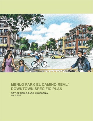
  • 1. MENLO PARK EL CAMINO REAL/ DOWNTOWN SPECIFIC PLAN CITY OF MENLO PARK, CALIFORNIA July 12, 2012
  • 2.
  • 3. PREPARED BY: PERKINS+WILL IN ASSOCIATION WITH STRATEGIC ECONOMICS | FEHR & PEERS | BKF | HDR/THE HOYT COMPANY | ESA CITY OF MENLO PARK, CALIFORNIA July 12, 2012 MENLO PARK EL CAMINO REAL/ DOWNTOWN SPECIFIC PLAN
  • 4. ACKNOWLEDGMENTS CITY OF MENLO PARK CITY COUNCIL Richard Cline Andrew Cohen Kelly Fergusson Kirsten Keith Peter Ohtaki John Boyle (Council Member 2006-2010) Heyward Robinson (Council Member 2006-2010) CITY COUNCIL SUBCOMMITTEE Richard Cline Kirsten Keith John Boyle (Council Member 2006-2010) KEY CITY PERSONNEL Thomas Rogers, Project Manager and Associate Planner Arlinda Heineck, Community Development Director Vanh Malathong, Technical Service Coordinator Alex D. McIntyre, City Manager Glen Rojas (former City Manager) Starla Jerome-Robinson, Assistant City Manager Cherise Brandell, Community Services Director Carol Augustine, Finance Director Chip Taylor, Public Works Director Atul Patel, Senior Transportation Engineer Kent Steffens (former Public Works Director) David Johnson (former Business Development Manager) Many others on staff contributed to the success of the community workshops, review and refinement of draft concepts, and the production of documents. CONTRACT ATTORNEY Barbara Kautz, Goldfarb Lipman, Attorneys PLANNING COMMISSION Vincent Bressler Ben Eiref Katie Ferrick John Kadvany John O’Malley Henry Riggs Peipei Yu Kirsten Keith (former Commissioner) Melody Pagee (former Commissioner) CITY COMMISSIONS Bicycle Commission Environmental Quality Commission Finance and Audit Committee Housing Commission Parks and Recreation Commission Transportation Commission OVERSIGHT/OUTREACH COMMITTEE Charlie Bourne Patty Boyle Kristi Breisch Vincent Bressler Charles Catalano Rick Ciardella Ben Eiref Steve Elliott John Fox Bill Frimel J. Michael Gullard Tom Hilligoss Clark Kepler Bud Kohn Elizabeth Lazensky Reginald Rice Henry Riggs Douglas Scott Todd Temple Jeff Warmouth Elizabeth Weiss …And the thousands of community members who did the real work of the Specific Plan by providing direction for their community for the next 20 to 30 years. Their dedication to working in a constructive, collaborative way to create a plan that will make our community the best it can be is an admirable testament to our ability to achieve the vision set forth in the Specific Plan.
  • 5. CONSULTANT TEAM PERKINS+WILL Prakash Printo, Principal-in-Charge Mark Hoffheimer, Project Manager and Senior Planner Karen Alschuler, Participating Principal Geeti Silwal, Urban Designer Patrick Vaucheret, Urban Designer Saba Ghole, Urban Planner Poonam Narkar, Urban Planner STRATEGIC ECONOMICS Nadine Fogarty, Principal Sujata Srivastava, Principal Sarah Graham, Senior Associate Derek Braun, Associate FEHR & PEERS Jane Bierstedt, Principal-in-Charge Joe Fernandez, Project Manager Nicole Nagaya, Project Planner Gregory Ripa, Project Engineer Ian Moore, Senior Bicycle Planner Carrie Nielson, Bicycle Planner Katherine Spencer, Graphic Artist and GIS Analyst BKF ENGINEERS Daniel Schaefer, Principal Eric Girod, Associate/Project Manager HDR/THE HOYT COMPANY Peter Castles, Outreach Project Manager Tammy Nguyen, Community Relations Coordinator
  • 6.
  • 7. CONTENTS A PLAN OVERVIEW B PLAN CONTEXT C PLAN PRINCIPLES, FRAMEWORK + PROGRAM D PUBLIC SPACE E LAND USE + BUILDING CHARACTER F CIRCULATION G IMPLEMENTATION H APPENDIX
  • 8. LIST OF FIGURES A. PLAN OVERVIEW Fig. A1 Illustrative Site Plan ....................................................................................................... A3 Fig. A2 Regional Map ................................................................................................................. A6 Fig. A3 Plan Area Map ............................................................................................................... A7 Fig. A4 “Project North” ............................................................................................................... A10 Fig. A5 Types of Information Found in Specific Plan .................................................................. A11 B. PLAN CONTEXT Fig. B1 Site Context ................................................................................................................... B4 Fig. B2 Site Character ............................................................................................................... B5 Fig. B3 Opportunities and Constraints ....................................................................................... B9 Fig. B4 Peak Period Intersection Level of Service in Plan Area ................................................ B17 Fig. B5 Pedestrian Facilities in Plan Area .................................................................................. B18 Fig. B6 Bicycle Facilities in Plan Area ........................................................................................ B19 Fig. B7 Transit Service in Plan Area .......................................................................................... B21 C. PLAN PRINCIPLES, FRAMEWORK + PROGRAM Fig. C1 Concept Diagram ........................................................................................................... C7 Fig. C2 El Camino Real South ................................................................................................... C11 Fig. C3 Opportunities and Constraints ....................................................................................... C15 Fig. C4 Detail of Downtown Public Space Program ................................................................... C16 Fig. C5 Downtown ...................................................................................................................... C17 Fig. C6 Illustrative Plan .............................................................................................................. C21 D. PUBLIC SPACE Fig. D1 Public Space Framework ............................................................................................... D3 Fig. D2 Connected + Walkable Downtown and Station Area Concept ....................................... D4 Fig. D3 Green + Shaded Downtown and Station Area Concept .................................................. D5 Fig. D4 Bicycle Network + Access Downtown and Station Area Concept ................................... D6 Fig. D5 El Camino Real South Concept ..................................................................................... D7 Fig. D6 Downtown Public Space Plan with Major Public Space Improvements ......................... D8 Fig. D7 Concept Plan of Key Public Spaces Downtown ............................................................. D9 Fig. D8 Sidewalk Section ........................................................................................................... D12 Fig. D9 Section through Santa Cruz Avenue ............................................................................. D13 Fig. D10 Concept Plan of Santa Cruz Avenue with Major Streetscape Improvements .............. D13 Fig. D11 Section through Santa Cruz Ave Central Plaza, with Median Trees Preserved ............ D17 Fig. D12 Concept Plan of the Santa Cruz Avenue Central Plaza ................................................ D17 Fig. D13 Concept Plan of Santa Cruz Avenue Central Plaza and the Chestnut Paseo .............. D19 Fig. D14 Concept Plan of South Parking Plazas Pedestrian Link .............................................. D23 Fig. D15 Concept Plan of Station Area ...................................................................................... D29 Fig. D16 Concept Plan of Ravenswood Gateway ...................................................................... D35 Fig. D17 Typical Section / Plan at El Camino Real North between Valparaiso and Oak Grove Avenues ............................................................................................................. D39
  • 9. Fig. D18 Typical Section / Plan at El Camino Real Downtown between Oak Grove and Menlo Avenues ....................................................................................................................... D40 Fig. D19 Typical Section / Plan at El Camino Real South of Roble Avenue ................................ D41 Fig. D20 Typical Intersection Improvement .................................................................................. D43 E. LAND USE + BUILDING CHARACTER Fig. E1 Land Use Designations .................................................................................................. E3 Fig. E2 Development Intensity / Density ....................................................................................... E14 Fig. E3 Maximum Building Height and Maximum Façade Height ............................................... E19 Fig. E4 Heights, Setbacks and Building Profile ........................................................................... E20 Fig. E5 Building and Architectural Projections ............................................................................ E22 Fig. E6 Building and Architectural Projection Standards ............................................................ E22 Fig. E7 Building Front and Corner Side Setbacks ...................................................................... E23 Fig. E8 Allowable Building Projection Area ................................................................................. E24 Fig. E9 Minimum Building Break Requirements in El Camino Real (ECR) SE District .............. E27 Fig. E10 Vertical Façade Modulation and Upper Floor Façade Length ...................................... E29 Fig. E11 45-Degree Building Profile for Floors Above the Maximum Allowable Façade Height ... E29 Fig. E12 45-Degree Building Profile Set at Minimum Setback Line ............................................ E29 Fig. E13 Raised Residential Unit Entries .................................................................................... E31 Fig. E14 Clearly Articulated Ground-Floor Bays ......................................................................... E33 Fig. E15 Retail Entries at a Maximum of Every 50-Feet ............................................................. E34 Fig. E16 Key Map of Zoning Districts .......................................................................................... E45 Fig. E17 Mixed Use Residential Projects in El Camino Real North-East (ECR NE-L) District ..... E47 Fig. E18 Mixed Use Commercial Projects in El Camino Real North-East – Low Density (ECR NE-L) District ....................................................................................................................... E48 Fig. E19 El Camino Real North-East (ECR NE) District Required Setback ................................. E51 Fig. E20 Mixed Use Residential Projects in El Camino Real North-East (ECR NE) District ........ E52 Fig. E21 Mixed Use Commercial Projects in El Camino Real North-East (ECR NE) District ....... E53 Fig. E22 El Camino Real North East (ECR NE-R) District Required Setback ............................... E56 Fig. E23 Mixed Use Residential Projects in El Camino Real North East (ECR NE-R) District E57 Fig. E24Mixed Use Commercial Projects in El Camino Real North-East – Residential Emphasis (ECR NE-R) District ..................................................................................................................... E58 Fig. E25 El Camino Real South-East (ECR SE) District Required Setback ................................. E61 Fig. E26 Mixed Use Residential Projects in El Camino Real South-East (ECR SE) District ......... E62 Fig. E27 Mixed Use Commercial Projects in El Camino Real South-East (ECR SE) District ....... E63 Fig. E28 Mixed Use Residential Projects in El Camino Real North-West (ECR NW) District ...... E67 Fig. E29 Mixed Use Commercial Projects in El Camino Real North-West (ECR NW) District ..... E68 Fig. E30 El Camino Real South-West (ECR SW) District Required Setback ............................... E71 Fig. E31 Mixed Use Residential Projects in El Camino Real South-West (ECR SW) District ..... E72 Fig. E32 Mixed Use Commercial Projects in El Camino Real South-West (ECR SW) District ..... E73 Fig. E33 Mixed Use Residential Projects in Station Area East (SA E) District ............................. E77 Fig. E34 Mixed Use Commercial Projects in Station Area East (SA E) District ........................... E78 Fig. E35 Mixed Use Residential Projects in Station Area East (SA E) District – Alma Street East E79 Fig. E36 Mixed Use Residential Projects in Station Area West (SA W) District ............................ E83 Fig. E37 Mixed Use Commercial Projects in Station Area West (SA W) District ........................... E84 LIST OF FIGURES (continued)
  • 10. Fig. E38 Mixed Use Residential Projects in Downtown (D) District .............................................. E88 Fig. E39 Mixed Use Commercial Projects in Downtown (D) District ............................................. E89 Fig. E40 Parking Garage Project in Downtown (D) District ......................................................... E90 Fig. E41 Downtown Adjacent (DA) District Required Setback ...................................................... E93 Fig. E42 Mixed Use Residential Projects in Downtown Adjacent (DA) District ............................ E94 Fig. E43 Mixed Use Commercial Projects in Downtown Adjacent (DA) District ........................... E95 F. CIRCULATION Fig. F1 Vehicular Circulation ...................................................................................................... . F3 Fig. F2 Pedestrian Improvements .............................................................................................. F5 Fig. F3 Bicycle Facilities ............................................................................................................. F11 Fig. F4 Transit Service ................................................................................................................ F15 Fig. F5 Parking Areas ................................................................................................................. F21 Fig. F6 Proposed Public Parking Downtown .............................................................................. F25 G. IMPLEMENTATION Fig. G1 Proposed Public Improvements .................................................................................... G18 Fig. G2 Storm Drainage ............................................................................................................. G29 Fig. G3 Sanitary Sewer .............................................................................................................. G31 Fig. G4 Water Supply and Delivery ............................................................................................ G33 LIST OF FIGURES (continued)
  • 11. LIST OF TABLES C. PLAN PRINCIPLES, FRAMEWORK + PROGRAM Table C1 Guiding Principles Matrix ............................................................................................. C3 E. LAND USE + BUILDING CHARACTER Table E1 Land Use Designations and Allowable Uses ............................................................... E6-7 Table E2 Development Standards by Zoning Districts ................................................................. E15 Table E3 Required Building Breaks in the Zoning Districts ......................................................... E26 Table E4 Required Building Breaks in the El Camino Real South-East (ECR SE) Zoning District E26 Table E5 Summary of Green Building Requirements .................................................................. E41 Table E6 Development Standards for El Camino Real North East–Low Density (ECR NE-L) District ....................................................................................................................... E49-50 Table E7 Development Standards for El Camino Real North-East (ECR NE) District.................. E54-55 Table E8 Development Standards for El Camino Real North-East–Residential Emphasis (ECR NE-R) District .................................................................................................... E59-60 Table E9 Development Standards for El Camino Real South-East (ECR SE) District ................ E64-65 Table E10 Development Standards for El Camino Real North-West (ECR NW) District ............ E69-70 Table E11 Development Standards for El Camino Real South-West (ECR SW) District ............ E74-75 Table E12 Development Standards for Station Area East (SA E) District ................................... E80-81 Table E13 Development Standards for Station Area West (SA W) District ................................ E85-86 Table E14 Development Standards for Downtown (D) District .................................................. E91-92 Table E15 Development Standards for Downtown Adjacent (DA) District ................................. E96-97 F. CIRCULATION Table F1 Bicycle Parking Requirements ....................................................................................... F13 Table F2 Parking Rates ................................................................................................................ F19 Table E3 Existing and Future Downtown Parking Supply ............................................................. F24 G. IMPLEMENTATION Table G1 El Camino Real/Downtown Specific Plan/City of Menlo Park General Plan Consistency Analysis ..................................................................................................................... G4-13 Table G2 Potential Funding Sources, Financing Alternatives and Participating Parties ............... G19 Table G3 Potential Funding Strategies ......................................................................................... G20 Table G4 Public Space Improvements and Public Parking Spaces Displaced ............................. G27
  • 12.
  • 13. PLAN OVERVIEW A. A.1 SUMMARY A.2 SETTING AND BACKGROUND A.3 SCOPE OF SPECIFIC PLAN A.4 HOW TO USE THIS DOCUMENT A.5 PLANNING PROCESS A.6 VISION PLAN GOALS A2 A5 A8 A10 A12 A17
  • 14. A2 MENLO PARK EL CAMINO REAL AND DOWNTOWN SPECIFIC PLAN A.1 SUMMARY The El Camino Real/Downtown Specific Plan establishes a framework for private and public improvements on El Camino Real, in the Caltrain station area and in downtown Menlo Park for the next several decades. The plan’s focus is on the character and extent of enhanced public spaces, the character and intensity of private infill development and circulation and connectivity improvements. It includes a strategy for implementation of public space improvements, such as wider sidewalks and plazas, and other infrastructure improvements. The overall intent of the El Camino Real/Downtown Specific Plan is to preserve and enhance community life, character and vitality through public space improvements, mixed use infill projects sensitive to the small-town character of Menlo Park and improved connectivity. As discussed later in more detail, the Specific Plan reflects the outcome of an extensive community outreach and engagement process. Illustrated in Figure A1, the El Camino Real/Downtown Specific Plan:  Encourages infill development of vacant and under-utilized lots along El Camino Real through increased intensities, coupled with strict building modulation and ground-floor setback and building profile requirements that both attenuate the mass and scale of larger buildings and create wider public sidewalks;  Retains the existing “village” character downtown by keeping buildings low and requiring varied building massing, including through building profile and façade modulation requirements;  Increases downtown activity, foot traffic and transit use through enhanced public spaces, mixed-use infill projects (including residential uses) and higher intensities of development near the commuter rail station;  Enhances community life through an integrated network of widened sidewalks, promenades, pocket parks and public gathering spaces; and  Enhances east-west connectivity across El Camino Real through crosswalk and sidewalk improvements, while accommodating north-south vehicular through-traffic, and across the railroad tracks through grade-separated pedestrian and bicycle connections. “We need to do something. ”- Workshop #1 Participant
  • 15. CaltrainParking P P P P P CaltrainParking CCaCatalalttraiinPParkinltrainPaarkiinngngg PPPP PPP PPP PPPPP PPPPP PP ALMA MIDDLEFIELD LAUREL ELCAMINOREAL ELCAMINOREAL MIDDLE OAK GROVE ISABELLA YALE ENCINAL PARK WATKINS SANTA CRUZ VALPARAISO COLLEGE CREEK ROBLE EMILIE MILLS GLENWOOD PINE CAMBRIDGE ARBOR FREMONT LIVE OAK RAVENSWOOD ALEJANDRA ALTO LINFIELD FELTON HARVARD ARDEN BURGESS JOHNSON PARTRIDGE NOEL ALLEY GARWOOD LENNOX UNIVERSITY PRINCETON HOOVER MERRILL SPRUCE EVELYN ROSE OAK CRANE VICTORIA LEON CLAIRE LEE MILLIE LANE ALICE MARCUSSEN STONE PINE WERTH FLORENCE MAC BAIN WAVERLEY PRIOR MCCORMICK CORNELL SANANTONIO BAY LAUREL BRITTON MOREY MENLO DOUGLAS MOULTON BUCKTHORN REBECCA DOYLE BLAKE SHERWOOD HOPKINS CURTIS WESTFIELD MALONEY BARRON MICHAELS NEALON PARK JACK W. LYLE MEMORIAL PARK FREMONT PARK BURGESS PARK CIVIC CENTER KENWOOD KENT SAXON CASTLE CLAREMONT CHERRY RYAN'S FOREST MALLET TUDOR HOMEWOOD SURREY HOWARD ELIZABETH CHATEAU FENNWOOD VERSAILLES BASSETT CREEKPL SUSSEX MANOR BLAKE CREEK CURTIS UNIVERSITY CRANE WAVERLEY ARBOR SHERWOOD RAVENSWOOD ROBLE ARBOR MENLO CURTIS Enhanced pedestrian crossings on El Camino Real at Oak Grove, Santa Cruz and Menlo Avenues El Camino Real East Promenade Civic Plaza / Entry Feature Burgess Park Linkage /Open Space Plaza / Retail Node Enhanced Streetscape on Santa Cruz Avenue Market Place P P P P Parking / Flexible Space Hotel Downtown El Camino Real Station Area Civic Center Existing Buildings Not Included in Opportunity Sites Potential Opportunity Sites Proposed / Approved Projects Surface Parking Lot Public Plazas / Open Space Parks Plan Area Boundary Railroad Menlo Park City Limit P 0 200 400 Feet A3 CHAPTER A PLAN OVERVIEW Figure A1. Illustrative Site Plan
  • 16. A4 MENLO PARK EL CAMINO REAL AND DOWNTOWN SPECIFIC PLAN The illustrative plan, as shown in Figure A1, depicts how the plan area could potentially build out over the next several decades in conformance with the overall planning principles and within the land use and development regulations and design guidelines contained in subsequent chapters. It is important to emphasize that the illustrative plan indicates only one potential development concept and that the actual build-out will likely vary from the initial projection. As envisioned, the full build-out of the plan area could result in up to approximately 330,000 square feet of additional retail and commercial development, 680 new residential units and 380 new hotel rooms, resulting in 1,357 new jobs and 1,537 additional residents. It is important to emphasize that the illustrative plan indicates only one potential development concept and that the actual build-out will likely vary from the initial projection. Rendering of El Camino Real at Ravenswood, looking north
  • 17. A5 CHAPTER A PLAN OVERVIEW downtown’s main street, provide convenient parking for downtown visitors and employees. Extensive streetscape and sidewalk improvements on Santa Cruz Avenue, constructed in the 1970’s, with additional improvements in later decades, lend a distinct character and pleasant tree cover to the street. The street’s sidewalks, however, tend to be narrow and lack adequate social space and spill-out space for adjacent retailers that many in the community strongly desire. The historic train station, currently providing commuter rail service to San Francisco and San Jose, is one block off El Camino Real opposite downtown. There is a relatively weak connection between the train station area and downtown, with limited foot traffic and activities that would otherwise generate more vibrancy in the area. In addition, the rail line, in combination with El Camino Real, run north-south, making east-west connectivity for vehicular, pedestrian, and bicycle movement challenging. In 2007, the City initiated a two-phase planning process to enhance and plan for the long-term success of El Camino Real, the Caltrain station area and downtown. As discussed in section A.5, Phase I established an overarching vision for the project area (discussed below). Phase II, this Specific Plan, refines the vision and establishes an implementation framework for future improvements to the area. Rendering of El Camino Real at Partridge, looking north The City of Menlo Park is located approximately 30 miles south of San Francisco on the Peninsula. Home to approximately 30,000 residents, Menlo Park is part of a string of communities connected to San Francisco and San Jose via El Camino Real (an historic road and State Highway), Caltrain rail service and Interstates 101 and 280. Figure A2 illustrates Menlo Park’s regional context. El Camino Real, the Caltrain rail station, and downtown, along with the nearby Civic Center, constitute the historic core of Menlo Park. Figure A3 illustrates the Specific Plan’s plan area, which encompasses El Camino Real, the rail station area and downtown. An historic route, El Camino Real is now State Highway 82, an active arterial roadway and commercial corridor. It was once home to a number of automobile dealerships, most of which are vacant today. Stanford University, the largest private land owner in the project area, owns 12.8 acres on the east side of El Camino Real south of downtown, encompassing most of the former automobile dealerships and the active Stanford Park Hotel. Menlo Park’s downtown includes relatively few historic buildings but retains its historic fabric of small parcels and local-serving, independent street-front retail businesses. Surface parking lots behind Santa Cruz Avenue, A.2 SETTING AND BACKGROUND
  • 18. San Francisco Sausalito Daly City South San Francisco San Francisco Bay Pacific Ocean San Bruno Millbrae Pacifica Burlingame San Mateo Foster City Belmont San Carlos Redwood City Half Moon Bay Menlo Park East Palo Alto Palo Alto Mountain View Newark Fremont Union City Hayward San Lorenzo Dublin Pleasanton San Ramon San Leandro Alameda Piedmont Berkeley El Cerrito Walnut Creek Danville Oakland Castro Valley Sunnyvale Santa Clara Cupertino Saratoga San Jose Milpitas 80 880 580 580 680 880 680 280 280 280 1 1 101 101 280 1 82 82 El Camino Real 101 El Camino Real Freeway / Highway Railroad El Camino Real Figure A2. Regional Map A6 MENLO PARK EL CAMINO REAL AND DOWNTOWN SPECIFIC PLAN
  • 19. A7 CHAPTER A PLAN OVERVIEW MIDDLEFIELD LAUREL LAUREL MIDDLE ISABELLA YALE ENCINAL PARK WATKINS COLLEGE CREEK ROBLE EMILIE MILLS PINE CAMBRIDGE ARBOR FREMONT LIVE OAK RAVENSWOOD ALEJANDRA ALTO LINFIELD FELTON HARVARD ARDEN BURGESS JOHNSON PARTRIDGE NOEL ALLEY GARWOOD LENNOX PRINCETON HOOVER MERRILL SPRUCE EVELYN ROSE OAK CRANE VICTORIA LEON CLAIRE LEE MILLIE LANE ALICE MARCUSSEN STONE PINE WERTH FLORENCE MAC BAIN WAVERLEY PRIOR CORNELL SANANTONIO BAY LAUREL BRITTON MOREY MENLO DOUGLAS MOULTON BUCKTHORN REBECCA DOYLE BLAKE SHERWOOD HOPKINS CURTIS WESTFIELD MALONEY BARRON MICHAELS KENWOOD KENT ON TLE CLAREMONT CHERRY RYAN'S FOREST MALLET TUDOR CHESTNUT HOMEWOOD SURREY HOWARD ELIZABETH CHATEAU FENNWOOD VERSAILLES BASSETT EKPL SUSSEX MANOR OAK GROVE PLAZA BLAKE CHESTNUT CREEK CURTIS CRANE WAVERLEY ARBOR SHERWOOD WILLOW JOHNSON ROBLE ARBOR CURTIS AlmaStreet University University Oak Grove GlenwoodValparaiso Oak Grove Santa Cruz Ave Menlo Ravenswood ElCaminoReal N 0 300 600 1200 Feet Downtown Menlo Park El Camino Real Station Area Stanford University Property Santa Cruz Avenue Caltrain WAVERLEY Plan Area Civic Center Figure A3. Plan Area Map
  • 20. A8 MENLO PARK EL CAMINO REAL AND DOWNTOWN SPECIFIC PLAN A.3 SCOPE OF SPECIFIC PLAN The El Camino Real/Downtown Specific Plan establishes the location and character of streetscape and public space improvements; the character and intensity of commercial and residential development; and the circulation pattern (vehicular, pedestrian, bicycle and transit) and parking strategy to support businesses and overall vitality, and enhance east-west connectivity. The Specific Plan includes standards and guidelines for public and private enhancements to the area, and it offers strategies for financing and implementing public improvements. In general, a specific plan is a tool for the systematic implementation of the general plan. It effectively establishes a link between implementing policies of the general plan and the individual development proposals in a defined area. A specific plan may be as general as setting forth broad policy concepts, or as detailed as providing direction to every facet of development from the type, location and intensity of uses to the design and capacity of infrastructure; from the resources used to finance public improvements to the design guidelines of a subdivision. Rendering of Santa Cruz Avenue
  • 21. A9 CHAPTER A PLAN OVERVIEW According to California law, Section 65451 of the Government Code mandates that a specific plan contain the following: (A) A specific plan shall include a text and a diagram or diagrams which specify all of the following in detail: (1) The distribution, location, and extent of the uses of land, including open space, within the area covered by the plan; (2) The proposed distribution, location, and extent and intensity of major components of public and private transportation, sewage, water, drainage, solid waste disposal, energy, and other essential facilities proposed to be located within the area covered by the plan and needed to support the land uses described in the plan; (3) Standards and criteria by which development will proceed, and standards for the conservation, development, and utilization of natural resources, where applicable; and (4) A program of implementation measures including regulations, programs, public works projects, and financing measures necessary to carry out paragraphs (1), (2), and (3). (B) The specific plan shall include a statement of the relationship of the specific plan to the general plan. The El Camino Real/Downtown Specific Plan builds upon the El Camino Real/Downtown Vision Plan, unanimously accepted by the Menlo Park City Council on July 15, 2008. In addition to the Specific Plan, the planning effort includes an associated Environmental Impact Report (EIR), fiscal impact analysis (FIA) and revisions to the Menlo Park General Plan and Zoning Ordinance to make this specific plan fully operational. The sketches and photographs in the El Camino Real/ Downtown Specific Plan are meant only to relay particular concepts as described in the text or make reference to pertinent precedents and should not be considered exact models. Also, the Specific Plan provides standards and guidelines for private and public development, but does not include detailed plans. The El Camino Real/ Downtown Specific Plan builds upon the El Camino Real/Downtown Vision Plan, unanimously accepted by the Menlo Park City Council on July 15, 2008. The sketches and photographs in the El Camino Real/Downtown Specific Plan are meant only to relay particular concepts as described in the text or make reference to pertinent precedents and should not be considered exact models. Also, the Specific Plan provides standards and guidelines for private and public development, but does not include detailed plans.
  • 22. A10 MENLO PARK EL CAMINO REAL AND DOWNTOWN SPECIFIC PLAN A.4 HOW TO USE THIS DOCUMENT The El Camino Real/Downtown Specific Plan conveys an overarching vision for enhancements in the plan area for community residents, business and property owners, City staff and developers. It provides guidance for those making public and private improvement in the plan area. The Specific Plan includes the following chapters.  A. Plan Overview  B. Plan Context  C. Plan Principles, Framework + Program  D. Public Space  E. Land Use + Building Character  F. Circulation  G. Implementation  H. Appendix The first three chapters provide an overview, context and broad principles and concepts for the plan area, providing all readers with a broad framework within which individual improvements should be made. Chapters D, F and G focus on public improvements, including their character, associated standards and guidelines, and implementation strategies. Chapter E provides the regulatory framework for private development, including allowable building heights, allowable development intensities, setback requirements and other standards and guidelines. This chapter is the major focus for property owners and private developers, and it is used by City staff when reviewing private development proposals. Note: building diagrams in Chapter E are intended to illustrate how different standards are measured, and are not intended to necessarily dictate the placement of different uses or parking within a development. Although each chapter presents information differently based on its focus, Figure A5 illustrates the types of information found within this Specific Plan. Figure A4. “Project North” - Although El Camino Real and the Caltrain line do not run in a precisely north-south direction within Menlo Park, they are overall north-south corridors and are considered by the community as such. Directional references in this document use this convention. N N Project North View of Project Area Oriented to Project North True North N N N Project North View of Project Area Oriented to True North True North
  • 23. D10 MENLO PARK EL CAMINO REAL AND DOWNTOWN SPECIFIC PLAN Widened sidewalks providing ample space for sitting and outdoor dining (City of Santa Cruz, California) Santa Cruz Avenue Sidewalks The Specific Plan calls for improving the pedestrian realm on Santa Cruz Avenue, increasing street activity and enhancing the image of downtown by widening sidewalks, providing ample space for informal gathering, sitting and outdoor dining and introducing new streetscape improvements. The plan establishes sidewalk functional zones, ensuring a pedestrian clear zone and more pleasant and functional sidewalks. It redistributes the right-of-way between traffic lanes, on-street parking and sidewalks in order to focus on an enhanced pedestrian experience while still accommodating vehicular circulation and on-street parking. Intent Encourage walking and increase levels of street activity with wider, more functional sidewalks. Renew the image of downtown with updated streetscape elements. Character Tree canopy with clear visibility to storefronts. Median trees retained, which are iconic features of downtown. Improvements Retain existing median trees and integrate them into new streetscape design. Replace diagonal parking with parallel parking, and use reclaimed width to widen sidewalks. On the side with diagonal parking, replace the diagonal parking with parallel parking, narrow travel lane and widen sidewalk. On the side with parallel parking, retain parallel parking, narrow travel lane and widen sidewalk. Integrate street trees into on-street parking zones, particularly where sidewalks are narrowest. Upgrade streetscape elements, such as benches, seating, trash receptacles, newspaper racks, paving, and street lighting. Existing Santa Cruz Avenue sidewalk (Menlo Park, California) “Encourage restaurants and shops to utilize sidewalks and storefronts for public space gathering, dining, resting ”- Workshop #1 Participant “I would absolutely trade parking spaces on Santa Cruz and El Camino for well-designed parking garages with safe, pleasant pedestrian paths! ”- Workshop #1 Participant D11 CHAPTER D PUBLIC SPACE 12’ wide sidewalk (Palo Alto, California) Illustration of 19’ wide sidewalk Implement and evaluate Santa Cruz Avenue sidewalk improvements on a trial basis, before moving forward with a permanent installation. The trial period shall be the basis for the review and consideration of a permanent installation. Standards D.2.01 Streetscape improvements on Santa Cruz Avenue shall retain existing median trees to the extent possible. Guidelines Streetscape improvements on Santa Cruz Avenue should include the following: D.2.02 Provide widest sidewalk possible while retaining on- street parallel parking. D.2.03 Introduce safe pedestrian crossings by using elements such as marked crossings, clear signage, supplementary lighting, and curb extensions. D.2.04 Introduce street trees in parking zone to maximize sidewalk width, particularly in those areas where a 12 foot minimum sidewalk dimension cannot be achieved. D.2.05 Coordinate with streetscape improvements in the station area. D.2.06 Consider the following as criteria for streetscape furnishing selection: timeless, functional, easy maintenance, durability and sustainability. D.2.07 Achieve safe lighting for vehicular circulation and comfortable lighting for pedestrians; consider additional decorative lighting for nightscape. “I like the wider sidewalks on Santa Cruz ”- Workshop #3 Participant Renewed/memorable image for downtown (San Jose, California) D13 CHAPTER D PUBLIC SPACE Chestnut SectionCut Curtis 10’ 30’ 60’ Figure D10. Concept Plan of Santa Cruz Avenue with Major Streetscape Improvements. This plan does not feature the Central Plaza described in the next section. Figure D9. Section through Santa Cruz Avenue, showing two traffic lanes with parallel parking, median trees retained, diagonal parking removed, one moderately-sized sidewalk and one wide sidewalk 75’ 19’ 11’ 12’ 5’ 11’ 8’ 11’8’ 7’ Pedestrian Thru Zone 12’ Pedestrian Thru Zone 5’8’11’7’11’8’11’ A11 CHAPTER A PLAN OVERVIEW A B F C D E A. OVERALL DESCRIPTION / INTENT: Each section / sub-section typically begins with an overall description that outlines the general objectives and intent. B. QUOTES / COMMENTS: Quotes / comments from the community workshops appear in the sidebar to highlight the voices of the participants. The workshop number indicates where the quote / comment was collected. Occasionally, important points of emphasis also appear in the sidebar. C. PHOTO: Photos that appear in the sidebar are intended to relay general principles and not serve as exact models. D. STANDARDS: These are the aspects that must be implemented (strict requirements) for public and private development. E. GUIDELINES: These are the aspects that should be implemented (not strict requirements) for public and private development. F. CONCEPT DRAWINGS: Conceptual drawings serve as examples of one potential design, to be refined if and when the improvement is to be built. Figure A5. Types of Information Found in Specific Plan
  • 24. A12 MENLO PARK EL CAMINO REAL AND DOWNTOWN SPECIFIC PLAN A.5 PLANNING PROCESS The El Camino Real/Downtown Specific Plan is the result of a multi-year process designed to evolve a community judgment about the future of the plan area. Community judgment, as opposed to public opinion, is a shared conclusion based on beliefs, values and factual information that results in a legitimate, lasting and implementable outcome. Community judgment consists of a shared and common sense of public priorities but is not the same thing as consensus. This public judgment emerged through a two-phase process involving thousands of community members (over 950 on the regular email update list alone); representatives of key stakeholder groups such as downtown and El Camino Real business and property owners; an Oversight and Outreach Committee that included representatives of important stakeholder groups such as residents and business/property owners; City Commissions; and the Menlo Park City Council. The process was supported by an extensive community outreach campaign through both phases that included project newsletters and postcards to every Menlo Park postal address (including both residential and commercial properties); stories in the Menlo Park quarterly newsletter that also went to all households and businesses; news releases, posters, fliers and an extensive email update system; and one-on-one outreach to stakeholders by Council Members, Oversight and Outreach Committee Members and staff. “I think the emerging plan strikes a good ‘reasonable’ balance between character and progress…by allowing reasonable development ”- Workshop #3 Participant “I think the overall process has been a very constructive planning process! ”- Workshop #3 Participant
  • 25. A13 CHAPTER A PLAN OVERVIEW Phase I: Vision Plan As is typical of planning processes designed to develop community judgment, the El Camino Real/Downtown Specific Plan began with a community visioning process conducted in 2007 and 2008. This step included an educational speaker series, walking tours, three community workshops, one Planning Commission workshop and two City Council meetings. The visioning process was structured to gather together the core values, hopes and dreams the community has for the area so that when more specific decisions have been made later in the process, they are grounded in the community’s decision about what is most important for the future. The visioning effort was promoted by five city-wide mailings (including two return surveys), which were sent to all residential and commercial properties and which generated approximately 2,600 total returns. The outreach effort also included one-on-one outreach by the Oversight and Outreach Committee to members of their stakeholder groups, such as downtown businesses and residents. The City Council unanimously accepted the Vision Plan on July 15, 2008, and the Plan serves as the values base for the Specific Plan. The following section, Section A.6, lists the Vision Plan’s twelve principal goals. Phase II: Specific Plan Process As recommended in the Vision Plan, the City subsequently commenced work on a Specific Plan, to contain elements such as detailed land use regulations, design guidelines and implementation measures. As was the case with Phase I, the Phase II process has been a community-oriented planning project, with unprecedented levels of public outreach and participation. The Specific Plan process has strived to result in a community judgment, as defined earlier. The Specific Plan process included meetings, work sessions and workshops at critical project milestones:  Interviews with Project Stakeholders at the beginning of the project;  Meetings with the Oversight and Outreach Committee;  Meetings/work sessions with the Planning Commission;  Meetings/work sessions with the City Council; and  Three Community Workshops.  Detailed review of the Draft Specific Plan and EIR Community Workshops Three community workshops, each attended by over 100 people, engaged members of the community in facilitated, interactive activities designed to move from the values and goals of the vision phase to an informed judgment about the detailed elements of the Specific Plan. This required workshop participants to learn about the current conditions in the area, generate ideas about what could be done to improve those conditions in order to realize the community vision, understand and weigh the impacts of those ideas and improvements, and make choices about which ideas to include in the plan based on deliberation with other community members. Phase I visioning process
  • 26. A14 MENLO PARK EL CAMINO REAL AND DOWNTOWN SPECIFIC PLAN Workshop #1 on April 16, 2009. The purpose of the first workshop was to help the community confirm the Phase I vision and goals, to understand existing conditions, constraints and opportunities and to consider the primary issues and the possible positive and negative outcomes related to future potential changes in the plan area. The workshop was organized around four subject areas: connectivity, vibrancy, public space and character, all of which were based on the approved vision. Community Workshop #1
  • 27. A15 CHAPTER A PLAN OVERVIEW Workshop #2 on June 18, 2009 The purpose of the second workshop was to build upon the discussion from the first workshop and to begin to discuss the impacts of the various plan elements that were emerging. The process involved a presentation and discussion, in break-out sessions, of alternative concepts for connectivity, vibrancy, public space and character, based on comments from the first workshop, feedback from the Oversight and Outreach Committee, Planning Commission and City Council and analyses conducted by the consultant team. The analyses included preliminary fiscal information, diagrams of site character and opportunities/constraints and a preliminary study of the impacts of potentially tunneling El Camino Real. It included preparation and consideration of various plan concepts, massing options and photomontages, street sections, development scenarios and public space improvements. Community Workshop #2
  • 28. A16 MENLO PARK EL CAMINO REAL AND DOWNTOWN SPECIFIC PLAN Workshop #3 on September 17, 2009 The purpose of the third and final Community Workshop was to present an Emerging Plan developed from Community Workshops #1 and #2, to gain critical feedback on the Emerging Plan and to help decide on revisions to the Emerging Plan. Attendees were able to weigh in on proposed public improvements, including expanded public spaces, wider sidewalks on Santa Cruz Avenue and enhanced crossings of El Camino Real. Attendees also considered a preferred direction for the use, size and character of private development, with its associated traffic and fiscal implications and potential public benefits. Draft Specific Plan and EIR Following the Community Workshop process, the Draft Specific Plan was published on April 7, 2010, and the Draft EIR was published on April 29, 2011. Both documents were released to strong community interest. Following the Draft EIR comment period (discussed fully in the Final EIR), the Planning Commission and City Council were originally scheduled to hold one meeting each to provide direction on the Draft Specific Plan. However, both bodies expressed an interest and willingness to hold additional meetings in order to more fully explore and address comments, questions, and potential concerns, both from the Commission/Council and the public. The aim of this detailed review was to provide clear and specific direction on improvements and refinements to the plan. The Planning Commission held five meetings in July- August 2011, and the City Council followed with four meetings in August-October 2011. Concurrent with the Planning Commission and City Council’s review, the Housing, Transportation, and Bicycle Commissions conducted sessions on the Draft Specific Plan. Each of these Commissions recommended moving forward with the El Camino Real/Downtown Specific Plan process, subject to specific recommendations that were considered by the Planning Commission and City Council. All of these meetings benefited from diverse public input. The City Council concluded its review on October 4, 2011 with direction for substantive improvements to the Draft Specific Plan, which have been incorporated as appropriate into this Final Specific Plan. Community Workshop #3
  • 29. A17 CHAPTER A PLAN OVERVIEW A.6 VISION PLAN GOALS The El Camino Real/Downtown Specific Plan builds upon the Phase I Vision Plan, as unanimously accepted by the City Council on July 15, 2008. The Vision Plan’s twelve goals are: Maintain a village character unique to Menlo Park. Provide greater east-west, town-wide connectivity. Improve circulation and streetscape conditions on El Camino Real. Ensure that El Camino Real development is sensitive to and compatible with adjacent neighborhoods. Revitalize underutilized parcels and buildings. Activate the train station area. Protect and enhance pedestrian amenities on Santa Cruz Avenue. Expand shopping, dining and neighborhood services to ensure a vibrant downtown. Provide residential opportunities in the Vision Plan Area. Provide plaza and park spaces. Provide an integrated, safe and well-designed pedestrian and bicycle network. Develop parking strategies and facilities that meet the commercial and residential needs of the community. Section C.1 of this plan further describes the relationship between these goals and the guiding principles of the Specific Plan. Phase I visioning process
  • 30.
  • 31. PLAN CONTEXT B. B.1 OVERVIEW B.2 SITE CONTEXT AND CHARACTER B.3 OPPORTUNITIES AND CONSTRAINTS B.4 CIRCULATION OVERVIEW B.5 MARKET OVERVIEW B2 B2 B8 B16 B23
  • 32. B2 MENLO PARK EL CAMINO REAL AND DOWNTOWN SPECIFIC PLAN B.1 OVERVIEW Located on the Peninsula south of San Francisco, the plan area for the El Camino Real/Downtown Specific Plan is the historic center of Menlo Park. The plan area consists of an arterial corridor, a pedestrian-scale downtown and a transit center providing commuter rail service to San Francisco and San Jose. This chapter summarizes the following aspects of the plan area: • Site Context and Character; • Opportunities and Constraints; • Circulation Overview; and • Market Overview. B.2 SITE CONTEXT AND CHARACTER Figure B1 identifies major features of the area, including the El Camino Real corridor, Caltrain station area, downtown core, major roadways, the adjacent Civic Center and major parks, schools and landmarks in the area. Feature buildings, as shown, are those buildings that are highly visible and memorable, have historic or cultural value or contain uses that have large local and regional draws. Their inclusion in the figure helps orient the reader. Figure B2 illustrates some of the defining characteristics of the El Camino Real corridor, station area and downtown. It focuses on the visual quality and definition of the area by the way buildings orient to the street, with varying building setbacks; the effect of underutilized lots on street character; the provision and location of public parking plazas; and the area’s landscape character. It identifies familiar “landmark” buildings, which help orient visitors to the area, and places with a higher degree of activity, such as Draeger’s Market and the public library. In general, some of the most successful and memorable streets, in terms of character and activity, are ones where buildings address and frame the street with active ground floor uses and articulated façades; where pedestrians have a comfortable and welcoming place to walk; and where a consistent use of landscape treatment, through street trees, street lamps and other furnishings, create a welcome and unifying image.
  • 33. B3 CHAPTER B PLAN CONTEXT Building Character Buildings on El Camino Real vary in size and style, from automobile showrooms (many empty) and car repair shops to larger commercial buildings, office buildings up to four stories tall and smaller scale commercial buildings closer to downtown. Most buildings are one and two stories tall, although others are taller. El Camino Real, for the most part, lacks a clear definition of a built edge due to inconsistent building setbacks and numerous parking lots along the street. This detracts from the visual appeal of the corridor. In some cases, buildings with a strong built edge face away from the street and to rear parking lots, thereby detracting from street character. The stretch of El Camino Real between Valparaiso Avenue and Roble Street exhibits a better definition because most buildings have a consistent, minimum setback from the street, consistent with the historic center of Menlo Park, and because of the landscaped median. Santa Cruz Avenue has a consistent building character between El Camino Real and University Drive, with all buildings aligned to the sidewalk/lot line and most buildings along Santa Cruz Avenue being one and two stories tall. This provides very clear street definition and strong visual quality to the street by providing clear distinction of the public and private realm with active edges of doors and windows opening onto the street. The street consists of small, distinct storefronts, creating a visual interest to passersby. Secondary street frontage on Oak Grove and Menlo Avenues adjacent to Santa Cruz Avenue, and other smaller streets perpendicular to it, play an important role in providing uses and services that support the downtown. The Oak Grove and Menlo Avenue corridors have a range of existing building types, including some three-story structures. Menlo Center and the Caltrain Station are notable buildings and function as local landmarks, with the Presbyterian Church, Draeger’s Market, Trader Joe’s, Safeway, Burgess Park and the public library serving as “activity nodes” or places attracting significant numbers of people and creating activity within the plan area. Santa Cruz Avenue has a small-town character, with storefronts that face the street and a median planted with stately trees (Menlo Park, California) Parking lot interfacing with El Camino Real, creating an edge condition that lacks clear definition (Menlo Park, California) Caltrain Station is a local landmark (Menlo Park, California)
  • 34. B4 MENLO PARK EL CAMINO REAL AND DOWNTOWN SPECIFIC PLAN Figure B1. Site Context Menlo College Menlo School Draeger’s Safeway Trader Joe’s Theater Civic Center Burgess Park Fremont Park Theater Nealon ParkJack W. Lyle Memorial Park Menlo Center Encinal Elementary El Camino Park St. Raymond’s Catholic Church and School Sacred Heart Schools San Francisquito Creek Holbrook Palmer Park Menlo Park Presbyterian Church Caltrain Station Fig 5: Site Context Railway El Camino Real Primary Streets in Plan Area Downtown Core Schools and Religious Institutions Open Space Civic Space Caltrain Station Feature Buildings Plan Area Boundary Menlo Park City Limit Station Area El Camino Real El Camino Real Downtown ALMA MIDDLEFIELD LAUREL ELCAMINOREAL MIDDLE OAK GROVE YALE ENCINAL WATKINS SANTA CRUZ VALPARAISO COLLEGE CREEK ROBLE MILLS GLENWOOD PINE CAMBRIDGE ARBOR FREMONT LIVE OAK ALEJANDRA ALTO LINFIELD FELTON HARVARD ARDEN BURGESS JOHNSON PARTRIDGE NOEL ALLEY GARWOOD LENNOX UNIVERSITY PRINCETON HOOVER MERRILL SPRUCE EVELYN ROSE OAK CRANE VICTORIA LEON CLAIRE LEE MILLIE LANE ALICE MARCUSSEN STONE PINE WERTH FLORENCE WAVERLEY PRIOR CORNELL SANANTONIO BAY LAUREL MOREY MENLO DOUGLAS MOULTON BUCKTHORN REBECCA DOYLE BLAKE SHERWOOD HOPKINS CURTIS WESTFIELD MALONEY BARRON KENWOOD KENT CLAREMONT CHERRY RYAN'S FOREST MALLET TUDOR CHESTNUT HOMEWOOD SURREY ELIZABETH CHATEAU FENNWOOD VERSAILLES BASSETT CREEKPL SUSSEX MANOR OAK GROVE PLAZA BLAKE CHESTNUT CREEK CURTIS UNIVERSITY CRANE WAVERLEY ARBOR SHERWOOD RAVENSWOOD JOHNSON ROBLE ARBOR MENLO CURTIS WILLOW El Camino Real/Downtown Specific Plan City of Menlo Park N 0 300 600 1200 Feet 18 June 2009 Fehr & Peers Strategic Economics BKF Engineers ESA HDR/The Hoyt Company
  • 35. B5 CHAPTER B PLAN CONTEXT ALMA MIDDLEFIELD LAUREL ELCAMINOREAL MIDDLE OAK GROVE YALE ENCINAL WATKINS SANTA CRUZ VALPARAISO COLLEGE CREEK ROBLE MILLS GLENWOOD PINE CAMBRIDGE ARBOR FREMONT LIVE OAK ALEJANDRA ALTO LINFIELD FELTON HARVARD ARDEN BURGESS JOHNSON PARTRIDGE NOEL ALLEY GARWOOD LENNOX UNIVERSITY PRINCETON HOOVER MERRILL SPRUCE EVELYN ROSE OAK CRANE VICTORIA LEON CLAIRE LEE MILLIE LANE ALICE MARCUSSEN STONE PINE WERTH FLORENCE WAVERLEY PRIOR CORNELL SANANTONIO BAY LAUREL MOREY MENLO DOUGLAS MOULTON BUCKTHORN REBECCA DOYLE BLAKE SHERWOOD HOPKINS CURTIS WESTFIELD MALONEY BARRON KENWOOD KENT CLAREMONT CHERRY RYAN'S FOREST MALLET TUDOR CHESTNUT HOMEWOOD SURREY ELIZABETH CHATEAU FENNWOOD VERSAILLES BASSETT CREEKPL SUSSEX MANOR OAK GROVE PLAZA BLAKE CHESTNUT CREEK CURTIS UNIVERSITY CRANE WAVERLEY ARBOR SHERWOOD RAVENSWOOD JOHNSON ROBLE ARBOR MENLO CURTIS WILLOW LMA Draeger’s Safeway Trader Joe’s Theater Civic Center Public Library Burgess Park Fremont Park Caltrain Station Theater Menlo Center Presbyterian Church Oasis Beer Garden Site Character Railway Landmark Activity Node Parking Plaza Landscape Buffer Open Space Street Defintion El Camino Real Crosstown Connector Lack of Building Edge / Unifying Character / Consistent Building Orientation Project Area Boundary Menlo Park City Limit Median Street Trees El Camino Real/Downtown Specific Plan City of Menlo Park N 0 300 600 1200 Feet 18 June 2009 Fehr & Peers Strategic Economics BKF Engineers ESA HDR/The Hoyt Company Figure B2. Site Character
  • 36. B6 MENLO PARK EL CAMINO REAL AND DOWNTOWN SPECIFIC PLAN The plan area also includes a number of gateways, an entrance “expression” that heralds the approach of new landscape and defines the arrival point as a destination. The minimum building setbacks and median trees, which start at Valparaiso Avenue, create a sense of entry or gateway to downtown heading south. Other gateways include El Camino Real at the Menlo Park/Palo Alto city limit, heading north, and Santa Cruz Avenue at El Camino Real and at University Drive heading into the center of downtown. El Camino Real/Downtown Specific Plan City of Menlo Park 29 April 2009 Fehr & Peers Strategic Economics BKF Engineers ESA Fig 24: Streetscape Study - Santa Cruz Avenue South (between El Camino Real and Evelyn) RONIMACLE RUZ LIVE OAK YTISREVINU HOOVER MERRILL NYLEVE ROSE AK NARC MILLIE NLO ELYOD SITRUC YENOLAM RYAN'S TUNTSEHC ELIZABETH OAK GROVE PLAZA EKALB CHESTNUT ENARC JOHNSON BLE MENLO SITRUC Curtis Chestnut Chestnut Crane Doyle Curtis JohnsonLn. ElCaminoReal Doyle Crane Evelyn Streetscape - Downtown (Menlo Park, California); Santa Cruz Avenue consists of small, distinct storefronts, in one- and two- story buildings, that line and define the street Peet’s Coffee at the corner of Santa Cruz Avenue and University Drive (Menlo Park, California)
  • 37. B7 CHAPTER B PLAN CONTEXT s MIL N ALLEY RAVENSWOOD Streetscape Character Streetscape character is created by features such as landscaping, sidewalk design and street furniture and amenities. Along El Camino Real, the landscaping varies in design, quality and maturity, resulting in a range of experiences for pedestrians. Some areas such as the section between Roble and Ravenswood Avenues include mature street trees, providing a high quality experience for pedestrians. Areas with less mature landscaping are not as comfortable. Overall, the series of street trees and median trees, especially ones that are more mature, help lessen the impact of traffic along El Camino Real and make it more comfortable for pedestrians. The sidewalk dimension on El Camino Real varies in width and in a few locations narrows down to a size that makes it an uncomfortable pedestrian experience. In addition, several intersections along El Camino Real have been compromised by infrastructural elements (such as signage, light posts and utility boxes) or restrict pedestrian circulation in favor of vehicular circulation (especially in locations where there is a high frequency of vehicular turning). The existing intersections have been designed for vehicular speeds and do little to provide assistance for pedestrians. Typically Santa Cruz Avenue is comprised of a traffic lane in each direction, parking on both sides (sometimes parallel, sometimes angled), 10-foot sidewalk and one- to two- story buildings that have no setback from the street. The street is identifiable by a median planting of London Plane trees that average 30 to 35 feet tall. Additionally, trees of varying types and sizes are planted irregularly in the sidewalk and planting areas. Santa Cruz Avenue has been designed with a great deal of emphasis on the pedestrian. A strong effort has been made to separate pedestrian circulation from vehicular traffic as well as provide street furnishings and amenities. The existing streetscape design, built over the past few decades, is intended to serve pedestrians, yet also creates constraints by reducing the effective space for circulation and social interaction and, at times, being visually disruptive. In several locations, benches are fixed in location back-to-back, limiting informal use by larger groups. Much of the sidewalk space has been organized using low concrete walls and planting areas, which provide a perception of increased protection from vehicles, but limit the usable space of the sidewalk. Back-to-back benches (Menlo Park, California)
  • 38. B8 MENLO PARK EL CAMINO REAL AND DOWNTOWN SPECIFIC PLAN B.3 OPPORTUNITIES AND CONSTRAINTS Draeger’s is a local activity node (Menlo Park, California) The plan area offers ample opportunities and constraints for improvements, particularly as they relate to the community’s desires for enhanced pedestrian amenities and public spaces, a revitalized El Camino Real, an active, vibrant downtown and improved pedestrian and bicycle connections. Illustrated in Figure B3, the following sections describe the area’s opportunities and constraints. “Improving conditions for both (vehicles and pedestrians) should be the goal through wider sidewalks with green areas between traffic and sidewalks ”- Workshop #1 Participant “Need for good streetscape and ground floor design – pedestrian friendly ”- Workshop #1 Participant
  • 39. ALMA MIDDLEFIELD LAUREL ELCAMINOREAL MIDDLE OAK GROVE YALE ENCINAL WATKINS SANTA CRUZ VALPARAISO COLLEGE CREEK ROBLE MILLS GLENWOOD PINE CAMBRIDGE ARBOR FREMONT LIVE OAK ALEJANDRA ALTO LINFIELD FELTON HARVARD ARDEN BURGESS JOHNSON PARTRIDGE NOEL ALLEY GARWOOD LENNOX UNIVERSITY PRINCETON HOOVER MERRILL SPRUCE EVELYN ROSE OAK CRANE VICTORIA LEON CLAIRE LEE MILLIE LANE ALICE MARCUSSEN STONE PINE WERTH FLORENCE WAVERLEY PRIOR CORNELL SANANTONIO BAY LAUREL MOREY MENLO DOUGLAS MOULTON BUCKTHORN REBECCA DOYLE BLAKE SHERWOOD HOPKINS CURTIS WESTFIELD MALONEY BARRON KENWOOD KENT CLAREMONT CHERRY RYAN'S FOREST MALLET TUDOR CHESTNUT HOMEWOOD SURREY ELIZABETH CHATEAU FENNWOOD VERSAILLES BASSETT CREEKPL SUSSEX MANOR OAK GROVE PLAZA BLAKE CHESTNUT CREEK CURTIS UNIVERSITY CRANE WAVERLEY ARBOR SHERWOOD RAVENSWOOD JOHNSON ROBLE ARBOR MENLO CURTIS WILLOW Menlo College Menlo High School Civic Center Public Library Burgess Park Fremont Park Caltrain Station Nealon Park Arbor Rd Park Encinal Elementary El Camino Park St. Raymond’s Elementary School San Francisquito Creek Holbrook Palmer Park Presbyterian Church Downtown 5 M inu te W alkingRadius Project Area Boundary School Area Civic Area Park Space Menlo Park City Boundary Downtown/Station Area High Impacted / High Traffic Volume Intersection Caltrain Railway (Limits E-W Connectivity) Opportunities Constraints El Camino Real Corridor (Limits E-W Connectivity) Improve Pedestrian Routes - Opportunity for connecting existing and new civic uses Improve Pedestrian/Bicycle Connectivity Underutilized and Vacant Land Stanford University Ownership Enhance Gateways Public Parking Plazas - Opportunities for Improved Parking Management Intensify development near downtown/train station Site Opportunities and Constraints El Camino Real/Downtown Specific Plan City of Menlo Park N 0 300 600 1200 Feet 29 April 2009 Fehr & Peers Strategic Economics BKF Engineers ESA HDR/The Hoyt Company B9 CHAPTER B PLAN CONTEXT Figure B3. Opportunities and Constraints
  • 40. B10 MENLO PARK EL CAMINO REAL AND DOWNTOWN SPECIFIC PLAN Opportunities The Specific Plan recognizes opportunities for enhancements within the plan area. The following sections discuss these opportunities in more detail: • Improve Underutilized and Vacant Lands. • Improve Stanford University-Owned Property. • Focus Higher Density Development in Proximity to the Train Station Area. • Build on Downtown Character. • Improve and “Leverage” Existing Public Parking Plazas. • Improve Pedestrian Amenities and Overall Street Character. • Improve East/West Pedestrian and Bicycle Connectively. • Improve Linkages between Open Spaces and Civic Uses. Improve Underutilized and Vacant Parcels Vacant and under-utilized parcels in the plan area provide opportunities for mixed use development. New development would also help transform the streetscape character along El Camino Real by encouraging street level activity and enhancing the pedestrian environment. Several of the parcels have approved or pending projects that will serve these purposes as well as provide the potential for revenue generation and increase housing opportunities. Additionally, hotel uses have the potential to generate needed tax revenue for the city. Improve Stanford University-Owned Property Stanford University owns a large contiguous stretch of land of approximately 12.8 acres on the eastern side of El Camino Real just north of San Francisquito Creek. The land is suitable for multi-family residential, commercial and mixed use development. This single ownership allows for a comprehensive approach to redevelopment of this portion of El Camino Real, which is currently underutilized. It also provides an opportunity for an east-west pedestrian and bicycle linkage near Middle Avenue. Vacant and under-utilized parcels along El Camino Real (Menlo Park, California) Large, contiguous stretches of land along El Camino Real (Menlo Park, California) “Let’s really plan for a 50-year non-auto environment ”- Workshop #3 Participant
  • 41. B11 CHAPTER B PLAN CONTEXT Focus Higher Density Development in Proximity to the Train Station Area Vibrancy is achieved by a rich mix of uses, including residential and public amenities, arranged in a compact manner, in close proximity to transit. This mixed-use pattern supports pedestrian circulation and transit use while reducing relative vehicular trips in comparison to standalone projects of the same size. Also, clustering development near transit can potentially help justify improvements to existing transit. The intersection of Santa Cruz Avenue and El Camino Real is the “center” of Menlo Park’s commercial and historic core, the confluence of the city’s commercial corridor, downtown “Main Street” and transit station area. This central location is the logical place for increased intensity of mixed-use development. As shown in Figure B3, there is an opportunity to focus development within a five minute walking radius from this “center”. Build on Downtown Character Downtown Menlo Park is a walkable district with small blocks with most of the retail uses concentrated along Santa Cruz Avenue. The buildings in downtown are one or two stories with relatively small floor area. Enhancing the walkability in downtown by improving pedestrian movement along Santa Cruz Avenue and along the side- streets perpendicular to Santa Cruz Avenue will reinforce the village character. Opportunities exist to create limited new social spaces in the public parking plazas and through widening of sidewalks, which will further enhance the downtown character. As discussed above, intensifying mixed use development around the intersection of Santa Cruz Avenue and El Camino Real will also contribute to a vibrant downtown by increasing foot traffic and by enhancing pedestrian orientation of downtown. Existing downtown character consisting of small blocks, mostly retail uses and one to two story buildings with small floor areas (Menlo Park, California) Existing mixed use activity at Menlo Center (Menlo Park, California)
  • 42. B12 MENLO PARK EL CAMINO REAL AND DOWNTOWN SPECIFIC PLAN Improve and “Leverage” Existing Public Parking Plazas The downtown parking plazas provide needed parking for downtown stores and services. However, their current configuration is inefficient, with narrow drive aisles and sub-standard spaces in some cases. The city-owned parking plazas provide opportunities for possible limited infill development including modest new retail/restaurant uses, public open space and structured parking, enhancing the vitality and vibrancy of downtown. Such changes can enhance downtown character without reducing the inventory of available parking spaces. The opportunities listed will enhance foot traffic through increased patronage and support of local retail businesses downtown, in turn leading to increased sales. The parking plazas also provide opportunities for improved parking management, such as by relocating longer-term parking to garages and improving short-term parking opportunities elsewhere. Improve Pedestrian Amenities and Overall Street Character Opportunities exist to improve pedestrian amenities (street furniture, widened sidewalks), and overall street character, in downtown, particularly along Santa Cruz Avenue, the north-south streets, and on downtown parking plazas. In some places, on-street parking may be reconfigured and accommodated elsewhere to provide room for pedestrian improvements. El Camino Real offers its own challenges, with the arterial right-of-way needing to accommodate vehicular movement, on-street parking in some places and pedestrian movement. Buildings along the corridor are often built up to the property lines and sidewalks tend to be narrow, placing the pedestrian near fast-moving traffic. Opportunities, albeit limited, exist to improve the pedestrian experience by narrowing traffic lanes while maintaining the same number of lanes and expanding the sidewalk and by introducing and expanding sidewalks and publicly-accessible open space on adjacent properties. Opportunity to widen sidewalks along Santa Cruz Avenue (Menlo Park, California) Buildings along El Camino Real built up to the property lines with narrow sidewalk condition (Menlo Park, California) “We could walk more if we had good parking structures off downtown ”- Workshop #1 Participant “If there were less parking and more activity, I would walk to downtown ”- Workshop #3 Participant
  • 43. B13 CHAPTER B PLAN CONTEXT Improve East/West Pedestrian and Bicycle Connectivity The El Camino Real corridor and parallel railroad tracks impede safe and accessible east/west connections. There are opportunities to improve existing connections, particularly between downtown and the train station area, through enhanced pedestrian and bicycle amenities and managing traffic movements. Opportunities for new pedestrian and bicycle connections under or over the railroad tracks exist at the Caltrain station and at Middle Avenue, connecting through to Burgess Park. There is also an opportunity to improve existing pedestrian crossings at Oak Grove, Santa Cruz, and Menlo Avenues for enhanced east-west connectivity with high-visibility crosswalks with enhanced pavement, median islands/pedestrian refuges and other crossing improvements. Improve Linkages between Open Spaces and Civic Uses Some notable civic uses and parks in the vicinity of downtown include the Civic Center and Public Library, Caltrain Station, Menlo Park Presbyterian Church, Fremont Park, Nealon Park and Burgess Park. Improving pedestrian and bicycle routes between these civic uses provides an opportunity to create safe linkages and improve accessibility. Parallel railroad tracks impede safe and accessible east/west connections (Menlo Park, California) Poor accessibility and linkages between key spaces (Menlo Park, California)
  • 44. B14 MENLO PARK EL CAMINO REAL AND DOWNTOWN SPECIFIC PLAN Constraints The following sections discuss these constraints in the project area in more detail: • Railroad Line Limits East/West Connectivity Opportunities. • Arterial Function and Caltrans Jurisdiction of El Camino Real Limits Improvement Opportunities. • Ravenswood/Menlo/El Camino Real Intersection Congestion. • Funding for Public Improvements. • Financing Given the Current Market Situation. Railroad Line Limits East/West Connectivity Opportunities The railroad tracks are a barrier that limits east-west connectivity, although they also buffer taller buildings on El Camino Real from adjacent neighborhoods. Implementing attractive and safe connections across the tracks remains a real challenge in the project area. Future high speed rail is also planned for the Peninsula, and it requires track grade- separation. With high speed rail and its grade separations, east-west transportation connections can be enhanced. However, it will act as a visual barrier if the tracks are above grade. Arterial Function and Caltrans Jurisdiction of El Camino Real Limits Improvement Opportunities Under the California Department of Transportation (Caltrans) jurisdiction, El Camino Real is a major arterial roadway that must accommodate regional through traffic. While there is potential to improve the pedestrian environment, and street character, along the El Camino Real right of way, Caltrans has final authority and decision making power in this regard. Deviations from Caltrans policy or standards to meet community requests may require approval of an exception to a policy or nonstandard feature. Railroad line limiting east/west connectivity opportunities (Menlo Park, California) Arterial function of El Camino Real limiting improvement opportunities (Menlo Park, California)
  • 45. B15 CHAPTER B PLAN CONTEXT Ravenswood/Menlo/El Camino Real Intersection Congestion This intersection is the only one in the project area that currently operates at an unacceptable level of service for vehicular traffic under existing conditions (discussed in Section F.2 “Vehicular Circulation”). Accordingly, increased development and improving pedestrian and bike crossings, while accommodating traffic flows, remains a challenge in the area. Funding for Public Improvements Due to fiscal constraints being experienced by all levels of government, including the City of Menlo Park, the funding available for public improvements is limited. It is unlikely that the General Fund will be a significant source of funding for public improvement projects. Therefore, the City will need to identify other revenue sources to pay for proposed improvements. A wide variety of other funding sources and financing mechanisms, including Benefit Assessment Districts, Grants, and Development Impact Fees, are available for public improvements, but their applicability to Menlo Park varies substantially because of statutory constraints and political challenges, including the need for voter approval in some cases. Development Impact Fees and other contributions from developers will be limited by the amount of new development allowed in the specific plan area and, at least in the short-term, by the current real estate market conditions. The ultimate mix of funding sources and financing mechanisms for the proposed improvements will be subject to the larger priorities of the City. Please see Chapter G “Implementation” for more information on specific funding sources. Financing Given the Current Market Situation The current market situation is characterized by constrained credit markets and a broader economic downturn that has impacted the potential for real estate development. While current market conditions, wherein home prices and the volume of sales have both declined, are not conducive to real estate development at this time, the market for real estate tends to be cyclical in nature. It is difficult to predict when the market will improve; however it is unlikely that new projects in the plan area will be constructed and occupied until 2012–2013, at the earliest.
  • 46. B16 MENLO PARK EL CAMINO REAL AND DOWNTOWN SPECIFIC PLAN B.4 CIRCULATION OVERVIEW The circulation system in the Specific Plan project area accommodates, to varying degrees, vehicular movement, pedestrian movement, bicycle circulation and transit use. This section summarizes the following aspects of the existing circulation system: • Policy Context. • Transportation Conditions. • Opportunities. More detailed discussion of the circulation system is contained in Chapter F “Circulation”. Policy Context There are a number of agencies whose policies apply to the Specific Plan area, including the City of Menlo Park, the San Mateo City/County Association of Governments (C/ CAG), the Metropolitan Transportation Commission (MTC), the California Department of Transportation (Caltrans), San Mateo County Transit District (SamTrans) and the Town of Atherton. Moreover, the City of Menlo Park’s General Plan provides a blueprint for growth within the City, and sets the goals, policies, and programs that apply to the Specific Plan area. The General Plan specifies that the minimum acceptable level of service1 (LOS) for roadways is LOS D, and includes policies supporting the development of an equitable transportation network supporting transit, bicycles, and pedestrians. Caltrans controls El Camino Real, where it strives for operations at LOS C or better, but Caltrans documents note that there is flexibility in the application of its standards to accommodate community goals. 1 Level of Service (LOS) is a quantitative description of roadway opera- tions from the perspective of a vehicle driver. The LOS of a roadway facility can range from LOS A, with free-flow operations and little or no delay, to LOS F where traffic volumes exceed roadway capacity result- ing in stop-and-go operations and excessive delays. LOS E represents at-capacity conditions, LOS D represents below-capacity conditions where delays are tolerable for most drivers Transportation Conditions Roadway System The roadway system in Menlo Park is comprised of relatively short and discontinuous north-south and east- west roadways. This layout limits the amount of regional traffic on the roadways but creates circuitous traffic routings for people who live, work, and visit Menlo Park. Traffic congestion in the project area occurs primarily along El Camino Real, which carries regional traffic, and its intersections. The highest levels of congestion occur during the morning and evening peak commute hours, causing extensive queuing. About half of the traffic on El Camino Real in the downtown area is regional in nature, with an origin and destination outside of the project area. Pedestrian and Bicycle Facilities Pedestrian and bicycle facilities support attractive modes of travel in Menlo Park as nearly six percent2 of work trips are made by bicycle or on foot, well above both state and national averages. Pedestrian and bicycle accommodations are provided throughout much of the City. However, there are many gaps and deficiencies. While sidewalks are provided along most roadways in the plan area, El Camino Real and the Caltrain tracks serve as a barrier to east-west travel, and there are discontinuities in the sidewalk system leading into the downtown area. El Camino Real and the Caltrain tracks serve as a barrier to east-west bicycle travel as well and there are discontinuities in the bicycle network especially for north-south travel. 2 2000 Census journey to work data Discontinuities in bicycle network for north-south travel (Menlo Park, California)
  • 47. B17 CHAPTER B PLAN CONTEXT è q è tq è tq è tq è tq è tq è tq è tq è tq èè tq è tq Spruce Ave Watkins Ave Buckthorn Way Partridge Ave Roble Ave CraneSt VictoriaDr AlmaLn Middle Ave Creek Dr Oak Grove Plz College Ave UniversityDr Cambridge Ave Harvard Ave Encinal Ave Stone Pine Ln Live Oak Ave MillsSt SanAntonioAve Forest Ln CornellRd Menlo Ave NoelDr ChestnutSt JohnsonLn GarwoodWay EvelynSt CurtisSt AltoLn MaloneyLn Oak Grove Ave MerrillSt ElCaminoReal Valparaiso Ave Glenwood Ave Santa Cruz Ave AlmaSt Oak Grove Ave AlmaSt Ravenswood Ave 0 250 500 750 1,000125 Feet El Camino Real/Downtown Specific Plan City of Menlo Park 14 April 2009 Source: City of Menlo Park Traffix model, Fehr & Peers field observations (March & April, 2009) N ·|}þ82 ·|}þ82 Traffic Observations Figure 9 PM congestion backs up through Roble Ave, but clears in one cycle. AM and PM congestion spills back through Santa Cruz Congestion observed, but clears quickly Minimal congestion observed on Oak Grove AM and PM A number of vehicle turning movement/ bicycle/pedestrian conflicts at Ravenswood/Alma PM congestion on Menlo Ave takes 2-3 cycles to clear Congestion from Ravenswood spills back to Caltrain tracks è Emile Plan Area Caltrain Menlo Park City Limits AM PM è tq = A-B = C = D = E-F è tq tq è tq è tq > 3000 2000 - 3000 1000 - 2000 500 - 1000 < 500 Level of Service: Average Peak Hour Volume è t q è tq q è tq q q Cruz Figure B4. Peak Period Intersection Level of Service in Plan Area
  • 48. B18 MENLO PARK EL CAMINO REAL AND DOWNTOWN SPECIFIC PLAN !!!!!!!!!!!!!!!!!!!!!!!!!!!!!!!!!!!!!!!!!!!!!!!!!!!!!!!!!!!!!!!!!!!!!!!!!!!!!!!!!!!!!!!!!!!!!!!!!!!!!!!!!!!!!!!!!!!!!!!!!!!!!!!!!!!!!! ú ú ú ú Æý Æý Æý Æý Æý Æý Æý Æý Æý Spruce Ave Watkins Ave Buckthorn Way Partridge Ave Roble Ave College Ave VictoriaDr AlmaLn Middle Ave Creek Dr Ryans Ln Oak Grove Plz Cambridge Ave UniversityDr Harvard Ave MillsSt Encinal Ave Stone Pine Ln Live Oak Ave SanAntonioAve Forest Ln CornellRd Menlo Ave NoelDr DoyleSt ChestnutSt JohnsonLn GarwoodWay EvelynSt CurtisSt Derry Ln AltoLn MaloneyLn Oak Grove Ave MerrillSt CraneSt Valparaiso Ave Glenwood Ave Santa Cruz Ave AlmaSt Oak Grove Ave Ravenswood Ave AlmaSt MiddlefieldAve LaurelSt ElCaminoReal Legend ú Bicycle & Pedestrian Bridge ú Planned Bicycle & Æý Pedestrian Signal Complete Sidewalk on Partial Sidewalk on at ! !! !! !! !! !! !! !!! !! Informal Path Project Area Caltrain Menlo Park City Limits 0 250 500 750 1,000125 Feet Pedestrian Facilities Inside Study Area Figure 7 El Camino Real/Downtown Specific Plan City of Menlo Park 15 April 2009 Source: City of Menlo Park Sidewalk Master Plan (August 11, 2008), Fehr & Peers field observations (March 2009) N ·|}þ82 ·|}þ82 Pedestrian Tunnel* Least One Side of Street Both Sides of Street Next to Rail Road Tracks !!!!!!!!!!!!!!!!!!!!! 11 Average Pedestrian Crossing Time in Seconds ¤¤¤¤¤¤ ¤¤¤¤¤ & & 98 sec * Exact Location Subject to Further Review Æý Æý Æý Æý Æý Æý Æý Æý Æý Æý Æý Æý ElCaminoReal DoyleSt JohnsonLn MaloneyLn MerrillSt ¤¤¤¤¤¤ ¤¤¤¤¤ & &100 sec ¤¤¤¤¤¤ ¤¤¤¤¤ & & 102 sec ¤¤¤¤¤¤ ¤¤¤¤¤ & & 100 sec ¤¤¤¤¤¤¤¤¤¤¤ & & 91sec ¤¤¤¤¤¤¤¤¤¤¤ & & 92sec ¤¤¤¤¤¤¤¤¤¤¤ & & 90sec ¤¤¤¤¤¤ ¤¤¤¤¤ & & 99 sec ¤¤¤¤¤¤ ¤¤¤¤¤ & & 98 sec ¤¤¤¤¤¤ ¤¤¤¤¤ & & 90 sec ¤¤¤¤¤¤¤¤¤¤¤& & 92sec ¤¤¤¤¤¤¤¤¤¤¤ & & 91sec ¤¤¤¤¤¤¤¤¤¤¤ & & 101sec Inset 1 Average C rossing Times (Sum of wait time plus walking time) Wait Time = 0-150 seconds for pedestrians during AM & PM peak periods Figure B5. Pedestrian Facilities in Plan Area, from Field Observations and the “Menlo Park Comprehensive Bicycle Development Plan, 2005”
  • 49. B19 CHAPTER B PLAN CONTEXT !!!!!!!!!!!!!!!!!!!!!!!!!!!!!!!!!!!!!!!!!!!!!!!!!!!!!!!! ú ú ú Glenwood Ave Santa Cruz Ave AlmaSt Valparaiso Ave Oak Grove Ave Ravenswood Ave l LaurelSt ElCaminoReal Watkins Ave Buckthorn Way Partridge Ave Roble Ave VictoriaDr AlmaLn Middle Ave Creek Dr Ryans Ln Oak Grove Plz UniversityDr Encinal Ave Stone Pine Ln Live Oak Ave Forest Ln CornellRd Menlo Ave NoelDr Spruce Ave DoyleSt ChestnutSt JohnsonLn GarwoodWay EvelynSt CurtisSt Derry Ln AltoLn MaloneyLn Oak Grove Ave MerrillSt CraneSt College Ave Cambridge Ave Harvard Ave MillsSt SanAntonoiAve ! 0 260 520 780 1,040130 Feet Bicycle Facilities El Camino Real/Downtown Specific Plan City of Menlo Park 14 April 2009 Source: Menlo Park Comprehensive Bicycle Development Plan (January, 2005) N ·|}þ82 ·|}þ !!!!!!!!!!!!!!!!!!!!!!!!!!! !!!!!!!!!!!!!!!!!!!!!!!!!!! !!!!!!!!!!!!!!!!!!!!! 82 AmaSt ú Isabella Emile Mac Bain Britton drawoH Class II Bike Lane Class III Bike Route Planned Class III Bike Route Planned Bicycle & Pedestrian Tunnel * Informal Path Next to Rail Road Tracks Planned Class II Bike Lane Class I Bike Path Bicycle & Pedestrian Bridge Project Area Caltrain Menlo Park City Limits * Exact Location Subject to further review ! !! !! !! !! !! !! !! !! ú ú Figure B6. Bicycle Facilities in Plan Area, from Field Observations and the “Menlo Park Comprehensive Bicycle Development Plan, 2005”
  • 50. B20 MENLO PARK EL CAMINO REAL AND DOWNTOWN SPECIFIC PLAN Transit Transit service is provided by San Mateo County Transit District (SamTrans), Caltrain, and shuttles operated by the City of Menlo Park. Caltrain daily boardings at the Menlo Park station have increased steadily from under 900 in 1992 to over 1,400 in 20093 . Planning is currently underway for a High Speed Rail (HSR) corridor connecting Los Angeles with San Francisco, which is discussed in more detail in Section D.3 “Station Area”. As planned, the HSR would pass through Menlo Park along the Caltrain right- of-way. All HSR crossings with roadways would be grade separated. Figure B7 illustrates transit service in the plan area. Parking Parking is provided in a mixture of on-street spaces and both public and private lots. Over 1,500 public parking spaces are provided downtown. Short-term parking is free, but most of the public spaces have time restrictions of one or two hours, with some 15-minute zones on Santa Cruz Avenue. Parking Plazas 1 and 5 allow for longer-term paid parking, with on-site meter payment. The peak parking demand occurs mid-day on weekdays, when about 80% of the available on- and off-street spaces are occupied, according to the Downtown Menlo Park Parking Study (May 2010).  The City’s Municipal Code specifies minimum parking requirements, which are higher than average for commercial uses when compared to neighboring jurisdictions. 3 Caltrain ridership data posted on their website Transit service provided by SamTrans, Caltrain and City of Menlo Park shuttles at the Menlo Park station (Menlo Park, California) “Parking structures off of Santa Cruz to remove cars from walking areas makes downtown more attractive. ”- Workshop #1 Participant
  • 51. B21 CHAPTER B PLAN CONTEXT h Spruce Ave Watkins Ave Buckthorn Way Partridge Ave Roble Ave CraneSt VictoriaDr AlmaLn Middle Ave Creek Dr Ryans Ln Oak Grove Plz College Ave UniversityDr Cambridge Ave Harvard Ave Encinal Ave Stone Pine Ln Live Oak Ave MillsSt SanAntonioAve Forest Ln CornellRd Menlo Ave NoelDr DoyleSt ChestnutSt JohnsonLn GarwoodWay EvelynSt CurtisSt Derry Ln AltoLn MaloneyLn Oak Grove Ave MerrillSt Valparaiso Ave Glenwood Ave Santa Cruz Ave AlmaSt Oak Grove Ave AlmaSt Ravenswood Ave LaurelSt ElCaminoReal 0 250 500 750 1,000125 Feet Transit Service Figure 3 El Camino Real/Downtown Specific Plan City of Menlo Park 14 April 2009 Source: SamTrans, Caltrain N ·|}þ82 ·|}þ82 Project Area Caltrain Menlo Park City Limits Transit Station Bus Stops KX - SamTrans Express 83 - SamTrans 85 - SamTrans 295 - SamTrans 296 - SamTrans 390 - SamTrans MP Midday Shuttle Figure B7. Transit Service in Plan Area
  • 52. B22 MENLO PARK EL CAMINO REAL AND DOWNTOWN SPECIFIC PLAN Opportunities A number of potential opportunities are apparent based on this review of existing conditions. The plan area is well served by transit, is pedestrian and bike friendly in many places and enjoys a mix of uses in the downtown. The proximity of the downtown to the Caltrain station and the existing intensities in the plan area could allow for increased intensity and infill development with less new traffic compared to similar amounts of development in other locations or areas not served by transit. The City-owned parking plazas currently provide free short-term parking for visitors and employees, along with some options for longer-term paid parking. These plazas constitute the largest City-owned parcels in the project area, and could be converted to limited infill development, pocket parks and/or parking garages. Parking garages would consolidate parking to more central locations, reducing the amount of “cruising” as people search for a parking space and creating more orderly traffic patterns. If spread over two plazas, the garages would also disperse garage traffic over several locations versus one location. Parking garages can also provide a concentrated location for all-day employee parking for downtown businesses, helping free up spaces in surface lots for retail customers. (See Chapter F, Section F.9 “Downtown Parking” for more details). “Allow super-high density near train station ”- Workshop #1 Participant “Need more housing on El Camino Real. People bring vibrancy. ”- Workshop #1 Participant There is also an opportunity to reduce the minimum parking requirements for some types of development to account for the accessibility of the downtown to non-automobile users and the potential for shared parking. Different uses have different parking demand characteristics, with some uses (like offices) peaking during the day on weekdays and other uses (like housing) peaking in the evenings and on weekends. Providing parking spaces that can be shared between these uses is a more efficient usage of the limited amount of available parking. The plans for High Speed Rail (HSR) could also present transportation opportunities for the plan area, particularly by improving east-west connectivity. The grade separation required for the HSR project would eliminate the at-grade crossings that currently exist at four locations within the project area. The removal of the railroad crossing at Ravenswood Avenue near Alma Street would likely benefit traffic operations at El Camino Real as well as the pedestrian crossing at Alma Street. The reconstruction of the railroad right-of-way could also provide an opportunity for a bicycle/pedestrian path improving north-south connectivity in the project area without forcing riders onto El Camino Real. These potential benefits should be viewed in concert with potential negative attributes of HSR, such as creating a visual barrier through communities along the Peninsula, construction impacts, noise and vibration, tree removals, and property takings.
  • 53. B23 CHAPTER B PLAN CONTEXT B.5 MARKET OVERVIEW Based on an examination of major demographic, economic and market conditions, the market overview addresses the mid- to long-term potential for residential, retail, office, and hotel and conference space uses in the plan area. The overview encompasses key findings by Strategic Economics, which analyzed the economic and market context for this Specific Plan study in May 2009. This section briefly describes the major market findings for residential, retail, office and hotel land uses.
  • 54. B24 MENLO PARK EL CAMINO REAL AND DOWNTOWN SPECIFIC PLAN Residential Market The plan area is well positioned within the region to capture housing demand from a variety of groups. The plan area is located near employment centers, regional transportation options, educational institutions, and downtown’s walkable retail core. The availability of nearby services and amenities are likely to attract a wide range of households including single professionals, students, small families, and seniors. These household types demand a wide range of housing types, including small-lot single family homes, townhouses, condominiums, and rental apartments. Attached multi-family housing is likely to attract seniors “downsizing” from larger single-family homes in the Peninsula, single professionals, and families with no children. Allowing for a variety of housing types will also help to accommodate households at a range of income levels. While demand is strong for a variety of housing types, what is marketable in any given location will depend on site-specific characteristics. Within the project area, there are different physical contexts that will determine the housing types likely to be built. Properties fronting on El Camino Real are better suited to higher-density housing, while properties facing the residential streets parallel to El Camino Real are better suited to townhouses and small-lot single-family homes. Properties near the Caltrain station are ideal locations for higher-density transit-oriented development, and properties within downtown may be suitable for medium-density apartments, condominiums, and townhouses, at a scale that is sensitive to the downtown village character.
  • 55. B25 CHAPTER B PLAN CONTEXT Existing multi-family housing and retail mixed-use development near the Menlo Park station (Menlo Park, California) Key Residential Market Findings • The plan area has a major opportunity to tap into San Mateo County’s strong pent-up demand for housing. • The large number of jobs accessible at other transit stations on the corridor enhances the desirability of downtown Menlo Park as a place to live. New housing in the station area will offer residents the opportunity for a car-free commute to downtown San Jose, San Francisco, Palo Alto, San Mateo, or other major employment destinations within the regional transit system. • Demand for Menlo Park housing is primarily driven by the highly regarded schools, robust public amenities, sense of community, and proximity to employment centers. • The Menlo Park housing market experiences strong demand for all types of residential units. • Families drive the majority of housing demand with secondary demand from empty-nesters.
  • 56. B26 MENLO PARK EL CAMINO REAL AND DOWNTOWN SPECIFIC PLAN Retail Market The plan area is comprised of two distinct retail districts: El Camino Real and downtown Menlo Park. El Camino Real retail is geared toward more destination oriented retailers that benefit from convenient auto access, such as those at the Safeway shopping center and Staples and Big 5 Sporting Goods at Menlo Station. El Camino Real is also the location of one larger hotel and several smaller hotels/motels that contribute to City revenue in the form of transient occupancy taxes. El Camino Real’s advantages for retailers are strong linkages to other communities on the Peninsula, strong demographics, good visibility, and high traffic counts, which are desirable to many national and regional retailers. El Camino Real also contains a number of key redevelopment opportunities on vacant and underutilized sites. Nevertheless, many of the lot dimensions on El Camino Real are challenging for standard retail configuration and parking ratios. Downtown Menlo Park is a pedestrian-oriented “Main Street” shopping district that has evolved over time to include a range of independent retailers, including grocery stores, home furnishings stores, women’s apparel, specialty retail stores and dining establishments. Downtown Menlo Park has not traditionally attracted a great number of national and regional retailers, in part because these types of retailers are already located in Stanford Shopping Center and University Avenue in Palo Alto, and franchise agreements would typically not allow for another store within such close proximity. Furthermore, downtown Menlo Park is tucked away from major freeways, and does not offer the type of direct regional automotive access found in other Peninsula communities along the US-101 Highway. If additional housing is developed in the project area, downtown Menlo Park has the opportunity to attract stores and restaurants targeting young people and families with children, as well as senior households. Streetscape and pedestrian improvements and additional downtown housing or office uses would also enhance the success of project area retail and draw shoppers and diners. Flegel’s Home Furnishings, a major independent retailer located downtown at the corner of Santa Cruz Avenue and Evelyn Street (Menlo Park, California) “Like to see more street fair- type vendors on weekends ”- Workshop #3 Participant
  • 57. B27 CHAPTER B PLAN CONTEXT Based on comments from the three community workshops, community preferences for types of retail uses include independent, small retailers and those that invite more activity in the evening hours, including restaurants and cafes, particularly downtown. Community preferences also include a concentration of stores, restaurants and cafes along Santa Cruz Avenue, rather than financial and other services, that are apt to be closed at night. Key Retail Market Findings • Retail sales in the project area remained relatively steady from 2003 to 2007; however sales have declined during the current economic downturn. Neighborhood-serving retail generates the most sales of all categories for both El Camino Real and downtown. Neighborhood-serving retail includes food and beverage stores, such as grocery stores, hardware stores, and health and personal care stores, such as pharmacies. These types of stores are oriented toward nearby residents’ daily and weekly needs. • Although both areas have a high share of neighborhood-serving retail sales, downtown Menlo Park has a higher share of sales in specialty retail and home furnishings, whereas El Camino Real has a higher share of sales in restaurants and dining. Specialty retail draws patrons from a wider trade area and may include comparison shopping for larger items like electronics. Other specialty stores include book and music stores, sporting goods, apparel stores, and gift stores. • Even though most of the sales in the El Camino Real corridor and in downtown are from neighborhood-serving retail, specialty retail makes up a larger share of total stores. “Stores open in the evening to invite post-dining patrons to stay in the village ”- Workshop #3 Participant “Entertainment and more specialty retail would get me downtown ”- Workshop #3 Participant
  • 58. B28 MENLO PARK EL CAMINO REAL AND DOWNTOWN SPECIFIC PLAN Office Market Menlo Park is a desirable location for office uses due to its central location on the Peninsula and good access to major highways and bridges. Stanford University, the venture capital industry, and the local residential population base are the primary sources of demand for office space, attracting small and mid-size companies in real estate, venture capital, attorneys, and medical/dental, as well as high-tech and internet companies. In the short-term, there is demand for additional medical office space in the project area. Brokers report that they are seeing a high level of demand for medical space in the project area because of plans to demolish some medical buildings as part of the new Stanford Medical Center. Demand for medical office space is slightly higher in the downtown than on El Camino Real due to the high quality pedestrian environment and retail amenities. However, there is some community concern with medical office uses in the project area since they tend to generate trips but not revenue. In the mid- to long-term there will likely be demand for additional office space in the project area. Because of the economic downturn, most office users are currently not looking to relocate or expand. But as the economy recovers, demand for office space in the project area will likely be high, especially in downtown. Proximity to Caltrain and the walkability and amenities of downtown are significant draws for office tenants. Construction of new office space in the project area is constrained by difficulties in providing parking on typically- small parcel sizes. Revision of the parking requirement, particularly for non-medical office uses, may facilitate office building development in the project area. Existing 4-story office space along El Camino Real (Menlo Park, California) Existing office space at 1600 El Camino Real (Menlo Park, California)
  • 59. B29 CHAPTER B PLAN CONTEXT Key Office Market Findings • In both the plan area and the City of Menlo Park the majority of office employment is in the professional, scientific, and technical services industries. • The plan area attracts mostly small and mid- size companies in real estate, venture capital, attorneys, and medical/dental. Downtown also attracts a small number of high-tech and internet companies. • The Menlo Park office market is stronger than the Peninsula office market as a whole, achieving higher rents and lower vacancy rates. Existing 3-story retail / office space along El Camino Real (Menlo Park, California)