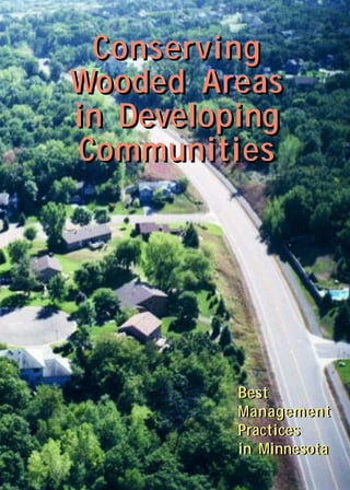
Conserving Wooded Areas in Developing Communities: Best Management Practices in Minnesota

Conserving Wooded Areas in Developing Communities: Best Management Practices in Minnesota ` For more information, Please see websites below: ` Organic Edible Schoolyards & Gardening with Children http://scribd.com/doc/239851214 ` Double Food Production from your School Garden with Organic Tech http://scribd.com/doc/239851079 ` Free School Gardening Art Posters http://scribd.com/doc/239851159` ` Increase Food Production with Companion Planting in your School Garden http://scribd.com/doc/239851159 ` Healthy Foods Dramatically Improves Student Academic Success http://scribd.com/doc/239851348 ` City Chickens for your Organic School Garden http://scribd.com/doc/239850440 ` Simple Square Foot Gardening for Schools - Teacher Guide http://scribd.com/doc/239851110

Recommended
Recommended
More Related Content
Viewers also liked
Viewers also liked (20)
Similar to Conserving Wooded Areas in Developing Communities: Best Management Practices in Minnesota
Similar to Conserving Wooded Areas in Developing Communities: Best Management Practices in Minnesota (20)
More from School Vegetable Gardening - Victory Gardens
More from School Vegetable Gardening - Victory Gardens (20)
Recently uploaded
Recently uploaded (20)
Conserving Wooded Areas in Developing Communities: Best Management Practices in Minnesota
- 1. Conserving Wooded Areas in Developing Communities Best Management Practices in Minnesota
- 2. Conserving Wooded Areas in Developing Communities Best Management Practices in Minnesota 2000 Revised USDA Forest Service Northeastern Area, State & Private Foresry
- 3. Prepared in cooperation with the following organizations: American Society of Landscape Architects, Minnesota Chapter Builders Association of Minnesota City Foresters of Eagan and Plymouth County Forester, Sherburne County Hennepin Parks Institute for Agriculture and Trade Policy Izaak Walton League, Minnesota Chapter Minnesota Association of Realtors Minnesota Department of Agriculture, Division of Agronomy and Plant Protection Minnesota Department of Natural Resources, Divisions of Forestry and Waters Minnesota Department of Transportation, Office of Environ-mental Services Minnesota Forestry Association Minnesota Pollution Control Agency, Division of Water Quality Minnesota Power National Association of the Remodeling Industry Northern States Power Company Society of American Foresters Tree Trust University of Minnesota, College of Natural Resources, Depart-ment of Forest Resources Westwood Professional Services, Inc. Funding for this guidebook was provided in part by the Minnesota Legislature through the Minnesota Department of Natural Resources, Division of Forestry. Reproduction of this guidebook is encouraged. Editing: Mary Hoff Design and Layout: Tami Glassel, DNR Graphic Design Drawings: Debbie Sroka Project Coordinator: Jean Mouelle, DNR Forestry Cover photo courtesy of the city of Eagan.
- 4. STATEMENT OF PURPOSE iii This best management practices (BMPs) guidebook for conserving wooded areas in developing communities of Minnesota was developed by an advisory committee composed of a wide representation of stakeholders from public, private, and nonprofit organizations. The goals of these BMPs are: • to provide communities with a better understanding and appreciation of economic, social, and environmental benefits of wooded areas and individual trees, • to provide decision makers, city planners, landowners, developers, and citizens with land-use approaches to conserve the ecological integrity and functions of wooded areas, including wildlife habitat and corridors throughout the landscape, • to help builders, utility companies, contractors, machine operators, and crews minimize impacts of construction on wooded areas and trees, and • to provide citizens with a better place to live and work.
- 6. CONTENTS STATEMENT OF PURPOSE iii FIGURES ix About the urban ecosystem 1 Current status of wooded areas in developing communities 4 About the BMP guidelines 6 Economic benefits 9 Economic stability....9 Increased property values....9 Tax revenue....10 Energy savings....11 Social benefits 12 Health benefits....12 Aesthetic values....12 Recreational and educational opportunities....12 Screening and privacy....12 Noise and glare reduction....13 Environmental benefits 13 Clean air....13 Clean water....13 Wildlife habitat....15 v INTRODUCTION 1 BENEFITS OF WOODED AREAS AND TREES 9
- 7. vi BMPs TO CONSERVE WOODED AREAS AT THE LANDSCAPE LEVEL 17 Audience 17 Overview 17 Recommended approach and conservation options 18 Define goals....18 Inventory and assess resource....19 Create a conservation plan....21 Identify and select land protection options....25 Check list 29 BMPs TO CONSERVE WOODED AREAS AT THE SUBDIVISION LEVEL 31 Audience 31 Overview 31 Recommended practices 32 Define goals....32 Inventory and assess resource....33 Create a wooded area protection plan....39 Select a protection method....42 Monitor and evaluate the conservation plan....47 Check list 49
- 8. Audience 51 Overview 51 Recommended practices 52 Define goals....54 Inventory and assess trees....54 Select trees or groups of trees to protect....56 Select building site and construction zone....58 Create a tree protection plan....59 Select and implement tree protection method....64 Monitor and evaluate....71 Check list 74 Audience 77 Overview 77 Transportation systems 77 Types of transportation systems....77 Planners of transportation systems....78 Funding for transportation systems....78 State road and highway design standards....79 Natural preservation routes....81 Reduce tree damage through subdivision trans-portation planning....85 vii BMPs TO PROTECT TREES AT THE LOT LEVEL: NEW CONSTRUCTION, REMODELING, AND REDEVELOPMENT 51 TRANSPORTATION SYSTEMS AND UTILITY INFRASTRUCTURE 77
- 9. Utility infrastructure 85 Types of utility infrastructure....85 Reduce tree damage through utility planning....86 Site readiness summary for utilities....90 APPENDICES 91 Appendix 1: Resources and Reference 91 Appendix 2: Financial Assistance Programs 97 Appendix 3: Tree Species and Tolerance 101 Appendix 4: Examples of Development Plans 105 Appendix 4 a: An example of a landscape-level inventory of natural resources, city of Burnsville....105 Appendix 4 b: An example of a city inventory of forest resources, city of Maple Grove....106 Appendix 4 c: An example of a landscape inventory and ranking of natural resources, city of Woodbury....107 Appendix 4 d: A series of comprehensive resource maps for a subdivision development plan....109 viii
- 10. ix FIGURES Figure Page 1 A balanced development approach includes the conservation of wooded areas and other natural resources as shown on the aerial view to the left but not their complete destruction as shown on the aerial view to the right. 2 2 Complete loss and fragmentation of woodlands are demonstrated by comparing the area they once occupied, as shown in the presettlement vegetation map (a), to the areas they occupied in the vegetation map of 1977 (b). Note that the 1977 vegetation map is more than 20 years old and more forest land has since been converted to development. 5 3 Successful conservation of wooded areas and individual trees requires active participation of all people involved in the land development. 7 4 Properties surrounded with trees have higher market value than treeless properties because trees are part of the property infrastructure. In addition, trees provide a healthier and a more pleasant living environment. 10 5 A windbreak on the west and north of the building and shade trees on the east and west of the building significantly reduce the cost of heating and cooling. 11 6 Trees clean the air by filtering dust particles, absorbing gases including carbon and nitrogen compounds, and releasing oxygen into the atmosphere. 14 7 A community forest provides recreational and educational opportunities as well as environmental benefits and wildlife habitat. 15
- 11. Figure Page 8 Infrared aerial photography is used by natural resource professionals to see patterns of water bodies, vegetation cover, and existing infrastructure. 20 9 A resource map such as this example of the city of Cottage Grove shows the location of important features of the landscape including tree stands, water bodies, historical sites, and existing land use. 22 10 People involved in subdivision development may have different priorities. 32 11 A comprehensive resource map of a subdivision such as this example from North Oaks shows location of wooded areas, individual trees, water bodies, proposed developable sites, and indicates conservancy areas. 38 12 Drawing different alternative development plans for the subdivision provides the opportunity to look at all possible options and optimize the land use and conservation effort. 41 13 Determining the construction danger zone between the protective fence and the building site assists with final site and building design and selection of equip-ment to be used. Note that the tree protective fence is placed in front to prevent access and disturbance to the protected root zone. 43 14 Highly visible ribbon identifies protected wooded areas and trees. 44 15 A combination of visual fences and silt fences prevent access to the protected root zone and construction damage to trees as well as runoff. 45 16 Using equipment near protected trees can cause severe mechanical injury to trees and compact soil in the protected root zone. 53 x
- 12. xi Figure Page 17 A resource map at individual lot level shows the loca-tion of the wooded area and individual trees, the species composition, and diameter of trees at breast height. 56 18 On a wooded lot (a), selecting the center of the lot as the building site (b) conserves less trees than selecting the corner of the lot as the building site (c), which saves more trees. 60 19 The protected root zone of a mature tree may be determined by projecting the dripline. 62 20 A highly visible fence and “off limits” signs should be placed around the protected root zone of each conserved tree to prevent any site disturbance and mechanical injury. 65 21 Parking equipment (a) or storing soil (b) within the protected root zone cause soil compaction and affect tree growth and survival. 66 22 A temporary crossing bridge can be used near the protected root zone to minimize soil compaction and mechanical injury to the tree. 68 23 When roots are cut or severed during trenching or excavation, immediately protect roots with a bag (a) or tarp (b) to prevent drying. 70 24 After cutting a grade near trees (a or b), build a retaining wall to prevent soil erosion. 72 25 A roadway clear zone in a wooded area specifies standards for conserving trees and providing safe road. 80 26 Construction standards for natural preservation routes are used to preserve wooded areas and trees during road construction. 84
- 13. Figure Page 27 A joint underground utility trench for electrical, gas, fiber optic, and cable television infrastructure is encouraged in wooded areas to minimize utility easements and enhance the conservation effort. 87 28 Tunneling below the root system is preferred over open trenching (on right) when installing the utility infrastructure near the protected root zone because tunneling impacts fewer roots and thereby increases tree survival. 88 29 Water under pressure can be used as an alternative method to remove soil near the protected root zone and prevent cutting roots. 89 xii
- 14. Introduction 1 INTRODUCTION About the urban ecosystem Urban populations will continue to grow and new residen-tial subdivisions and commercial, industrial, and institu-tional centers will continue to develop. However, decision makers, natural resource managers, landowners, and citizens are increasingly concerned that the urban bio-sphere is at risk under current land development practices (urban sprawl). Destruction and fragmentation of wooded areas and farmlands, loss of individual trees, and loss of wildlife habitat threaten the ecological integrity and func-tions of natural systems and the quality of life in urbanizing areas (Figure 1, page 2). This BMP guidebook provides communities, urban plan-ners, developers, and builders with ideas for meeting development needs and conserving wooded areas. The guidebook is comprised of five sections. The first describes the economic, social, and environmental benefits of wooded areas and trees in urban areas. The second pro-vides land-use approaches to promote conservation of ecosystem integrity and functions of wooded areas throughout the landscape. The third and fourth provide step-by-step, site-specific land development approaches and site options to minimize site disturbance and construc-tion damage to trees during development at subdivision and lot levels. The fifth presents an overview and new, context-sensitive design for transportation systems and utility infrastructure that should be considered at all levels
- 15. 2 Introduction Figure 1. A balanced development approach includes the conservation of wooded areas and other natural resources as shown on the aerial view to the left but not their complete destruction as shown on the aerial view to the right.
- 16. Introduction 3
- 17. 4 Introduction of development. The BMPs presented in the five sections are equally important for the conservation and protection of wooded areas and individual trees. Current status of wooded areas in developing communities Wooded areas are complex ecosystems in which trees are the dominant life form interacting with animals and other plants in a delicate balance. In Minnesota, wooded areas are comprised of native deciduous forests, coniferous forests, shrublands forests, and mixed hardwood-conifer-ous forests. Although urban areas are covered with shade trees, existing wooded areas are being fragmented and lost at rapid rates. This is the result of inefficient land-use practices for urban development and a lack of holistic approaches to incorpo-rate forested communities into land-use planning, as well as the lack of implementation of reasonable reforestation efforts. The extent of this destruction and fragmentation can be seen by comparing the presettlement vegetation map with the 1977 recent vegetation map (Figure 2). The comparison shows a significant reduction of the woodlands within the corridor encompassing Rochester, the Twin Cities area, and St. Cloud. Local and regional units of government should work cooperatively and proactively with landowners, developers, builders, nonprofit organizations, and citizens to conserve
- 18. Introduction 5
- 19. 6 Introduction remaining wooded areas. Cooperation can be demon-strated when counties, cities, or townships develop their comprehensive plans and zoning ordinances and also during construction. About the BMP guidelines The BMPs provided in this guidebook are voluntary guide-lines; they do not supersede existing local, state, and federal laws. They are designed to provide city planners, develop-ers, builders, utilities, and contractors with a framework of action to be taken before, during, and after development to increase the protection and conservation of wooded areas. The BMPs can be effective if they are accompanied by: •the goodwill and right attitude of all participants involved in land development (Figure 3), •proactive planning and use of appropriate land protection options, and •participation of natural resource professionals (e.g., foresters, arborists).
- 20. Introduction 7 Landowners Councils & Commissioners Natural Resource Professionals Architects Utilities Homeowners Planners Engineers Developers Builders Contractors Landscape Architects City, County, Township Administrators Residents Figure 3. Succssful conservation of wooded areas and individual trees requires active participation of all people involved in the land development.
- 22. Benefits of Wooded Areas and Trees 9 BENEFITSOF WOODED AREAS AND TREES Wooded areas have unique compositions, structures, and functions. They provide a wide range of economic, social, and environmental benefits. Economic benefits Wooded areas and trees provide both tangible and nontangible economic benefits. These include: ■Economic stability The beautifying and peaceful effect of healthy tree cover enhances land value, business development, and employ-ment opportunities. Wooded areas and trees are consid-ered part of the community’s infrastructure and assets. ■Increased property values Wooded areas and trees increase property value and marketability because they enhance appearance and other values. Properties with trees usually sell faster and at a higher price than treeless properties (Figure 4, page 10). Market evidence indicates that: •Mature landscaping (lawn, flowers, shrubs, and trees) can add up to 20 percent to the value of an improved residential property. •“Good tree cover” or “well-spaced” mature trees (trees planted or preserved for aesthetics, shade, energy
- 23. 10 Benefits of Wooded Areas and Trees conservation, and screening purposes) can increase the value of a developed property by 6 percent to 15 per-cent, or add 20 percent to 30 percent to the value of an undeveloped property (Source: Minnesota Society of Arboriculture, 1996). Figure 4. Properties surrounded with trees have higher market value than treeless properties because trees are part of the property infra-structure. In addition, trees provide a healthier and a more pleasant living environment. ■Tax revenue Property taxes provide government with revenue to fund public services. Trees increase appraisal and sale price, and so generate higher property and sales tax revenues.
- 24. Benefits of Wooded Areas and Trees 11 ■Energy savings Trees are living infrastructures. Shade trees can reduce the cost of cooling by up to 25 percent during hot sum-mer months. They also reduce the impact of urban heat islands caused by the concentration of pavement, build-ings, air conditioners, and engines in urban areas. Tree windbreaks can reduce the cost of heating during cold and windy winter months by as much as 20 percent (Figure 5). Living snow fences can provide a low-cost solution to problems from drifting snow. Figure 5. A windbreak on the west and north of the building and shade trees on the east and west of the building significantly reduce the cost of heating and cooling.
- 25. 12 Benefits of Wooded Areas and Trees Social benefits The social benefits of trees include health benefits, aes-thetic values, recreational and educational opportunities, and screening and privacy. ■Health benefits Wooded areas provide a place for mental and physical contentment. Research has shown that a walk in wooded areas can relieve psychological and emotional stress. Medical studies indicate that patients recover faster in facilities surrounded with trees and rooms offering views to wooded areas because they feel serene, peaceful, and restful. Wooded areas and trees provide mental comfort and relaxation. ■Aesthetic values Wooded areas and trees add beauty and character to the landscape, neighborhoods, and properties and enhance quality of life. ■Recreational and educational opportunities Wooded areas provide recreational activities and educa-tional opportunities. These include hiking, walking, watching birds and other wildlife, nature study, photogra-phy, picnicking, and camping. ■Screening and privacy Wooded areas and trees provide screening and privacy. Screening is the blocking out of an objectionable view
- 26. Benefits of Wooded Areas and Trees 13 while privacy is the seclusion of an area from its sur-roundings (Minnesota Society of Arboriculture, 1996). ■Noise and glare reduction Wooded areas may reflect and absorb sound energy, and block and reflect light scattering. Environmental benefits Wooded areas and trees provide a number of environmen-tal benefits including: ■Clean air Trees play an important role in cleaning air. They trap dust, reducing the need to clean doors, windows, decks, patios, and exterior walls. They also remove chemical pollutants, including carbon, nitrogen, and sulfur com-pounds, from the atmosphere and release oxygen (Figure 6, page 14). By trapping carbon compounds, they reduce the level of greenhouse gases in the atmosphere. ■Clean water Wooded areas and trees influence water flow, filtration, runoff, soil erosion, and sediment control, and provide clean water. According to studies by the U.S. Department of Agriculture (1975), wooded areas reduce runoff by 5 percent to 35 percent. This reduction is less than mowed grass and pastured areas depending on soil types. They also increase water percolation and infiltration. This function is of great importance to communities that depend essentially on ground water.
- 27. 14 Benefits of Wooded Areas and Trees
- 28. Benefits of Wooded Areas and Trees 15 ■Wildlife habitat Birds, mammals, fish, and other wild animals are a valuable resource. For many, their survival depends on the presence, structure, composition, and distribution of wooded areas across the landscape (Figure 7). Habitat requirements (shelter, food, water, diversity) vary among species. For example, squirrels may require only a few trees, while chipmunks require a small wood lot and other wildlife species may require much larger areas. Habitat requirements for a greater number of wildlife species can be met in urban wooded areas by conserving a network of connected green corridors and natural wooded open spaces across the landscape. Figure 7. A community forest provides recreational and educational opportunities as well as environmental benefits and wildlife habitat.
- 30. BMPs to Conserve Wooded Areas 17 at the Landscape Level BMPS TO CONSERVE WOODED AREAS AT THE LANDSCAPE LEVEL Audience This section is primarily aimed toward: • local and regional units of government, and • community and citizen organizations. Overview Landscape level is defined in this guidebook as the area under the jurisdiction of local or regional units of govern-ment (e.g., municipality, township, county, metropolitan council, park districts, transportation department) having authority over land development. The state of Minnesota has vested land-use planning and regulatory authority in local units of government (Minn. Stat. § 394.21 et seq. for counties and Minn. Stat. § 462.351 et seq. for municipalities and townships) to develop their own comprehensive plans. The role of local and regional units of government usually extends to: • planning, managing, and regulating urban growth, • defining types of development and creating standards, • implementing local, regional, state, and federal natural area protection regulations, and • assessing property value and taxes.
- 31. 18 BMPs to Conserve Wooded Areas at the Landscape Level The role of community organizations may be extended to: • providing inputs to local comprehensive plans and development of transportation systems, and • providing inputs in land development, price, and conser-vation values. To conserve wooded areas, local and regional units of government including decision makers, planners, and community activists should work together as partners and recognize wooded areas as community assets, adopt the recommended land-use approach, and implement conser-vation options. Recommended approach and conservation options Conserving wooded areas should be an integral part of land development. Wooded areas can be conserved when urban planners adopt the following step-by-step land-use ap-proach. ■Define goals Goals to conserve wooded areas across the landscape should include: •protection and/or restoration of ecological integrity and functions, •protection and promotion of connectivity and continu-ity of wooded areas across the landscape and political boundaries,
- 32. BMPs to Conserve Wooded Areas 19 at the Landscape Level •establishment or creation of networks of forest commu-nities as open space, and •protection of wildlife habitat and corridors. ■Inventory and assess resource A landscape-level inventory should be carried out by an interdisciplinary team. The team should include a forester, arborist, soil scientist, wildlife ecologist, land-scape architect, other natural resource professional, planner, engineer, archeologist, community activist, and nonprofit organization representative. A resource inven-tory can be based on the model used by the Minnesota County Biological Survey for assessing values and ecological functions of woodlands, or on models devel-oped by municipalities such as the model used by the city of Maple Grove (Westwood Professional Services Inc., 1994) or the city of Cottage Grove (Bonestroo, Rosene, Anderlik & Associates, 1998). The resource inventory includes land survey, resource assessment, and production of a landscape comprehensive resource map. ◆Conduct woodland survey and resource assessment A woodland survey provides information needed to make appropriate land-use decisions. It consists of delineating the tree stand, identifying and classifying wooded areas by type and condition, and assessing their ecological functions as well as conservation values (ranking) within the jurisdiction and adjacent jurisdictions. Other natural resources, including wetlands, farmlands, areas occupied by rare plant and
- 33. 20 BMPs to Conserve Wooded Areas at the Landscape Level animal species, and projected greenways areas (for the metro region) can be identified, classified, and as-sessed during the woodland survey. Other pertinent information, including watershed, drainage, topogra-phy, soil types, existing infrastructures, and areas of significant historical and cultural values can be identi-fied. Aerial photography can be used to identify re-sources prior to doing a land survey (Figure 8). Col-lected data should be accessible to landowners, devel-opers, and builders to coordinate conservation efforts. Figure 8. Infrared aerial photography is used by natural resource profes-sionals to see patterns of water bodies, vegetation cover, and existing infrastructure. FPO
- 34. BMPs to Conserve Wooded Areas 21 at the Landscape Level Land surveys can have significant financial cost. The Minnesota Department of Natural Resources (DNR) offers a number of financial assistance programs to communities and local and regional units of government to do resource inventory and assessment and to reach their natural resource management goals. A directory of financial assistance is available, and it provides summary-level information on DNR financial programs (see Appendix 2, page 97). ◆Create a comprehensive landscape resource map A comprehensive landscape resource map is a visual display of pertinent information collected during the land survey and resource assessment. The information must be accurate. Locations and types of wooded areas should be recorded on the map at the appropriate scale (Figure 9, page 22). Other examples of landscape resource maps of Burnsville, Maple Grove, and Woodbury are included in Appendix 4 (a, b, and c, page 105). ■Create a conservation plan A conservation plan should be based on the resource inventory and assessment data and the comprehensive landscape resource map. The process begins with identi-fication and location of the main transportation systems, utilities, and the wooded areas to conserve.
- 35. 22 BMPs to Conserve Wooded Areas at the Landscape Level Figure 9. A resource map such as this example of the city of Cottage Grove shows the location of important features of the landscape includ-ing tree stands, water bodies, historical sites, and existing land use. ◆Identify and locate wooded areas Find wooded areas within local and adjacent jurisdic-tions.
- 36. BMPs to Conserve Wooded Areas 23 at the Landscape Level ◆Identify and locate site for main transportation systems and utility infrastructure Transportation systems and utilities are usually con-nected to existing ones. Newer utility corridors can be located and designed in ways to conserve wooded areas. ◆Select wooded areas to conserve Wooded areas to conserve should include those that possess the condition and characteristics to satisfy conservation goals. The following wooded areas can be of high priority for conservation: ✴Larger tracts of remnant wooded areas The size of remnant tracts to give priority to depends on species composition (greater species diversity), species suitability to the site, health condition, and ecological functions. A county, city, or township may mandate a specified size of remnant wooded areas for protection. ✴Wooded areas that have the potential to be connected to others Continuity of wooded areas is valuable for wildlife habitat and water quality. A county, city, or township may mandate the protection of wooded areas found in flood plains, sensitive areas of watersheds, and green corridors.
- 37. 24 BMPs to Conserve Wooded Areas at the Landscape Level ✴Wooded areas having significant ecological functions and conservation values These include soil and water conservation, wildlife habitat and corridors, recreational and historical values, or social and cultural amenities. ✴Wooded areas occupied by rare plant and animal species The Minnesota County Biological Survey is conduct-ing a statewide survey for these areas and will be an important resource for this information (see Appen-dix 1, page 91). ✴Areas with reforestation and restoration potential Reforestation is important to achieve connectivity and continuity of wooded areas throughout the landscape. ◆Identify developable areas Once all of these areas, including sites for main trans-portation systems and utility infrastructure, protected woodlands, and developable areas, have been identi-fied, they should be recorded on the comprehensive landscape resource map and be entered in geographic information systems (GIS). They should be shared with other local and regional units of government, develop-ers, builders, and private organizations to promote continuity and connectivity of wooded areas across the landscape for wildlife habitat, water quality, and other
- 38. BMPs to Conserve Wooded Areas 25 at the Landscape Level ecological, social, and environmental functions and to enhance coordination and partnerships among all stakeholders. Developers and builders should partici-pate in this process and be informed about the conser-vation goals and wooded areas set aside for conserva-tion. ■Identify and select land protection options Once a comprehensive landscape resource map has been developed and wooded areas to conserve have been identified, select appropriate land-protection options. Options available to local and regional units of govern-ment include: ◆Use zoning and subdivision ordinances Zoning and subdivision ordinances are the most common land-use tools local units of government use to control development within their jurisdictions. When drafting ordinances to promote conservation of wooded areas, consider the following: • Gather input from developers, builders, and citizen organizations. • Integrate conservation values in zoning codes and policies. • Identify developable subdivisions and conservation zoning districts in the comprehensive plans.
- 39. 26 BMPs to Conserve Wooded Areas at the Landscape Level • Determine the type of development to be allowed using information contained in the landscape-comprehensive resource map. • Promote flexible subdivision ordinances that encour-age variable lot size and configuration, street width and setbacks according to traffic, utility types and easements, and creative development plans. • Draft local woodland and tree-protection ordinances for both public and private property. • Provide incentives to reduce impervious surfaces. Incentives may include reduced road width, set-backs, and parking lots. Other incentives may in-clude additional lots, tax incentives, and public recognition or awards such as the statewide builders’ and developers’ awards. • Promote the use of joint utility easements and trenches for underground utilities and rights of way for overhead lines. • Create a local natural resource advisory board to foster the participation of community organizations including citizens, nonprofit organizations, develop-ers, builders, and contractors. • Create conservation overlay districts in the jurisdic-tion using comprehensive plans and zoning ordi-nances, and determine urban growth boundaries.
- 40. BMPs to Conserve Wooded Areas 27 at the Landscape Level • Provide incentives to promote or mandate imple-mentation of conservation designs such as conserva-tion zoning designs, open space designs, conserva-tion subdivision designs, and cluster development designs. Washington County Planning and Adminis-trative Services published a comprehensive guide to open space design development (see Appendix 1, page 91). • Set up conservation standards based on sound protection options of wooded areas. For example, local and regional units of government should promote the conservation of 50 percent to 70 percent of wooded areas in residential zoning districts as natural wooded open space. • Promote new and flexible approaches to conserva-tion. For instance, the city of Eagan has established a park dedication policy in which as a general rule, 15 acres of land are dedicated for park, playground, and public open space for every 1,000 residents. Other communities prohibit development on wooded areas of 10 acres and larger or have adopted a one-for-one replacement per caliper inch. However, sound conservation plans should focus on species diversity of the woodlands, the health condition, and species suitability to the site. Native species that are well adapted to the local condition should be given higher conservation priority as well as species that are tolerant to site disturbances. For example, an oak sapling may be preserved instead of a mature box elder in many sites in the metro area.
- 41. 28 BMPs to Conserve Wooded Areas at the Landscape Level • Provide a management strategy to maintain and enhance the quality of the protected wooded areas. The management strategy should have an education component for the public and include frequent assessment of the tree and forest health (insect, disease, and stress), fire hazard (Great Lakes Fire Compact, 1990), and wood utilization. ◆Consider other conservation and protection options A number of land protection options have been devel-oped to assist landowner and local units of govern-ment. They include: • conservation easements, • land-retirement programs, • property tax-relief programs, • restoration cost-share programs, • registry programs, • transfers of land, • deed restrictions, • mutual covenants, • management agreements, • donating land, • selling land to conservation buyers, • land exchanges, • transfer of development rights,
- 42. BMPs to Conserve Wooded Areas 29 at the Landscape Level • purchase of development rights, • outright acquisition, • and carbon sequestration credits. These land protection options are described in Land Protec-tion Options: A Handbook for Minnesota Landowners and Natural Areas: Protecting a Vital Community Asset. Copies of these publications can be obtained free of charge to residents of Minnesota by contacting the Minnesota DNR. Check list Define goals Do resource inventory and assessment (landscape scale) Conduct woodland survey and resource assess-ment Create a comprehensive landscape resource map Create a conservation plan Identify and locate wooded areas Identify and locate site for main transportation systems and utility infrastructure Select wooded areas to conserve Large tracts of remnant woodlands Wooded areas that have the potential to be connected to others Wooded areas having significant ecological functions and conservation values
- 43. 30 BMPs to Conserve Wooded Areas at the Landscape Level Wooded areas occupied by rare plant and animal species Areas with reforestation and restoration poten-tial Identify developable areas Identify and select land protection options Use zoning and subdivision ordinances Determine type of development Residential Commercial Institutional or other Determine easements, types, and design of transportation systems Determine easements, types, and design of utilities Consider woodlands and tree preservation ordinances Consider other conservation and protection options Conservation districts Conservation easements and covenants Transfer of development rights Purchase of development rights Land exchange Land retirements Other land-protection options
- 44. BMPs to Conserve Wooded Areas 31 at the Subdivision Level BMPs TO CONSERVE WOODED AREAS AT THE SUBDIVISION LEVEL Audience This section is primarily directed toward: •local units of government, •landowners and developers, •builders and utility companies, and •community and citizen organizations. Overview The development of a subdivision is always affected by state and federal laws, local comprehensive plans and regulations, zoning and subdivision ordinances, codes and policies, and housing market demand. All people involved in subdivision development should recognize the need and reasons to protect wooded areas and other natural areas, while complying with regulations. City planners, landown-ers, developers, and builders play a major role in subdivi-sion development by planning and creating development plans in conformance with municipal, township, and county zoning and subdivision ordinances and by oversee-ing development. However, landowners, developers, builders, local units of government, and homeowners may have different agendas (Figure 10, page 32).
- 45. 32 BMPs to Conserve Wooded Areas at the Subdivision Level Local units of government • fulfill development needs • control lot density • provide tax revenue • protect the environment Neighborhoods, homeowners • affordable price • attractive and pleasant place to live and work • maintain biological diversity Landowners, developers, builders • observe zoning codes • meet market demand • maintain desirable appearance Figure 10. People involved in subdivision development may have different priorities. Recommended practices Protecting wooded areas and other plant communities must begin with a plan. “A planning process begins when the decision to develop the land is made and finishes when the completed development is occupied” (Watson and Neely, 1995). ■Define goals Defining goals is the first step to consider in land devel-opment. The goals should include: •conservation of green corridors, •conservation of wooded areas as natural open space or conservancy area, and •protection of individual trees.
- 46. BMPs to Conserve Wooded Areas 33 at the Subdivision Level ■Inventory and assess resource Resource inventory and assessment is an important step in protecting wooded areas and meeting the goals. The objective is to create a comprehensive resource map for the subdivision. This map will be the main document to use when making decisions. A resource inventory and assessment for a subdivision can be achieved in three steps: •evaluate existing resource information, •conduct site review and survey trees, and •create a comprehensive resource map for the subdivi-sion. ◆Evaluate existing resource information A number of local and regional units of government collect information on the status of natural resources. This information is useful in planning at the subdivi-sion level. Landowners and developers may take advantage of this information including topographic maps, aerial photography, and information on water-sheds, wetlands, historic land uses, proposed greenways, soils, septic system suitability, areas occu-pied by rare plant and animal species, conservation easements, and protected wooded areas (see Appendix 1, page 91). Local zoning and tree preservation ordi-nances may also provide some information and guidelines.
- 47. 34 BMPs to Conserve Wooded Areas at the Subdivision Level ◆Conduct site review and survey trees A site review and tree survey are the physical examina-tion of the resources within the subdivision and adjacent land. They include: • identification and location of wooded areas and other natural resources, and • delineation of potential wooded areas to protect. A site review and tree survey must be perfo rmed by a natural resource pro fessional such as a fo rester, arbo rist, o r landscape architect. ✴Obtain aerial photography Aerial photography can provide fast knowledge of existing resources and adjacent areas. Agencies that provide aerial photography (prints or services) include the Metropolitan Council, U.S. Geological Survey, or DNR (see Appendix 1, page 91). ✴Identify and locate wooded areas and other land types After identifying wooded areas using aerial photogra-phy, it is necessary to physically locate the wooded areas, measure them, profile trees by species and size distribution, determine cover types, and draw cover-type boundaries on the subdivision map using an appropriate scale. For definitions of specific cover
- 48. BMPs to Conserve Wooded Areas 35 at the Subdivision Level types use references such as Tester, J., 1995; Wovcha, D. S., B. C. Delaney, and G. E. Nordquist, 1995; Minnesota Department of Natural Resources, 1993. Sampling techniques can be used to profile trees on wooded areas larger than 10 acres and a complete inventory of trees on wooded areas of less than 10 acres. When profiling trees, highlight wooded areas and trees with historical, cultural, or biological significance. Identify wooded areas that have been located or designated for protection by units of government, landowners, and/or community organi-zations, and record them on the subdivision map. Pay particular attention to younger stands of trees and trees that are suited to the site condition. Con-tact the Minnesota DNR’s Division of Fish and Wildlife, Section of Ecological Services (County Biological Survey) to obtain information on the status and distribution of flora, fauna, and natural communities, and the State Historic Preservation Office to obtain other information. Other land types, including wetlands, farmlands, and land classified as potential natural areas for rare plant and animal species, should be located, identi-fied, and recorded on the comprehensive resource map. ✴Delineate potential wooded areas to protect The initial evaluation of natural resources should note areas of priority for protection and conserva-tion. These areas may include:
- 49. 36 BMPs to Conserve Wooded Areas at the Subdivision Level •wooded areas protected or identified by local, state, and federal laws; policies and/or regulations, such as wetlands, and designated greenways and natural areas, •wooded flood plains, wooded stream corridors, steep wooded slopes, and buffer zones. These areas have important ecological functions for water quality and wildlife habitat, and •remnant tracts of wooded areas at least one acre in size with healthy trees. Remnant tracts of wooded areas may have aesthetic values and provide recreation for surrounding neighborhoods. They may offer ecological benefits, including carbon sequestration; screening and privacy; wildlife attraction for resting, nesting, feeding, and breeding; and energy conservation and protection against drifting snow. All of these func-tions may have direct impact on property values and quality of life. A site review and tree survey may have significant financial cost. The DNR provides a number of financial assistance programs to organizations and individuals to do resource inventory and assessment and to reach their conservation and natural resource stewardship goals. Landowners and developers may be able to receive assistance for some types of projects. A directory of financial assistance is available to identify existing financial assistance programs administered by the DNR (see Appendix 2, page 97).
- 50. BMPs to Conserve Wooded Areas 37 at the Subdivision Level ◆Create a comprehensive resource map of the subdivision The ultimate purpose of the resource assessment and inventory is to create a comprehensive resource map for the subdivision. This map constitutes the basic tool from which to make all decisions related to the devel-opment, including the type of the development design, location of permanent structures (buildings, roads, and utilities), and location of temporary facilities such as offices, parking lots, equipment maintenance space, and rights of way. Record on the map pertinent infor-mation including location of wooded areas and trees by outlining their canopy or tree line, wetlands and other type of land cover, planned unit development (roads and buildings), and preserved areas. A develop-ment map from North Oaks is a good example of a subdivision resource map (Figure 11, page 38). Another example from Robert Engstrom Companies shows a series of five comprehensive steps or maps to develop the final development plan for a subdivision. The steps or maps include site analysis, existing vegetation/ woodlands, planned unit development/housing area, first development plan, and final development plan (Appendix 4 d, page 109).
- 51. 38 BMPs to Conserve Wooded Areas at the Subdivision Level
- 52. BMPs to Conserve Wooded Areas 39 at the Subdivision Level ■Create a wooded area protection plan Develop a protection plan for wooded areas based on informa-tion provided on the subdivision comprehensive resource map. The protection plan should include: •selection and delineation of the wooded areas to be protected, and •selection of the protection method. A succes sful pro tection plan to conserve wo o ded areas in a subdivision would set aside at least 50 percent to 70 percent o f the to tal wo o ded area in fo rm o f natural o pen space, green co rrido rs, o r conservancy area. A number o f lo cal develo pers and builders have achieved these go als (e.g., develo pment plans from No rth Oaks and Settler Ridge). If the subdivision is no t co vered with wo oded areas, an alternative plan, including refo restatio n, may b e initiated. Other techniques, including tree transplanting, can be used to save trees. ◆Select and delineate wooded areas to protect To achieve a successful wooded area protection plan, consider the following steps: ✴Record location of wooded areas to be protected Select wooded areas to be protected based on the goals and information provided on the comprehen-sive resource map. Record these areas on the com-prehensive resource map with a distinctive pattern.
- 53. 40 BMPs to Conserve Wooded Areas at the Subdivision Level ✴Record all areas likely to be adversely im-pacted during construction Wooded areas located on potentially sensitive sites such as wetlands and steep slopes may need additional protection. Identify and mark these areas as natural amenities to the development plan. ✴Record areas that can be used for reforesta-tion and/or restoration These areas may be located on natural drainage or sensitive sites. ✴Locate and delineate developable and buildable sites Locate areas for development to meet subdivision density requirements, road sites, and other ease-ments (sewer, water, communication and electrical lines, septic system, storm water, etc.). It is necessary to draw a few alternative sketches of concept plans before making a final decision. Alternative concept plans (Figure 12) may include the lot size, location, and distribution; road and transportation systems; utility systems, designs, and location; and location of areas to be graded (also see Appendix 4 d, page 109). ◆Submit the development plan for approval When submitting the final development plan, the developer and the county, city, or township planner should review the plan together.
- 54. BMPs to Conserve Wooded Areas 41 at the Subdivision Level Conservation or Open-space Development (c, d, e ) fpo Limited Development Mixed Residential Develop-ment (d) fpo fpo Conservation Village (c) (e) (a) (b) Farmstead/Subdivision fpo Conventional Development (Cookie-cutter Approach) Figure 12. Drawing different alternative development plans for the subdivision provides the opportunity to look at all possible options and optimize the land use and conservation effort.
- 55. 42 BMPs to Conserve Wooded Areas at the Subdivision Level ■Select a protection method Once the development plan is approved, the developer and/or builder should select the protection method that consists of several steps: •Determine the protected root zone. •Mark the protected root zone. •Identify the grading area and method. •Create the reforestation plan and method. •Identify trees to be transplanted. ◆Determine the protected root zone The protected root zone (PRZ) is defined as optimum space needed for a group of trees or an individual tree to retain good health and vigor. The larger or wider this zone is the better for the trees’ health and vigor. This zone should be protected and off limits to all construction activities, including driving and parking vehicles, storing materials, and soil excavation, to minimize site disturbance and physical damage to trees during construction. It should be determined and protected before construction begins. A number of methods including the dripline, minimum area, site occupancy, and trunk diameter methods have been developed to determine the protected root zone. These methods are described in the lot-level section of this guidebook (see page 51). Each method has
- 56. BMPs to Conserve Wooded Areas 43 at the Subdivision Level its own merit to provide adequate protection area. How-ever, the dripline m ethod is widely recommended and used to protect mature individual trees, groups of trees, or wooded areas. The minimum area method can be used to protect small mature individual trees, groups of trees, or wooded areas. The m inim um area m ethod can be sed to protect small and young trees. On larger develop-ment sites, a construction danger zone up to 30 feet wide between the construction area and the protected root zone is necessary to minimize construction damage to trees (Figure13). Figure 13. Determining the construction danger zone between the protective fence and the building site assists with final site and building design and selection of equipment to be used. Note that the tree protective fence is placed in front to prevent access and disturbance to the protected root zone.
- 57. 44 BMPs to Conserve Wooded Areas at the Subdivision Level ◆Mark the protected root zone Once the protected root zone has been determined, the protection method becomes a straightforward process. It consists of marking the protected area and putting up highly visible ribbon or fencing and signs to enclose the entire area (Figure 14). This area should be off limits to all construction activities including parking vehicles, storing materials, and soil excavation. Figure 14. Highly visible ribbon identifies protected wooded areas and trees. FPO If the protected areas are located on a down slope of the construction site or near wetlands, it is important to install a combination fence—a silt fence to prevent runoff and sediment, and a visual fence for enclosure (Figure 15).
- 58. BMPs to Conserve Wooded Areas 45 at the Subdivision Level FPO Figure 15. A combination of visual fences and silt fences prevent access to the protected root zone and construction damage to trees as well as runoff. ◆Determine the grading area and method Before construction begins, evaluate the site to determine the area that needs grading and also the percentage of grading needed. When filling or cutting grades near the protected root zone, build the retaining walls before grading begins to prevent runoff into the protected root zone, stabilize the slope, and prevent soil erosion. Custom grading is recommended and encouraged because it impacts a smaller area and saves more trees than mass grading (see individual lot level, page 51).
- 59. 46 BMPs to Conserve Wooded Areas at the Subdivision Level ◆Define reforestation plan and method On a site with few or no trees, a reforestation plan may be initiated with well-defined goals. Goals for reforestation may include the establishment of energy conservation trees, a living snow fence, a wildlife planting, windbreaks, or boulevard trees. A reforestation plan consists of selecting the most suitable tree species and planting design to meet the intended goals. Since the timing and design of the planting are important, the reforestation plan should be done by a natural resource professional. ◆Record trees to be transplanted and the site Some trees in the construction zone and on building sites can be transplanted to a different location. This conservation method can be cost effective and provide immediate func-tional and aesthetic benefits. However, tree transplanting is a highly specialized activity that needs to be done by a knowl-edgeable and experienced person. A number of tools is available to transplant trees. These tools may include a backhoe, tree spade, and crane. Understanding the biological limitations of each tree species to tolerate disturbance and the timing are critical for a successful transplantation. A system-atic tree care program, including irrigation and fertilization, is necessary after transplanting. When possible, transplant trees two to four years before construction begins.
- 60. BMPs to Conserve Wooded Areas 47 at the Subdivision Level ■Monitor and evaluate the conservation plan A successful conservation plan requires the participation and commitment of all parties involved in the development project. Before the project begins, communicate the tree conservation goals and methods to all participants, including landowners, developers, builders, contractors, and utility companies. The plan monitoring and evaluation should include education, site inspection, and financial penalties. ◆Educate Plan implementation should begin with education about the goals and tree protection measures. All people involved in the project should know about the tree protection goal and method. They should be informed about the protected root zone and the purpose of protective fences and signs. Contracts (including those with subcontractors) should explicitly state that any disturbance in the protected root zone (including human or machine activity, storage of material, and soil excavation) violates the contract and that specified penalties will be applied. A provision binding the contractor to the survival of protected trees up to five years from the date the construction was completed should be written into the contract. ◆Site inspection Monitor the program as the project proceeds. The monitoring program may include frequent visits to the site by the landowner, local unit of government, or citizen organization to check for violations of the tree protection
- 61. 48 BMPs to Conserve Wooded Areas at the Subdivision Level plan. Project managers, including the supervisor, superin-tendent, crew leader, or an outside consultant may be assigned this task. ◆Financial penalty The penalty may be monetary or replacement of trees. The Minneso ta Supplement to the Guide fo r Plant Appraisal with Regional Tree Appraisal Facto rs can be used as a guide defining the financial penalty (Minnesota Society of Arboriculture, 1996).
- 62. BMPs to Conserve Wooded Areas 49 at the Subdivision Level Check list Define goals Inventory and assess resource (subdivision scale) Evaluate existing resource information Conduct site review and survey trees Obtain aerial photography Identify and locate wooded areas and other land types Delineate potential wooded areas to protect Create a comprehensive resource map of the subdivision Create a wooded area protection plan Select and delineate wooded areas to protect Record location of wooded areas to be protected Record all areas likely to be adversely impacted during construction Record areas that can be used for reforestation and/or restoration Locate and delineate developable and buildable sites Submit the development plan for approval Select a protection method Determine the protected root zone Mark the protected root zone Determine the grading area and method Define reforestation plan and method
- 63. 50 BMPs to Conserve Wooded Areas at the Subdivision Level Record trees to be transplanted and site Monitor and evaluate the conservation plan Educate Site inspection Financial penalty
- 64. BMPs to Protect Trees at the Lot Level 51 BMPs TO PROTECT TREES AT THE LOT LEVEL: NEW CONSTRUCTION, REMODELING REDEVELOPMENT Audience This section is directed toward: • homeowners, businesses, landowners, and communities, • builders, contractors, and subcontractors, and • utility companies. Overview Protecting wooded areas and individual trees at the lot level has direct benefits to landowners, homeowners, businesses, neighborhoods, communities, and the landscape as a whole. Builders and contractors undertake construction in accordance with zoning ordinances and should observe existing conservation easements and covenants, including those related to trees. Wooded areas and trees can be severely damaged during land development. Construction damage to trees includes mechanical injuries, soil compaction, and soil contamina-tion (Figure 16, page 53). Mechanical injuries to trunks and branches are the most common types of above ground injuries. These injuries may cause trees to lose their aes-thetic value and initiate insect and disease problems such as oak wilt. Tree roots can also suffer mechanical damage from excavating, grading (cut and fill), trenching, or equip-
- 65. 52 BMPs to Protect Trees at the Lot Level ment traffic within the protected root zone. Although the tree’s root injuries are difficult to see and predict, they can severely impact tree survival and growth, predisposing affected trees to disease and insect problems. Soil compaction is most likely to occur when construction equipment is driven over an area. It can also be caused when construction materials or equipment (including workers’ personal vehicles) are stored or parked near trees. Soil compaction is the main cause of tree loss following construction. It is a physical compression of soil particles caused by ground pressure and vibration from equipment and by the weight of material stored near trees. It affects root growth, water percolation, gas exchange, and nutrient uptake. Severe soil compaction occurs on the topsoil within the first 2 to 4 inches, but may affect deeper soil. Trees affected by soil compaction will suffocate, become stressed and vulnerable to insects and disease, and be likely to die within two to five years. The same fate can occur when soil fill is added within the protected root zone or drainage patterns are altered and saturated soil conditions result within the protected root zone. Recommended practices Proactive planning and use of appropriate approaches and tools can ensure greater protection and conservation of wooded areas and trees during construction. The following steps are necessary to achieve protection goals. They include goal definition, tree inventory and assessment,
- 66. BMPs to Protect Trees at the Lot Level 53 Figure 16. Using equipment near protected trees can cause severe mechanical injury to trees and compact soil in the protected root zone.
- 67. 54 BMPs to Protect Trees at the Lot Level selection of building site and construction zone, creation of a protection plan, selection of a protection method, and monitoring and evaluation. ■Define goals The goals should include: •protection of wooded areas and trees from construction damage, •compliance with zoning regulations, conservation easements, and covenants, and •maintenance and enhancement of community aesthet-ics and property values. ■Inventory and assess trees Tree inventory and resource assessment are specialized activities that should be performed by a natural resource professional (e.g., forester or arborist). The extent of the tree inventory and assessment depends on a number of factors including lot size, cover type, and stage of devel-opment activity (new development and remodeling). On lots of less than two acres, do a complete tree survey (that is, the tree count by species of all trees 2 inches in diam-eter and larger). Also, assess the health and growth condition. On lots of more than two acres, use either a complete or partial survey, depending on the cover type. The local tree preservation ordinance may specify the type of tree survey.
- 68. BMPs to Protect Trees at the Lot Level 55 When doing a complete tree survey, measure the diam-eter of all trees and assess the health condition and growth characteristics of all measured trees. Trees less than 8 inches in diameter can be recorded by species, growth, and health condition. The diameter of trees larger than 8 inches is measured at 54 inches above the ground and slope side. The inventory should follow these steps: ◆Obtain or draw a boundary map of the lot Identify corners, streets, and all easements. ◆Record the location of all trees and wooded areas Record the location of all trees and wooded areas on the resource map (Figure 17, page 56). A professional surveyor may be used to more accurately locate trees close to the building site. ◆Do a tree survey and health assessment This assessment includes tree identification by species and age class and assesses health condition by growth characteristics, including trunk form (linear tree, crooked trunk, or bowing), crown form, and health condition (presence of conks, signs of stress, pests, disease, dead branches, and wilted leaves). Tree identification is needed to define the species distribu-tion and composition on the property; to determine site suitability; to anticipate the cost of removing, replacing, and transplanting; to determine long-term
- 69. 56 BMPs to Protect Trees at the Lot Level Figure 17. A resource map at individual lot level shows the location of the wooded area and individual trees, the species composition, and diameter of trees at breast height. health and disease problems as well as silvicultural or arboricultural treatments; and if applicable, to comply with local tree preservation ordinances. ◆Record tree survey and health assessment information Write the information gathered on the resource map including the species and size. Other information such as health condition and growth characteristics can be recorded on the map or on a separate sheet. ■Select trees or groups of trees to protect Use the following criteria to select trees or groups of trees to protect:
- 70. BMPs to Protect Trees at the Lot Level 57 •select trees or groups of trees as needed to comply with any local tree preservation ordinances, •select trees and wooded areas found within conserva-tion easements or covenants, •select trees that are suitable to the site conditions (e.g., native species and trees with desirable growth charac-teristics), •select trees that provide direct benefits (e.g., wildlife habitat, shade, windbreak, screening, privacy, etc.), •select trees that are connected to other trees (e.g., groups or lines of trees) on adjoining property to achieve connectivity, and •pay particular attention to younger trees that may have greater tolerance for site disturbance during construc-tion. ◆Mark trees or groups of trees to protect Identify protected wooded areas or trees with colored ribbon (yellow or orange). If there are fewer trees to remove than to save, it may be more cost effective to mark trees to be removed. Use a standard color. ◆Record information on the resource map Record the location of the tree and the species name or a code on the resource map. Trees or areas to protect may be indicated with a letter P (protect) or S (save) and trees to remove may be shown with a letter
- 71. 58 BMPs to Protect Trees at the Lot Level R (remove) or C (cut). Colored markers (e.g., yellow, orange, or blue) can also be used or a combination of letters and colored markers. ■Select building site and construction zone The homeowner, developer, builder, contractors, engi-neers, utility companies, and natural resource specialists should work together to select a building site and con-struction zone. Involving a realtor, landscape architect, and architect at the early stage of development is also important. After reviewing all ordinances pertaining to the subdivi-sion, including setback, conservation easements, utility and other easements, and existing covenants, select the building site, construction zone, and other areas. ◆Select building and additions site and assess open space The building site includes spaces for the main struc-ture and additions and other outbuildings, driveways, garage and parking areas, and utilities (septic systems, drain fields, sewer, gas, water, well, and communica-tion and electrical lines). The percentage of open space needs to be determined when selecting sites for building and additions sites. It should be part of the overall planning process.
- 72. BMPs to Protect Trees at the Lot Level 59 ◆Select construction zone The construction zone includes all access routes for construction equipment (trucks, tractors, utility vehicles), parking areas during construction, a material storage site, an area for cleaning and performing maintenance on equipment, and, if needed, a space for a temporary office. ◆Identify other areas Other areas to identify may include setbacks, utility and other easements, and areas dedicated to conserva-tion easements, covenants, and other uses. Check with local units of government (city, township, county), homeowner associations, and nonprofit organizations (such as the Minnesota Land Trust) for other pertinent information about land-use practices on the subdivi-sion (see Appendix 1, page 91). For single family residential development in wooded lots, select the corner of the lot as the building site to minimize loss of trees and maximize tree protection area (Figure 18, page 60). Areas having trees of lower conservation value or poor health can be selected as building sites and construction zones. ■Create a tree protection plan A tree protection plan for wooded areas or individual trees at the lot level consists primarily of protecting the protected root zone. The protected root zone should be off limits to any activity. More detailed guidance may be
- 73. 60 BMPs to Protect Trees at the Lot Level (a) (b) (c) Figure 18. On a wooded lot (a), selecting the center of the lot as the building site (b) conserves less trees than selecting the corner of the lot as the building site (c), which saves more trees.
- 74. BMPs to Protect Trees at the Lot Level 61 obtained from the Minnesota Extension Service publica-tion Pro tecting Trees from Construction Damage: a Homeowner’s Guid e(Miller et. al., 1993). A tree protection plan follows three orderly steps: ◆Determine and delineate the protected root zone The protected root zone is the area near trees that should be avoided during construction. It is defined as the area directly below the branches of mature trees or the dripline (Figure 19, page 62). Since roots extend beyond this zone, the protected root zone can be extended beyond the dripline whenever possible to minimize construction damage to roots. A number of methods have been developed to deter-mine the protected root zone. ✴Trunk diameter method Measure the tree diameter in inches at breast height (54 inches above ground). Convert the measurement to feet or to a foot and half for every inch to obtain the radius of the protected root zone (Coder, 1995). ✴Site occupancy method Predict the tree diameter at breast height in inches for that tree at 10 years old. Multiply the number by 2.25 and convert the result into feet to obtain the radius of the protected root zone (Coder, 1995).
- 75. 62 BMPs to Protect Trees at the Lot Level Protected Root Zone Figure 19. The protected root zone of a mature tree may be determined by projecting the dripline.
- 76. BMPs to Protect Trees at the Lot Level 63 ✴Minimum area method Protect an area of approximately 6 feet in radius around the trunk as the protected root zone. ✴Dripline method This is the most commonly used method. The radius of the protected root zone by the dripline method can be determined by two ways. The first consists of measuring the distance of the branch that extends horizontally farthest from the trunk and multiply by 1.5 to obtain the protected root zone radius. The second consists of projecting the tree dripline downward to the ground and delineating the area beneath the tree branches or crown as the protected root zone. Selecting the appropriate method requires knowl-edge of the tree species and site condition. A forester, arborist, or other natural resource professional should make the selection. The dripline method is often preferred to protect mature trees (individuals, groups of trees, or wooded areas). However, when using the dripline method for individual trees, some adjustment should be made for trees with narrow crowns. The minimum area method can be used to protect young trees (seedlings and saplings). The dripline or minimum area methods offer only an optimum space for tree survival and growth because roots extend far beyond the dripline or the minimum area. Therefore, the larger the protected root zone, the better it is for the tree’s growth and survival.
- 77. 64 BMPs to Protect Trees at the Lot Level ■Select and implement tree protection method Tree protection consists primarily of preventing physical damage to trees from driving or parking equipment, storing materials near trees, headquartering working crews near trees, and disturbing the site within the protected root zone. ◆Protected root zone does not conflict with building site and construction zone If enough clearance exists between the protected root zone and the building site or construction zone, simply build a fence to prevent any activity and access within the protected root zone and hang “off limits” signs on the fence to alert crews and other people visiting the site (Figure 20). A fence prevents activities such as driving or parking equipment and storing materials such as soil from occurring within the protected root zone (Figure 21, a and b, page 66). ◆Protected root zone overlaps with building site If the protected root zone overlaps with the building site, decide whether to remove trees, transplant trees, change the building site or the building design, or use building materials that may cause less site impact on trees. For instance, a pervious pavement may be used to build a driveway. A pavement type requiring a thinner cross section such as concrete may be used
- 78. BMPs to Protect Trees at the Lot Level 65 Figure 20. A highly visible fence and “off limits” signs should be placed around the protected root zone of each conserved tree to prevent any site disturbance and mechanical injury.
- 79. 66 BMPs to Protect Trees at the Lot Level
- 80. BMPs to Protect Trees at the Lot Level 67 instead of asphalt. Geotextile materials can be used at the bottom before pouring the concrete to reduce subbase compaction. ◆Protected root zone overlaps with construction zone If the protected root zone overlaps with the construc-tion zone, a number of options can be used: ✴Build a travel route to minimize impact on soil and root systems A layer of wood chips may be spread or a crossing bridge installed for temporary use (Figure 22, page 68). When using wood chips for a temporary travel route, the thickness and structure of the wood-chip layer will depend on the type, size, and weight of equipment to be used. The use of mixed, particle-size wood chips spread at least 12 inches thick may be adequate. After the project is completed, the wood chips or crossing bridge must be removed and the site restored by adding ventilation holes, fertilizating, and watering. ✴Reduce the size of the construction zone and limit the traffic The space allocated for the construction zone can be reduced and a limited crew allowed on the site at a given time. Ground traffic for moving building materials or debris can be reduced by using a crane and pumping system instead.
- 81. 68 BMPs to Protect Trees at the Lot Level Figure 22. A temporary crossing bridge can be used near the protected root zone to minimize soil compaction and mechanical injury to the tree. ◆Protected root zone overlaps with utility easements If the protected root zone overlaps with utility ease-ments, trees can be removed or the building design can be modified to comply with the easements. In a new development site, using a joint underground trench for utilities (gas, electricity, and cable) minimizes utility easements and site disturbance, and saves trees. Whenever cost effective and appropriate, tunneling
- 82. BMPs to Protect Trees at the Lot Level 69 can be used instead of an open trench. When possible, manual or water-pressure trenching can also be used to minimize impacts on tree root systems (see utility infrastructure, page 77). ◆Protected root zone overlaps with grading area, cut, or fill Cutting or filling grades near the protected root zone for road construction or the building site can affect tree growth and vigor (Figure 23, page 70). Use custom grading instead of mass grading to minimize distur-bances and tree damage during excavation. ✴Reduce damage from cutting grades Removing soil or cutting grades near the protected root zone may remove the organic soil, affect soil hydrology, deprive the tree of water and nutrients, and weaken tree resistance to wind (particularly when roots are severed). When cutting a grade near the protected root zone, prune severed woody roots immediately, water the soil around trees, and protect severed roots (with a temporary structure such as black plastic and a permanent structure thereafter) to minimize exposure to air and sun. Avoid stepper cuts exceeding 4 feet and use a step-down cut approach instead. After grading is complete, build a retaining wall, as needed, to stabilize the grade and prevent soil erosion (Figure 24, page 72).
- 83. 70 BMPs to Protect Trees at the Lot Level (a) (b) Figure 23. When roots are cut or severed during trenching or excavation, immediately protect roots with a bag (a) or tarp (b) to prevent drying.
- 84. BMPs to Protect Trees at the Lot Level 71 ✴Reduce damage from filling grades Adding soil or filling grades to level the site near the protected root zone has immediate and long-term effects on tree growth and survival. It may cause soil compaction and create anaerobic conditions. Trees may suffocate as a result. Before filling grades near the protected root zone, build retaining walls to prevent soil or filling materials from eroding over into the protected root zone (Figure 24, page 72). Retaining walls are structures built to stabilize the grade and prevent soil erosion and runoff. They can be built with a variety of materials including wood, rock, and concrete. After grades have been cut or filled, treatments such as root and branch pruning, irrigation, and soil amendments may be necessary before installing the protected root zone fence and starting construction. These treatments can reduce impacts of construc-tion, primarily those related to site disturbance (e.g., change in soil hydrology due to grading and microcli-mate). These treatments must be performed by skilled professionals. After construction is complete, site reclamation may be necessary. ■Monitor and evaluate Homeowners, businesses, landowners, developers, builders, and contractors should develop a monitoring and evaluation plan, indicate types of penalties, and sign a written tree protection plan before construction begins.
- 85. 72 BMPs to Protect Trees at the Lot Level (a) (b) Figure 24. After cutting a grade near trees (a or b), build a retaining wall to prevent soil erosion.
- 86. BMPs to Protect Trees at the Lot Level 73 The plan should specify tools and techniques that will be used to achieve protection goals. It may include frequent visits to the building site and penalties. ◆Visit the building site The homeowner or landowner should be allowed to visit the building site frequently during construction to check for any disturbance or violation of the tree protection plan. ◆Call for tree replacement plan The homeowner or landowner and the developer, builder, or contractor should agree on a tree survival and tree replacement program that should be extended between two to five years following construction. ◆Impose financial penalties Financial penalty should be agreed upon between the homeowner or landowner and the builder or contrac-tor. Amount of financial penalty can be based on recommendations made in the Minneso ta Supplement to the Guide fo r Plant Appraisal with Regional Tree Appraisal Facto rs (Minnesota Society of Arboriculture, 1996). ◆Make referrals The homeowner or landowner may agree to refer the builder or contractor to other homeowners for taking and protecting trees during construction.
- 87. 74 BMPs to Protect Trees at the Lot Level Check list Define goals Inventory and assess trees (lot scale) Obtain or draw a boundary map of the lot Record the location of all trees and wooded areas Do a tree survey and health assessment Record tree survey and health assessment information Select trees or groups of trees to protect Mark trees or groups of trees to protect Record information on the resource map Select building site and construction zone Select building and additions site and assess open space Select construction zone Identify other areas Create a tree protection plan Determine and delineate the protected root zone Trunk diameter method Site occupancy method Minimum area method Dripline method Select and implement tree protection method Protected root zone does not conflict with building site and construction zone
- 88. BMPs to Protect Trees at the Lot Level 75 Protected root zone overlaps with building site Protected root zone overlaps with construction zone Build a travel route to minimize impact on soil and root systems Reduce the size of the construction zone and limit the traffic Protected root zone overlaps with utility easements Protected root zone overlaps with grading area, cut, or fill Reduce damage from cutting grades Reduce damage from filling grades. Hang signs on the fence Monitor and evaluate Visit the building site Call for tree replacement plan Impose financial penalties Make referrals
- 90. Transportation Systems 77 and Utility Infrastructure Transportation Systems and Utility Infrastructure Audience • Local and regional units of government, • Landowners and developers, • Community and citizen organizations, and • Transportation/utility planners and engineers. Overview Transportation systems and utilities are major components of urban development. For instance, the old cliché “Build a _____ and the people will come!” certainly typifies the results of building transportation facilities through unde-veloped land. Transportation systems and utilities also play a major role in the loss of trees and woodlands. The impact of transportation systems and utility infrastructure should be considered at all three levels. Transportation systems ■Types of transportation systems Transportation facilities may include interstate highways, state trunk highways, county state-aid highways, munici-pal state-aid routes, county roads, municipal roads, township roads, railways, transit ways, airports, and bike and pedestrian ways. Construction of each type of transportation system results in varying degrees of
- 91. 78 Transportation Systems and Utility Infrastructure impact on wooded areas and other natural resources depending upon land use, zoning, and projected traffic volume and speed. ■Planners of transportation systems The Minnesota statewide transportation plan is required by state and federal regulations, as are transportation plans for each of the seven Minnesota Metropolitan Planning Organizations (MPOs). Minnesota Department of Transportation (Mn/DOT) districts are developing district long-range plans intended to complement the statewide planning process. Copies of district plans may be obtained by contacting the local Mn/DOT district office (Appendix 1, page 91). Planning for transportation systems involves many different players, including: •Mn/DOT—seven districts and the metro division, •MPOs—seven in Minnesota, •Regional Development Commissions (RDCs), •local county and city road authorities, and •Federal Highway Administration. ■Funding for transportation systems Funding for transportation improvement projects for all state trunk highway projects and all federally funded local highway and transit projects are listed in the Minnesota State Transportation Improvement Program
- 92. Transportation Systems 79 and Utility Infrastructure (STIP). The STIP is required by federal regulations, as are Transportation Improvement Programs (TIPs) from each of the seven MPOs. The STIP is developed through a local decision-making process using Area Transportation Partnerships (ATPs) to generate lists of local projects based on local transporta-tion needs, planning decisions, and regional funding targets. These lists are called Area Transportation Im-provement Programs (ATIPs). The membership of ATPs includes traditional and nontraditional stakeholders and can include MPOs, RDCs, cities, counties, townships, transit providers, tribal governments, other interests, and Mn/DOT. The ATIPs and the MPO TIPs are developed and ultimately incorporated into the STIP through a process outlined in Guidance fo r the Develo pment o f the State Transpo rtation Improvement Program. A copy can be obtained by contacting Mn/DOT Office of Investment Management (see Appendix 1, page 91). ■State road and highway design standards Safety is a primary concern in state road design. Trees over 4 inches in diameter within the clear zone pose a safety hazard to motorists that leave the highway. Factors influencing the clear-zone distance (Figure 25, page 80) include design speed, average daily traffic, and degree of curve (sharp curves require a wide clear zone), and cut or fill section.
- 93. 80 Transportation Systems and Utility Infrastructure Shoulder
- 94. Transportation Systems 81 and Utility Infrastructure Mn/DOT’s Road Design Manual addresses clear-zone design requirements. Valuable trees or forest communities may be preserved by shifting the road alignment, steepen-ing cut or fill slopes, constructing retaining walls, and installing guardrails. To purchase a copy of the Road Design Manual, contact Mn/DOT’s Map and Manual sales office (see address in Appendix 1, page 93). To read the manual or make copies of selected portion(s), contact the Mn/DOT Library (see phone number and e-mail address in Appen-dix 1, page 93). ■Natural preservation routes Transportation agencies are exploring “context-sensitive” design principles to preserve important natural plant communities during planning and construction of transportation facilities. Natural preservation routes provide one example. ◆Definition Natural preservation routes are designated roadways that possess sensitive or unique scenic, environmental, or historical characteristics. Examples may include roads along lakes, rivers, wetlands, or flood plains, or through forests or hilly, rocky, or bluff terrain. ◆Classification process Any county state-aid highway may be classified as a natural preservation route if it satisfies the definition criteria. Any person may make a written request to the
- 95. 82 Transportation Systems and Utility Infrastructure county board to have a route declared a natural preser-vation route. The county board asks the local advisory committee* to carefully consider all the information available and make a recommendation to the commis-sioner of transportation to either designate the route or reject the petition. Roadways designated as natural preservation routes are constructed using standards designed to reduce environmental impacts through reduced design speeds; narrower lanes, shoulders, and recovery areas; steeper slopes; fewer cuts and fills; and less contractor working space (Figure 26, page 84). There are three levels of natural preservation routes: Type I—Very low traffic volumes and few accidents—30 mph design speed. Type I is best characterized as one in which the natural surroundings convey a feeling of intimacy with nature. *Each district of the Mn/DOT has a local advisory committee consisting of three members of the general public, one representative from a recognized environmental organization, one representative from the DNR, the county highway engineer, and the county commissioner.
- 96. Transportation Systems 83 and Utility Infrastructure Type II—Generally low traffic volumes less than 300 vehicles per day—30–40 mph design speed. Type II routes are similar to type I, except that the surroundings and vistas may be more distant. Type III—Traffic volumes generally less than 750 vehicles per day—30–40 mph design speed. Type III routes are more like type I and type II, except that the scenery is even more distant.
- 97. 84 Transportation Systems and Utility Infrastructure STANDARDS FOR NATURAL PRESERVATION ROUTES Note: For more details on Natural Preservation Route standards, see the Minnesota Department of Transportation, Division of State Aid, Operations Rules chapter 8820. Figure 26. Construction standards for natural preservation routes are used to preserve wooded areas and trees during road construction.
- 98. Transportation Systems 85 and Utility Infrastructure ■Reduce tree damage through subdivision trans-portation planning Planning for transportation systems within a develop-ment should include temporary protection fencing, clean root cutting, watering, topsoil fill (type and placement), utility construction, tree pruning, assessing damage to trees, oak wilt prevention, and other vegetation protec-tion measures (Mn/DOT Standard Specifications 2572, Pro tection and Resto ration o f Vegetation ). A copy of this document can be obtained by contacting any Mn/DOT district office, the Mn/DOT Library (see Appendix 1, page 93, for telephone number and e-mail address), or the County Auditor’s Office. Tree Protection Details (Mn/ DOT Sheet C) illustrates temporary fence placement, root protection and trenching, sandy loam fill placement, and slope rounding. Utility infrastructure ■Types of utility infrastructure Utilities include water, storm water systems, irrigation lines, gas, sanitary sewer, power, cable television, and fiber optics for communication. Major concerns utilities have in development are to maximize customer connec-tions to utilities, minimize the installed infrastructure and impact on the environment, and minimize the visual impact where practical by burying the facilities under-ground in dedicated utility easements, usually located adjacent to the street or backyard lot lines.
- 99. 86 Transportation Systems and Utility Infrastructure ■Reduce tree damage through utility planning Regional and local planners, developers, and builders must plan the utility infrastructure before construction begins so that connection and installation can be accom-plished efficiently. Before trenching for utilities or septic systems, make sure that wooded areas and trees to conserve have been identified, protection measures have been installed, and the final grade is complete. On larger new developments try to install utilities two to three years before construction begins and to evaluate the tree protection plan. ◆Utilize joint utility trench Utilities can often share the same trench (Figure 27). A common utility trench within the same easement may be cost effective, reduce the size of area disturbed, and save trees. The size of underground structures ranges from 2 to 8 feet wide and 2 to 5 feet deep, and so the trench may require extensive excavation (Matheny and Clark, 1998). One of the few exceptions to joint utility trenches is that water and sewer utilities may be required to be in separate trenches. Other utilities, including electric, gas, fiber optic, and cable television, can be installed in the same trench. The North Oaks development in Minnesota has been using a joint utility trench. When considering a joint utility trench, the landowner, developer, and utility companies must coordinate the schedule and activities. Also, utilities must abide by certain specifications and rules within the trench (e.g., National Electric Safety Code).
- 100. Transportation Systems 87 and Utility Infrastructure 48 24 12 Warning tape Optional gas Main gas 12 Optional gas CATV Electric cable cable Communication cable Figure 27. A joint underground utility trench for electrical, gas, fiber optic, and cable television infrastructure is encouraged in wooded areas to minimize utility easements and enhance the conservation effort. ◆Use tunneling rather than open trenching Vegetation is discouraged in dedicated utility ease-ments because of the potential for conflict with utili-ties. To protect wooded areas and trees on utility easements, consider tunneling for utility installation as an alternative to open trenching and tree removal.
- 101. 88 Transportation Systems and Utility Infrastructure Tunnel at least 2 feet below the soil surface to minimize impacts on roots (Figure 28). Tunneling is very effective to protect trees when done appropriately. Figure 28. Tunneling below the root system is preferred over open trenching (on right) when installing the utility infrastructure near the protected root zone because tunneling impacts fewer roots and thereby increases tree survival. Mn/DOT Standard Specifications 2572 (Pro tectio n and Resto ration o f Vegetation) provides information about tunneling considerations related to timing and dis-tance of tunneling in relation to trees. Tunnel Open trench
- 102. Transportation Systems 89 and Utility Infrastructure ◆Consider other soil excavation methods Manual or hydraulic excavation with water pressure may be a cost-effective alternative to tunneling (Figure 29). They cause less damage to roots than mechanized trenching. When trenching manually, avoid physical damage to roots greater than 2 inches in diameter. Hydraulic excavation requires knowledge of soils, roots, hydraulics, and use of proper specialty equipment. Water pressurized at 60 to 80 pounds per square inch at the nozzle will be effective and efficient (Gross, 1995). Figure 29. Water under pressure can be used as an alternative method to remove soil near the protected root zone and prevent cutting roots.
- 103. 90 Transportation Systems and Utility Infrastructure ■Site readiness summary for utilities Site is within 4 inches of final grade (installation area and cable route) Block numbers and lot corners are identified and staked Curbs are installed and the first layer of blacktop com-pleted (if required by ordinance) Curbs are back-filled for utility trucks to access Utility conduits crossing under roadways are installed and ends are marked Protected wooded areas and trees are identified Tree protection measures are installed (e.g., fence, signs, wood chips, crossing bridge) Sites for storing soil and other excavation materials are identified A travel route for utility equipment is available (8 foot-wide clearance is adequate) When using a joint trench for utilities, the landowner, homeowner, or developer coordinates the work schedule with all utility companies
- 104. Resources and References 91 APPENDIX 1: Resources and References Aerial photography • Metropolitan Council, Regional Data Center, St. Paul, Minnesota; phone (651) 602-1140; e-mail data.center@ metc.state.mn.us • Minnesota Department of Natural Resources, Division of Forestry, Resource Assessment Unit, 413 Southeast 13th Street, Grand Rapids, Minnesota 55744; phone (218) 327-4449; fax (218) 327-4517; e-mail steve.gallay@dnr.state.mn.us; web site http://www.ra.dnr.state.mn.us • U.S. Geological Survey, EROS Data Center, Sioux Falls, South Dakota; phone (605) 594-6151 • U.S. Geological Survey, Denver, Colorado; phone (303) 202- 4200; fax (303) 202-4695 • USDA Aerial Photo Field Office, Salt Lake City, Utah; phone (801) 524-5856 Conservation easements • Land Stewardship Project, 2200 4th Street, White Bear Lake, Minnesota 55110; phone (651) 653-0618; fax (651) 653-0589 • Local and regional units of government (county, munici-pality, township, etc.) • Minnesota Land Trust, 70 North 22nd Avenue, Minneapolis, Minnesota 55411-2237; phone (612) 522-3743; fax (612) 521- 2376
- 105. 92 Resources and References • The Nature Conservancy, 1313 5th Street Southeast, Suite 320, Minneapolis, Minnesota 55414; phone (612) 331-0750; fax (612) 331-0770 • The Trust for Public Land, 420 North 5th Street, Suite 865, Minneapolis, Minnesota 55401; phone (612) 338-8494; fax (612) 338-8467 Historic land uses • Minnesota County Biological Survey, St. Paul, Minnesota; phone (651) 296-8319 • State Historical Preservation Office, St. Paul, Minnesota; phone (651) 296-5462 Land and tree management information • Energy Saving Landscapes: The Minnesota Homeowner’s Guide, 1994. For information contact: Energy Information Center; phone (800) 657-3710 or Minnesota Department of Natural Resources; phone (888) 646-6367 • Protecting life and property from wildfire: An introduction to designing zoning and building standards for local officials. Great Lakes Forest Fire Compact, 1990 • Land Management Information Center, 330 Centennial Building, St. Paul, Minnesota; phone (651) 296-1211; web site http://www.lmic.state.mn.us • Local County Extension Office • Minnesota Department of Natural Resources, 500 Lafayette Road, Box 25, St. Paul, Minnesota 55155; phone (651) 296-2835 or (888) 646-6367 or (800) 657-3929 for hearing impaired; and regional offices: -Bemidji (218) 755-2891 -Brainerd (218) 828-2616
- 106. Resources and References 93 -Grand Rapids (218) 327-4418 -New Ulm (507) 359-6053 -Rochester (507) 285-7428 -St. Paul (651) 772-7925 -Metro Greenways, 1200 Warner Road, St. Paul, Minnesota 55106; phone (651) 772-7952 -Scientific and Natural Areas Program, St. Paul, Minnesota; phone (651) 297-2357 • Minnesota Department of Transportation -Mn/DOT Office of Investment Management, 395 John Ireland Boulevard, St. Paul, Minnesota 55155; or web site http:// www.oim.dot.state.mn.us -Mn/DOT Map and Manual Sales Office, Mail Stop 260, 395 John Ireland Boulevard, St. Paul, Minnesota 55155; phone (651) 296-2215 -Mn/DOT Library, Mail Stop 155, 395 John Ireland Boulevard, St. Paul, Minnesota 55155; phone (651) 296-2385; e-mail library@dot.state.mn.us -Mn/DOT, local and regional offices; St. Paul, Minnesota; phone (651) 215-1973 • Minnesota Forestry Association; phone (800) 281-8733 • University of Minnesota, College of Natural Resources, St. Paul, Minnesota • Tree Trust, 6300 Walker Street, St. Louis Park, Minnesota 55416; phone (612) 920-9326; fax (612) 920-4558 • USDA Forest Service, Northeastern Area, State and Private Forestry, St. Paul, Minnesota; phone (651) 649-5262 • U.S. Fish and Wildlife Service, St. Paul, Minnesota; phone (651) 725-3500
- 107. 94 Resources and References Nonpoint source pollution • Minnesota Pollution Control Agency, Division of Water Quality, St. Paul, Minnesota; phone (800) 657-3864 or (800) 627-3864 for hearing impaired; and regional offices: -Brainerd (218) 828-2492 -Detroit Lakes (218) 847-1519 -Duluth (218) 723-4660 -Marshall (507) 537-7146 -Rochester (507) 285-7343 • Soil Water and Conservation District (for each county) Soil information and septic suitability • Minnesota Board of Soil and Water Resources, St. Paul, Minnesota; phone (651) 296-3767 • Natural Resources Conservation Service (local office) • Soil and Water Conservation District (for each county) Topography • Local and regional units of government (county, municipal-ity, township, etc.) • Minnesota Geological Survey, St. Paul, Minnesota; phone (651) 627-4782 • U.S. Geological Survey, EROS Data Center, Sioux Falls, South Dakota; phone (605) 594-6151 Watershed and wetland protection • Minnesota Board of Water and Soil Resources, St. Paul, Minnesota; phone (651) 297-5615
- 108. Resources and References 95 • Minnesota Department of Natural Resources (local and regional offices) • Soil and Water Conservation District (for each county) • U.S. Army Corps of Engineers, St. Paul, Minnesota; phone (651) 290-5375 References Allmann, Laurie, 1997. Natural Areas: Protecting a Vital Community Asset; A Source Book for Minnesota Local Governments and Citizens. Minnesota Department of Natural Resources, 148 pp. Allmann, Laurie, 1996. Land Protection Options: A Handbook for Minnesota Landowners. The Nature Conservancy, Minnesota Department of Natural Resources, The Trust for Public Land, and The Minnesota Land Trust, 78 pp. Bonestroo, Rosene, Anderlik Associates, 1998. Final Report: Natural Resources Inventory. City of Cottage Grove, Minnesota. Coder, K. D., 1995. “Tree quality BMPs for developing wooded areas and protecting residual trees.” In: Trees and Building Sites, ed. Watson, G. W., and Neely, D., 1995. International Society of Arboriculture. Gross, R., 1995. “Construction applications of hydraulic soil excavation.” In: Trees and Building Sites, ed. Watson, G. W., and Neely, D., 1995. International Society of Arboriculture. Matheny, N., and J. R. Clark., 1998. Trees and Development: A Technical Guide to Preservation of Trees During Land Develop-ment. International Society of Arboriculture. Miller, N. L., D. M. Rathke and G. R. Johnson, 1993. Protecting Trees from Construction Damage: A Homeowner’s Guide. Minnesota Extension Service, 13 pp.