Tulane University Payson Center for International Development 2014 Panama Global Development Summer Institute

Panama City, PANAMA: GIS for International Development Experience May 11 - 30, 2014 Instructor: Julie Hernandez http://payson.tulane.edu/si International Development scholars and practitioners nowadays would be hard-pressed to find a Request for Proposal that does not include a GIS component, be it for targeting programmatic activities, collecting geo-referenced data, monitoring impact, evaluating accessibility of structures and services or selecting new operational sites. Mastering the skills necessary for spatial data collection, analysis and display skills is thus a significant competitive advantage in developing and implementing IDEV, Public Health, Urban Planning or Environmental projects. However, while in Geographic Information Systems developed in Europe and the U.S are often very expensive and technically esoteric affairs, their transfer into resources-limited contexts requires significant flexibility, creativity and a what’s-the-end-game approach to tailor data collection, input, analysis and display processes that will produce adequate and relevant data for each specific issue. This course proposes to introduce the students to the basic principles and skills necessary to operate GIS into producing consistent, relevant and quality information in a developing environment. We will especially focus on how open-source GIS (QGIS, SIGEpi Google Earth, Ushahidi) can be mobilized in association with other cost-effective and user-friendly software (Office suite, OpenDataKit, KoBo Surveys) to design routine and strategic information systems, adapted to the needs and constrains of developing contexts. The course will be organized to support individual Panama-based GIS projects designed and implemented by each students, with an emphasis on critically approaching the tools, skills and processes mobilized to complete these projects, in order to offer original GIS solutions that will go beyond the punctual “technofix” and could be scaled-up and replicated elsewhere in the developing world. - See more at: http://payson.tulane.edu/summerinst/geographic-information-systems-gis-international-development-experience

Recommended
More Related Content
Viewers also liked
Viewers also liked (19)
More from Tulane University Law School Payson Center for International Development
More from Tulane University Law School Payson Center for International Development (20)
Recently uploaded
Recently uploaded (20)
Tulane University Payson Center for International Development 2014 Panama Global Development Summer Institute
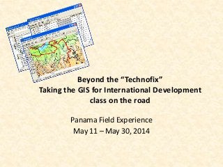
- 1. Beyond the “Technofix” Taking the GIS for International Development class on the road Panama Field Experience May 11 – May 30, 2014
- 2. Nothing but a clumsy technofix? • Can’t throw a rock at a USAID, PEPFAR, UN, Gates… Request for Proposal without hitting a GIS component requirement…
- 3. Nothing but a clumsy technofix? • Can’t throw a rock at a USAID, PEPFAR, UN, Gates… Request for Proposal without hitting a GIS component requirement… • Problem: most commercial GIS are highly proprietary, very expensive, have low-compatibility with other software, and are neither user friendly nor very intuitive…
- 4. Nothing but a clumsy technofix? • Can’t throw a rock at a USAID, PEPFAR, UN, Gates… Request for Proposal without hitting a GIS component requirement… • Problem: most commercial GIS are highly proprietary, very expensive, have low-compatibility with other software, and are neither user friendly nor very intuitive… • … i.e. a headache by any Technology Transfer principles
- 5. Nothing but a clumsy technofix? • Can’t throw a rock at a USAID, PEPFAR, UN, Gates… Request for Proposal without hitting a GIS component requirement… • Problem: most commercial GIS are highly proprietary, very expensive, have low-compatibility with other software, and are neither user friendly nor very intuitive… • … i.e. a headache by any Technology Transfer principles • Truth is, you only need about 15% of all ESRI ArcGIS capacities to complete most mapping activities used to support international development, public health, urban planning or disaster management projects
- 6. Defying the ESRI overlords • Recent development in open-source, customized GIS • Google Earth, QGIS, Philcarto, Crowdmap… even Esri Online
- 7. Defying the ESRI overlords • Recent development in open-source, customized GIS • Google Earth, QGIS, Philcarto, Crowdmap… even Esri Online • OpenDataKit and smartphone-based data collection, analysis and mapping… • Currently used by WHO, UNDP and Gates Foundations in Cote d’Ivoire, Ghana, D.R. Congo, Rwanda, India, etc…
- 8. Course contents • Introduction to basic GIS architecture and functionalities • Case-studies: literature review • Case-studies: uses of digital data collection and GIS software by organization working in Panama • Panama field experience: field visits to international organization and nonprofits working in Panama • Field-research project: A to Z independent research design, data collection, analysis and presentation using the tools and skills learned throughout the course.
- 9. Do I need computer / quantitative skills? • Familiarity with Excel is recommended and knowledge of most common Data Analysis software (Stata, SPSS, EpiInfo) is a plus, but is by no means mandatory!
- 10. Do I need computer / quantitative skills? • Familiarity with Excel is recommended and knowledge of most common Data Analysis software (Stata, SPSS, EpiInfo) is a plus, but is by no means mandatory! • Flexibility and willingness to adapt one’s skills and work to resourceconstrained environment are much more valuable!
- 11. Do I need computer / quantitative skills? • Familiarity with Excel is recommended and knowledge of most common Data Analysis software (Stata, SPSS, EpiInfo) is a plus, but is by no means mandatory! • Flexibility and willingness to adapt one’s skills and work to resourceconstrained environment are much more valuable! What kind of skills will I acquire? • Research design and Protocol Writing
- 12. Do I need computer / quantitative skills? • Familiarity with Excel is recommended and knowledge of most common Data Analysis software (Stata, SPSS, EpiInfo) is a plus, but is by no means mandatory! • Flexibility and willingness to adapt one’s skills and work to resourceconstrained environment are much more valuable! What kind of skills will I acquire? • Research design and Protocol Writing • Mapping and basic spatial analysis using Google Earth, QGIS and other GIS software
- 13. Do I need computer / quantitative skills? • Familiarity with Excel is recommended and knowledge of most common Data Analysis software (Stata, SPSS, EpiInfo) is a plus, but is by no means mandatory! • Flexibility and willingness to adapt one’s skills and work to resourceconstrained environment are much more valuable! What kind of skills will I acquire? • Research design and Protocol Writing • Mapping and basic spatial analysis using Google Earth, QGIS and other GIS software • Principles and Tools for Digital data collection (smartphone based)
- 14. Do I need computer / quantitative skills? • Familiarity with Excel is recommended and knowledge of most common Data Analysis software (Stata, SPSS, EpiInfo) is a plus, but is by no means mandatory! • Flexibility and willingness to adapt one’s skills and work to resourceconstrained environment are much more valuable! What kind of skills will I acquire? • Research design and Protocol Writing • Mapping and basic spatial analysis using Google Earth, QGIS and other GIS software • Principles and Tools for Digital data collection (smartphone based) • Excel, XSL and XML programing
- 15. Why Panama? • The epicenter of U.N. and other international organizations activities for Central America and the Caribbean – UNDP – UNICEF; UNEP, WFP, PAHO, OCHA
- 16. Why Panama? • The epicenter of U.N. and other international organizations activities for Central America and the Caribbean – UNDP – UNICEF; UNEP, WFP, PAHO, OCHA • Varied research environments in a relatively small country: from issues of urban equality in Panama City to questions of natural resource conservations and environmental sustainability in Campana.
- 17. Why Panama? • The epicenter of U.N. and other international organizations activities for Central America and the Caribbean – UNDP – UNICEF; UNEP, WFP, PAHO, OCHA • Varied research environments in a relatively small country: from issues of urban equality in Panama City to questions of natural resource conservations and environmental sustainability in Campana. • Tulane networks! With the Universidad Católica María la Antigua & with UNDP!
- 18. Why Panama? • The epicenter of U.N. and other international organizations activities for Central America and the Caribbean – UNDP – UNICEF; UNEP, WFP, PAHO, OCHA • Varied research environments in a relatively small country: from issues of urban equality in Panama City to questions of natural resource conservations and environmental sustainability in Campana. • Tulane networks! With the Universidad Católica María la Antigua & with UNDP! • A great stepping stone towards Payson’s Master of Science Panama Field Work Experience! http://www.payson.tulane.edu/panama-field-workexperience
- 19. Did I mention it’s a gorgeous and culturally diverse country?
- 20. Practical FAQs • 3 Credits courses • Cost $ 4,100 (not including airfare) • Location: City of Knowledge, 15 min from downtown Panama City