
Recommended
More Related Content
What's hot
What's hot (20)
Similar to Maps and Globes Unit for 3rd Grade
Similar to Maps and Globes Unit for 3rd Grade (20)
Recently uploaded
Recently uploaded (20)
Maps and Globes Unit for 3rd Grade
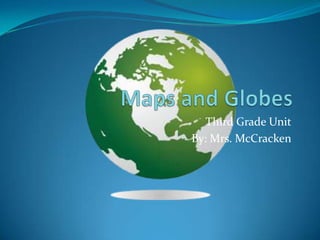
- 1. Maps and Globes Third Grade Unit By: Mrs. McCracken
- 2. You will develop map skills by: SOL 3.5 positioning and labeling the seven continents and five oceans to create a world map; using the equator and prime meridian to identify the Northern, Southern, Eastern, and Western Hemispheres; locating the countries of Spain, England, and France; locating specific places, using a simple letter-number grid system. SOL 3.6 You will read and construct maps, tables, graphs, and/or charts.
- 3. Agree or Disagree The Equator is an imaginary line that divides the Earth into the Eastern and Western Hemispheres. There are seven continents in our world. There are 4 major oceans on Earth The Earth is mostly covered by land.
- 4. Where in the world?
- 6. Using Grids Locate which continent you would land on if you were at 20 degrees North Latitude and 20 degrees East Longitude. Use the map on the previous slide.
- 7. Parts of a map Parts of a map • Map title • Map legend • Compass rose Maps may include a compass rose with the intermediate directions of northeast, southeast, northwest, and southwest. On the next slide we will locate each part.
- 8. Locate the title, legend and compass rose.
- 9. Let’s Review Terms to know hemisphere: Half of a sphere (globe); created by the prime meridian or the equator equator: An imaginary line around the middle of the Earth that divides it into the Northern and Southern Hemispheres prime meridian: An imaginary line that divides the Earth into the Eastern and Western Hemispheres • regions: Places that have common characteristics The equator and the prime meridian are used to create the Northern, Southern, Eastern and Western Hemisphere. The letter (on the left) and number (at the bottom) coordinates of a grid system identify the approximate location of a place.
- 10. Agree or Disagree The Equator is an imaginary line that divides the Earth into the Eastern and Western Hemispheres. There are seven continents in our world. There are 4 major oceans on Earth The Earth is mostly covered by land.