Monumental mapping: GIS and Hadrian’s Wall
•
1 like•793 views

A case study on the use of GIS in archaeology. Presented by Stuart at a Research Data seminar on GIS , which took place at the London School of Hygiene & Tropical Medicine on 17th March 2014

Recommended
Recommended
More Related Content
What's hot
What's hot (20)
Similar to Monumental mapping: GIS and Hadrian’s Wall
Similar to Monumental mapping: GIS and Hadrian’s Wall (16)
More from London School of Hygiene and Tropical Medicine
More from London School of Hygiene and Tropical Medicine (20)
Recently uploaded
Recently uploaded (20)
Monumental mapping: GIS and Hadrian’s Wall
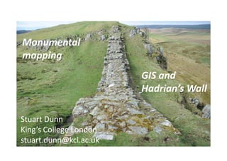
- 1. Monumental mapping GIS and Hadrian’s Wall Stuart Dunn King’s College London stuart.dunn@kcl.ac.uk
- 2. • Vector – points, lines and polygons • Ratser – pixels with attributes • GIS allows us to query and overlay data with geographic coordinates • “A map on top of a database”
- 3. • Everything happens somewhere • Historical sources refer to place in many different ways • Associating exact location with these is complex • Georeferencing • Accuracy versus precision • Relative versus absolute
- 4. e.g. roads, rivers e.g. places e.g. countries, territories etc Vector GIS
- 7. • ArcView x.x – ESRI; proprietary • GRASS – www.grass.osgeo.org • Quantum GIS - http://hub.qgis.org/projects/quantum- gis/wiki/Download • Google Earth – www.earth.google.com • Open Street Map - http://www.openstreetmap.org
- 8. Volunteered Geographical Information (VGI) is considered a special case of an intermediary discourse: information is not fixed, it can be extended, altered, or even deleted at any time. This multi-stage, reflective character has to taken into consideration in a discourse- analytical approach. C. Fink, 2011 - Mapping Together : On collaborative implicit cartographies, their discourses and space construction.
- 13. AD 1250 – Matthew Paris (Image source - British Library)
- 14. Antonine Wall, c. 1906
- 16. E.g. search for Chollerford GeoNames
- 19. Introduction: What is GIS? Vector & unique identifiers, APIs and openstreetmap
- 21. Introduction: What is GIS? Vector & unique identifiers, APIs and openstreetmap
- 22. Introduction: What is GIS? Vector & unique identifiers, APIs and openstreetmap
- 23. Introduction: What is GIS? Vector & unique identifiers, APIs and openstreetmap
- 24. Introduction: What is GIS? Vector & unique identifiers, APIs and openstreetmap