Sea level CO2
•Download as PPTX, PDF•
1 like•749 views

Consequences of increasing CO2: Sea level changes lecture

Recommended
More Related Content
What's hot
What's hot (20)
Viewers also liked
Similar to Sea level CO2
Similar to Sea level CO2 (20)
More from Loretta Roberson
More from Loretta Roberson (20)
Recently uploaded
Recently uploaded (20)
Sea level CO2
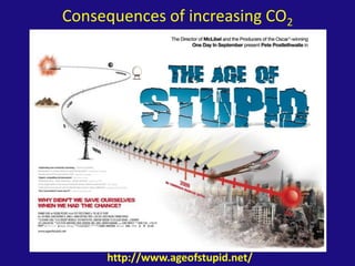
- 1. Consequences of increasing CO2 http://www.ageofstupid.net/
- 2. Consequences of increasing CO2 Global temperature Temperature has increased of 0.6 +/- 0.2 C over past 150 years Temperature is predicted to rise between 1.5 C and 5.8 C by 2100 Changes in precipitation Average precipitation will increase in tropical areas, decrease in subtropical areas, and increase in high latitudes Intensity of rainfall events will increase Changes in sea level Sea level has risen 120 m over past 20,000 years In the last 100 years, the average rate has been 1-2 mm/year (10 times greater than the last 3,000 years) Sea level is predicted to rise 0.13-0.94 m by 2100
- 3. Consequences of increasing CO2 For marine processes More vigorous hydrological cycle More river run off higher productivity Ice cover will decrease General reduction in wind stress (ie, major currents will be less strong) Intensification of the land-sea temperature gradient increased upwelling For marine organisms Poleward shift of species “Competing predator” blooms can adversely affect populations Changes in productivity
- 4. Sea level Mean sea level (MSL)
- 5. Two types of sea level change Relative Changes in sea level and/or land level (Isostatic changes, tectonic activity, extraction of groundwater, oil and gas) Eustatic/Absolute Most commonly brought about by changes in ocean water volume (melting/growth ice sheets, thermal expansion)
- 9. Global water balance Isostasy Restrained Rebound (Rr) Occurs beneath a thinning ice sheet - the lithosphere will gradually rise in response to decreasing pressure. Postglacial Rebound (Pr) The rebound recorded in an area after deglaciation. Residual Rebound (rr) The asthenosphere can take > 10,000 years to reach a new equilibrium following ice loading or removal.
- 11. Mississippi – sediment isostasy
- 13. Global Environmental Changes:Natural rhythms Sea level has dropped 350 m over 100 Ma
- 15. Rahmstorf et al. 2007 Science (a) Changes in key global climate parameters since 1973, compared to the scenarios of the IPCC [shown as dashed and gray ranges in all panels]. Monthly carbon dioxide concentration and its trend line at Mauna Loa, Hawaii (blue) up to January 2007, from Scripps in collaboration with NOAA. Annual global-mean land and ocean combined surface temperature from GISS (red) and the Hadley Centre / Climatic Research Unit (blue) up to 2006, with their trends. Sea-level data based primarily on tide gauges (annual, red) and from satellite altimeter (3-month data spacing, blue, up to mid-2006) and their trends. For temperature and sea level, data are shown as deviations from the trend-line value in 1990, the base year of the IPCC scenarios. (b) (c)
- 18. The deglacial rise in sea level
- 19. What are the consequences of sea level changes?
- 22. Puerto Rico and USVI ~21 ka
- 23. San Juan sea level rise simulation 1-20 m
- 24. Current and FutureSea-Level Change There is strong evidence that global sea level gradually rose during the 20th century and is currently rising at an increased rate Sea level is projected to rise at an even greater rate in this century The two major causes of sea-level rise are thermal expansion of the oceans and the loss of land-based ice due to increased melting
- 25. Annual averages of global mean sea level Satellite altimetry Mean sea level, 1961-1990, (1993-2001 for black curve) Coastal tide gauge measurements since 1950 5.13-Bindoff et al., 2007
- 26. Global mean sea level (deviation from 1980-1999 mean) in the past and as projected for the future FAQ 5.1-Bindoff et al., 2007
- 27. Slope of shoreline and affects of sea-level rise 20.D-Tarbuck & Lutgens, 2005
- 29. What are the consequences of sea level changes?
- 30. What are the consequences of sea level changes? From: Jan/Feb 2008 Atlantic http://www.humanimpressions.com/
- 31. Latest research Geophys. Res. Lett.36, L17501 doi: 10.1029/2009LL039126 (2009) The rate of thinning of the Pine Island Glacier — the largest stream of fast-moving ice on the West Antarctic Ice Sheet — quadrupled from 1995 to 2006. If the current rate of acceleration continues, the main trunk of the glacier could be afloat within 100 years. Using satellite radar altimetry to examine the ice thickness, Duncan Wingham of University College London and his colleagues found that the thinning process has rapidly propagated inland since 1995, with the frozen tributaries that flow into the central trunk of the ice stream now losing mass as well. Scientists think that the imbalance has been triggered by warm waters at the glacier's ocean terminus.
- 32. Normal Latest research From : Climate change: The El Niño with a difference, Karumuri Ashok & Toshio Yamagata Nature 461, 481-484(24 September 2009)
- 33. Latest research Holocene carbon cycle A new atmospheric 13C record derived from measurements of air trapped in the EPICA Dome C Antarctic ice core, combined with a simple carbon model, provides a high-resolution view of the carbon cycle during the Holocene, the current interglacial period that started about 11,000 years ago. The new data suggest that the increase of atmospheric CO2 during the later Holocene can be mostly explained in terms of carbonate compensation of earlier land biosphere uptake and coral reef formation, with a minor contribution from a small decrease of the land biosphere carbon inventory. J Elsiget al.Nature461, 507-510 (2009)
- 34. Latest research Holocene carbon cycle a, Cumulative land-biosphere uptake for the land-biosphere–marine-carbonate . b, Atmospheric CO2 is simulated by prescribing the land-biosphere changes shown in a. Grey squares represent CO2 data from Dome C (mean of six samples; error bars, 1 of the mean). Green line, land biosphere (LB) only; black line, LB and carbonate compensation during the Holocene (CCH); red line, LB plus CCH plus 700 Gt C land biosphere uptake during the transition which causes carbonate compensation (CCT). The bar chart indicates the modelled contributions to the CO2 rise from 6.5–0 kyr bp by individual processes LB, CCT and CCH, and the total (red bar), assuming the land-biosphere–marine-carbonate scenario. The remaining difference between the simulated and measured CO2 increase may be attributed to coral reef growth and other mechanisms. J Elsiget al.Nature461, 507-510 (2009)
Editor's Notes
- 1-20 m san Juan