
Recommended
Recommended
More Related Content
What's hot
What's hot (20)
Viewers also liked
Viewers also liked (20)
Similar to CRADLE CITY MASTER PLAN
Similar to CRADLE CITY MASTER PLAN (20)
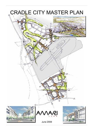
CRADLE CITY MASTER PLAN
- 1. CRADLE CITY MASTER PLAN June 2008
- 2. CRADLE CITY MASTER PLAN 27 June 2008 Submitted to the City of Johannesburg Development Planning and Urban Management Department (Development Planning & Facilitation) Prepared by the Cradle City Professional Team: GAPP Architects & Urban Designers ASM Architects & Urban Designers Van Brakel Professional Planning & Property Services PDNA & Associates (transport & services infrastructure) RWP Consulting Electrical Engineers SEF (environmental) For
- 3. Cradle City Master Plan Contents CONTENTS 6.3 Public Environment, Landscape & Natural Environment Plan 1.0 INTRODUCTION 6.4 Land Use Activities, Community 1.1 The Lanseria Node Opportunity Facilities and Housing 1.2 The AMARI Land-holding 6.5 Land Budget and Development 1.3 Building on the Gauteng Growth Rights and Development Strategy and 6.6 Engineering services & Meeting City Region Strategy Infrastructure Development Plan Objectives 6.7 The Urban Design Plan 1.4 Unlocking the Opportunity 1.5 Purpose of the Master Plan Report 7.0 THE DEVELOPMENT PRINCILES & DESIGN GUIDELINES 2.0 THE VISION 7.1 Environment 7.2 Movement & Transportation 3.0 THE OBJECTIVES 7.3 Engineering Services & Social 3.1 An Economically & Spatially Viable Facilities Development 7.4 Place-making Guidelines 3.2 A Sustainable Environment - Built form & public spaces 3.3 An Integrated Movement Framework design guidelines 3.4 Mixed Use, Mixed Density & - Sustainable built environment Supporting Social Facilities guidelines 3.5 Sustainable Infrastructure - Architectural & green building Development- Energy & Resource principles Efficiency 3.6 A Quality Public Environment, Open 8.0 THE PRECINCT STRUCTURE, Space and Landscape PRECINCT PLANS AND PHASING 3.7 Urban Management 8.1 The Precinct Structure 8.2 Package of Plans Approach 4.0 ALIGNMENT WITH SPATIAL 8.3 Precinct Plan Requirements DEVELOPMENT POLICIES OF 8.4 Proposed Phasing LOCAL AUTHORITIES 4.1 City of Johannesburg 9.0 CONCLUSION 4.2 Mogale City SDF 4.3 City of Tshwane SDF 5.0 CONSOLIDATING THE DEVELOPMENT DIRECTION 5.1 The Three Places 5.2 Getting There: Access & Connectivity 5.3 A Quality Live, Work & Play Environment 5.4 Realising Spatial Planning Policy 5.5 The Triggers: Development Catalysts 6.0 THE CRADLE CITY MASTER PLAN 6.1 The Overall Spatial Structure. 6.2 Movement Systems & Transportation Plan Page i
- 4. Cradle City Master Plan Section 1: Introduction Lanseria Midrand Fourways Joburg CBD Figure 1-1: The Amari Land-holding Page 1 /1
- 5. Cradle City Master Plan Section 1: Introduction 1.0 INTRODUCTION • The land-holdings are on the rural- is primarily are used for agricultural urban edge, adjacent to an purposes and rural residential. An extensive and growing tourism, exception to this is a 90Ha land portion 1.1 The Lanseria Node Opportunity leisure and hospitality region. This adjoining the airport to the north, which includes, in close proximity, the has existing zoning rights for industrial The area around the Lanseria Cradle of Human Kind World and business rights. AMARI is presently International Airport has for a number of Heritage Site. obtaining approvals and undertaking years been identified by prospective • The land-holdings are within the township establishment procedures to property and business owners as a major developing Hans Strijdom (R512) enable it to develop the land and release development and economic growth corridor with industrial and it to the market. opportunity. The realisation of this residential development interest. opportunity has been hindered in the past This indicates that existing growth is The land-holding falls within the due to supporting infrastructure happening and future growth is administrative jurisdiction of two local development constraints and the anticipated. municipalities: fractured ownership of the land. Various • The land-holdings are nested within • The City of Johannesburg recent initiatives have begun to unlock the planned PWV- and K routes • Mogale City Local Municipality this opportunity. These include: provincial road network. This The northern border of the land-holding is provides excellent access to the in close proximity of the City of Tshwane’s • The Gauteng province’s growth and land-holdings and overall municipal boundary. development strategy and its drive connectivity to the existing urban to turn the province into a globally system. The proposed realisation of competitive city region. Enabling the developments will also bring faster economic growth and job forward the physical establishment creation are imperatives. of the provincial road system. Undoubtedly the Lanseria node has Existing investment into road a role to play and an important infrastructure around the airport is contribution to make within this estimated at R 120 million, and the policy dynamic. R512 is also earmarked for • The strategic urban planning for the upgrading. Lanseria Node by the City of • The land-holdings are within reach Johannesburg, the Lanseria of new key public transport systems Development Framework 2020 (the SPTN routes with their BRT (Version 2.0, Johannesburg systems and potential Gautrain Metropolitan Municipality, April, feeder systems), which are 2008) identifies the Lanseria airport envisaged to form an integral part of as a major business and commercial the future development. node within the precinct. The development framework directs the future development of the area, 1.2 The Amari Land-holding effectively unlocking the inherent development opportunity, provided The Amari Land-holding (Figure 1-1) that its directives are met and that comprises an area of approximately policy is complied with. Similarly the 900Ha located around the Lanseria Mogale City spatial development International Airport in the north-western framework identifies Lanseria airport areas of the City of Johannesburg. The as an opportunity, allowing for mixed northern part of the landholding also falls use development in the vicinity of within the jurisdiction of Mogale City and the airport. the City of Tshwane. It is in this context that the AMARI land The northern portion of the landholding company has made a significant property has as its western border Malibongwe investment within the wider Lanseria Drive and the southern border comprises precinct area. The reasons, in addition to the Lanseria airport. It stretches north- latest policy developments, include: eastward, across the municipal boundary • The strategic location of the land- of the City of Johannesburg into the holding gives it the potential to be foothills of the Rhenosterkoppies, developed into a regional bordering with residential lifestyle estates development node. This, as such as Monahan and Blair Atholl. This highlighted above, is recognised by portion of the landholding is the City of Johannesburg’s future approximately 500Ha in extent. planning for the area. This will require the integrated development The southern portion of the land-holding of higher order facilities and central is bordered by Malibongwe Drive in the business district elements, with west, the extension of Cedar Road in the supporting infrastructure south, the proposed K215 in the east, and development. the airport landholding in the north. This • The Lanseria airport is considered portion is approximately 400Ha in extent. as an established regional anchor and growing catalyst that is bringing Two individual portions of land are increasing development energy to located to the west and east of the airport. the area. The airport is to be upgraded via an investment of R The acquired area (Figure 1-2) 100 million, and its passenger comprises mainly farmland of relatively volumes have doubled every 9 small portions and smallholdings which years. have an “undetermined” zoning. The land Figure 1-2: Land Acquisition Page 1 /2
- 6. Cradle City Master Plan Section 1: Introduction Figure 1-3: City Region Context Page 1 /3
- 7. Cradle City Master Plan Section 1: Introduction 1.3 Building on the Gauteng Growth iii. Tourism. the Lanseria node has the potential to be and Development Strategy and iv. Agriculture (agri-processing and bio- expanded and consolidated into a Meeting City Region Strategy tech). regional node. The regional connections Objectives v. Manufacturing (steel related and its accessibility support this. Its industries, automotive parts and development will consolidate the In the Newsletter of the Gauteng components, beer and malt). Malibongwe drive development corridor, Provincial Government, Gauteng News vi. Infrastructure expansion and and bring new development into the sub- (April / May 2008), the Gauteng investment. region, complementing the existing government states that building Gauteng residential development and commercial into a globally competitive city region is Within the provincial GDS, the city region activity associated with Lanseria airport. the overarching response to the initiative is a specific mechanism, which challenges of poverty, unemployment and includes, amongst other salient features, underdevelopment, which face the the following objectives: 1.4 Unlocking the Opportunity province. • To enable significant agglomeration and size. To unlock the major opportunity that is In a briefing to journalists, Premier • To establish high levels of economic represented by the AMARI land-holding, Shilowa states that “the provincial linkages including business the following four principles have been government will continue to invest money connectivity and economic identified and adopted: for the creation of strategic economic transactions. infrastructure following the success with • To build significant strategic i. Establish partnerships with the three projects under Blue IQ”. This will be networks between the state- local authorities: The City of driven by the establishment of an business-finance and voluntary Johannesburg, the City of Tshwane investment vehicle called the Gauteng sectors. and Mogale City local municipality. Fund, which is to attract capital from the • To achieve a balance between private sector and state-owned social and economic progress, ii. Establish an environmentally enterprises, in addition to the R500 million growth and redistribution. responsible and sustainable plan in provincial seed funding already com- • To ensure appropriate socio- order to utilise resources in the most mitted. The latter is to finance projects economic development and efficient manner, and comply with such as the Gauteng Link (G-Link), the activities in conjunction with local relevant environmental legislation. Amakhosi Stadium precinct, the government. This includes obtaining relevant EIA Kopanong precinct, the Gauteng Freeway authorisation and compliance. Improvement Scheme, public hospitals, In order to achieve a sustainable city energy-generation projects and urban region a spatial logic is needed to guide iii. Establish a plan that demonstrates regeneration. balanced development (Figure 1-3). The and places “inclusionary housing” Gauteng urban system has developed as within it, which includes a range of The focuses of the province’s efforts are a particular pattern of nodes and housing and possibly tenure on: corridors. Johannesburg has become a options. This in support of • Road infrastructure maintenance. core node in the north-south development government’s “Breaking New • The establishment of a one-stop corridor (PTA/JHB/Vereeniging) and in Ground” programme to build service and business portal to the east-west development corridor spatially and socially integrated and support business in Gauteng. (mining belt, from Krugersdorp to sustainable human settlements and • A number of programmes to build Germiston). Over time, as the urban communities. spatially and socially integrated and system expanded and development sustainable human settlements and needs and activities within these centres iv. Establish a plan that supports and communities. intensified, a ring of nodes has developed enhances infrastructure develop- • The fast-tracking of urban renewal in concentric circles around them. The ment in partnership with and mixed-income and mixed tenure first ring, district (tertiary) nodes, supports government. This is to enable co- settlements to enable the socio- these centres, without taking over their ordinated and phased development economic integration of function. As the centres matured with to the required standards, and in communities. more intense activities and the urban area line with the negotiated allocation of • Establishing alternative, innovative consolidated around them, and began to rights, and in support of overall bulk- health financing and service-delivery expand further, a second ring of nodes infrastructure development of the options for health services. was established. These are typically sub-region. • The provision of quality education, regional nodes (secondary nodes), which especially to the poor. have similar functions to the primary city • A major provincial offensive against centre nodes, but serve the expanded crime through the Gauteng Safety urban hinterland. Nodes within this band Strategy. include Midrand, Krugersorp, Kempton • The commitment to work together Park, Germiston etc. Some of the latter with local government to build are located on the main development Gauteng as a globally competitive axes, and have contributed to the city region. establishment of the development • The province’s commitment to the corridors. success of the 2010 Fifa World Cup in South Africa. The Lanseria node falls within the band of regional nodes, but has as yet not The proposed Cradle City development advanced in development as the others. It contributes to the Gauteng Growth and is located on the Malibongwe Drive Development Strategy (GDS). The latter development axis, forming the northern focuses on the following six growth “bookend”. In addition the R28 freeway sectors and clusters: forms a strong mobility link with i. Smart industries (including ICT, Krugersdorp and Centurion (south-west pharmaceuticals, etc.). Tshwane). This connectivity is ii. Trade and services (including complemented by additional main route finance and film). links with Midrand. It is in this context that Page 1 /4
- 8. Cradle City Master Plan Section 1: Introduction Figure 1-4: The Master Plan Procedures & Outcomes Page 1 /5
- 9. Cradle City Master Plan Section 1: Introduction 1.5 Purpose of the Master Plan Report The purpose of this Cradle City Master Plan Report is to outline the development proposals for the Amari land-holdings within the Lanseria Precinct Development Framework 2020 (City of Johannesburg, Version 2, April 2008) and spatial development frameworks of the adjoining municipal areas. It sets out the overall vision for the development, the objectives, the development plan and the development principles that underpin it, the resultant development parameters and associated development rights, the environmental aspects, the proposed service- and transport infrastructure development and the proposed phasing. The master plan will indicate the alignment of the proposals with the spatial planning of the three local authorities, namely: • The City of Johannesburg Northern Areas Development Framework • The Tshwane City SDF • The Mogale City SDF The above would allow for future submissions of rezoning applications to the relevant authorities in terms of the Town Planning and Townships Ordinance, 1986 (Ordinance 15 of 1986), to obtain rights in terms of the approved master plan and the physical realisation thereof according to its phasing. The outcome of the master plan (Figure 1-4) will be: • A land use plan and rights. • A Transport Plan & associated Movement Network Plan • Engineering services Plans • Urban Design Plan It is considered to be a statutory plan which prescribes the land use and intensity for the landholding to guide the physical development of the land. Page 1 /6
- 10. Cradle City Master Plan Section 2: The Vision Figure 2-1: The Vision Page 2 /1
- 11. Cradle City Master Plan Section 2: The Vision & Section 3: The Objectives 2.0 THE VISION sprawl) and establishes a quality living 3.0 THE OBJECTIVES and working environment. This supports: The vision of the Cradle City development • establishment of mixed use; The Cradle City vision is based on a (Figure 2-1) represents the • a built form that is adaptable over series of development objectives, which understanding of the initial development time; encompass the establishment of an context (physical, economic and policy • making connections and economically, socially, spatially and wise), an assessment of the inherent establishing access; environmentally integrated mixed use and opportunity represented in the AMARI • including a range of residential mixed tenure development. The latter is land-holding and the culmination of a opportunities; to be undertaken based on sustainable series of aspirations. It shows what • inclusion of social, cultural, religious principles across all sectors. The AMARI would like to achieve, and what & entertainment facilities; and established objectives fundamentally can be achieved for the benefit of the • establishing a high quality public direct the incremental development of the wider urban region in general and the environment through place making 900Ha land-holding into a regional node. Lanseria sub-region in specific. and landscape. It is in effect a new city which: • Creates value for the land owner. The Cradle City vision encompasses the The realisation of the Cradle City vision is • Creates an economically viable and establishment of a new city – bringing a based on the understanding that this will environmentally sustainable centre new offering - within the Gauteng urban require a partnership based approach, for the Lanseria sub-region. system, structured around the Lanseria given the diversity of role-players that a • Creates a quality live-work-play airport node. This vision is to create an development of this nature includes. It is environment for all sectors of urban development that is sustainable in vital that a developmental partnership be society. economic, social, environmental and created with all local authorities to effect spatial / physical terms. the development and guide it over time. In addition to this an appropriate urban 3.1 An Economically & Spatially Economic sustainability encompasses the management regime will have to be Viable Development establishment of a development that is established and maintained, which viable and enables economic growth and includes the participation of owners, An economically viable development is activities which: residents, businesses and workforce, and enabled through the establishment of an • meets market demand and creates includes the good governance appropriate level of development new market opportunities through requirements of local government, intensification, supported by applicable the establishment of a diversity of directing the responsibilities of all role- levels of densification and a diverse business and economic activities, players and partnerships, and ensuring activity mix. This enables it to capitalise and the targeting of niche markets; that relevant management performances on overall market development trends • attracts capital and enables and standards are met and maintained. and positions it such that identified market investment; niches can be targeted and exploited. • creates long-term and sustained The vision of Cradle City has yielded the employment opportunities; and incremental development of a 900Ha 3.1.1 Intensification • increases land values & the land-holding into a regional node, with concomitant rates base of the city; three distinct precincts: Urban development practice in South • The Business and Airport Precinct Africa has, in response to urban growth Social sustainability encompasses the • The Mixed Use Precinct pressures (sprawl, environmental support of a diversity of users, from all • The Lifestyle, Leisure and Tourism degradation, inequitable quality of life, socio-economic backgrounds, and Precinct changing housing dynamics) moved enables access to urban opportunity by It is estimated that Cradle City will toward the intensification – an increase in even the marginalised in society. This is potentially yield a mixed use regional mixed land use and mixed residential accompanied by the establishment of a node with approximately 8 million m² of densities - of new and existing urban supporting engineering service floor area and 180Ha of environmental areas. This is considered an appropriate infrastructure, social facilities and open space systems. way of making an urban environment services, cultural and religious facilities, more liveable and reducing its and entertainment, leisure and recreation. environmental impact. Environmental sustainability This approach is supported in the Spatial encompasses the integration of the Development Frameworks of the affected natural environment and associated local authorities. The establishment of heritage resources of the land-holding. strong viable nodes through the clustering This includes the commitment to the and concentration of activities at conservation / preservation and appropriate and accessible nodal strengthening of existing ecological locations is overall policy. The nodes processes, environmental systems and require to be well integrated with the the enhancement of hydrological systems movement systems of the city and and associated fauna and flora. It also support the surrounding sub-regions. encompasses the commitment to the reduction of the development’s ecological The above is reinforced by the drive to footprint by the incorporation of initiate and implement corridor environmentally sustainable forms of development. This establishes a clear resources utilisation, such as alternative structure for movement and accessibility, forms of energy, the adoption of a green supported by the establishment of a more buildings approach, and more efficient compact urban form, which is directly utilisation of water, electricity etc. linked to the strong high intensity, mixed use nodes and associated higher Spatial and / or physical sustainability residential densities. encompasses the establishment of an urban development that completes The aim is to ensure a more effective and (complements) the urban system, is more efficient use of facilities, enabling people compact in its urban form (avoiding urban to live closer to amenities and work Page 2 /2
- 12. Cradle City Master Plan Section 2: The Vision & Section 3: The Objectives opportunities. It also enables the 3.1.3 Diversification 3.3 An Integrated Movement management, maintenance, protection Framework and expansion of the significant public For the optimal functioning of a and private sector investment in services development of this nature an appropriate The movement framework of the and infrastructure within a typical node. diversity of land use activities should be development determines its connectivity This intensification approach is to be established. This begins with those land and accessibility, which in turn affects driven by economic and environmental uses that meet daily needs of residents uses and activities, density, security and sustainability to ensure that people are and its workforce. Integrated with that the impact of the development on living in harmony with the environment. should be a diverse range of secondary adjoining areas. The structural activities, such as social support and components of the movement framework 3.1.2 Densification public facilities (education, health, are the hierarchy of movement routes, the religious), as well as public space and associated intersections, access points Hand in hand with intensification, is an recreation areas. The business and retail and crossings, cycle ways and the appropriate level of overall densification. activities to be promoted are informed by pedestrian pathways (separate and / or The number of people attracted to and the urban and regional context of the sidewalks), whist the individual activities living within an urban environment, development, and possibly a particular and components comprise walking, combined with their skills, knowledge and activity or mix that gives the development cycling, vehicular transport (commercial disposable income, creates the potential a focus, which reinforces the vision and and private) and public transport. economic market and creates the particular identity that is being sought, required support threshold for amenities, strengthens its position and role in the A successful movement framework for the services and facilities. In general terms, wider urban context. development will: the higher the population density in an • provide a maximum choice for how urban area, the better for the potential people will make their journeys market threshold. The benefits of seeking 3.2 A Sustainable Environment (walking, cycling, motor-driven / higher density levels include: vehicular, and various modes of • Social: Encouraging positive Conserving and enhancing the natural public transport); interaction and diversity, improving environment, water systems and open • provides good access, taking into the viability of, and access to, space systems form an integral part of the account the kinds of movement that community services, and enabling development of an urban environment. are generated within and for the more and better integrated This enables the integration and most development; and residential development. effective utilisation of the urban area’s • establish clear connections to • Economic: Enhancing the economic existing and future physical and natural existing routes, local facilities and viability of development, and resources. In general terms the open neighbouring nodes and activities. providing economies of scale with space systems should support a range of regard to infrastructure and ecological, social and institutional The establishment of an efficient amenities functions, which conserve and enhance movement system is included in the • Transport: Supports public transport, the urban environment’s natural heritage, Spatial Development Frameworks of the reduces car travel and parking and contributes to the establishment of a affected local authorities. In general these demand, and makes underground / sustainable living and urban environment include: basement parking more that supports human activities. • The establishment of an Integrated economically viable. Transport Plan. • Environmental: Increases energy This approach forms an integral part of • The establishment of a road network efficiency, decreases resource the Spatial Development Frameworks of hierarchy and associated consumption, potentially reduces the affected local authorities. All have management guidelines. pollution, preserves and helps fund proposed Metropolitan Open Space • The establishment of appropriate the maintenance of public open Systems with associated Environmental public transport infrastructure (bus, space and reduces urban sprawl. Management Plans. The metropolitan rail and comb-taxi). open space systems aim to establish an To avoid the negative socio-economic inter-connected and managed network of The City of Johannesburg’s SDF states and spatial impacts of over-densification, open spaces that support interactions that the “movement strategy is premised the approach should be design-led, between social, economic and ecological on the provision and maintenance of a underpinned by urban design principles activities, sustaining and enhancing both highly accessible movement system and and design guidelines, concentrating on a ecological processes and human network that supports a range of modes sustainable and viable urban quality. settlements (JMOSS). (road and rail, public and private) and Urban market trends should be taken into activities at various levels, intensity and account but must not necessarily dictate In general, where identified areas have a scale. It specifically endorses the the outcome. high conservation and / or recreation promotion of the public transport as the potential, the principle is that open space means to increase accessibility of This densification objective is also and environmental considerations should opportunities to all city users.” supported in the Spatial Development take precedence over development Frameworks of the affected local considerations. This applies in particular authorities. In general the active to: 3.4 Mixed Use, Mixed Density and densification of strategic locations within • Ecologically sensitive and Supporting Social Facilities the city area (in and around nodes, along endangered areas. mobility and transportation routes) is • Where the open space system The development proposes the promoted to accommodate demand in requires to be linked to re-establish establishment of a mixed use and mixed close proximity to existing economic continuity. density development, with an appropriate opportunities and infrastructure. This also • Where the restoration of the level of supporting social facilities and avoids increased urban sprawl and ecological balance is required. services. The benefits of this mixed use enables the re-structuring of the urban and mixed density approach include: environment. The densification is • More convenient access to facilities. supported through the establishment of • Potentially reduced travel-to-work clear principles and density design trips in terms of time and / or guidelines. distance, reducing congestion and time delays. Page 3 /1
- 13. Cradle City Master Plan Section 3: The Objectives • Greater opportunities for social • Greenhouse gas emission physical object which gives it a high interaction. abatement. probability of evoking a strong image in • Socially diverse communities. • Water conservation. any given observer. It is that shape, • Visual stimulation and delight of • Waste avoidance, reuse and colour, or arrangement which facilitates different buildings in close proximity recycling. the making of vividly identified, powerfully to one another. • Pollution prevention - noise, water, structured, highly useful mental images of • Improved safety with more “eyes on air, soil & light. the environment. It might also be called the street”. • Enhanced biodiversity. legibility, or perhaps visibility in a • Greater energy efficiency and more • Reduced natural resource heightened sense, where objects are not efficient use of space and buildings. consumption. only able to be seen, but are presented • More consumer choice of lifestyle, • Productive and healthier sharply to the senses. location and building / lifestyle type. environments. • A development’s sense of place is Urban vitality and street life. • Useable buildings. determined by the identity and character • Increased viability of urban facilities • Social amenity. that is deeply felt by local inhabitants and and support for business, including • Transparent reporting. visitors. It is based on the collective public transport. perception and experiences of the activities, places and spaces that A mixture of residential typologies and 3.6 A Quality Public Environment, characterise it. This is defined by the built associated tenure mixes should also be Open Space and Landscape fabric and the natural environment, - promoted to support the land use mix. pedestrian-friendliness, the overall living This promotes social diversity and The quality of the public environment, the and urban experience, legibility, image enables the establishment of different associated open space and landscape, is and identity, buildings and architecture, residential typologies, which discourages underpinned by the liveability and the animated street activities, landscaping the establishment of exclusive enclaves. imageability of the proposed and special/unique features, such as development. The objective is to establish views, particular events etc. The mixed residential density approach is high quality public environments, also an objective outlined in the Spatial including public squares, piazza’s, open Development Frameworks of the affected spaces, parks and sidewalks; with 3.7 Urban Management local authorities. In principle these appropriate landscaping of flora and promote the establishment of sustainable fauna, that support activities taking place The overall urban management of the housing environments in appropriate and within these, provide human comfort and development is critical to its successful accessible locations. This is to be contribute to their overall environmental functioning and liveability. Components of supported by the provision of adequate sustainability. this include: social and economic amenities. Within this a range of housing typologies should • Safety and security. 3.6.1 Liveability be provided according to desirable • Emergency management, including densities and tenure. disaster management. The liveability of an urban environment refers to the contribution it makes to the • Municipal services. Within this proposed residential mix will quality of life of the area’s inhabitants and • Add-on services through public / be a component of inclusionary housing, users. This requires that the private partnerships such as an in order to assist in achieving development’s urban environment and its urban improvement precinct. government’s housing drive as proposed activities should contribute to the well- • The control of development through by its “Breaking New Ground” policy. To being of its entire population (residents, land use management systems and ensure the viability of the development, it workforce and visitors), with regard to the enforcement of by-laws. is considered that government will assist facilities and services, public spaces and with supporting incentives (possibly places, parks and open spaces, These aspects are to be established additional bulk, density bonuses or other supporting engineering infrastructure, within the context of the local mechanisms) in order to offset the recreation, entertainment and cultural municipalities’ municipal functions, as additional costs and enable viable activities. Some principles that enable this directed by the Municipal Systems Act. In margins. are: addition public-private partnerships (with • The goal to ensure that all residents, businesses and land owners) households have access to are to be investigated to enable a 3.5 Sustainable Infrastructure individual and community facilities satisfactory and integrated level of service Development encompassing and receive equitable and delivery and support. Energy & Resource Efficiency appropriate level of service. • The maintenance of existing The proposed development seeks to resources (natural and man-made) establish an appropriate supporting and infrastructure investment, engineering infrastructure and social including rehabilitating and facilities provision that is directed by sustaining ageing infrastructure energy and resource efficiency, placing before its deterioration beyond the infrastructure development on a recovery, and the provision of new sustainable trajectory. service infrastructure. • Ensuring full service provision of Within the context of an undersupply of community facilities, guided by infrastructure services in the wider sub- service standards and necessary region, as well as the lack of capacity operating funds required to sustain within the current systems, and in these facilities on a day-to-day particular electricity, sewerage and water, basis. a sustainable infrastructure development approach is required to service the 3.6.2 Sense of Place development. This is to include principles such as: Lynch (1960), in “The Image of the City” • Energy efficiency and the use of introduces the concept of ‘imageability’, alternative energy sources. which he defines as that quality in a Page 3 /2
- 14. Cradle City Master Plan Section 4: Alignment with Spatial Development Policy Figure 4-1: Lanseria Development Framework 2020 (April 2008, City of Johannesburg) Figure 4-2: Mogale City Spatial Development Framework Figure 4-3: Region 5 Spatial Development Framework (City of Tshwane SDF) Page 4 /1
- 15. Cradle City Master Plan Section 4: Alignment with Spatial Development Policy 4.0 ALIGNMENT WITH SPATIAL 4.3 City of Tshwane SDF DEVELOPMENT POLICIES OF LOCAL AUTHORITIES The Tshwane SDF identifies the Crocodile River and environs, abutting The development proposals contained in Cradle City to the north, as an important the Cradle City concur with the spatial natural, leisure and recreational area. The development policies and directives of the Region 5 Spatial Development three local municipalities. Framework identifies this area as a management zone, allowing for low intensity development, comprising 4.1 City of Johannesburg: environmentally friendly residential estates, leisure and tourism facilities. The City of Johannesburg’s (CoJ) Lanseria Development Framework 2020 spatial development plan for the wider Lanseria sub-region (Figure 4-1) includes the following: • The establishment of a freight corridor structured around Malibongwe Drive (K29), allowing commercial and limited residential development. • The reinforcement of the K-route road network; reinforcing proposed connections and the introduction of public transport. • The establishment of two mixed use nodes within the sub-region: The Lanseria Metropolitan Node and a district node. • The consolidation of commercial and business activities around Lanseria airport, allowing for the expansion of airport-related activities. • Further commercial and light industrial development, particularly in relation to the Malibongwe Drive freight corridor. The resultant land use structure (Figure 4-2) proposed by the city has been incorporated into the Cradle City master plan, ensuring correlation between the initiatives. It includes the commercial / airport expansion zone around the Lanseria airport and the mixed use node in the southern part of the site. The associated land uses, comprising retail, commercial, office and high density residential have also been also been incorporated. 4.2 Mogale City SDF The Mogale City SDF’s land use structure in the north is currently viewed as a district mixed use node, it is defined as a “mixed land use zone”. This is to comprise environmentally sensitive development (low density residential, hospitality, leisure and tourism facilities) abutting the Crocodile River system. This is complemented by mixed use developments with retail, commercial, office, and high density residential in relation to the Lanseria airport expansion The Cradle City master plan incorporates these land use activities. Page 4 /2
- 16. Cradle City Master Plan Section 5: Consolidating the Development Direction Figure 5-1: The Three Triggers- Development Catalysts Page 5 /1
- 17. Cradle City Master Plan Section 5: Consolidating the Development Direction 5.0 CONSOLIDATING THE secondary movement system, which, development synergies with the DEVELOPMENT DIRECTION together with existing road infrastructure Cradle of Humankind World is connected at as many points as Heritage Site and the existing The development direction is possible on the loop system, providing the residential lifestyle developments consolidated from the established critical access to sustain long term and leisure / tourism activities. objectives and the outlined spatial development. • The development of the Airport development policies of the local Gateway & Business Park (Lanseria municipalities. It focuses on five aspects: There are proposals by the City of Business Park), a component of the • Placemaking Johannesburg to link the BRT system to first phase of development. This is • Movement & Access the entrance of the Lanseria airport, predicated on existing development • Sustainable Community giving the land holding public transport rights and the proximity of services • Realising Policy access. This has the potential to be infrastructure which is also utilised • Development Catalysts extended and augmented. by the Lanseria airport. Services support to expansion & development of the airport, integration 5.1 The Three Places 5.3 A Quality Live, Work & Play • The first component of the Urban Environment Living Centre – lifestyle… the The opportunity that stands out comprises provision the beginnings of a mixed the potential to establish three distinct All urban policies and the objectives use node, based on a regional and unique places: promote the establishment of a quality shopping, the current lack of which urban environment. In this regard the frustrates a burgeoning residential • In the north the idea of “The Green desired quality must not be equated with market in the area, combined with Coast” area with lifestyle, tourism high income, i.e. implying that quality can office & business space, and high and leisure development: only be achieved in such areas. Rather, density residential - Lifestyle the quality urban environment to be - Cultural Heritage achieved here is based on a holistic and - Tourism sustainable development approach, which The development direction outlined herein - Leisure-Recreation-Sport protects and enhances the natural is in synergy and compliance with the environment, enables sensible economic spatial planning by the City of • In the center the Airport area growth and realises social justice (access Johannesburg and adjacent “Lanseria Airport, Business, for all people to urban opportunity, municipalities. How the compliance is Industrial, and Tourism Gateway” accommodating a diversity of activities achieved is outlined in the following area: and residential environments, and the section. - Aero city provision of supporting social and cultural - Health City facilities). - Business & Industrial - Hotels 5.4 Realising Spatial Planning Policy • In the south an “Urban Living The development proposals both from the Centre” area: public sphere (local government) and the - Regional Mixed Use Node & private sphere (land owners and Commercial Centre developers) are working in synergy, - Integrated Residential affording the opportunity to realise spatial - Business planning policy. The latter includes: - Industrial • The establishment of the Lanseria Mixed Use node, kick-starting phase 5.2 Getting There: Access & 1 which is estimated to be 70% of Connectivity the land area. • Establishing peripheral mixed use to Albeit that current connectivity and regional and district nodes. access is somewhat constrained, the • Establishing mixed density proposed PWV freeways & K-routes development. establish a comprehensive movement • Realising the incremental lattice, which releases significant development of infrastructure development potential. services and social facilities. • Realising mixed residential The existing and planned road development, as well as inclusionary infrastructure connects to the land-holding housing. peripherally, establishing strategic • Growing the city economy, yielding connections with other parts of the urban an increased rates base and system, and providing critical access. establishing employment opportunities. Unlocking the site’s access is achieved by a central spine (punching through – under - the Airport would be first prize). If the 5.5 The Triggers: Development continuous spine is not achieved, the Catalysts southern and northern portion will each have a central spine and associated loop A number of current development trends road. and initiatives form the basis for three development catalysts that can kick-start An overall loop movement system is to be the physical development (Figure 5-1): established, comprising Malibongwe • The establishment of a Tourism and Drive, the K31, the K215 and Cedar Road Leisure Node in the northern extension. This is overlain by a proposed precinct. This is predicated on Page 5 /2
- 18. Cradle City Master Plan Section 6: The Development Plan Figure 6-1: The Overall Spatial Structure Page 6 / 1
- 19. Cradle City Master Plan Section 6: The Development Plan 6.0 THE CRADLE CITY MASTER topography, combined with existing (and PLAN proclaimed) nature areas, as well as lifestyle estate developments. To the The Cradle City Master Plan comprises a north-west and west the development series of interrelated sub-plans. Each of falls within the interface zone of the these have their particular focus, yet form Cradle of Humankind World Heritage site. an integral part of the wider whole, fulfilling a particular role, that in The core of the land-holding is the combination form a co-ordinated and Lanseria International Airport. Albeit not in integrated master plan. The components the ownership of Amari land, it forms the include: knuckle around which the development is taking place. The benefits are the existing • A movement system and infrastructure to which connections can transportation plan, in support of the be established, forming a base for proposed development rights. This consolidation and future expansion. The is in support of current transport constraints are that the airport effectively planning by the Province and the forms a development vacuum, where the affected three municipalities. They edges can be intensified and links will indicate proposals for roads, between the north and south formed road reserves and cross sections, as along its perimeter. well as public transport, cycle paths and pedestrian sidewalks and paths. Consequently the development is • Underpinning and directing the land structured into three components: use allocation is an Environmental Impact Assessment, and associated 6.1.1 The north; the idea of “The Green specialist studies, which outline a Coast” area with lifestyle, tourism series of environmental principles. and leisure development • A land use plan and rights informed (Lifestyle / Cultural Heritage / by specialist investigations of current Leisure-Recreation-Sport). market trends, the capacity of the land holding, and the overall 6.1.2 The core; the idea of the development objectives. “Lanseria Business Industrial, • Engineering services plans which and Tourism Gateway” area support the proposed rights and (Aero city / Health City / Business, indicate bulk services facilities and Industrial / Hotels / Residential proposals. Mixed Use). • An Urban Design Plan that indicates key developments and foci of the 6.1.3 The south; the idea of the “Urban development and their form, public Living Centre” area (Regional environment proposals and Commercial Centre / Integrated illustrates the spatial and physical Residential / Business / relationship between roads and the Industrial). built form. It also includes public open space and landscaping proposals, as well as social and cultural facilities. 6.1 The Overall Spatial Structure The overall spatial structure (Figure 6-1) is predicated on the establishment of an access matrix and sub-regional connectivity route network. This forms a strong development lattice. The latter connects to the existing and planned road infrastructure at as many points as possible, providing key connectivity to sustain long term development. The land- holding access is achieved by the establishment of new road links, and the upgrading of existing road infrastructure, to establish a ring road around the land- holding. This is reinforced by the planned north-south PWV-3 freeway development. and the existing N14 freeway. The alignment of this is adjusted according to the identified environmentally sensitive areas, which are closely associated with the various river systems in the area. The development is contained in the north and east by major river systems and their associated hilly and undulating Page 6 / 2
- 20. Cradle City Master Plan Section 6: The Development Plan Figure 6-2: The Movement System Page 6 / 3
- 21. Cradle City Master Plan Section 6: The Development Plan 6.2 Movement System and proposed development. It is Transportation Plan proposed to include an additional dedicated bus lane to accommodate The proposed Provincial PWV and K- the proposed Cradle City ring road Route road networks form a potential distribution system. This may be a movement and development lattice that is possibility in the long-term, but is not to direct the future development of the currently planned by the city. region and the land-holding. This is • The proposed K31 is a key east- overlaid by a secondary movement west route, which passes along the network and public transport system, northern edge of Lanseria Airport, which refines the development lattice to and intersects with all the major enable local connectivity and access. north-south road systems: The PWV3, Malibongwe Drive (K29 6.2.1 Movement Lattice R512), the Lanseria Airport access, and the K31. This route links with The movement lattice forms a matrix of Beyers Naude extension (in the far access and connections, which structure west), enabling access to the Cradle the Lanseria Cradle City site (Figure 6-2). of Human Kind World Heritage Site), The system consists of: and intersects with the Wiliam Nicol • The loop road and central boulevard (R511) extension in the far east, and spine. on to eastern routes which connect • The NS and EW link roads. In the into southern Centurion of the City of north these are meandering with the Tshwane, and eventually the nature of the environment (following Centurion CBD. the topography and undulating hill- sides and river valleys). In the south 6.2.2 Central Boulevard: Activity Street they are structured more formally as a distorted street grid, adjusted It is envisaged that the proposed central according to topography, river boulevard, which forms a central spine courses and sensitive natural through Cradle City (with a potential link environments, and form a pattern of under the airport), will be developed to city blocks. the standard of an Activity Street as • A secondary and local street system defined in the CoJ SDF. is established, forming fine-grained city blocks and enhanced access. The associated time frame for the development of the proposed Provincial PWV and K-Routes remains uncertain. However, they have formed the primary structure of the lattice. They include: • The PWV 3, a north-south freeway interchanging with the N14, K29 and K31. This proposed freeway is aligned in parallel with Malibongwe Drive, forming a major north- south mobility route, with a systems interchange with the N14. This will potentially add to the regional accessibility to the site, and provide links to the economic core of the Province. • Within the proposed freeways are a series of high order mobility K- routes, both in an east-west and north-south direction. Of particular significance to the site are the existing K29 (Malibongwe Drive) north / south route and the existing K33 (CedarRoad), again linking east - west to Cosmo City. • The K29 (Malibongwe Drive) will be upgraded to a dual carriageway in a north-south direction. Similarly the K33 (upgrading of Cedar Road). • A new access interchange with the N14 is proposed adjacent and east of the site. • The planned K-215 north-south route has been extended to the north and together with other secondary roads forms a ring road around the development. This will increase the connectivity and will allow for better circulation within the Page 6 / 4
- 22. Cradle City Master Plan Section 6: The Development Plan Note: TOD structured around BRT stop and route, as proposed by CoJ. Figure 6-3: The Public Transport System Page 6 / 5
- 23. Cradle City Master Plan Section 6: The Development Plan 6.2.3 Public Transport • A mixture of high density residential typologies, at a density that supports The movement lattice allows for a public transport. diversity of public transport possibilities • Well managed vehicular movement, (Figure 6-3). These are to be guided by access and parking, to avoid the proposed phasing of the pedestrian / vehicular conflict and development, the existing public transport reduce vehicular dominance of the services that are presently available along area. Malibongwe Drive and the proposed The above complies with the policy of the implementation of the Strategic Public City of Johannesburg SDF 2007/8 (June Transport Network (BRT) by the City of 2007). Johannesburg. The plan will thus enable a diversity of people to access and move The envisaged Cradle City movement within the development. system and transport plan, as outlined above, will support the following The City of Joburg is establishing a Bus development paradigms of the City of Rapid Transport system along the major Johannesburg’s Growth and north-south routes of the R512 (K29 / Development Strategy: Malibongwe Drive) / Lanseria; the R511 • Proactive absorption of the poor. (William Nicol Drive Extension) / • Balanced and shared growth. Fourways to Diepsloot and links to • Facilitated social mobility. Sunninghill. The Johannesburg Bus • Settlement restructuring. Rapid Transport system is planned to be extended on Malibongwe Drive (K29) up to the entrance of Lanseria airport. It is considered that in the long term, the public transport will be extended to form a loop within the development. This is not being planned by the city but is an option for the development. A further possibility in the long term may be a Gautrain link as well as other rail links to Tshwane and Krugersdorp. A rail system is currently being investigated for high volume / freight transportation flows. 6.2.4 K29 (Malibongwe Drive) Freight Corridor The CoJ’s Lanseria Development Framework 2020 proposes, as a result of existing and planned commercial and industrial developments along its length, the consolidation of its development into a fully fledged freight corridor. The caveat is that it must be supported by the development of bulk services, for which the municipality is not taking responsibility. This freight corridor has been incorporated into the Cradle City Master Plan. 6.2.5 Transport Orientated Development (TOD) Given the impetus of Cradle City to incorporate viable public transport systems, the development proposes the establishment of mixed use activities and higher density residential development particularly around BRT stations, along their routes, and at future railway stations. This essentially supports and complies with the objectives of enabling Transport Orientated Development (TOD). This is typically characterised by: • A degree of mixed use activity (convenience retail, local business and commercial, social facilities public amenities, recreation- entertainment & cultural amenities). • Pedestrian friendly environments, with open space, public parks and piazza’s. Page 6 / 6
- 24. Cradle City Master Plan Section 6: The Development Plan Figure 6-4: Public Environment Structuring Elements Page 6 / 7
- 25. Cradle City Master Plan Section 6: The Development Plan 6.3 Public Environment, Landscape 6.3.2 Environmental Sensitivities Vegetation; and Natural Environment Plan - 3. Riparian Vegetation; and The environmental sensitivities of the - 4. Alien woodlands. The quality of the public environment is land-holding, predicated on the extensive • Site sensitivities (Figure 6-5) key to creating both land value and a river systems and associated tributaries - 1. Wetland and associated quality living environment that elicits use within and adjacent to the land-holding, vegetation and and enjoyment. This builds on and and the development imperatives of the - 2. Riparian area integrates the natural environment system Cradle of Human Kind World Heritage This includes potential habitat of and associated ecological sensitivities Site, implicate both the proposed urban Red Data species. that exist on the land-holding. structure of Cradle City, and the • Red Data Species for which development of its public environment evidence was found on the site: 6.3.1 Public Environment Structuring area. - 1. Pyxicephalus adspersus Elements (Giant Bullfrog) The environmental sensitivity studies - A skeleton of a Giant Bullfrog In the framework there are a number of (Figure 6-5), comprising a preliminary was found on site A. Within the public environment systems (Figure 6-4): ecological assessment (Source: SEF, 5 urban edge, a buffer of at least May 2008), are summarised as follows: 60m around the outer edge of • The large natural riverside open • Biome: Grassland wetlands should be adhered to space in the north providing a • Regional Vegetation: Egoli Granite where the Giant Bullfrog “Green Coast” for the tourism Grassland (Mucina & Rutherford, occurs. Parts of the site fall facilities, low density residential and 2006). outside the urban edge where / or even a golf course is a potential. • Status of Regional Vegetation: a buffer of 500m should be Endangered (Mucina & Rutherford, respected around wetlands • The sensitive river wetlands in the 2006). (GDACE, 2006). The new draft southern portion of the site, • Vegetation found on site: GDACE Requirements for establishing a green lung and - 1. Disturbed Egoli Granite Biodiversity Assessments extensive natural landscape. Grassland (Secondary stipulate buffer zones of Grassland); 1000m (GDACE, 2008). • A system of hard landscaped - 2. Hydrophilic (Wetland) squares and soft landscaped formal parks which are associated with the central spine and loop road, and the core retail facility. • The hard public space and soft public space networks are linked to the natural open space and river systems. The latter form part of the overall network, forming an integrated network of natural open space and public environment. • The primary hard public spaces (urban squares and piazza’s) have been located at the proposed public transport (BRT) stations. The public facilities are predominantly within an approximate walking time of 12.5 minutes (or 1’000 metres). • The envisaged community facilities have been positioned at strategic locations along the public environment and open space network, enabling complementary use. They are strategically located within each of the sub-precincts, enabling easy access and integration with proposed activity patterns. • The road reserves are an important part of the open space system and should be heavily landscaped and tree-lined, creating the precedent for the environmental quality that the Cradle City promotes. A series of boulevards and avenues will be established throughout the development, with appropriately landscaped medians. Figure 6-5: Environmental Sensitivity Page 6 / 8
- 26. Cradle City Master Plan Section 6: The Development Plan Figure 6-6: Cradle of Human Kind- Development Zones Page 6 / 9
- 27. Cradle City Master Plan Section 6: The Development Plan This will consume most of the • Sustainability and Environmental proposed site and it is thus Justice advised that the suitable foraging, breeding, aestivation The plan supports the fundamental etc habitats on the site should principle of the City of Johannesburg to thus be assessed by a establish a sustainable and quality living qualified herpetologist in order environment for all of the city’s users to inform relevant buffer through the effective management of the zones around the wetlands city’s environmental resources and the (GDACE, 2008). enforcement of environmental legislation • Red Data Species with a possibility (CoJ SDF, June 2007). The of occurrence on the site: environmental plan and associated - 1. Tyto capensis (Grass Owl). principles outlined here form the - Suitable habitat exists on foundation to the more detailed the site, but no evidence of environmental planning and green their occurrence was found. building design that will be undertaken at - 2. Pyxicephalus adspersus a precinct level. At the latter stage the (Giant Bullfrog). A skeleton of a city’s JMOSS principles be applied in Giant Bullfrog was found on greater detail, as will its environmental site A. Further investigation management framework and associated is needed to confirm the Giant guidelines. Bullfrog’s usage of the site. - 3. Eupodotis specie (Korhaan). A couple of Korhaan were flushed from the grasslands on site B. The birds could not be positively identified. Follow-up visits were made in an attempt to encounter the birds again, but to no avail. • Conservation concerns: River, wetlands, Giant Bullfrog and Korhaan Conclusion: High sensitivity concentrated around wetlands, rivers and their associated buffer zones. This also includes the habitat of Pyxicephalus adspersus Bullfrog, Tyto capensis (Grass Owl) and a Eupodotis specie (Korhaan). The development will focus on combining land value creation, tied to management of resource, and a quality living environment that elicits use and enjoyment. The former are also the basis for the environmental impact assessment and associated outcomes, to enable environmental integration and legislative compliance. The development implications Cradle of Human Kind World Heritage Site have also been taken into consideration. The northern section, i.e. ”Green Coast” portion, falls within the development catchment zone of the heritage site (Figure 6-6). The proposed land use activities for this zone are: Leisure, tourism, lifestyle estates, recreational and residential development. Agriculture and conservation land use activities are also permitted. Mining and industrial activities are considered to be incompatible. The Green Coast precinct will incorporate compatible land use activities as recommended above. The envisaged Cradle City Public Environment, Landscape and Natural Environment Plan, as outlined above, will support the following development paradigms of the City of Johannesburg’s Growth and Development Strategy: Page 6 /10
- 28. Cradle City Master Plan Section 6: The Development Plan Figure 6-7: Land Use Activities Page 6 /11
- 29. Cradle City Master Plan Section 6: The Development Plan 6.4 Land Use Activities, Community The configuration of the land use Facilities and Housing activities was directed by the following principles. Cradle City will yield a diversity of land • Existing spatial planning policies, as use activities, with supporting social outlined above. facilities and a range of residential • Ensuring that the various environments, to enable the realisation of development areas and capacity of a sustainable and holistic development. It the land-holding respects the is estimated that this new town in town established environmental will accommodate approximately: sensitivities. • A total of 240,000 people. • The strategic location of the “best • This includes about 80,000 appropriate land use” in relation to residents. the proposed natural open space • 31,000 residential units for different and public environment network. markets. • Ensuring appropriate matching of the built fabric, the massing thereof, 6.4.1 Mixed Land Use Activities & the intensity of activity, to the access Densification and connectivity of the movement system. In order to maximise the The land uses of the development potential of the movement system to (Figure 6-7) comprise a mix of activities. generate and support the envisaged The types of land uses and activities have urban activity. been aligned with those of the Lanseria • Ensuring that mixed us urban Development Framework 2020 of the City development is established at a of Johannesburg. These include: horizontal level within the sub- precincts, as well as vertical mixed • Metropolitan Nodal Mixed Use use in buildings in areas of highest • Metropolitan Nodal Periphery Mixed intensity and density (such as in the Use nodal areas and their periphery). • District Nodal Mixed Use • District Nodal Periphery Mixed Use The mixed land use activity approach is • Airport Expansion Zone underpinned by establishing an • Medium Density Residential Zone appropriate level of development • Low Density Residential Zone intensity, supported by appropriate • Commercial and Light Industrial densities. The concentration and Zone intensification of activities in Cradle City is • Institutional Zone within the proposed mixed use nodes of the land-holding. These will include a • Conservation Area more intense mix of activities as well medium and higher density residential The resultant land use activities are development. The densification is to be structured into three sub-precincts: undertaken in accordance with the CoJ’s • The northern precinct, which falls density guidelines, directed by the predominantly into the Mogale City established location factors and local municipal area: The idea of development principles of the SDF. A “The Green Coast” area with particular emphasis in this regard is the lifestyle, tourism and leisure appropriate densification along and development. This includes land around relevant public transportation uses such as low and medium routes / infrastructure. This is to support density residential development, the Council’s public transport orientated associated tourism, recreation and development approach and the BRT that leisure uses, with district nodal is to service Cradle City. periphery mixed use. • The central precinct, adjoining The envisaged Cradle City mixed land Lanseria airport to the north (within use activities plan, with appropriate the City of Johannesburg intensification and densification, as metropolitan municipality), the: outlined above, will support the following “Lanseria Business. Industrial, and development paradigms of the City of Tourism Gateway” area: This will Johannesburg’s Growth and include land uses such as the Development Strategy: airport expansion zone to establish • Proactive absorption of the poor. “Aero city”, the inclusion of existing • Balanced and shared growth. industrial, business and hotel uses, and the inclusion of a district node • Facilitated social mobility. mixed use which could also • Settlement restructuring. incorporate health, leisure and tourism uses. • The southern precinct: (within the City of Johannesburg metropolitan municipality) – the proposed “Urban Living Centre” area. This is a metropolitan node with metropolitan nodal and periphery mixed uses. Page 6 /12
- 30. Cradle City Master Plan Section 6: The Development Plan Figure 6-8: Community Facilities Figure 6-9: Residential Development & Incremental Housing Page 6 /13
- 31. Cradle City Master Plan Section 6: The Development Plan 6.4.2 Community Facilities The provision of community facilities has been undertaken in accordance with the standards as set out in the Lanseria Development Framework 2020 of the City of Johannesburg. The required number of facilities is outlined in the table below (Table 6-a), and their location in Figure 6-8. The master plan establishes the amount of development rights ….. This is a framework and is being amended constantly as planning continues.… Table 6-a: Proposed Community Facilities 6.4.3 Residential Development and Inclusionary Housing A diversity of residential development is provided within each of the sub-precincts (Figure 6-9). The estimated number of units are indicated in Table 6-b. At present estimates the development will yield approximately 26’000 residential units. With the application of the bonus bulk another 5’000 units can be provided, potentially yielding in total 31’000 residential units. This translates into a potential residential bulk of approximately 3,700,000m². This includes 20% of floor area for inclusionary housing. As per National Government Housing Policy, 20% of the bulk residential floor area has been allocated to inclusionary housing. An indicative income split of this inclusionary housing is: 60% / 40% to an income range of R 7,500 – R 12,000; and range of R 4,000 – R 7,500; respectively. This is to be exactly determined at precinct plan level, where precise feasibilities and market needs will determine the exact outcomes. The master plan commits to the inclusionary housing in principle. The plan supports the following development paradigms of CoJ’s GDS: • Proactive absorption of the poor • Balanced & Shared Growth • Facilitated Social Mobility • Settlement Restructuring Table 6-b: Approximate Housing Yield Page 6 /14
- 32. Cradle City Master Plan Section 6: The Development Plan Figure 6-10: Land Budget Plan Page 6 /15
- 33. Cradle City Master Plan Section 6: The Development Plan 6.5 Land Budget and Development A comparison has been made to show Rights that the development complies with the rights schedule policy of the Lanseria A preliminary gross Land Use Budget has Development Framework 2020 of the City been established for the master plan, and of Johannesburg. This is outlined in Table is reflected in Table 6-c. This is in 6-d. It is noted that of the Metropolitan accordance with the Lanseria Mixed Use Node the development is Development Framework 2020 of the City taking up the following: of Johannesburg. It is estimated that the • Metropolitan Mixed Use Node 4A: development in total will yield the 65% of the area; 54% of the rights following: and 42% of the housing. • 750,000m² of retail. • Metropolitan Mixed Use Node 4B: • 2,5 million m² of business / office 41% of the area; 25% of the rights • 3,7 million m² of residential and 49% of the housing • 1,2 million m² of industrial / commercial • 200,000 m² of tourism / leisure An approximate total of 8,2 million m². Table 6-c: Cradle City- Summary Land Use Budget Table 6-d: Comparison of Rights- CoJ Policy & the proposed Cradle City Mixed Use Metropolitan Node Page 6 /16