SlideShare a Scribd company logo
1 of 1
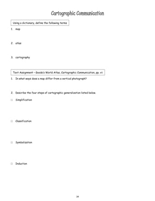
Using a dictionary, define the following terms

1.     map


2. atlas


3. cartography


     Text Assignment – Goode’s World Atlas, Cartographic Communication, pp. vii

1.     In what ways does a map differ from a vertical photograph?


2. Describe the four steps of cartographic generalization listed below.

□      Simplification


□      Classification


□      Symbolization


□      Induction


                                                         34

More Related Content

What's hot

Interactive Rendering Techniques for Highlighting (3D GeoInfo 2010)
Interactive Rendering Techniques for Highlighting (3D GeoInfo 2010)Interactive Rendering Techniques for Highlighting (3D GeoInfo 2010)
Interactive Rendering Techniques for Highlighting (3D GeoInfo 2010)Matthias Trapp
 
Remote Sensing in Digital Model Elevation
Remote Sensing in Digital Model ElevationRemote Sensing in Digital Model Elevation
Remote Sensing in Digital Model ElevationShishir Meshram
 
Built up area demarcation using NDBI
Built up area demarcation using NDBIBuilt up area demarcation using NDBI
Built up area demarcation using NDBISiva Subramanian M
 
Topography Lab
Topography LabTopography Lab
Topography LabJames Dunn
 
TYBSC IT PGIS Unit III Chapter I Spatial Referencing and Positioning
TYBSC IT PGIS Unit III Chapter I Spatial Referencing and PositioningTYBSC IT PGIS Unit III Chapter I Spatial Referencing and Positioning
TYBSC IT PGIS Unit III Chapter I Spatial Referencing and PositioningArti Parab Academics
 

What's hot (9)

Gis georeference
Gis georeferenceGis georeference
Gis georeference
 
Interactive Rendering Techniques for Highlighting (3D GeoInfo 2010)
Interactive Rendering Techniques for Highlighting (3D GeoInfo 2010)Interactive Rendering Techniques for Highlighting (3D GeoInfo 2010)
Interactive Rendering Techniques for Highlighting (3D GeoInfo 2010)
 
Remote Sensing in Digital Model Elevation
Remote Sensing in Digital Model ElevationRemote Sensing in Digital Model Elevation
Remote Sensing in Digital Model Elevation
 
Maps and GIS
Maps and GISMaps and GIS
Maps and GIS
 
Built up area demarcation using NDBI
Built up area demarcation using NDBIBuilt up area demarcation using NDBI
Built up area demarcation using NDBI
 
Modern cartography
Modern cartographyModern cartography
Modern cartography
 
Topography Lab
Topography LabTopography Lab
Topography Lab
 
Unit Summaries 1
Unit Summaries 1Unit Summaries 1
Unit Summaries 1
 
TYBSC IT PGIS Unit III Chapter I Spatial Referencing and Positioning
TYBSC IT PGIS Unit III Chapter I Spatial Referencing and PositioningTYBSC IT PGIS Unit III Chapter I Spatial Referencing and Positioning
TYBSC IT PGIS Unit III Chapter I Spatial Referencing and Positioning
 

More from hanslunow

Kbat industrialization and development
Kbat   industrialization and developmentKbat   industrialization and development
Kbat industrialization and developmenthanslunow
 
Cornell notes 2 (ap outline)
Cornell notes 2 (ap outline)Cornell notes 2 (ap outline)
Cornell notes 2 (ap outline)hanslunow
 
Cornell notes 1 (ap outline)
Cornell notes 1 (ap outline)Cornell notes 1 (ap outline)
Cornell notes 1 (ap outline)hanslunow
 
Chapter 11 key issue 4
Chapter 11 key issue 4Chapter 11 key issue 4
Chapter 11 key issue 4hanslunow
 
Chapter 11 key issue 3
Chapter 11 key issue 3Chapter 11 key issue 3
Chapter 11 key issue 3hanslunow
 
Chapter 11 key issue 2
Chapter 11 key issue 2Chapter 11 key issue 2
Chapter 11 key issue 2hanslunow
 
Chapter 11 key issue 1
Chapter 11 key issue 1Chapter 11 key issue 1
Chapter 11 key issue 1hanslunow
 
Chapter 9 key issue 4
Chapter 9   key issue 4Chapter 9   key issue 4
Chapter 9 key issue 4hanslunow
 
Chapter 9 key issue 3
Chapter 9   key issue 3Chapter 9   key issue 3
Chapter 9 key issue 3hanslunow
 
Chapter 9 key issue 2
Chapter 9   key issue 2Chapter 9   key issue 2
Chapter 9 key issue 2hanslunow
 
Chapter 9 key issue 1
Chapter 9   key issue 1Chapter 9   key issue 1
Chapter 9 key issue 1hanslunow
 
Rural land usage (student)
Rural land usage (student)Rural land usage (student)
Rural land usage (student)hanslunow
 
Green revolution
Green revolutionGreen revolution
Green revolutionhanslunow
 
Cornell notes (ap outline) 2
Cornell notes (ap outline) 2Cornell notes (ap outline) 2
Cornell notes (ap outline) 2hanslunow
 
Agri regions recording
Agri regions recordingAgri regions recording
Agri regions recordinghanslunow
 

More from hanslunow (20)

Kbat industrialization and development
Kbat   industrialization and developmentKbat   industrialization and development
Kbat industrialization and development
 
Cornell notes 2 (ap outline)
Cornell notes 2 (ap outline)Cornell notes 2 (ap outline)
Cornell notes 2 (ap outline)
 
Cornell notes 1 (ap outline)
Cornell notes 1 (ap outline)Cornell notes 1 (ap outline)
Cornell notes 1 (ap outline)
 
Chapter 11 key issue 4
Chapter 11 key issue 4Chapter 11 key issue 4
Chapter 11 key issue 4
 
Chapter 11 key issue 3
Chapter 11 key issue 3Chapter 11 key issue 3
Chapter 11 key issue 3
 
Chapter 11 key issue 2
Chapter 11 key issue 2Chapter 11 key issue 2
Chapter 11 key issue 2
 
Chapter 11 key issue 1
Chapter 11 key issue 1Chapter 11 key issue 1
Chapter 11 key issue 1
 
Chapter 9 key issue 4
Chapter 9   key issue 4Chapter 9   key issue 4
Chapter 9 key issue 4
 
Chapter 9 key issue 3
Chapter 9   key issue 3Chapter 9   key issue 3
Chapter 9 key issue 3
 
Chapter 9 key issue 2
Chapter 9   key issue 2Chapter 9   key issue 2
Chapter 9 key issue 2
 
Chapter 9 key issue 1
Chapter 9   key issue 1Chapter 9   key issue 1
Chapter 9 key issue 1
 
Rural land usage (student)
Rural land usage (student)Rural land usage (student)
Rural land usage (student)
 
Green revolution
Green revolutionGreen revolution
Green revolution
 
Cornell notes (ap outline) 2
Cornell notes (ap outline) 2Cornell notes (ap outline) 2
Cornell notes (ap outline) 2
 
Agri regions recording
Agri regions recordingAgri regions recording
Agri regions recording
 
Rubber
RubberRubber
Rubber
 
Tea
TeaTea
Tea
 
Salt
SaltSalt
Salt
 
Rice
RiceRice
Rice
 
Indigo
IndigoIndigo
Indigo
 

Cartographic communication

  • 1. Using a dictionary, define the following terms 1. map 2. atlas 3. cartography Text Assignment – Goode’s World Atlas, Cartographic Communication, pp. vii 1. In what ways does a map differ from a vertical photograph? 2. Describe the four steps of cartographic generalization listed below. □ Simplification □ Classification □ Symbolization □ Induction 34