SlideShare a Scribd company logo
1 of 33
Marco Grimaudo en Xander Bakker
2


 Vraag naar lichtgewicht viewer zonder plug-in

 Viewer die aansluit op architectuur van GeoWeb

 Viewer voor desktops, tablets en smartphones

 Wens om offline mobiel te werken
3
4


Minder prettige gebruikerservaring
   Betere mobiele browsers met HTML5 ondersteuning
Beperkte ondersteuning voor offline
   Betere netwerk dekking
   Toenemende mogelijkheden om offline mobiel te werken
Lastig toegang tot camera, GPS, opslag
   Toenemende functionaliteit in HTML 5
5


                                                http://www.dotcominfoway.com/blog/dot-com-infoway-releases-html5-infographic


http://visual.ly/html5-why-developers-need-it
6


GeoWeb Viewer for HTML5 (live demo)
7


Vanaf GeoWeb 4.1
8
9


Data voorbereiden voor Offline gebruik:
 Alleen Feature Services, geen Map Services
 Geen Basemaps (tiles)


Geocortex App:
 Basemaps offline beschikbaar
 Ondersteuning voor attachments (foto’s, video’s, etc)
10


Beperkt


 Rijk
11


Lengte tracé: ca. 73 kilometer
Oppervlakte: ca. 800 hectare
Kunstwerken: 10 tunnels
Capaciteit: 230M ton per jaar


                                 http://www.lsned.nl © Beeld: Koolen Fotografie
12


http://www.lsned.nl © Beeld: Koolen Fotografie
13
14
15
16
17
18
19
20
21
22
23
24
25
26
27
28
29
30


http://www.lsned.nl © Beeld: Koolen Fotografie
31


        1.0                        1.1                  1.2                  1.3


 HTML5 Framework            Offline Support       Offline verbeteringen    Geocortex App
 Ondersteuning Workflows    Feature Editing       Manager                  Informatie venster
 Basic Mapping UI           Synchronisatie        Feature highlighting     Tabellen sorteren
                             Layer List Control    Verbeteringen aan UX     Toolbar
32


 Bestaande site ook mobiel beschikbaar
 Snel een viewer met basis functionaliteit
 In GeoWeb 4.1 al HTML5 zaken in webmanager te regelen
 Online ondersteuning voor workflows
 Extra functionaliteit te programmeren
 Offline functionaliteit beschikbaar, vergt wel voorbereiding
 Binnenkort meer gemak voor offline functionaliteit via App
www.linkedin.com/in/marcogrimaudo                               nl.linkedin.com/in/xanderbakker


                 Marco [DOT] Grimaudo [AT] Grontmij [DOT] NL            Xander [DOT] Bakker [AT] Grontmij [DOT] NL


Marco Grimaudo                                                                                                       Xander Bakker
Programmeur                                                                                                            GIS Adviseur
                                                 http://software.grontmij.nl


      Grontmij Netherlands BV :: GIS & ICT – GIS Team :: http://www.Grontmij.com :: +31 30 220 79 11

More Related Content

Similar to GeoWeb HTML5 Viewer Online en Offline - Grontmij

Open IT-architectuur zet beheer publieke&private buitenruimte weer op de kaart
Open IT-architectuur zet beheer publieke&private buitenruimte weer op de kaartOpen IT-architectuur zet beheer publieke&private buitenruimte weer op de kaart
Open IT-architectuur zet beheer publieke&private buitenruimte weer op de kaartAdrie Tepas
 
GeoWeb 4 - wat is nieuw?
GeoWeb 4 - wat is nieuw?GeoWeb 4 - wat is nieuw?
GeoWeb 4 - wat is nieuw?GeoWeb2012
 
Het gemak van een Geoportaal, Esri Nederland
Het gemak van een Geoportaal, Esri NederlandHet gemak van een Geoportaal, Esri Nederland
Het gemak van een Geoportaal, Esri NederlandEsriGISConferentie
 
Tussentijdse presentatie maart 2013
Tussentijdse presentatie maart 2013Tussentijdse presentatie maart 2013
Tussentijdse presentatie maart 2013Tim Ameye
 
Kennismaking Suneco algemeen
Kennismaking Suneco algemeenKennismaking Suneco algemeen
Kennismaking Suneco algemeensuneco_nl
 
16:00 - Webviewers configureren
16:00 - Webviewers configureren16:00 - Webviewers configureren
16:00 - Webviewers configurerenGISTech2012
 
1.3 BGT_IMGeo en IMBOR_Ruud van Rossem IenM
1.3 BGT_IMGeo en IMBOR_Ruud van Rossem IenM1.3 BGT_IMGeo en IMBOR_Ruud van Rossem IenM
1.3 BGT_IMGeo en IMBOR_Ruud van Rossem IenMCROW
 
BIM en GIS: besparen in Lifecycle Asset Management, Grontmij
BIM en GIS: besparen in Lifecycle Asset Management, GrontmijBIM en GIS: besparen in Lifecycle Asset Management, Grontmij
BIM en GIS: besparen in Lifecycle Asset Management, GrontmijEsriGISConferentie
 
Mobility @ TDC Lighthouse
Mobility @ TDC LighthouseMobility @ TDC Lighthouse
Mobility @ TDC LighthouseTDC Lighthouse
 
16:00 - ArcGIS for Mobile
16:00 - ArcGIS for Mobile16:00 - ArcGIS for Mobile
16:00 - ArcGIS for MobileGISTech2012
 
Mugprofielencadgis
Mugprofielencadgis Mugprofielencadgis
Mugprofielencadgis Mugingbureau
 
Gijs Kootjes (TNO) - Tech update Big Datsa Visualisatie
Gijs Kootjes (TNO) - Tech update Big Datsa VisualisatieGijs Kootjes (TNO) - Tech update Big Datsa Visualisatie
Gijs Kootjes (TNO) - Tech update Big Datsa VisualisatieMedia Perspectives
 
Gijs Koot (TNO) @ Technology Update Big Data Visualisatie - techniek in vogel...
Gijs Koot (TNO) @ Technology Update Big Data Visualisatie - techniek in vogel...Gijs Koot (TNO) @ Technology Update Big Data Visualisatie - techniek in vogel...
Gijs Koot (TNO) @ Technology Update Big Data Visualisatie - techniek in vogel...Media Perspectives
 
Voyager Data op orde bij waterschap Zuiderzeeland
Voyager Data op orde bij waterschap ZuiderzeelandVoyager Data op orde bij waterschap Zuiderzeeland
Voyager Data op orde bij waterschap ZuiderzeelandEsriGISConferentie
 
Google Apps - Congres 2010 - V-ICT-OR
Google Apps - Congres 2010 - V-ICT-ORGoogle Apps - Congres 2010 - V-ICT-OR
Google Apps - Congres 2010 - V-ICT-ORBart Gysens
 
Verbind editing omgeving via ArcGIS for Server
Verbind editing omgeving via ArcGIS for ServerVerbind editing omgeving via ArcGIS for Server
Verbind editing omgeving via ArcGIS for ServerEsriGISConferentie
 
16:00 - ArcGIS Online & Content
16:00 - ArcGIS Online & Content16:00 - ArcGIS Online & Content
16:00 - ArcGIS Online & ContentGISTech2012
 
Conclusies werkgroep toepassingen nederlandse 3D pilot
Conclusies werkgroep toepassingen nederlandse 3D pilotConclusies werkgroep toepassingen nederlandse 3D pilot
Conclusies werkgroep toepassingen nederlandse 3D pilotRick Klooster
 

Similar to GeoWeb HTML5 Viewer Online en Offline - Grontmij (20)

Open IT-architectuur zet beheer publieke&private buitenruimte weer op de kaart
Open IT-architectuur zet beheer publieke&private buitenruimte weer op de kaartOpen IT-architectuur zet beheer publieke&private buitenruimte weer op de kaart
Open IT-architectuur zet beheer publieke&private buitenruimte weer op de kaart
 
GeoWeb 4 - wat is nieuw?
GeoWeb 4 - wat is nieuw?GeoWeb 4 - wat is nieuw?
GeoWeb 4 - wat is nieuw?
 
GeoWeb 4 3
GeoWeb 4 3GeoWeb 4 3
GeoWeb 4 3
 
Het gemak van een Geoportaal, Esri Nederland
Het gemak van een Geoportaal, Esri NederlandHet gemak van een Geoportaal, Esri Nederland
Het gemak van een Geoportaal, Esri Nederland
 
Tussentijdse presentatie maart 2013
Tussentijdse presentatie maart 2013Tussentijdse presentatie maart 2013
Tussentijdse presentatie maart 2013
 
Kennismaking Suneco algemeen
Kennismaking Suneco algemeenKennismaking Suneco algemeen
Kennismaking Suneco algemeen
 
Meetup ASP.NET 5 19/11/2015
Meetup ASP.NET 5 19/11/2015Meetup ASP.NET 5 19/11/2015
Meetup ASP.NET 5 19/11/2015
 
16:00 - Webviewers configureren
16:00 - Webviewers configureren16:00 - Webviewers configureren
16:00 - Webviewers configureren
 
1.3 BGT_IMGeo en IMBOR_Ruud van Rossem IenM
1.3 BGT_IMGeo en IMBOR_Ruud van Rossem IenM1.3 BGT_IMGeo en IMBOR_Ruud van Rossem IenM
1.3 BGT_IMGeo en IMBOR_Ruud van Rossem IenM
 
BIM en GIS: besparen in Lifecycle Asset Management, Grontmij
BIM en GIS: besparen in Lifecycle Asset Management, GrontmijBIM en GIS: besparen in Lifecycle Asset Management, Grontmij
BIM en GIS: besparen in Lifecycle Asset Management, Grontmij
 
Mobility @ TDC Lighthouse
Mobility @ TDC LighthouseMobility @ TDC Lighthouse
Mobility @ TDC Lighthouse
 
16:00 - ArcGIS for Mobile
16:00 - ArcGIS for Mobile16:00 - ArcGIS for Mobile
16:00 - ArcGIS for Mobile
 
Mugprofielencadgis
Mugprofielencadgis Mugprofielencadgis
Mugprofielencadgis
 
Gijs Kootjes (TNO) - Tech update Big Datsa Visualisatie
Gijs Kootjes (TNO) - Tech update Big Datsa VisualisatieGijs Kootjes (TNO) - Tech update Big Datsa Visualisatie
Gijs Kootjes (TNO) - Tech update Big Datsa Visualisatie
 
Gijs Koot (TNO) @ Technology Update Big Data Visualisatie - techniek in vogel...
Gijs Koot (TNO) @ Technology Update Big Data Visualisatie - techniek in vogel...Gijs Koot (TNO) @ Technology Update Big Data Visualisatie - techniek in vogel...
Gijs Koot (TNO) @ Technology Update Big Data Visualisatie - techniek in vogel...
 
Voyager Data op orde bij waterschap Zuiderzeeland
Voyager Data op orde bij waterschap ZuiderzeelandVoyager Data op orde bij waterschap Zuiderzeeland
Voyager Data op orde bij waterschap Zuiderzeeland
 
Google Apps - Congres 2010 - V-ICT-OR
Google Apps - Congres 2010 - V-ICT-ORGoogle Apps - Congres 2010 - V-ICT-OR
Google Apps - Congres 2010 - V-ICT-OR
 
Verbind editing omgeving via ArcGIS for Server
Verbind editing omgeving via ArcGIS for ServerVerbind editing omgeving via ArcGIS for Server
Verbind editing omgeving via ArcGIS for Server
 
16:00 - ArcGIS Online & Content
16:00 - ArcGIS Online & Content16:00 - ArcGIS Online & Content
16:00 - ArcGIS Online & Content
 
Conclusies werkgroep toepassingen nederlandse 3D pilot
Conclusies werkgroep toepassingen nederlandse 3D pilotConclusies werkgroep toepassingen nederlandse 3D pilot
Conclusies werkgroep toepassingen nederlandse 3D pilot
 

More from Xander Bakker

Python en la Plataforma ArcGIS
Python en la Plataforma ArcGISPython en la Plataforma ArcGIS
Python en la Plataforma ArcGISXander Bakker
 
Mobiel werken bij LSNed presentatie op Esri GIS conferentie 2013 - Grontmij
Mobiel werken bij LSNed presentatie op Esri GIS conferentie 2013 - GrontmijMobiel werken bij LSNed presentatie op Esri GIS conferentie 2013 - Grontmij
Mobiel werken bij LSNed presentatie op Esri GIS conferentie 2013 - GrontmijXander Bakker
 
Digital Elevation Models - WUR - Grontmij
Digital Elevation Models - WUR - GrontmijDigital Elevation Models - WUR - Grontmij
Digital Elevation Models - WUR - GrontmijXander Bakker
 
Eenvoudige Toets Brabantse Delta met AHN2 - Grontmij
Eenvoudige Toets Brabantse Delta met AHN2 - GrontmijEenvoudige Toets Brabantse Delta met AHN2 - Grontmij
Eenvoudige Toets Brabantse Delta met AHN2 - GrontmijXander Bakker
 
Bodemdaling model Provincie Utrecht - Grontmij
Bodemdaling model Provincie Utrecht - GrontmijBodemdaling model Provincie Utrecht - Grontmij
Bodemdaling model Provincie Utrecht - GrontmijXander Bakker
 
Playing around with LiDAR, AHN2, Aerial Photography and LAStools in ArcGIS 10.1
Playing around with LiDAR, AHN2, Aerial Photography and LAStools in ArcGIS 10.1Playing around with LiDAR, AHN2, Aerial Photography and LAStools in ArcGIS 10.1
Playing around with LiDAR, AHN2, Aerial Photography and LAStools in ArcGIS 10.1Xander Bakker
 
Characterizing regional dikes with LiDAR using ArcGIS 10 by Grontmij
Characterizing regional dikes with LiDAR using ArcGIS 10 by GrontmijCharacterizing regional dikes with LiDAR using ArcGIS 10 by Grontmij
Characterizing regional dikes with LiDAR using ArcGIS 10 by GrontmijXander Bakker
 
ArcGIS Mobile 10 Gas Leak Detection Application by Grontmij and Esri NL
ArcGIS Mobile 10 Gas Leak Detection Application by Grontmij and Esri NLArcGIS Mobile 10 Gas Leak Detection Application by Grontmij and Esri NL
ArcGIS Mobile 10 Gas Leak Detection Application by Grontmij and Esri NLXander Bakker
 
Esri DevSummit 2011 - Grontmij presentation
Esri DevSummit 2011 - Grontmij presentationEsri DevSummit 2011 - Grontmij presentation
Esri DevSummit 2011 - Grontmij presentationXander Bakker
 
ArcGIS Mobile 10 - Grontmij
ArcGIS Mobile 10 - GrontmijArcGIS Mobile 10 - Grontmij
ArcGIS Mobile 10 - GrontmijXander Bakker
 
Detecting Buildings in AHN2 LiDAR data with ArcGIS - Grontmij
Detecting Buildings in AHN2 LiDAR data with ArcGIS - GrontmijDetecting Buildings in AHN2 LiDAR data with ArcGIS - Grontmij
Detecting Buildings in AHN2 LiDAR data with ArcGIS - GrontmijXander Bakker
 
The 'right' choices in GIS - Grontmij
The 'right' choices in GIS - GrontmijThe 'right' choices in GIS - Grontmij
The 'right' choices in GIS - GrontmijXander Bakker
 

More from Xander Bakker (12)

Python en la Plataforma ArcGIS
Python en la Plataforma ArcGISPython en la Plataforma ArcGIS
Python en la Plataforma ArcGIS
 
Mobiel werken bij LSNed presentatie op Esri GIS conferentie 2013 - Grontmij
Mobiel werken bij LSNed presentatie op Esri GIS conferentie 2013 - GrontmijMobiel werken bij LSNed presentatie op Esri GIS conferentie 2013 - Grontmij
Mobiel werken bij LSNed presentatie op Esri GIS conferentie 2013 - Grontmij
 
Digital Elevation Models - WUR - Grontmij
Digital Elevation Models - WUR - GrontmijDigital Elevation Models - WUR - Grontmij
Digital Elevation Models - WUR - Grontmij
 
Eenvoudige Toets Brabantse Delta met AHN2 - Grontmij
Eenvoudige Toets Brabantse Delta met AHN2 - GrontmijEenvoudige Toets Brabantse Delta met AHN2 - Grontmij
Eenvoudige Toets Brabantse Delta met AHN2 - Grontmij
 
Bodemdaling model Provincie Utrecht - Grontmij
Bodemdaling model Provincie Utrecht - GrontmijBodemdaling model Provincie Utrecht - Grontmij
Bodemdaling model Provincie Utrecht - Grontmij
 
Playing around with LiDAR, AHN2, Aerial Photography and LAStools in ArcGIS 10.1
Playing around with LiDAR, AHN2, Aerial Photography and LAStools in ArcGIS 10.1Playing around with LiDAR, AHN2, Aerial Photography and LAStools in ArcGIS 10.1
Playing around with LiDAR, AHN2, Aerial Photography and LAStools in ArcGIS 10.1
 
Characterizing regional dikes with LiDAR using ArcGIS 10 by Grontmij
Characterizing regional dikes with LiDAR using ArcGIS 10 by GrontmijCharacterizing regional dikes with LiDAR using ArcGIS 10 by Grontmij
Characterizing regional dikes with LiDAR using ArcGIS 10 by Grontmij
 
ArcGIS Mobile 10 Gas Leak Detection Application by Grontmij and Esri NL
ArcGIS Mobile 10 Gas Leak Detection Application by Grontmij and Esri NLArcGIS Mobile 10 Gas Leak Detection Application by Grontmij and Esri NL
ArcGIS Mobile 10 Gas Leak Detection Application by Grontmij and Esri NL
 
Esri DevSummit 2011 - Grontmij presentation
Esri DevSummit 2011 - Grontmij presentationEsri DevSummit 2011 - Grontmij presentation
Esri DevSummit 2011 - Grontmij presentation
 
ArcGIS Mobile 10 - Grontmij
ArcGIS Mobile 10 - GrontmijArcGIS Mobile 10 - Grontmij
ArcGIS Mobile 10 - Grontmij
 
Detecting Buildings in AHN2 LiDAR data with ArcGIS - Grontmij
Detecting Buildings in AHN2 LiDAR data with ArcGIS - GrontmijDetecting Buildings in AHN2 LiDAR data with ArcGIS - Grontmij
Detecting Buildings in AHN2 LiDAR data with ArcGIS - Grontmij
 
The 'right' choices in GIS - Grontmij
The 'right' choices in GIS - GrontmijThe 'right' choices in GIS - Grontmij
The 'right' choices in GIS - Grontmij
 

GeoWeb HTML5 Viewer Online en Offline - Grontmij

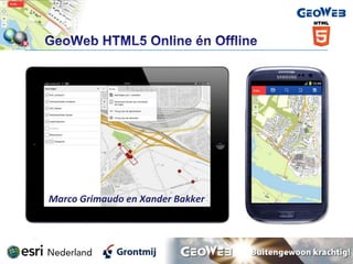
  • 1. Marco Grimaudo en Xander Bakker
  • 2. 2  Vraag naar lichtgewicht viewer zonder plug-in  Viewer die aansluit op architectuur van GeoWeb  Viewer voor desktops, tablets en smartphones  Wens om offline mobiel te werken
  • 3. 3
  • 4. 4 Minder prettige gebruikerservaring Betere mobiele browsers met HTML5 ondersteuning Beperkte ondersteuning voor offline Betere netwerk dekking Toenemende mogelijkheden om offline mobiel te werken Lastig toegang tot camera, GPS, opslag Toenemende functionaliteit in HTML 5
  • 5. 5 http://www.dotcominfoway.com/blog/dot-com-infoway-releases-html5-infographic http://visual.ly/html5-why-developers-need-it
  • 6. 6 GeoWeb Viewer for HTML5 (live demo)
  • 8. 8
  • 9. 9 Data voorbereiden voor Offline gebruik:  Alleen Feature Services, geen Map Services  Geen Basemaps (tiles) Geocortex App:  Basemaps offline beschikbaar  Ondersteuning voor attachments (foto’s, video’s, etc)
  • 11. 11 Lengte tracé: ca. 73 kilometer Oppervlakte: ca. 800 hectare Kunstwerken: 10 tunnels Capaciteit: 230M ton per jaar http://www.lsned.nl © Beeld: Koolen Fotografie
  • 12. 12 http://www.lsned.nl © Beeld: Koolen Fotografie
  • 13. 13
  • 14. 14
  • 15. 15
  • 16. 16
  • 17. 17
  • 18. 18
  • 19. 19
  • 20. 20
  • 21. 21
  • 22. 22
  • 23. 23
  • 24. 24
  • 25. 25
  • 26. 26
  • 27. 27
  • 28. 28
  • 29. 29
  • 30. 30 http://www.lsned.nl © Beeld: Koolen Fotografie
  • 31. 31 1.0 1.1 1.2 1.3  HTML5 Framework  Offline Support  Offline verbeteringen  Geocortex App  Ondersteuning Workflows  Feature Editing  Manager  Informatie venster  Basic Mapping UI  Synchronisatie  Feature highlighting  Tabellen sorteren  Layer List Control  Verbeteringen aan UX  Toolbar
  • 32. 32  Bestaande site ook mobiel beschikbaar  Snel een viewer met basis functionaliteit  In GeoWeb 4.1 al HTML5 zaken in webmanager te regelen  Online ondersteuning voor workflows  Extra functionaliteit te programmeren  Offline functionaliteit beschikbaar, vergt wel voorbereiding  Binnenkort meer gemak voor offline functionaliteit via App
  • 33. www.linkedin.com/in/marcogrimaudo nl.linkedin.com/in/xanderbakker Marco [DOT] Grimaudo [AT] Grontmij [DOT] NL Xander [DOT] Bakker [AT] Grontmij [DOT] NL Marco Grimaudo Xander Bakker Programmeur GIS Adviseur http://software.grontmij.nl Grontmij Netherlands BV :: GIS & ICT – GIS Team :: http://www.Grontmij.com :: +31 30 220 79 11