SlideShare a Scribd company logo
1 of 26
Download to read offline
Highland Creek Village Transportation Master Plan
Welcome to Public Information Centre #1
Wednesday June 25, 2014
HIGHLAND CREEK VILLAGE TRANSPORTATION MASTER PLAN
Purpose
• This evening we will introduce the study and seek
your feedback on:
o Existing and future transportation issues
o Problem and opportunity statement
o Ideas for improvements to the transportation
network and public realm
o Evaluation criteria
Format
• Drop-in to view information panels throughout the
evening
• Idea Rating exercise throughout the evening
• Attend presentation about study background and
ideas at 6:30 p.m.
• Question period from 6:50 p.m. to 7:30 p.m.
Feedback
• Speak directly with City and Project Team staff
• Stations have been set up to gather your feedback
through comment forms and Idea Rating
If you would like more time you can send
your comments by using one of the following
options:
Mail to:
Maogosha Pyjor
Public Consultation Unit
City of Toronto
Metro Hall, 19th Floor, 55 John St.
Toronto, ON M5V 3C6
Tel: 416-338-2850
TTY: 416-338-0889
Fax: 416-392-2974
Email: mpyjor@toronto.ca
Public Information Materials will be available on the project web page: www.toronto.ca/hcvtransportation
What is a Master Plan?
What is the Process?
• EAs provide the framework for planning of municipal infrastructure projects
• Phases 1 and 2 of the Municipal Class EA process are being followed
• A recommended ‘set’ of preferred alternatives will be identified
• Some alternatives may require additional phases of the Municipal Class EA process
• long range plans that integrate existing and future land use needs
2Highland Creek Village Transportation Master Plan
Transportation Master Plan (TMP) Process
January 2015 March 2015
June 2014
TMP Context
3Highland Creek Village Transportation Master Plan
Context and Study Purpose
• Vision for redevelopment in the community outlined through the Highland Creek Village Area Study (2012)
• Changes to transportation network required to support development:
o To open up new development lands
o To support the influx of people and jobs
• Existing multimodal network of roads, transit, pedestrian, and cyclist amenities needs to be enhanced to
meet the mobility needs of existing and future residents, businesses and employees
• The City has an opportunity to plan and implement transportation network solution that supports
development while maintaining character and supporting all modes of transport
What will the TMP achieve?
This study will conclude with an integrated plan that includes:
Planning for infrastructure in this way will determine the best overall transportation
solution for the Highland Creek Village community.
Infrastructure Needs: Short and long term transportation and water-related servicing needs
Network Analysis: Determine improvements that best address needs
Policy and Standards: Manage transportation infrastructure, promote sustainable choices
Implementation Plan: Costs, priorities and funding
4Highland Creek Village Transportation Master Plan
Study Area
Toronto Bike Plan
(2001). Presents the
City of Toronto’s vision
and plan to create a
safe, comfortable and
bicycle friendly
environment.
What previous studies and plans are considered?
5Highland Creek Village Transportation Master Plan
Historic Context
Pedestrian Charter
(2002). Outlines the City
of Toronto’s commitments
to create an urban
environment that
encourages and supports
walking.
Highland Creek Village
Area Functional Study
(1995). Initiated to address
unresolved issues in the
Village Area from the 1986
study and examine the
future role of the Highland
Creek Overpass.
Highland Creek Area
Transportation Study (1986).
Initiated to address
transportation issues and
examine transportation facility
needs in Highland Creek,
Centennial, and Rouge
Communities.
What previous studies and plans are considered?
Highland Creek
Community Secondary
Plan (2006). Provides
area-specific policies
and principles for the
Highland Creek
community.
Highland Creek
Village Urban
Design Guidelines
(2012). Provides
design guidance for
both the public and
private realm
elements of streets
and developments.
6Highland Creek Village Transportation Master Plan
Historic Context
City of Toronto
Official Plan
(approved in 2007 and
currently under
review). Includes a
wide range of
transportation policies
and opportunities to
support growth.
Highland Creek
Village Area Study
(completed in 2012).
Guides growth, future
initiatives and re-
development in the
area.
What we heard from you …
Extensive community outreach activities were carried out as part of the Area
Study.
Public feedback related to transportation generally consisted of the
following:
• Provide a safe, well-lit public realm with streetscape improvements
• Remove Lawson Road Overpass
• Make Morrish Road and Old Kingston Road the main intersection for the village
• Add more public parking
• Consider improvements to on-street parking
• Improve pedestrian and cycling network
• Provide new frontage and access opportunities
• Concerns about Meadowvale Road connection
• The potential increase in traffic associated with new developments/redevelopments is a
concern
7
Highland Creek Village Area Study (2012)
Highland Creek Village Transportation Master Plan
Cycling
• Old Kingston Road,
Lawson Road, and
Military Trail are
part of the City’s
on-street bicycle
network.
• Highland Creek
Trail to west of
study area
Overview of Findings
8Highland Creek Village Transportation Master Plan
Highland Creek Village Area Study (2012)
Road Network
• Existing network
does not follow a
grid pattern
• Realigned
network creates
opportunities for
more
developable
parcels
Pedestrian
Environment
• Recommended
enhancements to
pedestrian realm
(streetscaping)
• Intersection of
Morrish Road and
Old Kingston Road
identified as “Centre
of the Village”
Parking
• Lack of convenient
parking; no notable
shortage of parking
was identified
• Recommended on-
street parking
opportunities and
reconfiguration of
angled to parallel
parking (Old
Kingston Road)
Transit
• Village area served
by TTC bus and
Rouge Hill GO
Station
• No dedicated transit
infrastructure within
study area
• TTC will adjust
service as
population increases
“Promote the use of transit, cycling and
walking as viable modes of transportation to
access and explore the Village area”
“Encourage new on-
street and off-street
parking opportunities”
“…improved pedestrian and cycling
environment, safe parking options,
and traffic calming measures”
Highland Creek Village Transportation Master Plan
• A household travel survey conducted in the Greater Toronto Area and Hamilton (GTAH) every
5 years; most recent survey took place in 2011
• This table shows the AM Peak Period Mode Choices by trip start location (6 a.m. to 9 a.m.):
HCV and Surroundings Scarborough City of Toronto
Travel Modes 2006 2011 2006 2011 2006 2011
Automobile 72% 68% 66% 63% 60% 59%
Local Transit (TTC Only) 15% 17% 23% 25% 27% 28%
GO Transit 7% 6% 2% 2% 1% 1%
Walk or Cycle 6% 7% 8% 8% 11% 11%
Other (school bus, taxi) 1% 2% 2% 2% 1% 2%
Highland Creek Village (HCV)
And Surroundings
9
Transportation Tomorrow Survey (TTS) 2011
Existing Conditions - Travel Characteristics
Automobile is the dominant mode of travel in the HCV area especially
when compared to Scarborough and the City of Toronto as a whole. However,
automobile usage has declined between 2006 and 2011.
GO Transit is used more in the HCV area than in Scarborough and the City
of Toronto as a whole. Proximity to Rouge Hill GO Station.
Walking and cycling are used less in the HCV area than in Scarborough
and the City of Toronto as a whole.
Usage of transit and walk/cycle modes is much higher than shown above for
school trips: 38% and 26% respectively in 2011 for HCV and surroundings.
Highland Creek Village Transportation Master Plan
Existing Conditions – Travel Characteristics
2011 TTS – Auto Trips Starting or Ending in HCV and Surroundings
• Internal trip making within HCV and Surroundings is
significant . Over 30% of the trips that start or end in HCV
and Surroundings trips during the AM and PM peak periods
stay within this area.
• The Rest of Scarborough and Downtown Toronto are the
next most significant trip locations for HCV and
Surroundings trip makers.
• Most HCV and Surroundings trips stay within the City of
Toronto. Relatively few trips go to/from Durham and York
Regions to the north and east.
AMPeakPeriod
(TripStartinginHCVandSurrounding)
PMPeakPeriod
(TripEndinginHCVandSurroundings)
Local area trip makers primarily travel to and from points
within Scarborough and points to the west within the City of
Toronto.
Subsequent work in this study will analyze the paths / roads
used by local area trip makers and longer distance through
traffic.
10
Highland Creek Village Transportation Master Plan
• TTC Bus Routes #38 Highland Creek and #86 Scarborough travel through Highland Creek Village Study Area
• Note: GO Bus Route 51 travels through the area but does not make local stops between University of Toronto Scarborough and Pickering
Legend
/ TTC Route 38 / 86 Eastbound
/ TTC Route 38 / 86 Westbound
AM(PM) Peak Period Boarding
& Exiting Passengers
Average AM (PM) Peak Period
Load Through Each Segment
TTC Bus Stop Location
# (#)
# (#)
# (#) # (#)
# (#) # (#)
• WB primary direction of travel in PM peak,
EB primary direction of travel in AM peak
• Both routes have similar number of
passengers per bus but Route 86 carries
more people due to higher frequency
• Major Stops:
• Kingston Road @ Highland Creek Overpass
• Kingston Road @ Meadowvale Road
• Lawson Road @ Meadowvale Road
Route 38
Bus every 10 minutes (AM Peak)
Bus every 10 minutes (PM Peak)
Route 86
Bus every 3-4 minutes (AM Peak)
Bus every 5-6 minutes (PM Peak)
Data: March 8, 2013 Data: May 13, 2010
AM and PM Peak Period Transit Ridership
Existing Conditions – Travel Characteristics
Highland Creek Village Transportation Master Plan
• Traffic data analysis reveals
that the majority of study area
road network operates well
• NB left turn at Kingston Rd
and Highland Creek Overpass
is only potential capacity issue
• WB is peak direction of travel
in AM, while EB is the peak
direction of travel PM
• Overpass is only crossing of
Hwy 2A between creek to the
west and Hwy 401 to the east
• Traffic levels have stabilized
since the mid 1990’s
• Hwy 401 widening to 12 lanes was
complete by 2000
• 92% of dwellings in area constructed
by 2000 (2011 NHS)
Legend:
Existing Traffic Signal
Ramp to/from Hwy 2A
AM and PM Peak Hour Traffic Assessment
Existing Conditions – Traffic Operations
Highland Creek Village Transportation Master Plan
Reported Collisions that Occurred in
Highland Creek Village Study Area
During Period Spanning November 5th,
2010 to November 4th, 2013
39 Collisions Reported in 3 Years
• 18 non-fatal injury collisions
(i.e. personal injury)
• 20 property damage only
collisions
• Total of 5 collisions involving
either a pedestrian or a cyclist
• One reported fatal collision
involving two pedestrians at the
Old Kingston Road at Watson
Street intersection
• Rear end collisions were the
most predominant, accounting
for almost 40% of all collisions
• The majority of collisions
occurred during ideal driving
conditions (i.e. clear visibility)
13
Existing Conditions – Collision Assessment
Cultural Heritage Resources
The City’s Heritage Preservation Services plays a
key role in the conservation of cultural heritage
resources in the community. Five properties are
listed on the City’s heritage inventory, however no
buildings are currently designated under the Ontario
Heritage Act.
14Highland Creek Village Transportation Master Plan
Existing Conditions – Cultural and Natural Heritage
LEGEND
STUDY AREA
Buildings
^ HERITAGE REGISTER
PROPERTY LINES
0 100 20050
metres
´
1:2,000
UTM Zone 17 NAD 83
A Stage 1 Archaeological Assessment is also being carried out as part of this study. Based on preliminary findings,
further archaeological investigation is recommended in three areas. The City of Toronto is in the process of developing an
archaeological master plan to identify areas of archaeological potential and to require archaeological assessments on land
prior to development.
Natural Heritage Resources
Based on information provided by the Toronto Region Conservation Authority, Ministry of Natural Resources and City staff,
there are limited areas consisting of natural heritage features within the study area. To date, no Species at Risk have been
identified.
Parking • Some say keep angled parking others say parallel parking is safer
• Concern parallel parking would reduce number of spots
• Ideas for how to increase number of spots, including addition of parking
lot or usage of space behind buildings
Road Network • Improve access to Military Trail from Highway 2A
• While some state Highway 2A keeps traffic out of the Village (good for
pedestrians) others have no issues with through traffic in the Village
(good for business)
• Some feel roundabout could work space permitting while also concern
regarding feasibility and potential impacts on property
• Remove westward access at Kingston and Old Kingston Roads
• Requests for at grade intersection at Highway 2A and Lawson Road
• Kingston Road should become major intersection with Highway 2A
• Some say remove Highland Creek Overpass and others say retain it
Traffic
Improvements
• Install traffic light at Military Trail and Kingston Road
• If traffic becomes issue in Village area, install traffic calming measures
• Pedestrian signal at Kingston Road and Old Kingston Road
• Remove stoplight at Old Kingston Road
• Remove signal at Morrish Road and Old Kingston Road
What Did We Hear?
While there are differences of opinion regarding existing transportation problems and potential improvements,
there is common ground on opportunities to support local businesses and revitalization through continuous
sidewalks, enhanced streetscaping, and other modifications that focus on safely and efficiently accommodating
all road users.
15Highland Creek Village Transportation Master Plan
WalkShop – June 5, 2014
What other suggestions did we hear?
Cycling
Improvements
• Safety
• Connectivity
• Wayfinding
• Bicycle lanes (with buffer in some areas)
• Bicycle parking facilities and benches
• Very little need
• Bicycle port in Village core
Pedestrian
Improvements
• Widen sidewalks
• Level walk areas
• Sidewalks on either side of roadway
• Consider seniors
• New sidewalks (various locations suggested)
Transit • Remove buses through village, use Kingston Road
• Confusing bus routes and stops in the Village
Aesthetic
Improvements
• Add greenspace
• Landscaping (trees, flower gardens, etc.)
Note: A detailed summary of the input received is provided
on the resource table and on the study website.
16Highland Creek Village Transportation Master Plan
WalkShop – June 5, 2014
The City of Toronto has established a vision for the long-term
revitalization of the Highland Creek Village into a vibrant, pedestrian
friendly and mixed use community. In order to accommodate all
roadway users, and support this vision, changes are required to the
transportation network that promote redevelopment opportunities and
reinvestment in the Village. There are significant opportunities to
improve the public realm and pedestrian environment to encourage
the use of transit, cycling, and walking as viable modes of
transportation.
Problem and Opportunity Statement:
17Highland Creek Village Transportation Master Plan
Problem and Opportunity Statement
Transportation alternatives developed as part of this study will be evaluated based on their
ability to provide solutions to identified problems and take advantage of opportunities.
Highland Creek Village Transportation Master Plan
Feedback wanted on alternatives
Three preliminary ideas are presented on the following boards for discussion.
Each alternative consists of a set of individual improvements (e.g. new roads,
re-aligned roads, new intersections, sidewalks, parking).
We want to hear your thoughts on each of the three preliminary alternatives:
• What elements do you support?
• What elements do you have concerns about?
• Are there additional options or improvements that you would like to
see considered?
Your feedback will help the study team develop the final set of alternatives that
will be evaluated as part of this study. The final set may combine some
elements from each of the three alternatives presented here and include
additional improvements that are received from the public.
Preliminary Alternative Solutions
18
It is important to consider the overall network of the study area when
developing alternatives since some network improvements may not be
compatible with others.
Highland Creek Village Transportation Master Plan
Preliminary Alternative Solutions
Name
Alternative 1
Overpass Removal and Reconfigure
Intersection
Alternative 2
Meadowvale Signals and Westbound
Overpass Ramp
Alternative 3
(NEW) Kingston Road Connection and
Roundabout
Year Proposed
Highland Creek Area Study Recommended
Network (2012); generally consistent with
1986 Highland Creek Area Transportation
Study recommended alternative
Highland Creek Functional Study (1995)
Recommended Long-Term Plan
New Option (2014)
Overpass and development
opportunities
Provides development opportunities
through removal of Lawson Rd Overpass
and Hwy 2A ramps; replaced with an all-
directional signalized intersection
Maintains overpass while adding a
westbound ramp and opening up existing
ramp lands for development
Maintains overpass, removing all existing
ramps and opening up ramp lands for
development
Meadowvale Road
Provides westbound access to Hwy 2A Meadowvale Rd connected to Hwy 2A
through all-directional signalized
intersection
Same as Alternative 1
Hwy 2A connections
Provides signalized T-intersection at
Military Trail; ramps between Hwy 2A,
Kingston Rd and Morrish Rd are closed
Same as Alternative 1 Signalized intersection at Hwy 2A,
Kingston Rd, Lawson Rd; ramps at
Military Trail and Morrish Rd closed
Kingston Rd/ Lawson Rd
Overpass
Reconfigured intersection Same as Alternative 1 Potential roundabout
Parking
Conversion of angled parking spaces along
Kingston Rd (east of Morrish Rd) to parallel
parking. Additional on-street parking for
existing and re-aligned streets.
Maintains all existing parking Same as Alternative 1
Pedestrian Realm Additional sidewalks, sidewalk improvements, and streetscape enhancements throughout Highland Creek study area 19
The three alternatives are preliminary ideas. We want to hear your thoughts.
Highland Creek Village Transportation Master Plan
Alternative 1 - Overpass Removal and Reconfigure Intersection
New WB access to Hwy 2A
New “T” intersection at
Hwy 2A – Military Trail
Removal of overpass and
ramps. Add new signal.
New laneway
Reconfigure
intersectionRealignment of Kingston
Rd and Morrish Rd
Closure of accesses
to Hwy 2A
• This is the Highland Creek
Area Study (2012)
Recommended Network
• Provides development
opportunities through
removal of Lawson
Overpass and Hwy 2A
ramps
• New intersections with Hwy
2A provide additional access
opportunities and enhanced
pedestrian environment
• Opportunities for additional
parking along realigned
Kingston and Morrish Roads
• Is generally consistent with
the 1986 Highland Creek
Area Transportation Study
recommended alternative
Conversion to
parallel parking
Legend:
New Signalized Intersection
Ramp Closure
Re-Aligned Or New Road
Parallel Parking Conversion
New Right-In Connection
20
Preliminary Alternative Solutions
Highland Creek Village Transportation Master Plan
• Taken from Highland Creek
Functional Study (1995)
Recommended Long-Term
Plan
• Maintains overpass while
opening up ramp lands for
development
• New ramp to Hwy 2A (WB)
from Lawson overpass
• Meadowvale Road
connected through Hwy 2A
• Remainder of network is the
same as Alternative 1
Alternative 2 – Meadowvale Signals and Westbound Overpass Ramp
New signals on
Meadowvale Road
New “T” intersection at
Hwy 2A – Military Trail
Removal of ramps (if
needed for development)
Reconfigure
intersectionRealignment of Kingston
Rd and Morrish Rd
Closure of accesses
to Hwy 2A
New ramp to
WB Hwy 2A
Legend:
New Signalized Intersection
Ramp Closure
Re-Aligned Or New Road
21
Preliminary Alternative Solutions
Highland Creek Village Transportation Master Plan
Alternative 3 – (NEW) Kingston Road Connection and Roundabout
New WB access to Hwy 2A
New intersection at Hwy 2A–
Kingston Rd – Lawson Rd
Removal of ramps
Potential
roundabout
Realignment of Kingston
Rd and Morrish Rd
Closure of accesses
to Hwy 2A
• Maintains overpass while
opening up ramp lands for
development
• New intersection at Hwy 2A –
Kingston Rd – Lawson Rd
• New internal road connecting
Military Trail, Morrish Rd, and
Kingston Rd
• Potential roundabout at
Kingston Rd – Lawson Rd
Overpass
Conversion to
parallel parking
Legend:
New Signalized Intersection
Ramp Closure
Re-Aligned Or New Road
New Roundabout
New Right- In Connection
Preliminary Alternative Solutions
22
Highland Creek Village Transportation Master Plan
What will be assessed for all alternatives
Active Transportation Supportive Improvements
• Pedestrian and cycling environment are important components of
this study. Examples:
o Additional and wider sidewalks, improved streetscaping,
cycling lanes, new trail connections, new pedestrian crossings
• Improvements to be consistent with streetscape elements,
suggested Right-of-Way widths, and proposed cross-sections from
the Highland Creek Urban Design Guidelines (2012)
Transit Network Considerations
• Network changes and new signals may have impacts on transit
routing and stop locations
• Improved pedestrian environment will be supportive of transit
System / Signal Optimization
• Optimization of study area traffic signals will be considered
• Potential usage of roundabouts
• Signal Warrants - need for the existing Old Kingston Rd and
Morrish Rd intersection will be re-evaluated
Preliminary Alternative Solutions
23
Highland Creek Village Transportation Master Plan
Evaluation of Preliminary Alternative Solutions
Each of the road network alternatives will be evaluated against the following criteria to compare their respective benefits and
impacts using both quantitative and qualitative measures for the various indicators.
Evaluation Criteria Indicators
Technical/Transportation
- Network performance
- Potential to improve traffic safety
- Potential to accommodate transit operations
- Potential to provide on-street parking
- Ability to accommodate Accessibility Design Guidelines
Social Environment
- Potential to incorporate streetscape and landscape elements
- Potential to incorporate gateway features, public art features and amenities
- Potential to provide a well connected pedestrian network
- Potential to improve pedestrian/cyclist safety
Cultural Environment
- Potential to maintain historic character of village area
- Potential to impact listed cultural heritage features
- Potential to impact archaeological resources
Natural Environment
- Potential to impact wooded Areas
- Potential to impact open Space areas
- Potential to impact wildlife/habitat areas
- Potential to impact air quality
Economic
- Costs
- Ability to support community accessibility
- Potential to support future development opportunity areas
- Ability to support goods movement
- Ability to support new business frontage and access opportunities
Are there any additional criteria or indicators that you feel should be included?
Proposed Evaluation Criteria and Indicators
24
Highland Creek Village Transportation Master Plan
Next Steps
- Review and consider comments received at/following PIC #1
- Finalize and evaluate the alternative long term network solutions
- Identify water, wastewater, and stormwater functional servicing requirements
- Develop transportation policies and standards
- Hold PIC #2 to present draft Transportation Master Plan recommendations
- Develop implementation and funding plan to support the recommendations
- Prepare and finalize Transportation Master Plan report
- Present Transportation Master Plan to City Council for approval
What happens next?
25
January 2015
March 2015
June 2014
Please complete a comment sheet and place it in the box provided or submit written comments via
email, mail and/or fax to the following study team member:
Comment Box
Idea Rating Sheet
How can you continue to participate?
Provide your opinion. If you have new suggestions, write each down on its own sheet and leave
out for rating.
We’ll Keep You Posted!
Please check the study website www.toronto.ca/hcvtransportation often to review new information.
• News and updates
• Study Background
• Notices of upcoming events
• Links to other related information
Thank You!
26
Maogosha Pyjor
Senior Public Consultation Coordinator
City of Toronto
Metro Hall, 19th Floor
55 John Street
Toronto, ON M5V 3C6
Tel: 416-338-2850
Fax: 416-392-2974
TTY: 416-397-0831
mpyjor@toronto.ca

More Related Content

What's hot

Cycle 2 Business and Industry Presentation
Cycle 2 Business and Industry PresentationCycle 2 Business and Industry Presentation
Cycle 2 Business and Industry Presentationdirectionsto2050
 
Scarborough Subway Extension Project Assessment - Draft Terms of Reference
Scarborough Subway Extension Project Assessment - Draft Terms of ReferenceScarborough Subway Extension Project Assessment - Draft Terms of Reference
Scarborough Subway Extension Project Assessment - Draft Terms of ReferenceToronto Public Consultation Unit
 
Northeast Hsr
Northeast HsrNortheast Hsr
Northeast Hsranxora
 
@ UDRI - Traffic & Transportation Plan - Final
@ UDRI - Traffic & Transportation Plan - Final@ UDRI - Traffic & Transportation Plan - Final
@ UDRI - Traffic & Transportation Plan - FinalAltamash Khan
 
Silver Line Update: December 1, 2015
Silver Line Update: December 1, 2015Silver Line Update: December 1, 2015
Silver Line Update: December 1, 2015Fairfax County
 
I-66 Corridor Improvements Outside the Beltway
I-66 Corridor Improvements Outside the BeltwayI-66 Corridor Improvements Outside the Beltway
I-66 Corridor Improvements Outside the BeltwayFairfax County
 
Dumbarton Crossbay
Dumbarton Crossbay Dumbarton Crossbay
Dumbarton Crossbay Adina Levin
 
Summit Parkline Presentation to City Council
Summit Parkline Presentation to City CouncilSummit Parkline Presentation to City Council
Summit Parkline Presentation to City CouncilGabriela Kappes
 
Reston Network Analysis: 2050 1st Tier Mitigation Results
Reston Network Analysis: 2050 1st Tier Mitigation ResultsReston Network Analysis: 2050 1st Tier Mitigation Results
Reston Network Analysis: 2050 1st Tier Mitigation ResultsFairfax County
 
Reston Network Analysis: Mid-Buildout Results and Roadway Classifications- Ap...
Reston Network Analysis: Mid-Buildout Results and Roadway Classifications- Ap...Reston Network Analysis: Mid-Buildout Results and Roadway Classifications- Ap...
Reston Network Analysis: Mid-Buildout Results and Roadway Classifications- Ap...Fairfax County
 
Countywide Transit Network Study: Introductory Public Meeting
Countywide Transit Network Study: Introductory Public MeetingCountywide Transit Network Study: Introductory Public Meeting
Countywide Transit Network Study: Introductory Public MeetingFairfax County
 
Braddock Road Multimodal Study: Guinea Road to I-495
Braddock Road Multimodal Study: Guinea Road to I-495Braddock Road Multimodal Study: Guinea Road to I-495
Braddock Road Multimodal Study: Guinea Road to I-495Fairfax County
 

What's hot (20)

2016-06-06 Scarborough Subway Extension SAG
2016-06-06 Scarborough Subway Extension SAG2016-06-06 Scarborough Subway Extension SAG
2016-06-06 Scarborough Subway Extension SAG
 
Draft Relief Line Corridor Evaluation
Draft Relief Line Corridor EvaluationDraft Relief Line Corridor Evaluation
Draft Relief Line Corridor Evaluation
 
GoTriangle Update on DOLRT Project
GoTriangle Update on DOLRT ProjectGoTriangle Update on DOLRT Project
GoTriangle Update on DOLRT Project
 
SMART Plan DTPW Corridor Estimates
SMART Plan DTPW Corridor EstimatesSMART Plan DTPW Corridor Estimates
SMART Plan DTPW Corridor Estimates
 
Update from Regional Transportation Alliance
Update from Regional Transportation AllianceUpdate from Regional Transportation Alliance
Update from Regional Transportation Alliance
 
First-Last Mile Presentation
First-Last Mile PresentationFirst-Last Mile Presentation
First-Last Mile Presentation
 
Cycle 2 Business and Industry Presentation
Cycle 2 Business and Industry PresentationCycle 2 Business and Industry Presentation
Cycle 2 Business and Industry Presentation
 
Scarborough Subway Extension Project Assessment - Draft Terms of Reference
Scarborough Subway Extension Project Assessment - Draft Terms of ReferenceScarborough Subway Extension Project Assessment - Draft Terms of Reference
Scarborough Subway Extension Project Assessment - Draft Terms of Reference
 
Northeast Hsr
Northeast HsrNortheast Hsr
Northeast Hsr
 
@ UDRI - Traffic & Transportation Plan - Final
@ UDRI - Traffic & Transportation Plan - Final@ UDRI - Traffic & Transportation Plan - Final
@ UDRI - Traffic & Transportation Plan - Final
 
Silver Line Update: December 1, 2015
Silver Line Update: December 1, 2015Silver Line Update: December 1, 2015
Silver Line Update: December 1, 2015
 
I-66 Corridor Improvements Outside the Beltway
I-66 Corridor Improvements Outside the BeltwayI-66 Corridor Improvements Outside the Beltway
I-66 Corridor Improvements Outside the Beltway
 
Reston Funding Plan
Reston Funding PlanReston Funding Plan
Reston Funding Plan
 
2 cip infuse-ottawa-bennett
2 cip infuse-ottawa-bennett2 cip infuse-ottawa-bennett
2 cip infuse-ottawa-bennett
 
Dumbarton Crossbay
Dumbarton Crossbay Dumbarton Crossbay
Dumbarton Crossbay
 
Summit Parkline Presentation to City Council
Summit Parkline Presentation to City CouncilSummit Parkline Presentation to City Council
Summit Parkline Presentation to City Council
 
Reston Network Analysis: 2050 1st Tier Mitigation Results
Reston Network Analysis: 2050 1st Tier Mitigation ResultsReston Network Analysis: 2050 1st Tier Mitigation Results
Reston Network Analysis: 2050 1st Tier Mitigation Results
 
Reston Network Analysis: Mid-Buildout Results and Roadway Classifications- Ap...
Reston Network Analysis: Mid-Buildout Results and Roadway Classifications- Ap...Reston Network Analysis: Mid-Buildout Results and Roadway Classifications- Ap...
Reston Network Analysis: Mid-Buildout Results and Roadway Classifications- Ap...
 
Countywide Transit Network Study: Introductory Public Meeting
Countywide Transit Network Study: Introductory Public MeetingCountywide Transit Network Study: Introductory Public Meeting
Countywide Transit Network Study: Introductory Public Meeting
 
Braddock Road Multimodal Study: Guinea Road to I-495
Braddock Road Multimodal Study: Guinea Road to I-495Braddock Road Multimodal Study: Guinea Road to I-495
Braddock Road Multimodal Study: Guinea Road to I-495
 

Similar to Highland Creek Village Transportation Master Plan

Park Lawn Lake Shore Transportation Master Plan Community Workshop 1 Display ...
Park Lawn Lake Shore Transportation Master Plan Community Workshop 1 Display ...Park Lawn Lake Shore Transportation Master Plan Community Workshop 1 Display ...
Park Lawn Lake Shore Transportation Master Plan Community Workshop 1 Display ...Toronto Public Consultation Unit
 
Public Transit + Active Transportation: A network greater than the sum of its...
Public Transit + Active Transportation: A network greater than the sum of its...Public Transit + Active Transportation: A network greater than the sum of its...
Public Transit + Active Transportation: A network greater than the sum of its...Aaron Antrim
 
REimagining Yonge Street - Public Open House 1 Display Panels [may 25-16]
REimagining Yonge Street - Public Open House 1 Display Panels [may 25-16]REimagining Yonge Street - Public Open House 1 Display Panels [may 25-16]
REimagining Yonge Street - Public Open House 1 Display Panels [may 25-16]knelischer
 
Movement for Liveable London Street Talks - Ben Kennedy 22nd January 2014
Movement for Liveable London Street Talks - Ben Kennedy 22nd January 2014Movement for Liveable London Street Talks - Ben Kennedy 22nd January 2014
Movement for Liveable London Street Talks - Ben Kennedy 22nd January 2014Movement for Liveable London
 
RGS conference 2014 presentation
RGS conference 2014 presentationRGS conference 2014 presentation
RGS conference 2014 presentationabinder24
 
RV 2014: Urban Circulator Roundtable: Shaping Cities one Challenge at a Time ...
RV 2014: Urban Circulator Roundtable: Shaping Cities one Challenge at a Time ...RV 2014: Urban Circulator Roundtable: Shaping Cities one Challenge at a Time ...
RV 2014: Urban Circulator Roundtable: Shaping Cities one Challenge at a Time ...Rail~Volution
 
Maumee Valley Planning Organization Regional Transportation Planning Overview
Maumee Valley Planning Organization Regional Transportation Planning OverviewMaumee Valley Planning Organization Regional Transportation Planning Overview
Maumee Valley Planning Organization Regional Transportation Planning OverviewRPO America
 
Scarborough Subway Extension - Public Meeting Presentation - January/February...
Scarborough Subway Extension - Public Meeting Presentation - January/February...Scarborough Subway Extension - Public Meeting Presentation - January/February...
Scarborough Subway Extension - Public Meeting Presentation - January/February...Toronto Public Consultation Unit
 
Scarborough Subway Extension Stakeholder Advisory Group Meeting 1
Scarborough Subway Extension Stakeholder Advisory Group Meeting 1Scarborough Subway Extension Stakeholder Advisory Group Meeting 1
Scarborough Subway Extension Stakeholder Advisory Group Meeting 1Toronto Public Consultation Unit
 
Public Forum 3 - Presentation (Feb 6_2014)
Public Forum 3 - Presentation (Feb 6_2014)Public Forum 3 - Presentation (Feb 6_2014)
Public Forum 3 - Presentation (Feb 6_2014)GardinerEast
 
Avenue station open house
Avenue station open house Avenue station open house
Avenue station open house Crosstown TO
 
Avenue station open house presentation
Avenue station open house presentation Avenue station open house presentation
Avenue station open house presentation Crosstown TO
 
Fairfax County and Franconia-Springfield Parkways - Alternatives Analysis and...
Fairfax County and Franconia-Springfield Parkways - Alternatives Analysis and...Fairfax County and Franconia-Springfield Parkways - Alternatives Analysis and...
Fairfax County and Franconia-Springfield Parkways - Alternatives Analysis and...Fairfax County
 
Keelesdale station open house
Keelesdale station open houseKeelesdale station open house
Keelesdale station open houseCrosstown TO
 

Similar to Highland Creek Village Transportation Master Plan (20)

Park Lawn Lake Shore Transportation Master Plan Community Workshop 1 Display ...
Park Lawn Lake Shore Transportation Master Plan Community Workshop 1 Display ...Park Lawn Lake Shore Transportation Master Plan Community Workshop 1 Display ...
Park Lawn Lake Shore Transportation Master Plan Community Workshop 1 Display ...
 
Public Transit + Active Transportation: A network greater than the sum of its...
Public Transit + Active Transportation: A network greater than the sum of its...Public Transit + Active Transportation: A network greater than the sum of its...
Public Transit + Active Transportation: A network greater than the sum of its...
 
REimagining Yonge Street - Public Open House 1 Display Panels [may 25-16]
REimagining Yonge Street - Public Open House 1 Display Panels [may 25-16]REimagining Yonge Street - Public Open House 1 Display Panels [may 25-16]
REimagining Yonge Street - Public Open House 1 Display Panels [may 25-16]
 
Movement for Liveable London Street Talks - Ben Kennedy 22nd January 2014
Movement for Liveable London Street Talks - Ben Kennedy 22nd January 2014Movement for Liveable London Street Talks - Ben Kennedy 22nd January 2014
Movement for Liveable London Street Talks - Ben Kennedy 22nd January 2014
 
RGS conference 2014 presentation
RGS conference 2014 presentationRGS conference 2014 presentation
RGS conference 2014 presentation
 
RV 2014: Urban Circulator Roundtable: Shaping Cities one Challenge at a Time ...
RV 2014: Urban Circulator Roundtable: Shaping Cities one Challenge at a Time ...RV 2014: Urban Circulator Roundtable: Shaping Cities one Challenge at a Time ...
RV 2014: Urban Circulator Roundtable: Shaping Cities one Challenge at a Time ...
 
Maumee Valley Planning Organization Regional Transportation Planning Overview
Maumee Valley Planning Organization Regional Transportation Planning OverviewMaumee Valley Planning Organization Regional Transportation Planning Overview
Maumee Valley Planning Organization Regional Transportation Planning Overview
 
Scarborough Subway Extension - Public Meeting Presentation - January/February...
Scarborough Subway Extension - Public Meeting Presentation - January/February...Scarborough Subway Extension - Public Meeting Presentation - January/February...
Scarborough Subway Extension - Public Meeting Presentation - January/February...
 
15 03-24 rlpa sag1 presentation
15 03-24 rlpa sag1 presentation15 03-24 rlpa sag1 presentation
15 03-24 rlpa sag1 presentation
 
Pic 2 panels june 23 2015
Pic 2 panels june 23 2015Pic 2 panels june 23 2015
Pic 2 panels june 23 2015
 
Public Meeting #2 Information Materials
Public Meeting #2 Information MaterialsPublic Meeting #2 Information Materials
Public Meeting #2 Information Materials
 
East Don Trail - Design Concepts
East Don Trail - Design ConceptsEast Don Trail - Design Concepts
East Don Trail - Design Concepts
 
Scarborough Subway Extension Stakeholder Advisory Group Meeting 1
Scarborough Subway Extension Stakeholder Advisory Group Meeting 1Scarborough Subway Extension Stakeholder Advisory Group Meeting 1
Scarborough Subway Extension Stakeholder Advisory Group Meeting 1
 
June Relief Line Update
June Relief Line UpdateJune Relief Line Update
June Relief Line Update
 
Public Forum 3 - Presentation (Feb 6_2014)
Public Forum 3 - Presentation (Feb 6_2014)Public Forum 3 - Presentation (Feb 6_2014)
Public Forum 3 - Presentation (Feb 6_2014)
 
Avenue station open house
Avenue station open house Avenue station open house
Avenue station open house
 
Avenue station open house presentation
Avenue station open house presentation Avenue station open house presentation
Avenue station open house presentation
 
Fairfax County and Franconia-Springfield Parkways - Alternatives Analysis and...
Fairfax County and Franconia-Springfield Parkways - Alternatives Analysis and...Fairfax County and Franconia-Springfield Parkways - Alternatives Analysis and...
Fairfax County and Franconia-Springfield Parkways - Alternatives Analysis and...
 
Toronto Relief Line Public Meeting Presentation
Toronto Relief Line Public Meeting PresentationToronto Relief Line Public Meeting Presentation
Toronto Relief Line Public Meeting Presentation
 
Keelesdale station open house
Keelesdale station open houseKeelesdale station open house
Keelesdale station open house
 

More from Toronto Public Consultation Unit

Waterfront Sanitary Servicing Master Plan Update (Oct. 30 PIE).
Waterfront Sanitary Servicing Master Plan Update (Oct. 30 PIE). Waterfront Sanitary Servicing Master Plan Update (Oct. 30 PIE).
Waterfront Sanitary Servicing Master Plan Update (Oct. 30 PIE). Toronto Public Consultation Unit
 
King-Liberty Pedestrian / Cycling Bridge Project Update - Slides
King-Liberty Pedestrian / Cycling Bridge Project Update - Slides King-Liberty Pedestrian / Cycling Bridge Project Update - Slides
King-Liberty Pedestrian / Cycling Bridge Project Update - Slides Toronto Public Consultation Unit
 
Six Points Interchange Reconfiguration public event display panels, May 11, 2017
Six Points Interchange Reconfiguration public event display panels, May 11, 2017Six Points Interchange Reconfiguration public event display panels, May 11, 2017
Six Points Interchange Reconfiguration public event display panels, May 11, 2017Toronto Public Consultation Unit
 
College Street Promenade BIA Streetscaping Update Public Meeting Feb 28 final
College Street Promenade BIA Streetscaping Update Public Meeting Feb 28  finalCollege Street Promenade BIA Streetscaping Update Public Meeting Feb 28  final
College Street Promenade BIA Streetscaping Update Public Meeting Feb 28 finalToronto Public Consultation Unit
 
King-Liberty Pedestrian / Cycling Bridge (Dec. 8 2016 Information Panels)
King-Liberty Pedestrian / Cycling Bridge (Dec. 8 2016 Information Panels)King-Liberty Pedestrian / Cycling Bridge (Dec. 8 2016 Information Panels)
King-Liberty Pedestrian / Cycling Bridge (Dec. 8 2016 Information Panels)Toronto Public Consultation Unit
 

More from Toronto Public Consultation Unit (20)

Waterfront Sanitary Servicing Master Plan Update (Oct. 30 PIE).
Waterfront Sanitary Servicing Master Plan Update (Oct. 30 PIE). Waterfront Sanitary Servicing Master Plan Update (Oct. 30 PIE).
Waterfront Sanitary Servicing Master Plan Update (Oct. 30 PIE).
 
SmartTrack Public Meeting Presentation
SmartTrack Public Meeting PresentationSmartTrack Public Meeting Presentation
SmartTrack Public Meeting Presentation
 
Waterfront Transit Reset Phase 2 Display Panels
Waterfront Transit Reset Phase 2 Display PanelsWaterfront Transit Reset Phase 2 Display Panels
Waterfront Transit Reset Phase 2 Display Panels
 
Waterfront Transit Reset Public Meeting Presentation
Waterfront Transit Reset Public Meeting Presentation Waterfront Transit Reset Public Meeting Presentation
Waterfront Transit Reset Public Meeting Presentation
 
King-Liberty Pedestrian / Cycling Bridge Project Update - Slides
King-Liberty Pedestrian / Cycling Bridge Project Update - Slides King-Liberty Pedestrian / Cycling Bridge Project Update - Slides
King-Liberty Pedestrian / Cycling Bridge Project Update - Slides
 
Sewer Outfall Project
Sewer Outfall ProjectSewer Outfall Project
Sewer Outfall Project
 
General information
General informationGeneral information
General information
 
Disinfection System
Disinfection SystemDisinfection System
Disinfection System
 
2017 Sediment Basin construction updated information
2017 Sediment Basin construction updated information 2017 Sediment Basin construction updated information
2017 Sediment Basin construction updated information
 
Scarborough Subway TPAP Boards
Scarborough Subway TPAP Boards Scarborough Subway TPAP Boards
Scarborough Subway TPAP Boards
 
2017 05-18 Etobicoke Creek Nort Trail panels final
2017 05-18 Etobicoke Creek Nort Trail panels final2017 05-18 Etobicoke Creek Nort Trail panels final
2017 05-18 Etobicoke Creek Nort Trail panels final
 
King Street Phase 2 Slide Deck
King Street Phase 2 Slide Deck King Street Phase 2 Slide Deck
King Street Phase 2 Slide Deck
 
Scarborough Subway TPAP PIC
Scarborough Subway TPAP PICScarborough Subway TPAP PIC
Scarborough Subway TPAP PIC
 
Six Points Interchange Reconfiguration public event display panels, May 11, 2017
Six Points Interchange Reconfiguration public event display panels, May 11, 2017Six Points Interchange Reconfiguration public event display panels, May 11, 2017
Six Points Interchange Reconfiguration public event display panels, May 11, 2017
 
Downsview Area Long Term Water Servicing
Downsview Area Long Term Water Servicing Downsview Area Long Term Water Servicing
Downsview Area Long Term Water Servicing
 
FG Gardiner New Simcoe Ramp - display boards
FG Gardiner   New Simcoe Ramp - display boardsFG Gardiner   New Simcoe Ramp - display boards
FG Gardiner New Simcoe Ramp - display boards
 
College Street Promenade BIA Streetscaping Update Public Meeting Feb 28 final
College Street Promenade BIA Streetscaping Update Public Meeting Feb 28  finalCollege Street Promenade BIA Streetscaping Update Public Meeting Feb 28  final
College Street Promenade BIA Streetscaping Update Public Meeting Feb 28 final
 
Swc public consultation_pres_170307_final
Swc public consultation_pres_170307_finalSwc public consultation_pres_170307_final
Swc public consultation_pres_170307_final
 
King Street Pilot Public Meeting
King Street Pilot Public MeetingKing Street Pilot Public Meeting
King Street Pilot Public Meeting
 
King-Liberty Pedestrian / Cycling Bridge (Dec. 8 2016 Information Panels)
King-Liberty Pedestrian / Cycling Bridge (Dec. 8 2016 Information Panels)King-Liberty Pedestrian / Cycling Bridge (Dec. 8 2016 Information Panels)
King-Liberty Pedestrian / Cycling Bridge (Dec. 8 2016 Information Panels)
 

Recently uploaded

2023 Ecological Profile of Ilocos Norte.pdf
2023 Ecological Profile of Ilocos Norte.pdf2023 Ecological Profile of Ilocos Norte.pdf
2023 Ecological Profile of Ilocos Norte.pdfilocosnortegovph
 
Republic Act 11032 (Ease of Doing Business and Efficient Government Service D...
Republic Act 11032 (Ease of Doing Business and Efficient Government Service D...Republic Act 11032 (Ease of Doing Business and Efficient Government Service D...
Republic Act 11032 (Ease of Doing Business and Efficient Government Service D...MartMantilla1
 
NO1 Certified Best vashikaran specialist in UK USA UAE London Dubai Canada Am...
NO1 Certified Best vashikaran specialist in UK USA UAE London Dubai Canada Am...NO1 Certified Best vashikaran specialist in UK USA UAE London Dubai Canada Am...
NO1 Certified Best vashikaran specialist in UK USA UAE London Dubai Canada Am...Amil Baba Dawood bangali
 
NL-FR Partnership - Water management roundtable 20240403.pdf
NL-FR Partnership - Water management roundtable 20240403.pdfNL-FR Partnership - Water management roundtable 20240403.pdf
NL-FR Partnership - Water management roundtable 20240403.pdfBertrand Coppin
 
Press Freedom in Europe - Time to turn the tide.
Press Freedom in Europe - Time to turn the tide.Press Freedom in Europe - Time to turn the tide.
Press Freedom in Europe - Time to turn the tide.Christina Parmionova
 
Yellow is My Favorite Color By Annabelle.pdf
Yellow is My Favorite Color By Annabelle.pdfYellow is My Favorite Color By Annabelle.pdf
Yellow is My Favorite Color By Annabelle.pdfAmir Saranga
 
PETTY CASH FUND - GOVERNMENT ACCOUNTING.pptx
PETTY CASH FUND - GOVERNMENT ACCOUNTING.pptxPETTY CASH FUND - GOVERNMENT ACCOUNTING.pptx
PETTY CASH FUND - GOVERNMENT ACCOUNTING.pptxCrisAnnBusilan
 
Uk-NO1 Black magic Specialist Expert in Uk Usa Uae London Canada England Amer...
Uk-NO1 Black magic Specialist Expert in Uk Usa Uae London Canada England Amer...Uk-NO1 Black magic Specialist Expert in Uk Usa Uae London Canada England Amer...
Uk-NO1 Black magic Specialist Expert in Uk Usa Uae London Canada England Amer...Amil baba
 
ECOSOC YOUTH FORUM 2024 - Side Events Schedule -16 April.
ECOSOC YOUTH FORUM 2024 - Side Events Schedule -16 April.ECOSOC YOUTH FORUM 2024 - Side Events Schedule -16 April.
ECOSOC YOUTH FORUM 2024 - Side Events Schedule -16 April.Christina Parmionova
 
Digital Transformation of the Heritage Sector and its Practical Implications
Digital Transformation of the Heritage Sector and its Practical ImplicationsDigital Transformation of the Heritage Sector and its Practical Implications
Digital Transformation of the Heritage Sector and its Practical ImplicationsBeat Estermann
 
ECOSOC YOUTH FORUM 2024 Side Events Schedule-18 April.
ECOSOC YOUTH FORUM 2024 Side Events Schedule-18 April.ECOSOC YOUTH FORUM 2024 Side Events Schedule-18 April.
ECOSOC YOUTH FORUM 2024 Side Events Schedule-18 April.Christina Parmionova
 
If there is a Hell on Earth, it is the Lives of Children in Gaza.pdf
If there is a Hell on Earth, it is the Lives of Children in Gaza.pdfIf there is a Hell on Earth, it is the Lives of Children in Gaza.pdf
If there is a Hell on Earth, it is the Lives of Children in Gaza.pdfKatrina Sriranpong
 
ECOSOC YOUTH FORUM 2024 - Side Events Schedule -17 April.
ECOSOC YOUTH FORUM 2024 - Side Events Schedule -17 April.ECOSOC YOUTH FORUM 2024 - Side Events Schedule -17 April.
ECOSOC YOUTH FORUM 2024 - Side Events Schedule -17 April.Christina Parmionova
 
In credit? Assessing where Universal Credit’s long rollout has left the benef...
In credit? Assessing where Universal Credit’s long rollout has left the benef...In credit? Assessing where Universal Credit’s long rollout has left the benef...
In credit? Assessing where Universal Credit’s long rollout has left the benef...ResolutionFoundation
 
2024 ECOSOC YOUTH FORUM -logistical information - United Nations Economic an...
2024 ECOSOC YOUTH FORUM -logistical information -  United Nations Economic an...2024 ECOSOC YOUTH FORUM -logistical information -  United Nations Economic an...
2024 ECOSOC YOUTH FORUM -logistical information - United Nations Economic an...Christina Parmionova
 
GOVERNMENT OF NCT OF DELHI DIRECTORATE OF EDUCATION
GOVERNMENT OF NCT OF DELHI DIRECTORATE OF EDUCATIONGOVERNMENT OF NCT OF DELHI DIRECTORATE OF EDUCATION
GOVERNMENT OF NCT OF DELHI DIRECTORATE OF EDUCATIONShivamShukla147857
 
High-Level Thematic Event on Tourism - SUSTAINABILITY WEEK 2024- United Natio...
High-Level Thematic Event on Tourism - SUSTAINABILITY WEEK 2024- United Natio...High-Level Thematic Event on Tourism - SUSTAINABILITY WEEK 2024- United Natio...
High-Level Thematic Event on Tourism - SUSTAINABILITY WEEK 2024- United Natio...Christina Parmionova
 
Build Tomorrow’s India Today By Making Charity For Poor Students
Build Tomorrow’s India Today By Making Charity For Poor StudentsBuild Tomorrow’s India Today By Making Charity For Poor Students
Build Tomorrow’s India Today By Making Charity For Poor StudentsSERUDS INDIA
 
Canadian Immigration Tracker - Key Slides - February 2024.pdf
Canadian Immigration Tracker - Key Slides - February 2024.pdfCanadian Immigration Tracker - Key Slides - February 2024.pdf
Canadian Immigration Tracker - Key Slides - February 2024.pdfAndrew Griffith
 

Recently uploaded (20)

2023 Ecological Profile of Ilocos Norte.pdf
2023 Ecological Profile of Ilocos Norte.pdf2023 Ecological Profile of Ilocos Norte.pdf
2023 Ecological Profile of Ilocos Norte.pdf
 
Republic Act 11032 (Ease of Doing Business and Efficient Government Service D...
Republic Act 11032 (Ease of Doing Business and Efficient Government Service D...Republic Act 11032 (Ease of Doing Business and Efficient Government Service D...
Republic Act 11032 (Ease of Doing Business and Efficient Government Service D...
 
NO1 Certified Best vashikaran specialist in UK USA UAE London Dubai Canada Am...
NO1 Certified Best vashikaran specialist in UK USA UAE London Dubai Canada Am...NO1 Certified Best vashikaran specialist in UK USA UAE London Dubai Canada Am...
NO1 Certified Best vashikaran specialist in UK USA UAE London Dubai Canada Am...
 
NL-FR Partnership - Water management roundtable 20240403.pdf
NL-FR Partnership - Water management roundtable 20240403.pdfNL-FR Partnership - Water management roundtable 20240403.pdf
NL-FR Partnership - Water management roundtable 20240403.pdf
 
Press Freedom in Europe - Time to turn the tide.
Press Freedom in Europe - Time to turn the tide.Press Freedom in Europe - Time to turn the tide.
Press Freedom in Europe - Time to turn the tide.
 
Yellow is My Favorite Color By Annabelle.pdf
Yellow is My Favorite Color By Annabelle.pdfYellow is My Favorite Color By Annabelle.pdf
Yellow is My Favorite Color By Annabelle.pdf
 
PETTY CASH FUND - GOVERNMENT ACCOUNTING.pptx
PETTY CASH FUND - GOVERNMENT ACCOUNTING.pptxPETTY CASH FUND - GOVERNMENT ACCOUNTING.pptx
PETTY CASH FUND - GOVERNMENT ACCOUNTING.pptx
 
Uk-NO1 Black magic Specialist Expert in Uk Usa Uae London Canada England Amer...
Uk-NO1 Black magic Specialist Expert in Uk Usa Uae London Canada England Amer...Uk-NO1 Black magic Specialist Expert in Uk Usa Uae London Canada England Amer...
Uk-NO1 Black magic Specialist Expert in Uk Usa Uae London Canada England Amer...
 
ECOSOC YOUTH FORUM 2024 - Side Events Schedule -16 April.
ECOSOC YOUTH FORUM 2024 - Side Events Schedule -16 April.ECOSOC YOUTH FORUM 2024 - Side Events Schedule -16 April.
ECOSOC YOUTH FORUM 2024 - Side Events Schedule -16 April.
 
Digital Transformation of the Heritage Sector and its Practical Implications
Digital Transformation of the Heritage Sector and its Practical ImplicationsDigital Transformation of the Heritage Sector and its Practical Implications
Digital Transformation of the Heritage Sector and its Practical Implications
 
ECOSOC YOUTH FORUM 2024 Side Events Schedule-18 April.
ECOSOC YOUTH FORUM 2024 Side Events Schedule-18 April.ECOSOC YOUTH FORUM 2024 Side Events Schedule-18 April.
ECOSOC YOUTH FORUM 2024 Side Events Schedule-18 April.
 
If there is a Hell on Earth, it is the Lives of Children in Gaza.pdf
If there is a Hell on Earth, it is the Lives of Children in Gaza.pdfIf there is a Hell on Earth, it is the Lives of Children in Gaza.pdf
If there is a Hell on Earth, it is the Lives of Children in Gaza.pdf
 
ECOSOC YOUTH FORUM 2024 - Side Events Schedule -17 April.
ECOSOC YOUTH FORUM 2024 - Side Events Schedule -17 April.ECOSOC YOUTH FORUM 2024 - Side Events Schedule -17 April.
ECOSOC YOUTH FORUM 2024 - Side Events Schedule -17 April.
 
In credit? Assessing where Universal Credit’s long rollout has left the benef...
In credit? Assessing where Universal Credit’s long rollout has left the benef...In credit? Assessing where Universal Credit’s long rollout has left the benef...
In credit? Assessing where Universal Credit’s long rollout has left the benef...
 
2024 ECOSOC YOUTH FORUM -logistical information - United Nations Economic an...
2024 ECOSOC YOUTH FORUM -logistical information -  United Nations Economic an...2024 ECOSOC YOUTH FORUM -logistical information -  United Nations Economic an...
2024 ECOSOC YOUTH FORUM -logistical information - United Nations Economic an...
 
GOVERNMENT OF NCT OF DELHI DIRECTORATE OF EDUCATION
GOVERNMENT OF NCT OF DELHI DIRECTORATE OF EDUCATIONGOVERNMENT OF NCT OF DELHI DIRECTORATE OF EDUCATION
GOVERNMENT OF NCT OF DELHI DIRECTORATE OF EDUCATION
 
Housing For All - Fair Housing Choice Report
Housing For All - Fair Housing Choice ReportHousing For All - Fair Housing Choice Report
Housing For All - Fair Housing Choice Report
 
High-Level Thematic Event on Tourism - SUSTAINABILITY WEEK 2024- United Natio...
High-Level Thematic Event on Tourism - SUSTAINABILITY WEEK 2024- United Natio...High-Level Thematic Event on Tourism - SUSTAINABILITY WEEK 2024- United Natio...
High-Level Thematic Event on Tourism - SUSTAINABILITY WEEK 2024- United Natio...
 
Build Tomorrow’s India Today By Making Charity For Poor Students
Build Tomorrow’s India Today By Making Charity For Poor StudentsBuild Tomorrow’s India Today By Making Charity For Poor Students
Build Tomorrow’s India Today By Making Charity For Poor Students
 
Canadian Immigration Tracker - Key Slides - February 2024.pdf
Canadian Immigration Tracker - Key Slides - February 2024.pdfCanadian Immigration Tracker - Key Slides - February 2024.pdf
Canadian Immigration Tracker - Key Slides - February 2024.pdf
 

Highland Creek Village Transportation Master Plan

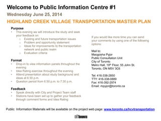
  • 1. Highland Creek Village Transportation Master Plan Welcome to Public Information Centre #1 Wednesday June 25, 2014 HIGHLAND CREEK VILLAGE TRANSPORTATION MASTER PLAN Purpose • This evening we will introduce the study and seek your feedback on: o Existing and future transportation issues o Problem and opportunity statement o Ideas for improvements to the transportation network and public realm o Evaluation criteria Format • Drop-in to view information panels throughout the evening • Idea Rating exercise throughout the evening • Attend presentation about study background and ideas at 6:30 p.m. • Question period from 6:50 p.m. to 7:30 p.m. Feedback • Speak directly with City and Project Team staff • Stations have been set up to gather your feedback through comment forms and Idea Rating If you would like more time you can send your comments by using one of the following options: Mail to: Maogosha Pyjor Public Consultation Unit City of Toronto Metro Hall, 19th Floor, 55 John St. Toronto, ON M5V 3C6 Tel: 416-338-2850 TTY: 416-338-0889 Fax: 416-392-2974 Email: mpyjor@toronto.ca Public Information Materials will be available on the project web page: www.toronto.ca/hcvtransportation
  • 2. What is a Master Plan? What is the Process? • EAs provide the framework for planning of municipal infrastructure projects • Phases 1 and 2 of the Municipal Class EA process are being followed • A recommended ‘set’ of preferred alternatives will be identified • Some alternatives may require additional phases of the Municipal Class EA process • long range plans that integrate existing and future land use needs 2Highland Creek Village Transportation Master Plan Transportation Master Plan (TMP) Process January 2015 March 2015 June 2014
  • 3. TMP Context 3Highland Creek Village Transportation Master Plan Context and Study Purpose • Vision for redevelopment in the community outlined through the Highland Creek Village Area Study (2012) • Changes to transportation network required to support development: o To open up new development lands o To support the influx of people and jobs • Existing multimodal network of roads, transit, pedestrian, and cyclist amenities needs to be enhanced to meet the mobility needs of existing and future residents, businesses and employees • The City has an opportunity to plan and implement transportation network solution that supports development while maintaining character and supporting all modes of transport What will the TMP achieve? This study will conclude with an integrated plan that includes: Planning for infrastructure in this way will determine the best overall transportation solution for the Highland Creek Village community. Infrastructure Needs: Short and long term transportation and water-related servicing needs Network Analysis: Determine improvements that best address needs Policy and Standards: Manage transportation infrastructure, promote sustainable choices Implementation Plan: Costs, priorities and funding
  • 4. 4Highland Creek Village Transportation Master Plan Study Area
  • 5. Toronto Bike Plan (2001). Presents the City of Toronto’s vision and plan to create a safe, comfortable and bicycle friendly environment. What previous studies and plans are considered? 5Highland Creek Village Transportation Master Plan Historic Context Pedestrian Charter (2002). Outlines the City of Toronto’s commitments to create an urban environment that encourages and supports walking. Highland Creek Village Area Functional Study (1995). Initiated to address unresolved issues in the Village Area from the 1986 study and examine the future role of the Highland Creek Overpass. Highland Creek Area Transportation Study (1986). Initiated to address transportation issues and examine transportation facility needs in Highland Creek, Centennial, and Rouge Communities.
  • 6. What previous studies and plans are considered? Highland Creek Community Secondary Plan (2006). Provides area-specific policies and principles for the Highland Creek community. Highland Creek Village Urban Design Guidelines (2012). Provides design guidance for both the public and private realm elements of streets and developments. 6Highland Creek Village Transportation Master Plan Historic Context City of Toronto Official Plan (approved in 2007 and currently under review). Includes a wide range of transportation policies and opportunities to support growth. Highland Creek Village Area Study (completed in 2012). Guides growth, future initiatives and re- development in the area.
  • 7. What we heard from you … Extensive community outreach activities were carried out as part of the Area Study. Public feedback related to transportation generally consisted of the following: • Provide a safe, well-lit public realm with streetscape improvements • Remove Lawson Road Overpass • Make Morrish Road and Old Kingston Road the main intersection for the village • Add more public parking • Consider improvements to on-street parking • Improve pedestrian and cycling network • Provide new frontage and access opportunities • Concerns about Meadowvale Road connection • The potential increase in traffic associated with new developments/redevelopments is a concern 7 Highland Creek Village Area Study (2012) Highland Creek Village Transportation Master Plan
  • 8. Cycling • Old Kingston Road, Lawson Road, and Military Trail are part of the City’s on-street bicycle network. • Highland Creek Trail to west of study area Overview of Findings 8Highland Creek Village Transportation Master Plan Highland Creek Village Area Study (2012) Road Network • Existing network does not follow a grid pattern • Realigned network creates opportunities for more developable parcels Pedestrian Environment • Recommended enhancements to pedestrian realm (streetscaping) • Intersection of Morrish Road and Old Kingston Road identified as “Centre of the Village” Parking • Lack of convenient parking; no notable shortage of parking was identified • Recommended on- street parking opportunities and reconfiguration of angled to parallel parking (Old Kingston Road) Transit • Village area served by TTC bus and Rouge Hill GO Station • No dedicated transit infrastructure within study area • TTC will adjust service as population increases “Promote the use of transit, cycling and walking as viable modes of transportation to access and explore the Village area” “Encourage new on- street and off-street parking opportunities” “…improved pedestrian and cycling environment, safe parking options, and traffic calming measures”
  • 9. Highland Creek Village Transportation Master Plan • A household travel survey conducted in the Greater Toronto Area and Hamilton (GTAH) every 5 years; most recent survey took place in 2011 • This table shows the AM Peak Period Mode Choices by trip start location (6 a.m. to 9 a.m.): HCV and Surroundings Scarborough City of Toronto Travel Modes 2006 2011 2006 2011 2006 2011 Automobile 72% 68% 66% 63% 60% 59% Local Transit (TTC Only) 15% 17% 23% 25% 27% 28% GO Transit 7% 6% 2% 2% 1% 1% Walk or Cycle 6% 7% 8% 8% 11% 11% Other (school bus, taxi) 1% 2% 2% 2% 1% 2% Highland Creek Village (HCV) And Surroundings 9 Transportation Tomorrow Survey (TTS) 2011 Existing Conditions - Travel Characteristics Automobile is the dominant mode of travel in the HCV area especially when compared to Scarborough and the City of Toronto as a whole. However, automobile usage has declined between 2006 and 2011. GO Transit is used more in the HCV area than in Scarborough and the City of Toronto as a whole. Proximity to Rouge Hill GO Station. Walking and cycling are used less in the HCV area than in Scarborough and the City of Toronto as a whole. Usage of transit and walk/cycle modes is much higher than shown above for school trips: 38% and 26% respectively in 2011 for HCV and surroundings.
  • 10. Highland Creek Village Transportation Master Plan Existing Conditions – Travel Characteristics 2011 TTS – Auto Trips Starting or Ending in HCV and Surroundings • Internal trip making within HCV and Surroundings is significant . Over 30% of the trips that start or end in HCV and Surroundings trips during the AM and PM peak periods stay within this area. • The Rest of Scarborough and Downtown Toronto are the next most significant trip locations for HCV and Surroundings trip makers. • Most HCV and Surroundings trips stay within the City of Toronto. Relatively few trips go to/from Durham and York Regions to the north and east. AMPeakPeriod (TripStartinginHCVandSurrounding) PMPeakPeriod (TripEndinginHCVandSurroundings) Local area trip makers primarily travel to and from points within Scarborough and points to the west within the City of Toronto. Subsequent work in this study will analyze the paths / roads used by local area trip makers and longer distance through traffic. 10
  • 11. Highland Creek Village Transportation Master Plan • TTC Bus Routes #38 Highland Creek and #86 Scarborough travel through Highland Creek Village Study Area • Note: GO Bus Route 51 travels through the area but does not make local stops between University of Toronto Scarborough and Pickering Legend / TTC Route 38 / 86 Eastbound / TTC Route 38 / 86 Westbound AM(PM) Peak Period Boarding & Exiting Passengers Average AM (PM) Peak Period Load Through Each Segment TTC Bus Stop Location # (#) # (#) # (#) # (#) # (#) # (#) • WB primary direction of travel in PM peak, EB primary direction of travel in AM peak • Both routes have similar number of passengers per bus but Route 86 carries more people due to higher frequency • Major Stops: • Kingston Road @ Highland Creek Overpass • Kingston Road @ Meadowvale Road • Lawson Road @ Meadowvale Road Route 38 Bus every 10 minutes (AM Peak) Bus every 10 minutes (PM Peak) Route 86 Bus every 3-4 minutes (AM Peak) Bus every 5-6 minutes (PM Peak) Data: March 8, 2013 Data: May 13, 2010 AM and PM Peak Period Transit Ridership Existing Conditions – Travel Characteristics
  • 12. Highland Creek Village Transportation Master Plan • Traffic data analysis reveals that the majority of study area road network operates well • NB left turn at Kingston Rd and Highland Creek Overpass is only potential capacity issue • WB is peak direction of travel in AM, while EB is the peak direction of travel PM • Overpass is only crossing of Hwy 2A between creek to the west and Hwy 401 to the east • Traffic levels have stabilized since the mid 1990’s • Hwy 401 widening to 12 lanes was complete by 2000 • 92% of dwellings in area constructed by 2000 (2011 NHS) Legend: Existing Traffic Signal Ramp to/from Hwy 2A AM and PM Peak Hour Traffic Assessment Existing Conditions – Traffic Operations
  • 13. Highland Creek Village Transportation Master Plan Reported Collisions that Occurred in Highland Creek Village Study Area During Period Spanning November 5th, 2010 to November 4th, 2013 39 Collisions Reported in 3 Years • 18 non-fatal injury collisions (i.e. personal injury) • 20 property damage only collisions • Total of 5 collisions involving either a pedestrian or a cyclist • One reported fatal collision involving two pedestrians at the Old Kingston Road at Watson Street intersection • Rear end collisions were the most predominant, accounting for almost 40% of all collisions • The majority of collisions occurred during ideal driving conditions (i.e. clear visibility) 13 Existing Conditions – Collision Assessment
  • 14. Cultural Heritage Resources The City’s Heritage Preservation Services plays a key role in the conservation of cultural heritage resources in the community. Five properties are listed on the City’s heritage inventory, however no buildings are currently designated under the Ontario Heritage Act. 14Highland Creek Village Transportation Master Plan Existing Conditions – Cultural and Natural Heritage LEGEND STUDY AREA Buildings ^ HERITAGE REGISTER PROPERTY LINES 0 100 20050 metres ´ 1:2,000 UTM Zone 17 NAD 83 A Stage 1 Archaeological Assessment is also being carried out as part of this study. Based on preliminary findings, further archaeological investigation is recommended in three areas. The City of Toronto is in the process of developing an archaeological master plan to identify areas of archaeological potential and to require archaeological assessments on land prior to development. Natural Heritage Resources Based on information provided by the Toronto Region Conservation Authority, Ministry of Natural Resources and City staff, there are limited areas consisting of natural heritage features within the study area. To date, no Species at Risk have been identified.
  • 15. Parking • Some say keep angled parking others say parallel parking is safer • Concern parallel parking would reduce number of spots • Ideas for how to increase number of spots, including addition of parking lot or usage of space behind buildings Road Network • Improve access to Military Trail from Highway 2A • While some state Highway 2A keeps traffic out of the Village (good for pedestrians) others have no issues with through traffic in the Village (good for business) • Some feel roundabout could work space permitting while also concern regarding feasibility and potential impacts on property • Remove westward access at Kingston and Old Kingston Roads • Requests for at grade intersection at Highway 2A and Lawson Road • Kingston Road should become major intersection with Highway 2A • Some say remove Highland Creek Overpass and others say retain it Traffic Improvements • Install traffic light at Military Trail and Kingston Road • If traffic becomes issue in Village area, install traffic calming measures • Pedestrian signal at Kingston Road and Old Kingston Road • Remove stoplight at Old Kingston Road • Remove signal at Morrish Road and Old Kingston Road What Did We Hear? While there are differences of opinion regarding existing transportation problems and potential improvements, there is common ground on opportunities to support local businesses and revitalization through continuous sidewalks, enhanced streetscaping, and other modifications that focus on safely and efficiently accommodating all road users. 15Highland Creek Village Transportation Master Plan WalkShop – June 5, 2014
  • 16. What other suggestions did we hear? Cycling Improvements • Safety • Connectivity • Wayfinding • Bicycle lanes (with buffer in some areas) • Bicycle parking facilities and benches • Very little need • Bicycle port in Village core Pedestrian Improvements • Widen sidewalks • Level walk areas • Sidewalks on either side of roadway • Consider seniors • New sidewalks (various locations suggested) Transit • Remove buses through village, use Kingston Road • Confusing bus routes and stops in the Village Aesthetic Improvements • Add greenspace • Landscaping (trees, flower gardens, etc.) Note: A detailed summary of the input received is provided on the resource table and on the study website. 16Highland Creek Village Transportation Master Plan WalkShop – June 5, 2014
  • 17. The City of Toronto has established a vision for the long-term revitalization of the Highland Creek Village into a vibrant, pedestrian friendly and mixed use community. In order to accommodate all roadway users, and support this vision, changes are required to the transportation network that promote redevelopment opportunities and reinvestment in the Village. There are significant opportunities to improve the public realm and pedestrian environment to encourage the use of transit, cycling, and walking as viable modes of transportation. Problem and Opportunity Statement: 17Highland Creek Village Transportation Master Plan Problem and Opportunity Statement Transportation alternatives developed as part of this study will be evaluated based on their ability to provide solutions to identified problems and take advantage of opportunities.
  • 18. Highland Creek Village Transportation Master Plan Feedback wanted on alternatives Three preliminary ideas are presented on the following boards for discussion. Each alternative consists of a set of individual improvements (e.g. new roads, re-aligned roads, new intersections, sidewalks, parking). We want to hear your thoughts on each of the three preliminary alternatives: • What elements do you support? • What elements do you have concerns about? • Are there additional options or improvements that you would like to see considered? Your feedback will help the study team develop the final set of alternatives that will be evaluated as part of this study. The final set may combine some elements from each of the three alternatives presented here and include additional improvements that are received from the public. Preliminary Alternative Solutions 18 It is important to consider the overall network of the study area when developing alternatives since some network improvements may not be compatible with others.
  • 19. Highland Creek Village Transportation Master Plan Preliminary Alternative Solutions Name Alternative 1 Overpass Removal and Reconfigure Intersection Alternative 2 Meadowvale Signals and Westbound Overpass Ramp Alternative 3 (NEW) Kingston Road Connection and Roundabout Year Proposed Highland Creek Area Study Recommended Network (2012); generally consistent with 1986 Highland Creek Area Transportation Study recommended alternative Highland Creek Functional Study (1995) Recommended Long-Term Plan New Option (2014) Overpass and development opportunities Provides development opportunities through removal of Lawson Rd Overpass and Hwy 2A ramps; replaced with an all- directional signalized intersection Maintains overpass while adding a westbound ramp and opening up existing ramp lands for development Maintains overpass, removing all existing ramps and opening up ramp lands for development Meadowvale Road Provides westbound access to Hwy 2A Meadowvale Rd connected to Hwy 2A through all-directional signalized intersection Same as Alternative 1 Hwy 2A connections Provides signalized T-intersection at Military Trail; ramps between Hwy 2A, Kingston Rd and Morrish Rd are closed Same as Alternative 1 Signalized intersection at Hwy 2A, Kingston Rd, Lawson Rd; ramps at Military Trail and Morrish Rd closed Kingston Rd/ Lawson Rd Overpass Reconfigured intersection Same as Alternative 1 Potential roundabout Parking Conversion of angled parking spaces along Kingston Rd (east of Morrish Rd) to parallel parking. Additional on-street parking for existing and re-aligned streets. Maintains all existing parking Same as Alternative 1 Pedestrian Realm Additional sidewalks, sidewalk improvements, and streetscape enhancements throughout Highland Creek study area 19 The three alternatives are preliminary ideas. We want to hear your thoughts.
  • 20. Highland Creek Village Transportation Master Plan Alternative 1 - Overpass Removal and Reconfigure Intersection New WB access to Hwy 2A New “T” intersection at Hwy 2A – Military Trail Removal of overpass and ramps. Add new signal. New laneway Reconfigure intersectionRealignment of Kingston Rd and Morrish Rd Closure of accesses to Hwy 2A • This is the Highland Creek Area Study (2012) Recommended Network • Provides development opportunities through removal of Lawson Overpass and Hwy 2A ramps • New intersections with Hwy 2A provide additional access opportunities and enhanced pedestrian environment • Opportunities for additional parking along realigned Kingston and Morrish Roads • Is generally consistent with the 1986 Highland Creek Area Transportation Study recommended alternative Conversion to parallel parking Legend: New Signalized Intersection Ramp Closure Re-Aligned Or New Road Parallel Parking Conversion New Right-In Connection 20 Preliminary Alternative Solutions
  • 21. Highland Creek Village Transportation Master Plan • Taken from Highland Creek Functional Study (1995) Recommended Long-Term Plan • Maintains overpass while opening up ramp lands for development • New ramp to Hwy 2A (WB) from Lawson overpass • Meadowvale Road connected through Hwy 2A • Remainder of network is the same as Alternative 1 Alternative 2 – Meadowvale Signals and Westbound Overpass Ramp New signals on Meadowvale Road New “T” intersection at Hwy 2A – Military Trail Removal of ramps (if needed for development) Reconfigure intersectionRealignment of Kingston Rd and Morrish Rd Closure of accesses to Hwy 2A New ramp to WB Hwy 2A Legend: New Signalized Intersection Ramp Closure Re-Aligned Or New Road 21 Preliminary Alternative Solutions
  • 22. Highland Creek Village Transportation Master Plan Alternative 3 – (NEW) Kingston Road Connection and Roundabout New WB access to Hwy 2A New intersection at Hwy 2A– Kingston Rd – Lawson Rd Removal of ramps Potential roundabout Realignment of Kingston Rd and Morrish Rd Closure of accesses to Hwy 2A • Maintains overpass while opening up ramp lands for development • New intersection at Hwy 2A – Kingston Rd – Lawson Rd • New internal road connecting Military Trail, Morrish Rd, and Kingston Rd • Potential roundabout at Kingston Rd – Lawson Rd Overpass Conversion to parallel parking Legend: New Signalized Intersection Ramp Closure Re-Aligned Or New Road New Roundabout New Right- In Connection Preliminary Alternative Solutions 22
  • 23. Highland Creek Village Transportation Master Plan What will be assessed for all alternatives Active Transportation Supportive Improvements • Pedestrian and cycling environment are important components of this study. Examples: o Additional and wider sidewalks, improved streetscaping, cycling lanes, new trail connections, new pedestrian crossings • Improvements to be consistent with streetscape elements, suggested Right-of-Way widths, and proposed cross-sections from the Highland Creek Urban Design Guidelines (2012) Transit Network Considerations • Network changes and new signals may have impacts on transit routing and stop locations • Improved pedestrian environment will be supportive of transit System / Signal Optimization • Optimization of study area traffic signals will be considered • Potential usage of roundabouts • Signal Warrants - need for the existing Old Kingston Rd and Morrish Rd intersection will be re-evaluated Preliminary Alternative Solutions 23
  • 24. Highland Creek Village Transportation Master Plan Evaluation of Preliminary Alternative Solutions Each of the road network alternatives will be evaluated against the following criteria to compare their respective benefits and impacts using both quantitative and qualitative measures for the various indicators. Evaluation Criteria Indicators Technical/Transportation - Network performance - Potential to improve traffic safety - Potential to accommodate transit operations - Potential to provide on-street parking - Ability to accommodate Accessibility Design Guidelines Social Environment - Potential to incorporate streetscape and landscape elements - Potential to incorporate gateway features, public art features and amenities - Potential to provide a well connected pedestrian network - Potential to improve pedestrian/cyclist safety Cultural Environment - Potential to maintain historic character of village area - Potential to impact listed cultural heritage features - Potential to impact archaeological resources Natural Environment - Potential to impact wooded Areas - Potential to impact open Space areas - Potential to impact wildlife/habitat areas - Potential to impact air quality Economic - Costs - Ability to support community accessibility - Potential to support future development opportunity areas - Ability to support goods movement - Ability to support new business frontage and access opportunities Are there any additional criteria or indicators that you feel should be included? Proposed Evaluation Criteria and Indicators 24
  • 25. Highland Creek Village Transportation Master Plan Next Steps - Review and consider comments received at/following PIC #1 - Finalize and evaluate the alternative long term network solutions - Identify water, wastewater, and stormwater functional servicing requirements - Develop transportation policies and standards - Hold PIC #2 to present draft Transportation Master Plan recommendations - Develop implementation and funding plan to support the recommendations - Prepare and finalize Transportation Master Plan report - Present Transportation Master Plan to City Council for approval What happens next? 25 January 2015 March 2015 June 2014
  • 26. Please complete a comment sheet and place it in the box provided or submit written comments via email, mail and/or fax to the following study team member: Comment Box Idea Rating Sheet How can you continue to participate? Provide your opinion. If you have new suggestions, write each down on its own sheet and leave out for rating. We’ll Keep You Posted! Please check the study website www.toronto.ca/hcvtransportation often to review new information. • News and updates • Study Background • Notices of upcoming events • Links to other related information Thank You! 26 Maogosha Pyjor Senior Public Consultation Coordinator City of Toronto Metro Hall, 19th Floor 55 John Street Toronto, ON M5V 3C6 Tel: 416-338-2850 Fax: 416-392-2974 TTY: 416-397-0831 mpyjor@toronto.ca