SlideShare a Scribd company logo
1 of 42
Download to read offline
HANDBOOK: APPROACH TO CHAPTER 40B DESIGN REVIEWS 
Prepared for: 
Massachusetts Department of 
Housing and Community Development 
MassDevelopment 
Mass Housing 
Massachusetts Housing Partnership 
Prepared by: 
The Cecil Group, Inc. 
January 2011 
Canton Village, Canton 
Oxbow Road, Wayland 
Chocksett Crossing, Sterling 
Residences at Canal Bluffs, Bourne 
Treehouse at Easthampton Meadow, Easthampton 
Waverly Woods, Belmont
B | TABLE OF CONTENTS
Dear Reader, 
The 40B Design Handbook is a result of a collaborative process of the four Massachusetts housing agencies that are authorized to review and approve site eligibility for Chapter 40B affordable housing developments. 
This handbook is a reflection of these agencies and their commitment to ensuring that 40B affordable housing developments adhere to high standards of site and building design that enhance the quality of life for residents and the communities in which they reside. 
Chapter 40B has a long history of success in Massachusetts. Enacted in 1969, it is credited with having produced over 58,000 units of housing for owners and renters, seniors and families, special needs households and veterans. 
This handbook strives to create a shared language and vision of well-designed housing in order to create models of success for future developments to follow. Affordable housing is an art as well as an industry and we are committed to marrying the two. 
Sincerely, 
Tina Brooks 
Undersecretary 
Massachusetts Department of Housing & Community Development 
Robert L. Culver 
Executive Director 
MassDevelopment 
Thomas R. Gleason 
Executive Director 
MassHousing 
Clark L. Ziegler 
Executive Director 
Massachusetts Housing Partnership
TABLE OF CONTENTS | i 
TABLE OF CONTENTS 
Section 1: Purpose.................................................................................1 
Section 2: Requirements for Design Review..........................................3 
c.40B Regulations on Design Elements...........................................................................................3 
c.40B Guidelines on Design Review................................................................................................4 
Section 3: Design Review Recommendations.......................................5 
A. How Design Fits Into the Site Eligibility Review Process.............................................................5 
B. Design Terms and Phrases Explained.........................................................................................6 
C. Application Materials..................................................................................................................15 
D. Checklist Review Procedure......................................................................................................19 
Initial Project Review: Design Elements Checklist.........................................................................20 
Checklist of Design Options for Integration into Existing Development Patterns..........................22 
Attachment A: Key Design Issues........................................................25 
Attachment B: Guidelines for Reviewing Designs................................27 
Architectural Treatments.................................................................................................................27 
Modulating Building Mass, Scale and Bulk....................................................................................27 
Environmental Resources..............................................................................................................28 
Parking and Access........................................................................................................................28 
Buffering Techniques......................................................................................................................29 
Attachment C: Reference Materials and Resources............................31 
Subsidizing Agency Web Sites.......................................................................................................31 
Online Maps and Aerial Photos......................................................................................................31 
Figures 
Figure 1: Building Massing and Scale.........................................................................................6 
Figure 2: Elevations of Different Building Types..........................................................................7 
Figure 3: Range of Building Types...............................................................................................8 
Figure 4: Conceptual Site Plans Over Aerials..............................................................................9 
Figure 5: Aerial Photograph - Belmont, MA...............................................................................10 
Figure 6: Development Using Topography and Vegetation as Buffer.......................................11 
Figure 7: Surrounding Context - Ground Level Perspective......................................................12 
Figure 8: Surrounding Context - Aerial Perspective...................................................................13 
Figure 9: Elements for Consideration of Relationship to Adjacent Buildings and Streets........13 
Figure 10: Settlement Patterns.....................................................................................................14 
Figure 11: Conceptual Site Plans................................................................................................16 
Figure 12: SketchUp Concept Plans - Use of 3D Modeling Software to 
Illustrate Project and Context......................................................................................18 
Photo and Image Credits 
Cover – MassHousing, Oxbow Partners 
Fig 1 – Oxbow Partners, The Cecil Group 
Fig 4 – MHP, The Cecil Group 
Fig 5 – MassGIS 
All other photos and images provided by The Cecil Group 
Fig 6 – Oxbow Partners 
Fig 8 – Bing.com 
Fig 10 – MassGIS 
Attachment A – MHP, The Cecil Group
ii | TABLE OF CONTENTS
PURPOSE | 1 
The Chapter 40B Design Principles Handbook (Handbook) was created to provide information and guidance for the design review process undertaken by the agencies subsidizing c.40B affordable housing projects in Massachusetts. Design review is necessary when evaluating new c.40B housing developments for consistency with the requirements of the c.40B regulations in terms of use, site planning and building design. 
The reason for creating this Handbook is that certain changes were recently made in the Chapter 40B program regarding review criteria for the siting and design of projects. These design elements are listed in the implementing regulations found at 760 CMR 56.04(4)(b) and (c). Using a list of criteria, the sections require findings: 
“that the site of the proposed Project is generally appropriate for residential development” and, “that the conceptual project design is generally appropriate for the site on which it is located” 
The c.40B Guidelines prepared by the Department of Housing and Community Development further define the reasons for this Handbook in the design review process for c.40B projects, specifically to: 
“…draw attention to factors that are of particular importance when introducing a Project into existing surroundings, encourage a uniform perspective among Subsidizing Agencies, and to create a more transparent review process…” 
This Handbook provides some suggestions for applying these program standards and goals in the early stages of the design process. The Handbook provides information for non-designers when making findings of conformance with the review criteria and requirements for the project proposals. The Handbook includes: 
• A glossary (Section 2, pg. 3 and Attachment A, pg. 25) to describe and help clarify the terms and criteria included in the regulations and guidelines, and how the terms may be applied in the design review process; 
• Typical submissions (Section 2, pg. 3) that convey a sufficient level of information for the reviews; and 
• A recommended process (Section 3, pg. 5) for reviewing the design criteria of projects submitted for eligibility reviews, including recommendations on the content and form of the applications. 
While this handbook is intended for the Subsidizing Agencies and the individuals who perform the design reviews under the regulations, the content will also inform Project proponents submitting Projects for Site Eligibility. However, this is only a recommended approach and each of the Subsidizing Agencies will determine their specific requirements for the design review. Those not involved in the design or review processes may use this information to understand the criteria that are considered by the Subsidizing Agencies in the review process. 
Section 1: 
PURPOSE
2 | PURPOSE 
The Handbook intentionally does not provide specific guidance on density, typically represented as units per acre, because the acceptable density of a given housing development is site- and context-specific. This Handbook instead suggests that the site and building design, not the numerical density, determines if a development is “generally appropriate for the site.” In some instances, a proposed development may contain more units than a site can reasonably accommodate. In those instances, the reviewing subsidizing agency may reject a proposed development that it determines to be inappropriate or make a determination that results in modifications of the project by the sponsor, including a reduction in size.
REQUIREMENTS FOR DESIGN REVIEW | 3 
Subsidizing Agencies, the primary audience for this Handbook, are responsible for determining Site Eligibility. Site Eligibility determinations are typically the first step for a c.40B Project and are completed with the issuance of a Project or Site Eligibility Letter. The Project or Site Eligibility Letter allows the Project to then be reviewed under a Comprehensive Permit process with the local zoning board of appeals. 
A review of the project design is included in this step and is required to complete the Findings before determining Site Eligibility. Recommendations on the means to analyze a Project design that integrates the Project into the existing development patterns have been provided in the c.40B Regulations and Guidelines, as summarized below. 
c.40B Regulations on Design Elements 
The implementing regulations for the law are found in 760 CMR 56.00. Within section 56.04(4) of those regulations, entitled Findings in Determination, there are a number of terms to consider related to use and design. The relevant subsections read as follows: 
“(b) that the site of the proposed Project is generally appropriate for residential development, taking into consideration information provided by the municipality or other parties regarding municipal actions previously taken to meet affordable housing needs, such as inclusionary zoning, multifamily districts adopted under M.G.L. c.40A, and overlay districts adopted under M.G.L. c.40R, (such finding, with supporting reasoning, to be set forth in reasonable detail); 
“(c) that the conceptual project design is generally appropriate for the site on which it is located, taking into consideration factors that may include proposed use, conceptual site plan and building massing, topography, environmental resources, and integration into existing development patterns (such finding, with supporting reasoning, to be set forth in reasonable detail);” 
The regulations at subsection (b) frame the considerations for the choice of a site for the Project. Using this standard, the determination of consistency should be defined as a general allowance for residential development. The regulations at subsection (c) then consider the Project design which at this early stage is a ‘conceptual project design.’ The Project design elements considered here include the use (expected to be predominantly residential), the building in terms of massing, site conditions defined by topography and environmental resources, and the Project’s ‘integration into existing development patterns.’ 
The c.40B Guidelines that were drafted to meet the goals stated in the Introduction to this Handbook define the ‘context’ of a Project by elaborating on the relationships with adjacent buildings and streets, as described in the next sections. 
Section 2: 
REQUIREMENTS 
FOR DESIGN REVIEW
4 | REQUIREMENTS FOR DESIGN REVIEW 
c.40B Guidelines on Design Review 
The c.40B Guidelines prepared by DHCD (revised as of July 30, 2008) suggest approaches for applying the regulations with some additional terms and phrases in section 3. Findings, Design (760 CMR 56.04(4)(c)): 
“Relationship to Adjacent Building Typology – Generally, a Project is developed in the context of single family dwellings and introduces a different form of housing into the neighborhood. Assuming that this is the case, it is important to mitigate the height and scale of the buildings to adjoining sites. In this context, it is particularly important to consider the predominant building types, setbacks, and roof lines of the existing context. 
• The massing of the Project should be modulated and/or stepped in perceived height, bulk and scale to create an appropriate transition to adjoining sites. 
• Where possible, the site plan should take advantage of the natural topography and site features, or the addition of landscaping, to help buffer massing. 
• Design may use architectural details, color and materials taken from the existing context as a means of addressing the perception of mass and height. 
Relationship to Adjacent Streets – Likewise, the manner in which the buildings relate to adjacent streets is critically important. Massing should take into account the pattern of the existing street frontage as well as maintain a human scale by reasonably relating the height of buildings to the width of the public way.” 
These elements form the criteria under which the design review process is executed. The next sections provide an approach for completing the reviews including the sequential steps for the review, further define the terms used in the process and provide the forms for consistent applications.
DESIGN REVIEW RECOMMENDATIONS | 5 
The recommendations of this Handbook are for the Subsidizing Agencies to follow common approaches in the reviews to promote a consistent design review process. For this purpose we will review: 
A. How Design Fits into the Site Eligibility Review Process (pg. 5), 
B. Design Terms and Phrases Explained (pg. 6), 
C. Suggested Information, to be supplied for the review (pg. 15), 
D. Suggested Checklist Review Procedure, with checklists (pg. 19). 
Each of these is further described in the following sections. 
A. How Design Fits Into the Site Eligibility Review Process 
The initiation of the Project/Site Eligibility process starts with an application for Site Eligibility by a Project proponent submitted to one of the Subsidizing Agencies. The content of that application is governed by the existing agency requirements. 
Note that while much of the regulatory criteria may be determined from a desktop review in the office and a checklist is recommended here to ensure the design elements are addressed, a site visit is highly recommended to understanding the context of the Project site from an on-the-ground perspective. 
Requests for additional design information at this time could include further descriptions of the means to address elements of the design and other supplemental information listed in the application requirements. However, detailed suggestions on design can be incorporated into the next stages of the project design process after agency review and after a comprehensive permit is issued and do not need to be fully addressed at this stage. These additional recommendations may be included in the Project Eligibility Letter. 
For successful projects, issuance of the Project Eligibility Letter is followed by the local permitting phase. With successful completion of the Comprehensive Permit the Project eventually goes back to the agency which is subsidizing the construction where more detailed project plans are submitted for funding approval. So while the design of a Project is a part of the initial review, the level of detail is commensurate with the early stages of conceptual design. 
Section 3: 
DESIGN REVIEW RECOMMENDATIONS
6 | DESIGN REVIEW RECOMMENDATIONS 
B. Design Terms and Phrases Explained 
This section of the handbook reviews definitions of the terms as applied in project reviews. 
Affordable housing projects under c.40B often have design elements that are different from the surrounding context as described by the terms used in the regulations; e.g., use, scale. However, with careful design and consideration of the project elements in relationship to the adjacent streets and properties, the projects can better integrate with the surrounding context. Consequently, to help describe these terms, the definitions here include the context in which these terms and phrases may be applied. 
The following terms are taken from the c.40B Regulations and Guidelines. 
Building Massing and Scale 
Buildings may be defined by simple dimensions of height and width, but they may also be described by the effective presence of those dimensions in terms of massing and scale. 
Massing is the “organization of the building’s overall volume”. As an example, building forms providing the same volume of space may be low and wide or tall and thin. The images in Figure 1 indicate some of these variations. 
Scale may be defined as the height and massing of a building and building elements and the relationship to surrounding spaces and structures. Common relationships are to the size of a human, to the context of the site, or in the relationships to adjacent buildings. 
The mass and scale of a building may be reduced by altering the building’s bulk. The features that can minimize the mass and scale should be about the same size as the same features on adjacent properties. The images in Figure 1 indicate some of these features. In this way, the building’s appearance may be improved. Such features may include: 
• Window shutters, corner boards and trim work around doors and windows. 
• Transitions of large to small building sizes by stepping down heights and lowering roof lines, attaching storage sheds and covering entry porches and patios. 
• Facades that are made more visually interesting by adding architectural bands that break up the siding or cladding. 
• Using a human scale for these features so that they are related to the size of a person using the building. 
• Natural forms can also be incorporated such as landscaping and land forms to add interest to the building’s surrounding areas. (see Figure 6) 
Figure 1 | Building Massing and Scale 
Note transition created by varied rooflines and colors 
Compare with above image and note the similarity of apparent scale and mass, yet buildings are separated 
Note facade elements, door and window treatments, that create a human scale 
Note composition of buildings on the land that are arranged with the topography and angled orientation to create private and common spaces
DESIGN REVIEW RECOMMENDATIONS | 7 
Building Typology 
Building typology is a classification of characteristics commonly found in buildings of similar construction. It may be defined by the building elements such as the structure of the building according to the design of the walls, columns and roofs, and other elements of the building façade such as bays, openings, and materials. 
Figure 2 illustrates two different building types and how they relate to the existing development on the right. Each prototype requires different site and building configurations. Affordable housing projects typically vary from surrounding building types, but within the range of building types of buildings in the neighborhood. The image on the bottom includes a townhouse building type with sloped roofs and building separations. The image on the top suggests an apartment building that is distinctly different in form, but a more efficient use of the land. 
These comparisons show how the variation in mass and scale that a chosen building typology can make. The graphic in Figure 3 shows a range of building types leading from low density to high density based on footprint, organization and height. 
Figure 2 | Elevations of Different Building Types 
STREET 
STREET 
STREET 
STREET 
STREET 
STREET 
APARTMENT BUILDING 
24 Units 
4 Units 
2 Units 
Height difference 
TOWNHOUSES 
(with gables and peaked roofs) 
EXISTING HOMES 
EXISTING HOMES 
Note differences in height, density and style. While that particular apartment style on top is not similar to the existing homes, other building styles may provide similar densities.
8 | DESIGN REVIEW RECOMMENDATIONS 
Key design issues to review in the application materials and discuss with the applicant include: 
• Facade appearance and orientation - Does the proposed design front onto the street the same way as the adjacent properties? 
• Architectural and site details - Are the construction details of the proposed design compatible with the adjacent properties or minimize the differences between the new and existing structures? 
• Design treatments of the edge - Do the street and landscaping details minimize the differences or buffer the transition between the different sizes, materials or orientation of the new design and adjacent properties? 
See Attachment A for additional descriptions of the terms. 
Conceptual Project Design 
The Conceptual Project Design must sufficiently define the Project to allow decisions on the eligibility of the project for agency funding. A project’s design evolves from the simple idea to detailed drawings ready for construction. In the early stages of design, concepts are developed as tests to determine the project’s viability. 
Items typically shown in a Conceptual Project Design are the buildings and site improvements where the details and information relate to the context of the site and project. The details of building’s style and site design are limited but provide enough information to explain the approach. 
The images of site plans in Figure 4 show ways that conceptual project designs may be illustrated. Simple conceptual plans can provide enough detail for this stage of the review, when they are properly documented. 
Note that on Figure 4 in Image B, the information includes both graphics and notes to describe the proposed Project. On Image A the plan is laid on top of an aerial photo to help locate the Project and show how it may fit into the surrounding neighborhood. 
Figure 3 | Range of Building Types 
Building types: All of these could be appropriate in a suburban community depending on the site, design, and surrounding context. 
Low‐rise block 2 SFDU Low rise block Low‐rise block 2 SFDU Low rise block Low‐rise block 2 SFDU 
SINGLE FAMILY 
3/4 FAMILY 
TOWNHOUSE 
APARTMENTS 
MULTI-FAMILY
DESIGN REVIEW RECOMMENDATIONS | 9 
Figure 4 | Conceptual Site Plans Over Aerials 
Conceptual plan with notes and text. 
Conceptual plan shows neighborhood above and river below project area. Source: Elkus Manfredi Architects 
A 
B
10 | DESIGN REVIEW RECOMMENDATIONS 
Environmental Resources 
The site’s environmental resources are generally submitted on a survey or an aerial photo-graph. 
As shown in the example in Figure 5, the natural and manmade features shown in 
this aerial map of Belmont, MA are trees or vegetative land cover, wetlands and waterways 
as well as open areas and buildings. Additional information may be collected with site pho-tographs 
and site visits. 
Some wetland areas are determined in accordance with state 
laws and regulations (see 310 CMR 10.00). The adjacent image 
of the regulated wetland areas may not be obvious on the site 
however. If there is an indication of a wetland on the site, sur-vey, 
or aerial plan, ask whether such a determination has been 
officially made and have it shown on the submitted plans with 
the date of determination. 
Topography 
Topography is the variation in ground elevation. The topog-raphy 
across a site and in the adjacent areas can be both a 
limitation and a benefit to site development. Steep and highly 
varied topography may be used as desirable features of a site 
or may require substantial reworking of the grades to allow 
site improvements. Flat sites may require less for improve- 
Undeveloped land 
Golf course 
Open water 
Highway interchange 
Potential wetland 
Residential development 
Figure 5 | Aerial Photograph - Belmont, MA 
Plan showing wetlands with river setbacks. 
Aerial photos can provide information on land cover and potential environmental resources. Source: MassGIS
DESIGN REVIEW RECOMMENDATIONS | 11 
ments but may hold less visual interest and could have drainage problems. Note that site improvement and development costs increase with substantial site regrading. For example, severely steep slopes and bedrock will add significant costs if they are part of the site development plan. 
In site planning, the topography must be sufficient to plan at the scale of the project. This may require a contour for every half-meter, or every two feet, to greater intervals (one meter) on larger areas or flat sites. Half-meter or two-foot contours are typical for site planning but available topography may be used in the initial project planning stage. Information on topography can be obtained from the town or city hall or may be available in the MassGIS data. 
The images in Figure 6 show how topography and vegetation were used as a visual buffer and features in the Project’s design development. 
Figure 6 | Development Using Topography and Vegetation as Buffer 
Vegetated mound along frontage softens visual impact of building 
Vegetated drainage basin provides a different buffer
12 | DESIGN REVIEW RECOMMENDATIONS 
Surrounding context 
The surrounding context is defined by the existing development patterns outside of the site. From the c.40B Guidelines, specific reference is made to adjacent building typology and adjacent streets. Assuming that the new buildings will vary from the surrounding buildings, consideration should be given to the differences in architecture and settings. The conditions of the adjacent streets may define access points that in turn affect site layouts. The location of the buildings in relation to the streets may also be a factor in the visual impact of the building, as the following images in Figure 7 show. 
Figure 7 | Surrounding Context - Ground Level Perspective 
At the same scale, the buildings above create a more suburban image while the buildings below work in an urban setting. A sidewalk landscape buffer would soften the lower image.
DESIGN REVIEW RECOMMENDATIONS | 13 
The aerial image (Figure 8) below is a perspective that provides a view of buildings within a neighborhood. It is not a typical or common view in that the general public and adjacent properties do not see the property from this viewpoint. However, this type of view may be used to indicate how the differences of the buildings may be recognized. 
The cross section below (Figure 9) indicates the ways in which the location and design of the proposed buildings may also be defined spatially in relation to surrounding streets and buildings. Again, this is not a common public viewpoint but helps illustrate and define relationships. 
Figure 8 | Surrounding Context - Aerial Perspective 
Figure 9 | Elements for Consideration of Relationship to Adjacent Buildings and Streets 
STREET 
BUFFERED PARKING AREA 
PROPOSED BUILDING 
Height 
ACCESS WAY 
HOUSE 
HOUSE 
STREET 
EXISTING NEIGHBORHOOD 
Separation to Buildings 
Separation to Street 
Landscape Buffer 
View Lines 
View Lines 
A low-angle image, which are available online, provides a different perspective. See Attachment C for online resources.
14 | DESIGN REVIEW RECOMMENDATIONS 
Existing development patterns 
The adjacent properties and neighborhood should be considered in the Site Eligibility review. The surrounding and existing development patterns will often vary within a community. Sites may include less developed areas of residential, commercial, or industrial land use. However, a wider view of the neighborhood may suggest a recognized pattern of settlement. 
The illustration below (Figure 10) shows the variability of settlement patterns within one community. A site may be located in the generally rural area but adjacent to residential tracts. Again, while the resources are available to obtain a substantial amount of information, the site visit is still an important part of the review. 
Figure 10 | Settlement Patterns 
Note that a project in any of these areas requires a different design approach to remain in context with adjacent development.
DESIGN REVIEW RECOMMENDATIONS | 15 
C. Application Materials 
To complete the review as envisioned requires submittal of application materials that properly explain the project. There is no need for a significant level of design detail at this stage because these are concept plans. But there is a need to have a clear understanding of the conditions at the site, the proposed Project concept and potential conflicts. With the online resources currently available (see Attachment C for resources), many of the requests for illustrative graphics and information are fairly simple to accommodate as noted below. 
The officially required submittal materials for Site Eligibility are listed in sec. 56.04(2). It is also important to review the application requirements of the subsidizing agency. The items pertinent to design review include: 
(a) a locus map identifying the site within a plan of the neighborhood, accompanied by photographs of the surrounding buildings and features that provide an understanding of the physical context of the site; 
(b) existing conditions at the site such as wetland boundaries and setback lines, topographic relief, and current use; 
(c) a tabulation of proposed buildings with the approximate number, size (number of bedrooms, floor area), and type (ownership or rental) of housing units proposed; 
(d) conceptual design drawings of the site plan and exterior elevations of the proposed buildings, along with a summary showing the approximate percentage of the tract to be occupied by buildings, by parking and other paved vehicular areas, and by open areas, the approximate number of parking spaces, and the ratio of parking spaces to housing units; and any other parking requirements for ancillary uses; 
(e) a narrative description of the approach to building massing, the relationships to adjacent properties, and the proposed exterior building materials; 
(f) a tabular analysis comparing existing zoning requirements to the waivers requested for the Project. 
The following are recommended submittals for information to support these requests for information: 
Description of the project site and surrounding buildings and features 
The area to be described should extend from the subject Site into all adjoining properties. [Additional areas may be in review after the site visit.] The description should include a survey or plot plan with designations of current use and zoning. The local assessor’s office may be able to provide information on the use designation of the site and adjoining land to determine property and adjacent use and lot configurations. The description should be supplemented with aerials and photos, which are available online, as per the example below. The description should also include a series of photos taken from within and outside the site showing all adjacent properties. These photos should be eye-level and taken so that the interior of the site and adjoining property are represented on all sides. 
Aerial images may be obtained for any location either through the state (MassGIS at http://www.mass.gov/mgis/massgis.htm) or from free online resources such as Google maps (http://maps.google.com/maps) or Bing maps (http://www.bing.com/maps/). 
This image (right) is from Bing maps showing the level of detail and information possible with this source. 
Aerial obtained from Bing Maps
16 | DESIGN REVIEW RECOMMENDATIONS 
Figure 11 | Conceptual Site Plans 
The plans show different aspects of design. Image 1 is a hand-drawn sketch; image 2 is a computer-aided design, while image 3 is a plan that shows certain existing site information. 
1 
3 
2
DESIGN REVIEW RECOMMENDATIONS | 17 
Conceptual design plans or site concept drawings 
The conceptual design or site concept plans are inter-related terms. At this stage of the project development these plans could be expected to be fairly simple, so long as they convey the correct amount of information needed for the review. The basic information required includes: 
(1) Siting of buildings, parking and accessways 
(2) Adjacent properties and buildings 
(3) Width of the right-of-way with elements and dimensions of ways in adjacent public streets 
(4) Topographic contours across the site and into adjacent properties 
(5) Wetland resources as regulated under state regulations 310 CMR 9.00 et seq. 
(6) Site and environmental restrictions in the form of easements and any Activity and Use Limitations 
Examples of conceptual plans with much of the basic information are shown on the previous page (Figure 11). Each represents a way to present a complex set of information and ideas in simple, easily accessible formats. The plans should include a table of dimensions and other data that may be included in the other application materials. 
The illustrations in Figure 11 show how site plans may be laid over aerial photos to provide a good source of information on a Project and its relationship to the adjacent streets and buildings. 
Description of the proposed buildings 
The description of the proposed buildings should provide enough information to determine what the proposed building typology is and describe any architectural or site design elements that will help integrate the Project with the existing development patterns. 
A simple method to represent buildings in the early stage of design is by using a three- dimensional graphic software program available for free on-line. The images in Figure 12 are an example of illustrative site plans using the SketchUp program, which is available for free, on-line (http://sketchup.google.com/). This application of the program shown below can be used to indicate building massing and form. When the adjacent buildings are also drawn in the program, the context of the surrounding area can also be illustrated.
18 | DESIGN REVIEW RECOMMENDATIONS 
Figure 12 | SketchUp Concept Plans - Use of 3D Modeling Software to Illustrate Project and Context 
These low-angle projections show old and new development using different colors and show how the sizes and orientations relate to the surrounding context. In the top image existing is shown in orange and new is shown in yellow. In the bottom image existing is shown in white and new in grey.
DESIGN REVIEW RECOMMENDATIONS | 19 
D. Checklist Review Procedure 
To facilitate the review procedures for a non-designer, and to provide clarity for others involved in the design review process, a checklist is recommended. This will encourage consistent and complete decisions on the design elements and a focus on the design aspects that may require mitigation. Of particular concern is the impact the Project’s design will have on adjacent properties. A suggested checklist is shown on the following page. This checklist simply lists the design elements listed in the regulations and allows an initial determination of conformance.
20 | DESIGN REVIEW RECOMMENDATIONS 
Initial Project Review: Design Elements Checklist 
This checklist is to determine whether “the conceptual project design is generally appropriate for the site.” The regulations found at section 56.04(4)(c) define conformance when considering the factors listed in the left hand column. 
Checklist of conformance with section 56.04(4)(c) 
Project: 
Location: 
Reviewer: 
Date: 
FACTOR 
FINDINGS 
40B design regulations 
Integration with adjoining properties 
Proposed Use 
Acceptable 
Not addressed 
Acceptable 
Requires additional discussion 
Conceptual Site Plan 
Acceptable 
Not addressed 
Acceptable 
Requires additional discussion 
Building Massing 
Acceptable 
Not addressed 
Acceptable 
Requires additional discussion 
Environmental Resources 
Acceptable 
Not addressed 
Acceptable 
Requires additional discussion 
Topography 
Acceptable 
Not addressed 
Acceptable 
Requires additional discussion 
Areas to consider in future review of the design:
DESIGN REVIEW RECOMMENDATIONS | 21 
Detailed Project Review: Design Review Checklist 
This second checklist is an optional approach for developing a response to the proposed design, based on the design review criteria from the DHCD c.40B Guidelines.
22 | DESIGN REVIEW RECOMMENDATIONS 
Checklist of Design Options for Integration into Existing Development Patterns 
Project: 
Location: 
Reviewer: 
Date: 
Review each of these design elements to form the overall design review findings. 
(See Attachment A: Key Design Issues for further discussion on these elements) 
Integration with adjoining properties 
Relation to Surrounding Structures and Public Spaces 
Acceptable Not addressed Unacceptable 
Why unacceptable: 
Architectural and Site Details 
Acceptable Not addressed Unacceptable 
Why unacceptable: 
Scale (descriptor) 
Acceptable Not addressed Unacceptable 
Why unacceptable: 
Height 
Acceptable Not addressed Unacceptable 
Why unacceptable: 
Proportion 
Acceptable Not addressed Unacceptable 
Why unacceptable: 
Shape or Form 
Acceptable Not addressed Unacceptable 
Why unacceptable: 
Façade Design 
Acceptable Not addressed Unacceptable 
Why unacceptable: 
Streetscape and Landscape 
Acceptable Not addressed Unacceptable 
Why unacceptable: 
Design Treatments of the Edge 
Acceptable Not addressed Unacceptable 
Why unacceptable: 
Building Setbacks 
Acceptable Not addressed Unacceptable 
Why unacceptable:
DESIGN REVIEW RECOMMENDATIONS | 23 
Building Height and Stepbacks 
Acceptable Not addressed Unacceptable 
Why unacceptable: 
Facade Length and Articulation 
Acceptable Not addressed Unacceptable 
Why unacceptable: 
Are the Guidelines for Reviewing Design addressed? (See Attachment B for additional discussion) 
Integration with adjoining properties 
Architectural Treatments 
Acceptable Not addressed Unacceptable 
Why unacceptable: 
Modulation of Building Mass, Scale and Bulk 
Acceptable Not addressed Unacceptable 
Why unacceptable: 
Environmental Resources 
Acceptable Not addressed Unacceptable 
Why unacceptable: 
Parking and Access 
Acceptable Not addressed Unacceptable 
Why unacceptable: 
Buffering Techniques 
Acceptable Not addressed Unacceptable 
Why unacceptable: 
Areas to consider in further review of the design:
24 | DESIGN REVIEW RECOMMENDATIONS
ATTACHMENT A: KEY DESIGN ISSUES | 25 
This section provides a more detailed description of elements of design that may be considered in a design review. Design review requires a balanced judgment based on consideration of the goals of affordable housing. The criteria include the Chap. 40B regulatory criteria, the surrounding context, and the proposed design as a composition of these elements. In almost all cases, design review decisions will not be an absolute finding of conformance, but will be based on a thoughtful analysis of how these Chap. 40B criteria apply. 
Note that in the cases where the surrounding context is a complex mix of buildings decisions of context could be made from review of local plans, regulations and other precedents. 
The following are key design elements to consider when determining if a Conceptual Project Design is generally appropriate for the site and relates to surrounding context. This list is meant to be used with Checklist of Design Options (pg. 22) to facilitate the review process. 
Relation to Surrounding Structures and Public Spaces – The relationships between the Project and the adjacent sites are a key aspect of Chapter 40B design review. The following terms are taken from the regulations and therefore, should be used to make decisions during the review. 
Architectural and Site Details – Architectural details include items such as the trim around entrances, corners, eaves, doors and windows; exterior cladding materials; and roof type. Site details include the type of curb, design of access into and through the site, signage, paving arrangements, lighting, landscape buffers and fences for example. The coordination of these features can result in a project’s overall impression as a nice place to live and contribute to the community’s character. 
Scale – The scale of a structure should be compatible with the surrounding architecture and landscape context. Compatibility of different building scales or sizes may be addressed through building typology, orientation, roof lines, setbacks, and the position of the building on the site. That is to say, the size of these elements relate proportionally to the size of the human body. 
Height – The height of the proposed buildings should generally be compatible with the surrounding buildings and structures. The treatment of rooflines, setbacks, and position of the building on the site may be used to mitigate differences in height. See also Building Height Stepbacks. 
Proportion – The proportions of building elements can define the character of a building. The widths, heights, and separations of doors, windows, signs and other architectural elements should be generally compatible with existing buildings and structures. 
Shape or Form – Within the site’s boundaries, there are edges that when differentiated produce better site designs. The shape of the building and building elements is another way to consider compatibility with existing structures. 
Attachment A: 
KEY DESIGN ISSUES 
A 
B 
C 
Note the differences between these project images showing different buildings with similar characteristics. The building in image A is two stories, building B is two and a half stories, and building C is three stories in height. All three buildings have peaked roofs with a higher pitch of the roof on building B. Each has a porch or porches but with different styles. Buildings A and B have clapboard siding and building C is shingled because building C is on Cape Cod in a neighborhood of shingled buildings. The proportions of building A, with the line of three windows and porch on the first floor and a trim board architectural band linked to the porch eave suggest a more squat, grounded building, while building B with the tall bay on the left side and the windows with side lights suggest a taller, but thinner building. Building B also includes panels under the roof peaks as an element that is intended to bring the eye down to the clapboards for mitigation of height. The entrances on building B are more prominent than buildings A and C. The façade on building C is articulated with the building wings, porches and the roof lines. While not shown, the surrounding context of each building helped inform these designs.
26 | ATTACHMENT A: KEY DESIGN ISSUES 
Façade Design – The facade is literally a French term meaning “the face”. It is a combination of design elements that when artfully composed create a harmonic impression. Just as we can have long and narrow or wide and open faces, so do buildings. A rule of thumb would have new construction mirror some aspects of the facade design of neighboring buildings so as to create a continuity across projects. 
Streetscape and Landscape – Perimeter streetscape and interior landscape treatments may include grading, planting and site amenities. The site landscaping and grading can be designed to soften the visual impact of a project. The landscape can also perform multiple duties for stormwater management and site improvements. Continuity of design with the public street may be appropriate; as for example to continue sidewalks and lighting, when present. 
Design Treatments of the Edge – An edge is a physical element which defines or separates space. Edges identify areas of different or conflicting activities, changes of urban scale or character, and areas of different landscape qualities. The edge is the most important element when designing an exterior space. Weak edge definition lacks separation of activities or views. Visual and spatial interest is also reduced. Strengthening of edges (including curbing, shrubs, screening, and street trees) enhances the overall visual experience. Plant materials have been used extensively to enhance the visual quality of new construction. They can provide visual relief, define space, and add aesthetic character to developed areas. They also provide shade, reduce surface heat and help filter air pollution. Some typical methods of improving the edge of a given development include the following: 
• Trees - can be used to provide scale and define space, shade, and variation on color and textures. 
• Shrubs – provide scale and interest in pedestrian areas. They provide a natural and physical barrier when needed. Variety in color and texture can be accomplished with a variety of plant materials. 
• Groundcovers – and vines are useful for providing texture and visual relief to ground and wall surfaces. Once established, these plants provide visual interest to otherwise plain surfaces. 
Building Setbacks – The creative use of setback areas, particularly the front and side yards, can be designed to enhance pedestrian access, outdoor accessory uses, or to facilitate access to the rear of the lot for parking and loading. Parking should typically not be included in the front setback when possible. Conceptual Site Plans should demonstrate that the setback area design accomplishes the community’s planning objectives and creates an inviting environment for pedestrians. Where rear yard setbacks are necessary, Conceptual Site Plans should demonstrate that appropriate screening is provided (i.e. trees, shrubbery and fencing as needed). 
In some settings (i.e. downtowns and other urban environments), minimizing building setback from a public street right-of-way is desirable so that the front and street side facade of the building visually reinforces street enclosure. This is often coupled with more formal streetscape improvements (i.e. concrete/brick pavers, street trees and furniture, decorative lighting consistent with equipment used by the municipality, and designated dining or retail display in mixed use developments). 
Building Height Stepbacks - The design objective of a building stepback is to reduce the shadowing effect on public streets and surrounding buildings and prevent a “canyon” effect when taller buildings are located directly across the street from, or adjacent to, one another. At the same time, street enclosure (or the “Street Wall”) is an important design element in establishing or reinforcing surrounding development patterns. A typical building stepback requirement would specify that building height within a certain 
Note in a rural/suburban context, street trees soften the edge while sidewalks may or may not be included depending on the adjoining streets and project type. Image A suggests a development within an area of single family residences. Image B shows an apartment complex within master planned development with a mix of residential building types. Note the use of peaked roofs, articulated facades and buildings, and landscaping to improve the design. 
A 
B
ATTACHMENT A: KEY DESIGN ISSUES | 27 
distance of the street right of way line not exceed a certain limit (stories or vertical feet). This height at the street right of way line may then be increased by a prescribed amount (in stories or feet) for interior portions of the building that are setback a further distance from the street right of way line. Building setback requirements may also specify certain roof styles, directional orientation and pitch facing to ensure compatibility with the surrounding area and established building patterns. Building stepback requirements may also specify that those portions of the roof in the stepback area may be used for certain specified accessory uses such as rooftop gardens, terraces, or similar uses. 
Façade Length and Articulation - Buildings or portions of a building with wide elevations can be divided into smaller parts through pronounced variation in wall plane articulation and materials and variations in the cornice/roofline to accomplish the desired divisions of elevations into smaller parts. This design technique is an effective way of breaking up the horizontal massing of the building.
28 | ATTACHMENT A: KEY DESIGN ISSUES
ATTACHMENT B: GUIDELINES FOR REVIEWING DESIGNS | 29 
The following are short descriptions of design elements and ways they may be considered in the context of the regulations and guidelines when reviewing a Project. 
Architectural Treatments 
Possible architectural treatments and design techniques to address the general compatibility of the Conceptual Site Plan with the existing building pattern in the surrounding area may include the following: 
Site Appearance – The character, layout and general composition of the site, including but not limited to the kind, color and texture of such materials as plantings, paving, benches, site lighting, utility structures and all other appurtenant elements should be generally consistent with the existing building patterns in the surrounding area. 
Exterior architectural appearance – The architectural character and general composition of the exterior of a building, including but not limited to the kind, color and texture of building materials, including paint color, and the type, design and character of all windows, doors, light fixtures, signs, awnings, utility and ventilation structures and all other appurtenant elements. 
Architectural features – Use of architectural features and details such as porches, awnings, columns, towers, turrets, skylights and arches, are effective methods of creating interesting buildings. 
Fenestration – Door and window openings should be proportional to facade length and height. The building design should create a sense of entry into the site through landscaping, facade treatment and signage. 
Modulating Building Mass, Scale and Bulk 
Design techniques for modulating building mass, scale and bulk may be used to address the general compatibility of the Conceptual Site Plan with the existing building pattern in the surrounding area. Techniques include: 
Building Orientation – The relationship of a building to the adjoining public way is best when it faces the street. While an attractive building wall and facade should always be presented to the public side of the property, when the longer walls are oriented away from the public view, the building form will appear smaller in bulk. 
Roof Pitch, Style and Elements – Roof pitch is an important design element is determining general compatibility with existing building patterns in the surrounding area. Attention should be paid to the range of roof styles and range pitches that are common in the area from flat roofs to steeply pitched roofs (i.e. 6 in 12 inch pitch), and elements such 
Attachment B: 
GUIDELINES FOR 
REVIEWING DESIGNS
30 | ATTACHMENT B: GUIDELINES FOR REVIEWING DESIGNS 
as dormers, parapets, turrets, etc. Long unbroken expanses of roofs should be avoided though use of dormers, skylights, chimneys and changes in ridge line. 
Wall Expanses – The use of facade divisions, such as building jogs, architectural detailing, and changes in surface materials, colors, textures and roof lines are an effective design technique for modulating building mass and scale. Facades on all sides of the building which are visible from public streets should feature characteristics similar to the front facade. 
Building Entrances – Entrances should be designed on the facades that front on and have a principal pedestrian access to a public street. New buildings should provide for the creation of pedestrian alleyways, where appropriate, in order to allow for passageways to parking at the rear of the lots and adjoining streets. 
Environmental Resources 
Natural Cover – The existing, natural cover of trees and shrubs on a site may provide a desired landscape buffer. The condition and type of vegetation should be considered as some robust plantings may be undesirable species or the vegetation may be in poor condition. 
Topography – Topographic contours can provide opportunities for mitigating the bulk of a building, or conversely, further expose the structure and its foundation. Significant modification of the existing topography adds costs to the Project and should be considered only when other options are unavailable. 
Parking and Access 
Access Management – In reviewing Conceptual Site Plans, consideration should be given to possibilities for improvements to pedestrian and vehicular circulation in relation to existing building patterns in the surrounding area. Some specific design techniques may include closing, sharing, or consolidating curb cuts; creating easements and links with adjoining uses or properties, moving parking areas to rear yards; merging parking areas to more effectively and efficiently use land; and connecting internal site sidewalks, paths, and crosswalks with external transportation systems. 
Parking and Circulation – In reviewing Conceptual Site Plans, consideration should be given to on-site parking and circulation as it related to the surrounding area. Applicants should demonstrate that adequate spaces have been provided but avoid excessive parking. Parking and circulation should also be designed to provide for the maximum pedestrian safety, ease in traffic flow, and access/egress on the property, while minimizing the need for impervious surfaces which increases storm water run-off and costs among other impacts, and maintaining the visual character of the property and adjacent areas. Some general parking and circulation design methods are as follows: 
• Locate parking access to the side or to the rear, when such are available. 
• Minimize vehicular parking next to a street frontage to the lowest possible number while maintaining safety. 
• Mask parking areas from the street frontage by buildings or appropriate landscaping. 
• Individual parking spaces should be designed, maintained and regulated so that no parking or maneuvering incidental to parking is on any public street or sidewalk and so that any automobile may be parked and un-parked without moving another automobile.
ATTACHMENT B: GUIDELINES FOR REVIEWING DESIGNS | 31 
• If artificially lighted, such lighting should be so designed and arranged that light is directed away from any adjoining property and so designed and arranged as to shield public roadways and all other adjacent properties from direct glare or hazardous interference of any kind. 
• Installation of curbs, motor vehicle stops or similar devices so as to prevent vehicles from overhanging on or into public rights-of-way or adjacent property. 
Buffering Techniques 
Landscaping Design – Consideration should be given to possibilities for maintenance and enhancement of the existing landscape to provide a transition and bridge the gap between public and private space. Some specific landscape design techniques for public and private frontages are discussed below: 
Public Frontages 
• Street Trees – The Public Frontage may include trees planted in a regular spacing pattern of varied species with shade canopies of a height that, at maturity, clears a certain height (depending on streetscape characteristics of the surrounding area), but remains predominantly clear of building frontages. The introduced landscape should consist primarily of durable species tolerant of salt and soil compaction. 
Private Frontages 
• Existing Significant Trees and Shrubs – should be maintained to the maximum extent possible. 
• Plantings – should not obscure site entrance and exit drives and road intersections. 
• Mixed Use Developments – When the front setback is greater than zero, those portions of the front yard not occupied by pedestrian amenities and public spaces should be landscaped. 
• Residential Developments – Private Frontage landscaping along the perimeter of the lot is an effective design tool when buffering a development from the surrounding area is necessary. In addition to retaining existing vegetation, new landscape plantings may include a combination of grasses, trees and shrubs indigenous to Massachusetts. 
• Street Trees – Trees of a sufficient caliper are suggested in a regular pattern along the frontage of property if the building is setback a sufficient distance to allow trees to property grow and spread out. All landscaped areas should be continuously maintained, irrigated, and fertilized. Plant materials should be organically maintained to the maximum extent possible. 
Parking Lot Landscaping 
• Shade Trees – Trees in paved areas and parking islands should have a sufficient amount of permeable area for proper growth. Selected species should have low water needs, salt tolerance, and low maintenance 
• Buffering – Portions of the interior parking area should be landscaped, and planting along the perimeter can be effective in reducing the visual impact on the area when necessary. 
• Stormwater Treatment – Stormwater should be sufficiently controlled and treated by either conventional methods or by evolving Low Impact Design techniques such as rain gardens, vegetative swales, bio-retention, filter strips, and pervious pavers.
32 | ATTACHMENT B: GUIDELINES FOR REVIEWING DESIGNS 
• Storage Areas – Exposed storage areas, machinery, garbage “dumpsters,” service areas, truck loading areas, utility buildings and structures should be screened from view of residents on abutting properties and streets using plantings, fences and other methods. Where feasible, shared use and designated areas for garbage dumpsters are an effective design technique. Trash dumpsters should be fully screened on three sides with solid walls of a sufficient height with a solid front gate. Trash compactors should be enclosed to minimize noise. 
• Fences – Opaque or semi-opaque fencing may be necessary in some cases to sufficiently screen surrounding areas. The materials, color, and height above the grade plane should be generally consistent with the existing or desired building patterns in the surrounding area.
ATTACHMENT C: REFERENCE MATERIALS AND RESOURCES | 33 
Subsidizing Agency Web Sites 
To find out more about agencies that subsidize affordable housing projects and their programs: 
MassHousing – www.masshousing.com 
Mass Housing Partnership – www.mhp.net 
Mass Department of Housing and Community Development – www.mass.gov/dhcd/ 
MassDevelopment – www.massdevelopment.com 
Online Maps and Aerial Photos 
On line maps and aerial photographs are available from these sources: 
(1) Google maps – www.maps.google.com 
(2) Bing maps – www.bing.com/maps/ 
(3) USGS maps – http://topomaps.usgs.gov 
(4) Visualizing Density, Julie Campoli and Alex MacLean, Lincoln Institute of Land Policy, Feb 2007 
State Environmental Regulations 
• Environmental regulations – www.mass.gov/eoeea/ 
The Housing and Urban Development’s Design Advisor 
• The Housing and Urban Development’s Design Advisor [with 2004 Updates sponsored through the Campaign for Excellence in Affordable Housing Design] may be found on line (www.designadvisor.org). The site provides a primer on affordable housing design with examples from around the country of ways in which high quality design elements have been incorporated. 
Accessibility Codes 
• There are building and design codes specific to accessibility; such as, Federal Fair Housing Act, Americans with Disabilities Act, and the Massachusetts Architectural Access Board. The reviewer should be aware that the designers must determine conformity to the provisions of these regulations. 
Attachment C: 
REFERENCE MATERIALS 
AND RESOURCES
34 | ATTACHMENT C: REFERENCE MATERIALS AND RESOURCES 
Other Related Information 
• The Smart Growth Toolkit may be consulted for information on the State’s smart growth and energy policies (http://www.mass.gov/envir/smart_growth_toolkit/). This site includes summaries of Low Impact Development and Smart Energy issues and ideas. 
• Planning and Urban Design Standards, by the American Planning Association and published by John Wiley & Sons (2006) includes information on conceptual site planning.
HANDBOOK: APPROACH TO CHAPTER 40B DESIGN REVIEWS 
Prepared by: THE CECIL GROUP, INC. | DECEMBER 2010

More Related Content

Similar to Handbook: Approach to Chapter 40B Design Reviews, Massachusetts

05 project scope management
05  project scope management05  project scope management
05 project scope managementAla Ibrahim
 
Human waste bank proposal,
Human  waste  bank  proposal,Human  waste  bank  proposal,
Human waste bank proposal,Eliud Kiogora
 
Know the project kickoff meeting and project execution plan
Know the project kickoff meeting and project execution planKnow the project kickoff meeting and project execution plan
Know the project kickoff meeting and project execution planNI BT
 
4 defining scope, quality, responsibility, and activity sequence
4 defining scope, quality, responsibility, and activity sequence4 defining scope, quality, responsibility, and activity sequence
4 defining scope, quality, responsibility, and activity sequenceDaw Juguilon
 
Рынок труда
Рынок трудаРынок труда
Рынок трудаEvgeniya
 
Sustainable development and project management
Sustainable development and project managementSustainable development and project management
Sustainable development and project managementOmar Latif
 
Professional practice of architects-Role of an architect (COA)
Professional practice of architects-Role of an architect (COA)Professional practice of architects-Role of an architect (COA)
Professional practice of architects-Role of an architect (COA)Aditi Garg
 
La design guidelines ppd 619 team 6 paper with appendix
La design guidelines ppd 619 team 6 paper with appendixLa design guidelines ppd 619 team 6 paper with appendix
La design guidelines ppd 619 team 6 paper with appendixSmart Growth
 
The Uses of BIM by Kreider and Messner.pdf
The Uses of BIM by Kreider and Messner.pdfThe Uses of BIM by Kreider and Messner.pdf
The Uses of BIM by Kreider and Messner.pdfRafaelHenriqueVianaA1
 
Assignment OverviewType Group ProjectUnit  Project Quality
Assignment OverviewType Group ProjectUnit  Project QualityAssignment OverviewType Group ProjectUnit  Project Quality
Assignment OverviewType Group ProjectUnit  Project Qualitymeghanthrelkeld256
 
FMA - 2_CM651_Group.pptx
FMA - 2_CM651_Group.pptxFMA - 2_CM651_Group.pptx
FMA - 2_CM651_Group.pptxArJayTambaoan
 
Constructability-Review-Guideline.pdf
Constructability-Review-Guideline.pdfConstructability-Review-Guideline.pdf
Constructability-Review-Guideline.pdfssuserfa0e691
 
swp-058-smart-urban-redevelopment-india.pdf
swp-058-smart-urban-redevelopment-india.pdfswp-058-smart-urban-redevelopment-india.pdf
swp-058-smart-urban-redevelopment-india.pdfAbhinavSharma751050
 

Similar to Handbook: Approach to Chapter 40B Design Reviews, Massachusetts (20)

West Loop Design Guidelines Draft
West Loop Design Guidelines DraftWest Loop Design Guidelines Draft
West Loop Design Guidelines Draft
 
05 project scope management
05  project scope management05  project scope management
05 project scope management
 
Human waste bank proposal,
Human  waste  bank  proposal,Human  waste  bank  proposal,
Human waste bank proposal,
 
Ch05
Ch05Ch05
Ch05
 
Know the project kickoff meeting and project execution plan
Know the project kickoff meeting and project execution planKnow the project kickoff meeting and project execution plan
Know the project kickoff meeting and project execution plan
 
4 defining scope, quality, responsibility, and activity sequence
4 defining scope, quality, responsibility, and activity sequence4 defining scope, quality, responsibility, and activity sequence
4 defining scope, quality, responsibility, and activity sequence
 
Рынок труда
Рынок трудаРынок труда
Рынок труда
 
Sustainable development and project management
Sustainable development and project managementSustainable development and project management
Sustainable development and project management
 
Professional practice of architects-Role of an architect (COA)
Professional practice of architects-Role of an architect (COA)Professional practice of architects-Role of an architect (COA)
Professional practice of architects-Role of an architect (COA)
 
La design guidelines ppd 619 team 6 paper with appendix
La design guidelines ppd 619 team 6 paper with appendixLa design guidelines ppd 619 team 6 paper with appendix
La design guidelines ppd 619 team 6 paper with appendix
 
The Uses of BIM by Kreider and Messner.pdf
The Uses of BIM by Kreider and Messner.pdfThe Uses of BIM by Kreider and Messner.pdf
The Uses of BIM by Kreider and Messner.pdf
 
ProcessGuide
ProcessGuideProcessGuide
ProcessGuide
 
Assignment OverviewType Group ProjectUnit  Project Quality
Assignment OverviewType Group ProjectUnit  Project QualityAssignment OverviewType Group ProjectUnit  Project Quality
Assignment OverviewType Group ProjectUnit  Project Quality
 
Mentorpaper 56786
Mentorpaper 56786Mentorpaper 56786
Mentorpaper 56786
 
FMA - 2_CM651_Group.pptx
FMA - 2_CM651_Group.pptxFMA - 2_CM651_Group.pptx
FMA - 2_CM651_Group.pptx
 
Hong Kong BIM Standards, Building Information Model - Project Execution Plan ...
Hong Kong BIM Standards, Building Information Model - Project Execution Plan ...Hong Kong BIM Standards, Building Information Model - Project Execution Plan ...
Hong Kong BIM Standards, Building Information Model - Project Execution Plan ...
 
Scope Management
Scope ManagementScope Management
Scope Management
 
Constructability-Review-Guideline.pdf
Constructability-Review-Guideline.pdfConstructability-Review-Guideline.pdf
Constructability-Review-Guideline.pdf
 
Amce analysis project
Amce analysis projectAmce analysis project
Amce analysis project
 
swp-058-smart-urban-redevelopment-india.pdf
swp-058-smart-urban-redevelopment-india.pdfswp-058-smart-urban-redevelopment-india.pdf
swp-058-smart-urban-redevelopment-india.pdf
 

Recently uploaded

Listing Turkey - Resim Modern Catalog Istanbul
Listing Turkey - Resim Modern Catalog IstanbulListing Turkey - Resim Modern Catalog Istanbul
Listing Turkey - Resim Modern Catalog IstanbulListing Turkey
 
Prestige Sanctuary Nandi Hills Bangalore.pdf
Prestige Sanctuary Nandi Hills Bangalore.pdfPrestige Sanctuary Nandi Hills Bangalore.pdf
Prestige Sanctuary Nandi Hills Bangalore.pdfashiyadav24
 
Mana Dale Kodathi, Sarjapur Road, Bangalore E-Brochure.pdf
Mana Dale Kodathi, Sarjapur Road, Bangalore E-Brochure.pdfMana Dale Kodathi, Sarjapur Road, Bangalore E-Brochure.pdf
Mana Dale Kodathi, Sarjapur Road, Bangalore E-Brochure.pdffaheemali990101
 
SVN Live 4.15.24 Weekly Property Broadcast
SVN Live 4.15.24 Weekly Property BroadcastSVN Live 4.15.24 Weekly Property Broadcast
SVN Live 4.15.24 Weekly Property BroadcastSVN International Corp.
 
Provident Botanico Whitefield E- Brochure.pdf
Provident Botanico Whitefield E- Brochure.pdfProvident Botanico Whitefield E- Brochure.pdf
Provident Botanico Whitefield E- Brochure.pdffaheemali990101
 
It’s Time to Fight Back Against the Media Narrative Regarding Real Estate Com...
It’s Time to Fight Back Against the Media Narrative Regarding Real Estate Com...It’s Time to Fight Back Against the Media Narrative Regarding Real Estate Com...
It’s Time to Fight Back Against the Media Narrative Regarding Real Estate Com...Tom Blefko
 
Prestige Orchards Plots in Shamshabad, Mamidipalli, Hyderabad pdf.pdf
Prestige Orchards Plots in Shamshabad, Mamidipalli, Hyderabad pdf.pdfPrestige Orchards Plots in Shamshabad, Mamidipalli, Hyderabad pdf.pdf
Prestige Orchards Plots in Shamshabad, Mamidipalli, Hyderabad pdf.pdfAhanundefined
 
Provident Ecopolitan Aerospace Park, Bangalore E- Brochure.pdf
Provident Ecopolitan Aerospace Park, Bangalore E- Brochure.pdfProvident Ecopolitan Aerospace Park, Bangalore E- Brochure.pdf
Provident Ecopolitan Aerospace Park, Bangalore E- Brochure.pdffaheemali990101
 
Honer Richmont Hyderabad E brochure - A Life With A View
Honer Richmont Hyderabad E brochure - A Life With A ViewHoner Richmont Hyderabad E brochure - A Life With A View
Honer Richmont Hyderabad E brochure - A Life With A ViewAhanundefined
 
Ganga Fusion 85 Gurugram - PDF Download.pdf
Ganga Fusion 85 Gurugram - PDF Download.pdfGanga Fusion 85 Gurugram - PDF Download.pdf
Ganga Fusion 85 Gurugram - PDF Download.pdfanjalisaini334541
 
Sankla East World Hadapsar Pune Brochure.pdf
Sankla East World Hadapsar Pune Brochure.pdfSankla East World Hadapsar Pune Brochure.pdf
Sankla East World Hadapsar Pune Brochure.pdfabbu831446
 
Pride Wonderland Dhanori Pune Brochure.pdf
Pride Wonderland Dhanori Pune Brochure.pdfPride Wonderland Dhanori Pune Brochure.pdf
Pride Wonderland Dhanori Pune Brochure.pdfabbu831446
 
Triaa Housing Lohegaon Pune E-Brochure.pdf
Triaa Housing Lohegaon Pune  E-Brochure.pdfTriaa Housing Lohegaon Pune  E-Brochure.pdf
Triaa Housing Lohegaon Pune E-Brochure.pdfManishSaxena95
 
Clemson Engineering Consultant Dubai For Innovative and Sustainable Engineeri...
Clemson Engineering Consultant Dubai For Innovative and Sustainable Engineeri...Clemson Engineering Consultant Dubai For Innovative and Sustainable Engineeri...
Clemson Engineering Consultant Dubai For Innovative and Sustainable Engineeri...Clemson Engineering Consultant
 
Managing Uncertainty: Newman George Leech's Real Estate Finance Strategy
Managing Uncertainty: Newman George Leech's Real Estate Finance StrategyManaging Uncertainty: Newman George Leech's Real Estate Finance Strategy
Managing Uncertainty: Newman George Leech's Real Estate Finance StrategyNewman George Leech
 
LCAR Unit 19 - Financing the Real Estate Transaction - 14th Edition Revised
LCAR Unit 19 - Financing the Real Estate Transaction - 14th Edition RevisedLCAR Unit 19 - Financing the Real Estate Transaction - 14th Edition Revised
LCAR Unit 19 - Financing the Real Estate Transaction - 14th Edition RevisedTom Blefko
 
Saheel ITREND Futura At Baner Annexe Pune - PDF.pdf
Saheel ITREND Futura At Baner Annexe Pune - PDF.pdfSaheel ITREND Futura At Baner Annexe Pune - PDF.pdf
Saheel ITREND Futura At Baner Annexe Pune - PDF.pdfmonikasharma630
 
LCAR RE Practice - The Power of Your Database
LCAR RE Practice - The Power of Your DatabaseLCAR RE Practice - The Power of Your Database
LCAR RE Practice - The Power of Your DatabaseTom Blefko
 
LCAR Unit 21 - Closing the Real Estate Transaction - 14th Edition Revised
LCAR Unit 21 - Closing the Real Estate Transaction - 14th Edition RevisedLCAR Unit 21 - Closing the Real Estate Transaction - 14th Edition Revised
LCAR Unit 21 - Closing the Real Estate Transaction - 14th Edition RevisedTom Blefko
 
Dubai Real Estate vs Other Global Markets-a-Comparative-Analysis
Dubai Real Estate vs Other Global Markets-a-Comparative-AnalysisDubai Real Estate vs Other Global Markets-a-Comparative-Analysis
Dubai Real Estate vs Other Global Markets-a-Comparative-AnalysisHomeStation1
 

Recently uploaded (20)

Listing Turkey - Resim Modern Catalog Istanbul
Listing Turkey - Resim Modern Catalog IstanbulListing Turkey - Resim Modern Catalog Istanbul
Listing Turkey - Resim Modern Catalog Istanbul
 
Prestige Sanctuary Nandi Hills Bangalore.pdf
Prestige Sanctuary Nandi Hills Bangalore.pdfPrestige Sanctuary Nandi Hills Bangalore.pdf
Prestige Sanctuary Nandi Hills Bangalore.pdf
 
Mana Dale Kodathi, Sarjapur Road, Bangalore E-Brochure.pdf
Mana Dale Kodathi, Sarjapur Road, Bangalore E-Brochure.pdfMana Dale Kodathi, Sarjapur Road, Bangalore E-Brochure.pdf
Mana Dale Kodathi, Sarjapur Road, Bangalore E-Brochure.pdf
 
SVN Live 4.15.24 Weekly Property Broadcast
SVN Live 4.15.24 Weekly Property BroadcastSVN Live 4.15.24 Weekly Property Broadcast
SVN Live 4.15.24 Weekly Property Broadcast
 
Provident Botanico Whitefield E- Brochure.pdf
Provident Botanico Whitefield E- Brochure.pdfProvident Botanico Whitefield E- Brochure.pdf
Provident Botanico Whitefield E- Brochure.pdf
 
It’s Time to Fight Back Against the Media Narrative Regarding Real Estate Com...
It’s Time to Fight Back Against the Media Narrative Regarding Real Estate Com...It’s Time to Fight Back Against the Media Narrative Regarding Real Estate Com...
It’s Time to Fight Back Against the Media Narrative Regarding Real Estate Com...
 
Prestige Orchards Plots in Shamshabad, Mamidipalli, Hyderabad pdf.pdf
Prestige Orchards Plots in Shamshabad, Mamidipalli, Hyderabad pdf.pdfPrestige Orchards Plots in Shamshabad, Mamidipalli, Hyderabad pdf.pdf
Prestige Orchards Plots in Shamshabad, Mamidipalli, Hyderabad pdf.pdf
 
Provident Ecopolitan Aerospace Park, Bangalore E- Brochure.pdf
Provident Ecopolitan Aerospace Park, Bangalore E- Brochure.pdfProvident Ecopolitan Aerospace Park, Bangalore E- Brochure.pdf
Provident Ecopolitan Aerospace Park, Bangalore E- Brochure.pdf
 
Honer Richmont Hyderabad E brochure - A Life With A View
Honer Richmont Hyderabad E brochure - A Life With A ViewHoner Richmont Hyderabad E brochure - A Life With A View
Honer Richmont Hyderabad E brochure - A Life With A View
 
Ganga Fusion 85 Gurugram - PDF Download.pdf
Ganga Fusion 85 Gurugram - PDF Download.pdfGanga Fusion 85 Gurugram - PDF Download.pdf
Ganga Fusion 85 Gurugram - PDF Download.pdf
 
Sankla East World Hadapsar Pune Brochure.pdf
Sankla East World Hadapsar Pune Brochure.pdfSankla East World Hadapsar Pune Brochure.pdf
Sankla East World Hadapsar Pune Brochure.pdf
 
Pride Wonderland Dhanori Pune Brochure.pdf
Pride Wonderland Dhanori Pune Brochure.pdfPride Wonderland Dhanori Pune Brochure.pdf
Pride Wonderland Dhanori Pune Brochure.pdf
 
Triaa Housing Lohegaon Pune E-Brochure.pdf
Triaa Housing Lohegaon Pune  E-Brochure.pdfTriaa Housing Lohegaon Pune  E-Brochure.pdf
Triaa Housing Lohegaon Pune E-Brochure.pdf
 
Clemson Engineering Consultant Dubai For Innovative and Sustainable Engineeri...
Clemson Engineering Consultant Dubai For Innovative and Sustainable Engineeri...Clemson Engineering Consultant Dubai For Innovative and Sustainable Engineeri...
Clemson Engineering Consultant Dubai For Innovative and Sustainable Engineeri...
 
Managing Uncertainty: Newman George Leech's Real Estate Finance Strategy
Managing Uncertainty: Newman George Leech's Real Estate Finance StrategyManaging Uncertainty: Newman George Leech's Real Estate Finance Strategy
Managing Uncertainty: Newman George Leech's Real Estate Finance Strategy
 
LCAR Unit 19 - Financing the Real Estate Transaction - 14th Edition Revised
LCAR Unit 19 - Financing the Real Estate Transaction - 14th Edition RevisedLCAR Unit 19 - Financing the Real Estate Transaction - 14th Edition Revised
LCAR Unit 19 - Financing the Real Estate Transaction - 14th Edition Revised
 
Saheel ITREND Futura At Baner Annexe Pune - PDF.pdf
Saheel ITREND Futura At Baner Annexe Pune - PDF.pdfSaheel ITREND Futura At Baner Annexe Pune - PDF.pdf
Saheel ITREND Futura At Baner Annexe Pune - PDF.pdf
 
LCAR RE Practice - The Power of Your Database
LCAR RE Practice - The Power of Your DatabaseLCAR RE Practice - The Power of Your Database
LCAR RE Practice - The Power of Your Database
 
LCAR Unit 21 - Closing the Real Estate Transaction - 14th Edition Revised
LCAR Unit 21 - Closing the Real Estate Transaction - 14th Edition RevisedLCAR Unit 21 - Closing the Real Estate Transaction - 14th Edition Revised
LCAR Unit 21 - Closing the Real Estate Transaction - 14th Edition Revised
 
Dubai Real Estate vs Other Global Markets-a-Comparative-Analysis
Dubai Real Estate vs Other Global Markets-a-Comparative-AnalysisDubai Real Estate vs Other Global Markets-a-Comparative-Analysis
Dubai Real Estate vs Other Global Markets-a-Comparative-Analysis
 

Handbook: Approach to Chapter 40B Design Reviews, Massachusetts

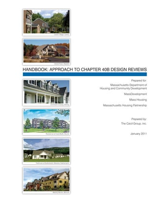
  • 1. HANDBOOK: APPROACH TO CHAPTER 40B DESIGN REVIEWS Prepared for: Massachusetts Department of Housing and Community Development MassDevelopment Mass Housing Massachusetts Housing Partnership Prepared by: The Cecil Group, Inc. January 2011 Canton Village, Canton Oxbow Road, Wayland Chocksett Crossing, Sterling Residences at Canal Bluffs, Bourne Treehouse at Easthampton Meadow, Easthampton Waverly Woods, Belmont
  • 2. B | TABLE OF CONTENTS
  • 3. Dear Reader, The 40B Design Handbook is a result of a collaborative process of the four Massachusetts housing agencies that are authorized to review and approve site eligibility for Chapter 40B affordable housing developments. This handbook is a reflection of these agencies and their commitment to ensuring that 40B affordable housing developments adhere to high standards of site and building design that enhance the quality of life for residents and the communities in which they reside. Chapter 40B has a long history of success in Massachusetts. Enacted in 1969, it is credited with having produced over 58,000 units of housing for owners and renters, seniors and families, special needs households and veterans. This handbook strives to create a shared language and vision of well-designed housing in order to create models of success for future developments to follow. Affordable housing is an art as well as an industry and we are committed to marrying the two. Sincerely, Tina Brooks Undersecretary Massachusetts Department of Housing & Community Development Robert L. Culver Executive Director MassDevelopment Thomas R. Gleason Executive Director MassHousing Clark L. Ziegler Executive Director Massachusetts Housing Partnership
  • 4.
  • 5. TABLE OF CONTENTS | i TABLE OF CONTENTS Section 1: Purpose.................................................................................1 Section 2: Requirements for Design Review..........................................3 c.40B Regulations on Design Elements...........................................................................................3 c.40B Guidelines on Design Review................................................................................................4 Section 3: Design Review Recommendations.......................................5 A. How Design Fits Into the Site Eligibility Review Process.............................................................5 B. Design Terms and Phrases Explained.........................................................................................6 C. Application Materials..................................................................................................................15 D. Checklist Review Procedure......................................................................................................19 Initial Project Review: Design Elements Checklist.........................................................................20 Checklist of Design Options for Integration into Existing Development Patterns..........................22 Attachment A: Key Design Issues........................................................25 Attachment B: Guidelines for Reviewing Designs................................27 Architectural Treatments.................................................................................................................27 Modulating Building Mass, Scale and Bulk....................................................................................27 Environmental Resources..............................................................................................................28 Parking and Access........................................................................................................................28 Buffering Techniques......................................................................................................................29 Attachment C: Reference Materials and Resources............................31 Subsidizing Agency Web Sites.......................................................................................................31 Online Maps and Aerial Photos......................................................................................................31 Figures Figure 1: Building Massing and Scale.........................................................................................6 Figure 2: Elevations of Different Building Types..........................................................................7 Figure 3: Range of Building Types...............................................................................................8 Figure 4: Conceptual Site Plans Over Aerials..............................................................................9 Figure 5: Aerial Photograph - Belmont, MA...............................................................................10 Figure 6: Development Using Topography and Vegetation as Buffer.......................................11 Figure 7: Surrounding Context - Ground Level Perspective......................................................12 Figure 8: Surrounding Context - Aerial Perspective...................................................................13 Figure 9: Elements for Consideration of Relationship to Adjacent Buildings and Streets........13 Figure 10: Settlement Patterns.....................................................................................................14 Figure 11: Conceptual Site Plans................................................................................................16 Figure 12: SketchUp Concept Plans - Use of 3D Modeling Software to Illustrate Project and Context......................................................................................18 Photo and Image Credits Cover – MassHousing, Oxbow Partners Fig 1 – Oxbow Partners, The Cecil Group Fig 4 – MHP, The Cecil Group Fig 5 – MassGIS All other photos and images provided by The Cecil Group Fig 6 – Oxbow Partners Fig 8 – Bing.com Fig 10 – MassGIS Attachment A – MHP, The Cecil Group
  • 6. ii | TABLE OF CONTENTS
  • 7. PURPOSE | 1 The Chapter 40B Design Principles Handbook (Handbook) was created to provide information and guidance for the design review process undertaken by the agencies subsidizing c.40B affordable housing projects in Massachusetts. Design review is necessary when evaluating new c.40B housing developments for consistency with the requirements of the c.40B regulations in terms of use, site planning and building design. The reason for creating this Handbook is that certain changes were recently made in the Chapter 40B program regarding review criteria for the siting and design of projects. These design elements are listed in the implementing regulations found at 760 CMR 56.04(4)(b) and (c). Using a list of criteria, the sections require findings: “that the site of the proposed Project is generally appropriate for residential development” and, “that the conceptual project design is generally appropriate for the site on which it is located” The c.40B Guidelines prepared by the Department of Housing and Community Development further define the reasons for this Handbook in the design review process for c.40B projects, specifically to: “…draw attention to factors that are of particular importance when introducing a Project into existing surroundings, encourage a uniform perspective among Subsidizing Agencies, and to create a more transparent review process…” This Handbook provides some suggestions for applying these program standards and goals in the early stages of the design process. The Handbook provides information for non-designers when making findings of conformance with the review criteria and requirements for the project proposals. The Handbook includes: • A glossary (Section 2, pg. 3 and Attachment A, pg. 25) to describe and help clarify the terms and criteria included in the regulations and guidelines, and how the terms may be applied in the design review process; • Typical submissions (Section 2, pg. 3) that convey a sufficient level of information for the reviews; and • A recommended process (Section 3, pg. 5) for reviewing the design criteria of projects submitted for eligibility reviews, including recommendations on the content and form of the applications. While this handbook is intended for the Subsidizing Agencies and the individuals who perform the design reviews under the regulations, the content will also inform Project proponents submitting Projects for Site Eligibility. However, this is only a recommended approach and each of the Subsidizing Agencies will determine their specific requirements for the design review. Those not involved in the design or review processes may use this information to understand the criteria that are considered by the Subsidizing Agencies in the review process. Section 1: PURPOSE
  • 8. 2 | PURPOSE The Handbook intentionally does not provide specific guidance on density, typically represented as units per acre, because the acceptable density of a given housing development is site- and context-specific. This Handbook instead suggests that the site and building design, not the numerical density, determines if a development is “generally appropriate for the site.” In some instances, a proposed development may contain more units than a site can reasonably accommodate. In those instances, the reviewing subsidizing agency may reject a proposed development that it determines to be inappropriate or make a determination that results in modifications of the project by the sponsor, including a reduction in size.
  • 9. REQUIREMENTS FOR DESIGN REVIEW | 3 Subsidizing Agencies, the primary audience for this Handbook, are responsible for determining Site Eligibility. Site Eligibility determinations are typically the first step for a c.40B Project and are completed with the issuance of a Project or Site Eligibility Letter. The Project or Site Eligibility Letter allows the Project to then be reviewed under a Comprehensive Permit process with the local zoning board of appeals. A review of the project design is included in this step and is required to complete the Findings before determining Site Eligibility. Recommendations on the means to analyze a Project design that integrates the Project into the existing development patterns have been provided in the c.40B Regulations and Guidelines, as summarized below. c.40B Regulations on Design Elements The implementing regulations for the law are found in 760 CMR 56.00. Within section 56.04(4) of those regulations, entitled Findings in Determination, there are a number of terms to consider related to use and design. The relevant subsections read as follows: “(b) that the site of the proposed Project is generally appropriate for residential development, taking into consideration information provided by the municipality or other parties regarding municipal actions previously taken to meet affordable housing needs, such as inclusionary zoning, multifamily districts adopted under M.G.L. c.40A, and overlay districts adopted under M.G.L. c.40R, (such finding, with supporting reasoning, to be set forth in reasonable detail); “(c) that the conceptual project design is generally appropriate for the site on which it is located, taking into consideration factors that may include proposed use, conceptual site plan and building massing, topography, environmental resources, and integration into existing development patterns (such finding, with supporting reasoning, to be set forth in reasonable detail);” The regulations at subsection (b) frame the considerations for the choice of a site for the Project. Using this standard, the determination of consistency should be defined as a general allowance for residential development. The regulations at subsection (c) then consider the Project design which at this early stage is a ‘conceptual project design.’ The Project design elements considered here include the use (expected to be predominantly residential), the building in terms of massing, site conditions defined by topography and environmental resources, and the Project’s ‘integration into existing development patterns.’ The c.40B Guidelines that were drafted to meet the goals stated in the Introduction to this Handbook define the ‘context’ of a Project by elaborating on the relationships with adjacent buildings and streets, as described in the next sections. Section 2: REQUIREMENTS FOR DESIGN REVIEW
  • 10. 4 | REQUIREMENTS FOR DESIGN REVIEW c.40B Guidelines on Design Review The c.40B Guidelines prepared by DHCD (revised as of July 30, 2008) suggest approaches for applying the regulations with some additional terms and phrases in section 3. Findings, Design (760 CMR 56.04(4)(c)): “Relationship to Adjacent Building Typology – Generally, a Project is developed in the context of single family dwellings and introduces a different form of housing into the neighborhood. Assuming that this is the case, it is important to mitigate the height and scale of the buildings to adjoining sites. In this context, it is particularly important to consider the predominant building types, setbacks, and roof lines of the existing context. • The massing of the Project should be modulated and/or stepped in perceived height, bulk and scale to create an appropriate transition to adjoining sites. • Where possible, the site plan should take advantage of the natural topography and site features, or the addition of landscaping, to help buffer massing. • Design may use architectural details, color and materials taken from the existing context as a means of addressing the perception of mass and height. Relationship to Adjacent Streets – Likewise, the manner in which the buildings relate to adjacent streets is critically important. Massing should take into account the pattern of the existing street frontage as well as maintain a human scale by reasonably relating the height of buildings to the width of the public way.” These elements form the criteria under which the design review process is executed. The next sections provide an approach for completing the reviews including the sequential steps for the review, further define the terms used in the process and provide the forms for consistent applications.
  • 11. DESIGN REVIEW RECOMMENDATIONS | 5 The recommendations of this Handbook are for the Subsidizing Agencies to follow common approaches in the reviews to promote a consistent design review process. For this purpose we will review: A. How Design Fits into the Site Eligibility Review Process (pg. 5), B. Design Terms and Phrases Explained (pg. 6), C. Suggested Information, to be supplied for the review (pg. 15), D. Suggested Checklist Review Procedure, with checklists (pg. 19). Each of these is further described in the following sections. A. How Design Fits Into the Site Eligibility Review Process The initiation of the Project/Site Eligibility process starts with an application for Site Eligibility by a Project proponent submitted to one of the Subsidizing Agencies. The content of that application is governed by the existing agency requirements. Note that while much of the regulatory criteria may be determined from a desktop review in the office and a checklist is recommended here to ensure the design elements are addressed, a site visit is highly recommended to understanding the context of the Project site from an on-the-ground perspective. Requests for additional design information at this time could include further descriptions of the means to address elements of the design and other supplemental information listed in the application requirements. However, detailed suggestions on design can be incorporated into the next stages of the project design process after agency review and after a comprehensive permit is issued and do not need to be fully addressed at this stage. These additional recommendations may be included in the Project Eligibility Letter. For successful projects, issuance of the Project Eligibility Letter is followed by the local permitting phase. With successful completion of the Comprehensive Permit the Project eventually goes back to the agency which is subsidizing the construction where more detailed project plans are submitted for funding approval. So while the design of a Project is a part of the initial review, the level of detail is commensurate with the early stages of conceptual design. Section 3: DESIGN REVIEW RECOMMENDATIONS
  • 12. 6 | DESIGN REVIEW RECOMMENDATIONS B. Design Terms and Phrases Explained This section of the handbook reviews definitions of the terms as applied in project reviews. Affordable housing projects under c.40B often have design elements that are different from the surrounding context as described by the terms used in the regulations; e.g., use, scale. However, with careful design and consideration of the project elements in relationship to the adjacent streets and properties, the projects can better integrate with the surrounding context. Consequently, to help describe these terms, the definitions here include the context in which these terms and phrases may be applied. The following terms are taken from the c.40B Regulations and Guidelines. Building Massing and Scale Buildings may be defined by simple dimensions of height and width, but they may also be described by the effective presence of those dimensions in terms of massing and scale. Massing is the “organization of the building’s overall volume”. As an example, building forms providing the same volume of space may be low and wide or tall and thin. The images in Figure 1 indicate some of these variations. Scale may be defined as the height and massing of a building and building elements and the relationship to surrounding spaces and structures. Common relationships are to the size of a human, to the context of the site, or in the relationships to adjacent buildings. The mass and scale of a building may be reduced by altering the building’s bulk. The features that can minimize the mass and scale should be about the same size as the same features on adjacent properties. The images in Figure 1 indicate some of these features. In this way, the building’s appearance may be improved. Such features may include: • Window shutters, corner boards and trim work around doors and windows. • Transitions of large to small building sizes by stepping down heights and lowering roof lines, attaching storage sheds and covering entry porches and patios. • Facades that are made more visually interesting by adding architectural bands that break up the siding or cladding. • Using a human scale for these features so that they are related to the size of a person using the building. • Natural forms can also be incorporated such as landscaping and land forms to add interest to the building’s surrounding areas. (see Figure 6) Figure 1 | Building Massing and Scale Note transition created by varied rooflines and colors Compare with above image and note the similarity of apparent scale and mass, yet buildings are separated Note facade elements, door and window treatments, that create a human scale Note composition of buildings on the land that are arranged with the topography and angled orientation to create private and common spaces
  • 13. DESIGN REVIEW RECOMMENDATIONS | 7 Building Typology Building typology is a classification of characteristics commonly found in buildings of similar construction. It may be defined by the building elements such as the structure of the building according to the design of the walls, columns and roofs, and other elements of the building façade such as bays, openings, and materials. Figure 2 illustrates two different building types and how they relate to the existing development on the right. Each prototype requires different site and building configurations. Affordable housing projects typically vary from surrounding building types, but within the range of building types of buildings in the neighborhood. The image on the bottom includes a townhouse building type with sloped roofs and building separations. The image on the top suggests an apartment building that is distinctly different in form, but a more efficient use of the land. These comparisons show how the variation in mass and scale that a chosen building typology can make. The graphic in Figure 3 shows a range of building types leading from low density to high density based on footprint, organization and height. Figure 2 | Elevations of Different Building Types STREET STREET STREET STREET STREET STREET APARTMENT BUILDING 24 Units 4 Units 2 Units Height difference TOWNHOUSES (with gables and peaked roofs) EXISTING HOMES EXISTING HOMES Note differences in height, density and style. While that particular apartment style on top is not similar to the existing homes, other building styles may provide similar densities.
  • 14. 8 | DESIGN REVIEW RECOMMENDATIONS Key design issues to review in the application materials and discuss with the applicant include: • Facade appearance and orientation - Does the proposed design front onto the street the same way as the adjacent properties? • Architectural and site details - Are the construction details of the proposed design compatible with the adjacent properties or minimize the differences between the new and existing structures? • Design treatments of the edge - Do the street and landscaping details minimize the differences or buffer the transition between the different sizes, materials or orientation of the new design and adjacent properties? See Attachment A for additional descriptions of the terms. Conceptual Project Design The Conceptual Project Design must sufficiently define the Project to allow decisions on the eligibility of the project for agency funding. A project’s design evolves from the simple idea to detailed drawings ready for construction. In the early stages of design, concepts are developed as tests to determine the project’s viability. Items typically shown in a Conceptual Project Design are the buildings and site improvements where the details and information relate to the context of the site and project. The details of building’s style and site design are limited but provide enough information to explain the approach. The images of site plans in Figure 4 show ways that conceptual project designs may be illustrated. Simple conceptual plans can provide enough detail for this stage of the review, when they are properly documented. Note that on Figure 4 in Image B, the information includes both graphics and notes to describe the proposed Project. On Image A the plan is laid on top of an aerial photo to help locate the Project and show how it may fit into the surrounding neighborhood. Figure 3 | Range of Building Types Building types: All of these could be appropriate in a suburban community depending on the site, design, and surrounding context. Low‐rise block 2 SFDU Low rise block Low‐rise block 2 SFDU Low rise block Low‐rise block 2 SFDU SINGLE FAMILY 3/4 FAMILY TOWNHOUSE APARTMENTS MULTI-FAMILY
  • 15. DESIGN REVIEW RECOMMENDATIONS | 9 Figure 4 | Conceptual Site Plans Over Aerials Conceptual plan with notes and text. Conceptual plan shows neighborhood above and river below project area. Source: Elkus Manfredi Architects A B
  • 16. 10 | DESIGN REVIEW RECOMMENDATIONS Environmental Resources The site’s environmental resources are generally submitted on a survey or an aerial photo-graph. As shown in the example in Figure 5, the natural and manmade features shown in this aerial map of Belmont, MA are trees or vegetative land cover, wetlands and waterways as well as open areas and buildings. Additional information may be collected with site pho-tographs and site visits. Some wetland areas are determined in accordance with state laws and regulations (see 310 CMR 10.00). The adjacent image of the regulated wetland areas may not be obvious on the site however. If there is an indication of a wetland on the site, sur-vey, or aerial plan, ask whether such a determination has been officially made and have it shown on the submitted plans with the date of determination. Topography Topography is the variation in ground elevation. The topog-raphy across a site and in the adjacent areas can be both a limitation and a benefit to site development. Steep and highly varied topography may be used as desirable features of a site or may require substantial reworking of the grades to allow site improvements. Flat sites may require less for improve- Undeveloped land Golf course Open water Highway interchange Potential wetland Residential development Figure 5 | Aerial Photograph - Belmont, MA Plan showing wetlands with river setbacks. Aerial photos can provide information on land cover and potential environmental resources. Source: MassGIS
  • 17. DESIGN REVIEW RECOMMENDATIONS | 11 ments but may hold less visual interest and could have drainage problems. Note that site improvement and development costs increase with substantial site regrading. For example, severely steep slopes and bedrock will add significant costs if they are part of the site development plan. In site planning, the topography must be sufficient to plan at the scale of the project. This may require a contour for every half-meter, or every two feet, to greater intervals (one meter) on larger areas or flat sites. Half-meter or two-foot contours are typical for site planning but available topography may be used in the initial project planning stage. Information on topography can be obtained from the town or city hall or may be available in the MassGIS data. The images in Figure 6 show how topography and vegetation were used as a visual buffer and features in the Project’s design development. Figure 6 | Development Using Topography and Vegetation as Buffer Vegetated mound along frontage softens visual impact of building Vegetated drainage basin provides a different buffer
  • 18. 12 | DESIGN REVIEW RECOMMENDATIONS Surrounding context The surrounding context is defined by the existing development patterns outside of the site. From the c.40B Guidelines, specific reference is made to adjacent building typology and adjacent streets. Assuming that the new buildings will vary from the surrounding buildings, consideration should be given to the differences in architecture and settings. The conditions of the adjacent streets may define access points that in turn affect site layouts. The location of the buildings in relation to the streets may also be a factor in the visual impact of the building, as the following images in Figure 7 show. Figure 7 | Surrounding Context - Ground Level Perspective At the same scale, the buildings above create a more suburban image while the buildings below work in an urban setting. A sidewalk landscape buffer would soften the lower image.
  • 19. DESIGN REVIEW RECOMMENDATIONS | 13 The aerial image (Figure 8) below is a perspective that provides a view of buildings within a neighborhood. It is not a typical or common view in that the general public and adjacent properties do not see the property from this viewpoint. However, this type of view may be used to indicate how the differences of the buildings may be recognized. The cross section below (Figure 9) indicates the ways in which the location and design of the proposed buildings may also be defined spatially in relation to surrounding streets and buildings. Again, this is not a common public viewpoint but helps illustrate and define relationships. Figure 8 | Surrounding Context - Aerial Perspective Figure 9 | Elements for Consideration of Relationship to Adjacent Buildings and Streets STREET BUFFERED PARKING AREA PROPOSED BUILDING Height ACCESS WAY HOUSE HOUSE STREET EXISTING NEIGHBORHOOD Separation to Buildings Separation to Street Landscape Buffer View Lines View Lines A low-angle image, which are available online, provides a different perspective. See Attachment C for online resources.
  • 20. 14 | DESIGN REVIEW RECOMMENDATIONS Existing development patterns The adjacent properties and neighborhood should be considered in the Site Eligibility review. The surrounding and existing development patterns will often vary within a community. Sites may include less developed areas of residential, commercial, or industrial land use. However, a wider view of the neighborhood may suggest a recognized pattern of settlement. The illustration below (Figure 10) shows the variability of settlement patterns within one community. A site may be located in the generally rural area but adjacent to residential tracts. Again, while the resources are available to obtain a substantial amount of information, the site visit is still an important part of the review. Figure 10 | Settlement Patterns Note that a project in any of these areas requires a different design approach to remain in context with adjacent development.
  • 21. DESIGN REVIEW RECOMMENDATIONS | 15 C. Application Materials To complete the review as envisioned requires submittal of application materials that properly explain the project. There is no need for a significant level of design detail at this stage because these are concept plans. But there is a need to have a clear understanding of the conditions at the site, the proposed Project concept and potential conflicts. With the online resources currently available (see Attachment C for resources), many of the requests for illustrative graphics and information are fairly simple to accommodate as noted below. The officially required submittal materials for Site Eligibility are listed in sec. 56.04(2). It is also important to review the application requirements of the subsidizing agency. The items pertinent to design review include: (a) a locus map identifying the site within a plan of the neighborhood, accompanied by photographs of the surrounding buildings and features that provide an understanding of the physical context of the site; (b) existing conditions at the site such as wetland boundaries and setback lines, topographic relief, and current use; (c) a tabulation of proposed buildings with the approximate number, size (number of bedrooms, floor area), and type (ownership or rental) of housing units proposed; (d) conceptual design drawings of the site plan and exterior elevations of the proposed buildings, along with a summary showing the approximate percentage of the tract to be occupied by buildings, by parking and other paved vehicular areas, and by open areas, the approximate number of parking spaces, and the ratio of parking spaces to housing units; and any other parking requirements for ancillary uses; (e) a narrative description of the approach to building massing, the relationships to adjacent properties, and the proposed exterior building materials; (f) a tabular analysis comparing existing zoning requirements to the waivers requested for the Project. The following are recommended submittals for information to support these requests for information: Description of the project site and surrounding buildings and features The area to be described should extend from the subject Site into all adjoining properties. [Additional areas may be in review after the site visit.] The description should include a survey or plot plan with designations of current use and zoning. The local assessor’s office may be able to provide information on the use designation of the site and adjoining land to determine property and adjacent use and lot configurations. The description should be supplemented with aerials and photos, which are available online, as per the example below. The description should also include a series of photos taken from within and outside the site showing all adjacent properties. These photos should be eye-level and taken so that the interior of the site and adjoining property are represented on all sides. Aerial images may be obtained for any location either through the state (MassGIS at http://www.mass.gov/mgis/massgis.htm) or from free online resources such as Google maps (http://maps.google.com/maps) or Bing maps (http://www.bing.com/maps/). This image (right) is from Bing maps showing the level of detail and information possible with this source. Aerial obtained from Bing Maps
  • 22. 16 | DESIGN REVIEW RECOMMENDATIONS Figure 11 | Conceptual Site Plans The plans show different aspects of design. Image 1 is a hand-drawn sketch; image 2 is a computer-aided design, while image 3 is a plan that shows certain existing site information. 1 3 2
  • 23. DESIGN REVIEW RECOMMENDATIONS | 17 Conceptual design plans or site concept drawings The conceptual design or site concept plans are inter-related terms. At this stage of the project development these plans could be expected to be fairly simple, so long as they convey the correct amount of information needed for the review. The basic information required includes: (1) Siting of buildings, parking and accessways (2) Adjacent properties and buildings (3) Width of the right-of-way with elements and dimensions of ways in adjacent public streets (4) Topographic contours across the site and into adjacent properties (5) Wetland resources as regulated under state regulations 310 CMR 9.00 et seq. (6) Site and environmental restrictions in the form of easements and any Activity and Use Limitations Examples of conceptual plans with much of the basic information are shown on the previous page (Figure 11). Each represents a way to present a complex set of information and ideas in simple, easily accessible formats. The plans should include a table of dimensions and other data that may be included in the other application materials. The illustrations in Figure 11 show how site plans may be laid over aerial photos to provide a good source of information on a Project and its relationship to the adjacent streets and buildings. Description of the proposed buildings The description of the proposed buildings should provide enough information to determine what the proposed building typology is and describe any architectural or site design elements that will help integrate the Project with the existing development patterns. A simple method to represent buildings in the early stage of design is by using a three- dimensional graphic software program available for free on-line. The images in Figure 12 are an example of illustrative site plans using the SketchUp program, which is available for free, on-line (http://sketchup.google.com/). This application of the program shown below can be used to indicate building massing and form. When the adjacent buildings are also drawn in the program, the context of the surrounding area can also be illustrated.
  • 24. 18 | DESIGN REVIEW RECOMMENDATIONS Figure 12 | SketchUp Concept Plans - Use of 3D Modeling Software to Illustrate Project and Context These low-angle projections show old and new development using different colors and show how the sizes and orientations relate to the surrounding context. In the top image existing is shown in orange and new is shown in yellow. In the bottom image existing is shown in white and new in grey.
  • 25. DESIGN REVIEW RECOMMENDATIONS | 19 D. Checklist Review Procedure To facilitate the review procedures for a non-designer, and to provide clarity for others involved in the design review process, a checklist is recommended. This will encourage consistent and complete decisions on the design elements and a focus on the design aspects that may require mitigation. Of particular concern is the impact the Project’s design will have on adjacent properties. A suggested checklist is shown on the following page. This checklist simply lists the design elements listed in the regulations and allows an initial determination of conformance.
  • 26. 20 | DESIGN REVIEW RECOMMENDATIONS Initial Project Review: Design Elements Checklist This checklist is to determine whether “the conceptual project design is generally appropriate for the site.” The regulations found at section 56.04(4)(c) define conformance when considering the factors listed in the left hand column. Checklist of conformance with section 56.04(4)(c) Project: Location: Reviewer: Date: FACTOR FINDINGS 40B design regulations Integration with adjoining properties Proposed Use Acceptable Not addressed Acceptable Requires additional discussion Conceptual Site Plan Acceptable Not addressed Acceptable Requires additional discussion Building Massing Acceptable Not addressed Acceptable Requires additional discussion Environmental Resources Acceptable Not addressed Acceptable Requires additional discussion Topography Acceptable Not addressed Acceptable Requires additional discussion Areas to consider in future review of the design:
  • 27. DESIGN REVIEW RECOMMENDATIONS | 21 Detailed Project Review: Design Review Checklist This second checklist is an optional approach for developing a response to the proposed design, based on the design review criteria from the DHCD c.40B Guidelines.
  • 28. 22 | DESIGN REVIEW RECOMMENDATIONS Checklist of Design Options for Integration into Existing Development Patterns Project: Location: Reviewer: Date: Review each of these design elements to form the overall design review findings. (See Attachment A: Key Design Issues for further discussion on these elements) Integration with adjoining properties Relation to Surrounding Structures and Public Spaces Acceptable Not addressed Unacceptable Why unacceptable: Architectural and Site Details Acceptable Not addressed Unacceptable Why unacceptable: Scale (descriptor) Acceptable Not addressed Unacceptable Why unacceptable: Height Acceptable Not addressed Unacceptable Why unacceptable: Proportion Acceptable Not addressed Unacceptable Why unacceptable: Shape or Form Acceptable Not addressed Unacceptable Why unacceptable: Façade Design Acceptable Not addressed Unacceptable Why unacceptable: Streetscape and Landscape Acceptable Not addressed Unacceptable Why unacceptable: Design Treatments of the Edge Acceptable Not addressed Unacceptable Why unacceptable: Building Setbacks Acceptable Not addressed Unacceptable Why unacceptable:
  • 29. DESIGN REVIEW RECOMMENDATIONS | 23 Building Height and Stepbacks Acceptable Not addressed Unacceptable Why unacceptable: Facade Length and Articulation Acceptable Not addressed Unacceptable Why unacceptable: Are the Guidelines for Reviewing Design addressed? (See Attachment B for additional discussion) Integration with adjoining properties Architectural Treatments Acceptable Not addressed Unacceptable Why unacceptable: Modulation of Building Mass, Scale and Bulk Acceptable Not addressed Unacceptable Why unacceptable: Environmental Resources Acceptable Not addressed Unacceptable Why unacceptable: Parking and Access Acceptable Not addressed Unacceptable Why unacceptable: Buffering Techniques Acceptable Not addressed Unacceptable Why unacceptable: Areas to consider in further review of the design:
  • 30. 24 | DESIGN REVIEW RECOMMENDATIONS
  • 31. ATTACHMENT A: KEY DESIGN ISSUES | 25 This section provides a more detailed description of elements of design that may be considered in a design review. Design review requires a balanced judgment based on consideration of the goals of affordable housing. The criteria include the Chap. 40B regulatory criteria, the surrounding context, and the proposed design as a composition of these elements. In almost all cases, design review decisions will not be an absolute finding of conformance, but will be based on a thoughtful analysis of how these Chap. 40B criteria apply. Note that in the cases where the surrounding context is a complex mix of buildings decisions of context could be made from review of local plans, regulations and other precedents. The following are key design elements to consider when determining if a Conceptual Project Design is generally appropriate for the site and relates to surrounding context. This list is meant to be used with Checklist of Design Options (pg. 22) to facilitate the review process. Relation to Surrounding Structures and Public Spaces – The relationships between the Project and the adjacent sites are a key aspect of Chapter 40B design review. The following terms are taken from the regulations and therefore, should be used to make decisions during the review. Architectural and Site Details – Architectural details include items such as the trim around entrances, corners, eaves, doors and windows; exterior cladding materials; and roof type. Site details include the type of curb, design of access into and through the site, signage, paving arrangements, lighting, landscape buffers and fences for example. The coordination of these features can result in a project’s overall impression as a nice place to live and contribute to the community’s character. Scale – The scale of a structure should be compatible with the surrounding architecture and landscape context. Compatibility of different building scales or sizes may be addressed through building typology, orientation, roof lines, setbacks, and the position of the building on the site. That is to say, the size of these elements relate proportionally to the size of the human body. Height – The height of the proposed buildings should generally be compatible with the surrounding buildings and structures. The treatment of rooflines, setbacks, and position of the building on the site may be used to mitigate differences in height. See also Building Height Stepbacks. Proportion – The proportions of building elements can define the character of a building. The widths, heights, and separations of doors, windows, signs and other architectural elements should be generally compatible with existing buildings and structures. Shape or Form – Within the site’s boundaries, there are edges that when differentiated produce better site designs. The shape of the building and building elements is another way to consider compatibility with existing structures. Attachment A: KEY DESIGN ISSUES A B C Note the differences between these project images showing different buildings with similar characteristics. The building in image A is two stories, building B is two and a half stories, and building C is three stories in height. All three buildings have peaked roofs with a higher pitch of the roof on building B. Each has a porch or porches but with different styles. Buildings A and B have clapboard siding and building C is shingled because building C is on Cape Cod in a neighborhood of shingled buildings. The proportions of building A, with the line of three windows and porch on the first floor and a trim board architectural band linked to the porch eave suggest a more squat, grounded building, while building B with the tall bay on the left side and the windows with side lights suggest a taller, but thinner building. Building B also includes panels under the roof peaks as an element that is intended to bring the eye down to the clapboards for mitigation of height. The entrances on building B are more prominent than buildings A and C. The façade on building C is articulated with the building wings, porches and the roof lines. While not shown, the surrounding context of each building helped inform these designs.
  • 32. 26 | ATTACHMENT A: KEY DESIGN ISSUES Façade Design – The facade is literally a French term meaning “the face”. It is a combination of design elements that when artfully composed create a harmonic impression. Just as we can have long and narrow or wide and open faces, so do buildings. A rule of thumb would have new construction mirror some aspects of the facade design of neighboring buildings so as to create a continuity across projects. Streetscape and Landscape – Perimeter streetscape and interior landscape treatments may include grading, planting and site amenities. The site landscaping and grading can be designed to soften the visual impact of a project. The landscape can also perform multiple duties for stormwater management and site improvements. Continuity of design with the public street may be appropriate; as for example to continue sidewalks and lighting, when present. Design Treatments of the Edge – An edge is a physical element which defines or separates space. Edges identify areas of different or conflicting activities, changes of urban scale or character, and areas of different landscape qualities. The edge is the most important element when designing an exterior space. Weak edge definition lacks separation of activities or views. Visual and spatial interest is also reduced. Strengthening of edges (including curbing, shrubs, screening, and street trees) enhances the overall visual experience. Plant materials have been used extensively to enhance the visual quality of new construction. They can provide visual relief, define space, and add aesthetic character to developed areas. They also provide shade, reduce surface heat and help filter air pollution. Some typical methods of improving the edge of a given development include the following: • Trees - can be used to provide scale and define space, shade, and variation on color and textures. • Shrubs – provide scale and interest in pedestrian areas. They provide a natural and physical barrier when needed. Variety in color and texture can be accomplished with a variety of plant materials. • Groundcovers – and vines are useful for providing texture and visual relief to ground and wall surfaces. Once established, these plants provide visual interest to otherwise plain surfaces. Building Setbacks – The creative use of setback areas, particularly the front and side yards, can be designed to enhance pedestrian access, outdoor accessory uses, or to facilitate access to the rear of the lot for parking and loading. Parking should typically not be included in the front setback when possible. Conceptual Site Plans should demonstrate that the setback area design accomplishes the community’s planning objectives and creates an inviting environment for pedestrians. Where rear yard setbacks are necessary, Conceptual Site Plans should demonstrate that appropriate screening is provided (i.e. trees, shrubbery and fencing as needed). In some settings (i.e. downtowns and other urban environments), minimizing building setback from a public street right-of-way is desirable so that the front and street side facade of the building visually reinforces street enclosure. This is often coupled with more formal streetscape improvements (i.e. concrete/brick pavers, street trees and furniture, decorative lighting consistent with equipment used by the municipality, and designated dining or retail display in mixed use developments). Building Height Stepbacks - The design objective of a building stepback is to reduce the shadowing effect on public streets and surrounding buildings and prevent a “canyon” effect when taller buildings are located directly across the street from, or adjacent to, one another. At the same time, street enclosure (or the “Street Wall”) is an important design element in establishing or reinforcing surrounding development patterns. A typical building stepback requirement would specify that building height within a certain Note in a rural/suburban context, street trees soften the edge while sidewalks may or may not be included depending on the adjoining streets and project type. Image A suggests a development within an area of single family residences. Image B shows an apartment complex within master planned development with a mix of residential building types. Note the use of peaked roofs, articulated facades and buildings, and landscaping to improve the design. A B
  • 33. ATTACHMENT A: KEY DESIGN ISSUES | 27 distance of the street right of way line not exceed a certain limit (stories or vertical feet). This height at the street right of way line may then be increased by a prescribed amount (in stories or feet) for interior portions of the building that are setback a further distance from the street right of way line. Building setback requirements may also specify certain roof styles, directional orientation and pitch facing to ensure compatibility with the surrounding area and established building patterns. Building stepback requirements may also specify that those portions of the roof in the stepback area may be used for certain specified accessory uses such as rooftop gardens, terraces, or similar uses. Façade Length and Articulation - Buildings or portions of a building with wide elevations can be divided into smaller parts through pronounced variation in wall plane articulation and materials and variations in the cornice/roofline to accomplish the desired divisions of elevations into smaller parts. This design technique is an effective way of breaking up the horizontal massing of the building.
  • 34. 28 | ATTACHMENT A: KEY DESIGN ISSUES
  • 35. ATTACHMENT B: GUIDELINES FOR REVIEWING DESIGNS | 29 The following are short descriptions of design elements and ways they may be considered in the context of the regulations and guidelines when reviewing a Project. Architectural Treatments Possible architectural treatments and design techniques to address the general compatibility of the Conceptual Site Plan with the existing building pattern in the surrounding area may include the following: Site Appearance – The character, layout and general composition of the site, including but not limited to the kind, color and texture of such materials as plantings, paving, benches, site lighting, utility structures and all other appurtenant elements should be generally consistent with the existing building patterns in the surrounding area. Exterior architectural appearance – The architectural character and general composition of the exterior of a building, including but not limited to the kind, color and texture of building materials, including paint color, and the type, design and character of all windows, doors, light fixtures, signs, awnings, utility and ventilation structures and all other appurtenant elements. Architectural features – Use of architectural features and details such as porches, awnings, columns, towers, turrets, skylights and arches, are effective methods of creating interesting buildings. Fenestration – Door and window openings should be proportional to facade length and height. The building design should create a sense of entry into the site through landscaping, facade treatment and signage. Modulating Building Mass, Scale and Bulk Design techniques for modulating building mass, scale and bulk may be used to address the general compatibility of the Conceptual Site Plan with the existing building pattern in the surrounding area. Techniques include: Building Orientation – The relationship of a building to the adjoining public way is best when it faces the street. While an attractive building wall and facade should always be presented to the public side of the property, when the longer walls are oriented away from the public view, the building form will appear smaller in bulk. Roof Pitch, Style and Elements – Roof pitch is an important design element is determining general compatibility with existing building patterns in the surrounding area. Attention should be paid to the range of roof styles and range pitches that are common in the area from flat roofs to steeply pitched roofs (i.e. 6 in 12 inch pitch), and elements such Attachment B: GUIDELINES FOR REVIEWING DESIGNS
  • 36. 30 | ATTACHMENT B: GUIDELINES FOR REVIEWING DESIGNS as dormers, parapets, turrets, etc. Long unbroken expanses of roofs should be avoided though use of dormers, skylights, chimneys and changes in ridge line. Wall Expanses – The use of facade divisions, such as building jogs, architectural detailing, and changes in surface materials, colors, textures and roof lines are an effective design technique for modulating building mass and scale. Facades on all sides of the building which are visible from public streets should feature characteristics similar to the front facade. Building Entrances – Entrances should be designed on the facades that front on and have a principal pedestrian access to a public street. New buildings should provide for the creation of pedestrian alleyways, where appropriate, in order to allow for passageways to parking at the rear of the lots and adjoining streets. Environmental Resources Natural Cover – The existing, natural cover of trees and shrubs on a site may provide a desired landscape buffer. The condition and type of vegetation should be considered as some robust plantings may be undesirable species or the vegetation may be in poor condition. Topography – Topographic contours can provide opportunities for mitigating the bulk of a building, or conversely, further expose the structure and its foundation. Significant modification of the existing topography adds costs to the Project and should be considered only when other options are unavailable. Parking and Access Access Management – In reviewing Conceptual Site Plans, consideration should be given to possibilities for improvements to pedestrian and vehicular circulation in relation to existing building patterns in the surrounding area. Some specific design techniques may include closing, sharing, or consolidating curb cuts; creating easements and links with adjoining uses or properties, moving parking areas to rear yards; merging parking areas to more effectively and efficiently use land; and connecting internal site sidewalks, paths, and crosswalks with external transportation systems. Parking and Circulation – In reviewing Conceptual Site Plans, consideration should be given to on-site parking and circulation as it related to the surrounding area. Applicants should demonstrate that adequate spaces have been provided but avoid excessive parking. Parking and circulation should also be designed to provide for the maximum pedestrian safety, ease in traffic flow, and access/egress on the property, while minimizing the need for impervious surfaces which increases storm water run-off and costs among other impacts, and maintaining the visual character of the property and adjacent areas. Some general parking and circulation design methods are as follows: • Locate parking access to the side or to the rear, when such are available. • Minimize vehicular parking next to a street frontage to the lowest possible number while maintaining safety. • Mask parking areas from the street frontage by buildings or appropriate landscaping. • Individual parking spaces should be designed, maintained and regulated so that no parking or maneuvering incidental to parking is on any public street or sidewalk and so that any automobile may be parked and un-parked without moving another automobile.
  • 37. ATTACHMENT B: GUIDELINES FOR REVIEWING DESIGNS | 31 • If artificially lighted, such lighting should be so designed and arranged that light is directed away from any adjoining property and so designed and arranged as to shield public roadways and all other adjacent properties from direct glare or hazardous interference of any kind. • Installation of curbs, motor vehicle stops or similar devices so as to prevent vehicles from overhanging on or into public rights-of-way or adjacent property. Buffering Techniques Landscaping Design – Consideration should be given to possibilities for maintenance and enhancement of the existing landscape to provide a transition and bridge the gap between public and private space. Some specific landscape design techniques for public and private frontages are discussed below: Public Frontages • Street Trees – The Public Frontage may include trees planted in a regular spacing pattern of varied species with shade canopies of a height that, at maturity, clears a certain height (depending on streetscape characteristics of the surrounding area), but remains predominantly clear of building frontages. The introduced landscape should consist primarily of durable species tolerant of salt and soil compaction. Private Frontages • Existing Significant Trees and Shrubs – should be maintained to the maximum extent possible. • Plantings – should not obscure site entrance and exit drives and road intersections. • Mixed Use Developments – When the front setback is greater than zero, those portions of the front yard not occupied by pedestrian amenities and public spaces should be landscaped. • Residential Developments – Private Frontage landscaping along the perimeter of the lot is an effective design tool when buffering a development from the surrounding area is necessary. In addition to retaining existing vegetation, new landscape plantings may include a combination of grasses, trees and shrubs indigenous to Massachusetts. • Street Trees – Trees of a sufficient caliper are suggested in a regular pattern along the frontage of property if the building is setback a sufficient distance to allow trees to property grow and spread out. All landscaped areas should be continuously maintained, irrigated, and fertilized. Plant materials should be organically maintained to the maximum extent possible. Parking Lot Landscaping • Shade Trees – Trees in paved areas and parking islands should have a sufficient amount of permeable area for proper growth. Selected species should have low water needs, salt tolerance, and low maintenance • Buffering – Portions of the interior parking area should be landscaped, and planting along the perimeter can be effective in reducing the visual impact on the area when necessary. • Stormwater Treatment – Stormwater should be sufficiently controlled and treated by either conventional methods or by evolving Low Impact Design techniques such as rain gardens, vegetative swales, bio-retention, filter strips, and pervious pavers.
  • 38. 32 | ATTACHMENT B: GUIDELINES FOR REVIEWING DESIGNS • Storage Areas – Exposed storage areas, machinery, garbage “dumpsters,” service areas, truck loading areas, utility buildings and structures should be screened from view of residents on abutting properties and streets using plantings, fences and other methods. Where feasible, shared use and designated areas for garbage dumpsters are an effective design technique. Trash dumpsters should be fully screened on three sides with solid walls of a sufficient height with a solid front gate. Trash compactors should be enclosed to minimize noise. • Fences – Opaque or semi-opaque fencing may be necessary in some cases to sufficiently screen surrounding areas. The materials, color, and height above the grade plane should be generally consistent with the existing or desired building patterns in the surrounding area.
  • 39. ATTACHMENT C: REFERENCE MATERIALS AND RESOURCES | 33 Subsidizing Agency Web Sites To find out more about agencies that subsidize affordable housing projects and their programs: MassHousing – www.masshousing.com Mass Housing Partnership – www.mhp.net Mass Department of Housing and Community Development – www.mass.gov/dhcd/ MassDevelopment – www.massdevelopment.com Online Maps and Aerial Photos On line maps and aerial photographs are available from these sources: (1) Google maps – www.maps.google.com (2) Bing maps – www.bing.com/maps/ (3) USGS maps – http://topomaps.usgs.gov (4) Visualizing Density, Julie Campoli and Alex MacLean, Lincoln Institute of Land Policy, Feb 2007 State Environmental Regulations • Environmental regulations – www.mass.gov/eoeea/ The Housing and Urban Development’s Design Advisor • The Housing and Urban Development’s Design Advisor [with 2004 Updates sponsored through the Campaign for Excellence in Affordable Housing Design] may be found on line (www.designadvisor.org). The site provides a primer on affordable housing design with examples from around the country of ways in which high quality design elements have been incorporated. Accessibility Codes • There are building and design codes specific to accessibility; such as, Federal Fair Housing Act, Americans with Disabilities Act, and the Massachusetts Architectural Access Board. The reviewer should be aware that the designers must determine conformity to the provisions of these regulations. Attachment C: REFERENCE MATERIALS AND RESOURCES
  • 40. 34 | ATTACHMENT C: REFERENCE MATERIALS AND RESOURCES Other Related Information • The Smart Growth Toolkit may be consulted for information on the State’s smart growth and energy policies (http://www.mass.gov/envir/smart_growth_toolkit/). This site includes summaries of Low Impact Development and Smart Energy issues and ideas. • Planning and Urban Design Standards, by the American Planning Association and published by John Wiley & Sons (2006) includes information on conceptual site planning.
  • 41.
  • 42. HANDBOOK: APPROACH TO CHAPTER 40B DESIGN REVIEWS Prepared by: THE CECIL GROUP, INC. | DECEMBER 2010