
Recommended
More Related Content
What's hot
What's hot (20)
Similar to F3 Village Development
Similar to F3 Village Development (20)
More from Southern New England American Planning Association
More from Southern New England American Planning Association (20)
Recently uploaded
Recently uploaded (20)
F3 Village Development
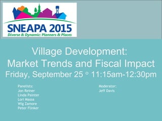
- 1. Village Development: Market Trends and Fiscal Impact Friday, September 25 11:15am-12:30pmᵒ Panelists: Moderator: Jon Reiner Jeff Davis Linda Painter Lori Massa Wig Zamore Peter Flinker
- 2. North Kingstown, RI The Planning Framework Jon Reiner
- 3. Redirecting Growth and Development • Historic Villages • Emerging Villages • Compact Development patterns • Transfer of Development Rights • Incentives and Policies
- 4. TDR The Concept sending area Owner of “sending” parcel sells development rights in exchange for permanent conservation easement. Owner of “receiving” parcel buys development rights to build at densities higher than allowed under base zoning. receiving area
- 5. Where can this happen today? • Sending Area: Sending Area Overlay District • Receiving Area: Post Road District Wickford Junction Compact Village District
- 6. The Wickford Junction Train Station
- 8. • What this will do for us? • Give us direction for solutions and an awareness of the market • What is the market reality and need for: – Retail – Office – Housing – Hospitality – Infrastructure – Smart growth vs. conventional development “Add on” projects: • Pro forma analysis; • TDR Value analysis. Market analysis
- 10. Village Economics September 25, 2015 Linda Painter
- 11. Where is Storrs Center? Located at the heart of the Mansfield and UConn community
- 12. What is Storrs Center? Phase Retail SF (% Leased) Residential Units (% Leased/Sold) 1A 28,000 (100%) 127 rental (100%) 1B 42,000 (100%) 195 rental (100%) 1C 16,000 (100%) 92 rental (100%) 2 50,000 (50%) 204 rental (100%) 4 37,000 (100%) – Total 173,000 (85%) 618 (100%) New Phases 3 – 42 for-sale (57%)
- 13. Then
- 14. Now
- 15. Then
- 16. Now
- 17. Then
- 18. Now
- 19. Then
- 20. Now
- 21. Then
- 22. Now
- 23. Project Planning o Mansfield Downtown Action Agenda 2000 – identified vision and evaluated market potential for creation of a new downtown o 2002 Master Plan included target market strategies o 2005 Municipal Development Plan based on 2003 market study o 2007 – Adoption of Special Design District
- 24. Evolution of a Partnership o Public Private Partnership (P3) – Town, University, Private Sector Mansfield Downtown Partnership established in 2002 Partnership officially designated as Town’s municipal development agent Master Developer (Leyland Alliance) selected in 2004 EDR added to development team in 2008
- 25. Formalizing the Partnership o Fiscal Impact Analysis (2008) Impact Analysis commissioned by Master Developer Town retained its own consultant to review the analysis and recommend refinements Study estimated annual net revenue of $2.6M at build-out
- 26. Formalizing the Partnership o Development Agreements (2011) Master Developer and Mansfield Downtown Partnership Master Developer and Town of Mansfield Master Developer and UConn (land acquisition; water and sewer service)
- 27. Project Financing o Approximately $200 Million of Private Investment o Infrastructure improvements funded by over $25 Million in State and Federal Grants o Town projects financed completely through grants and fundraising; no bonds or debt issued
- 28. Incentives o Developer 7-Year Tax Abatement for Phases 1A and 1B Reduced Permit Fees Town responsible for construction of public improvements (garage, streets, town square) Receives excess parking garage revenues (after contributions to Town repair reserve fund) o Town Town owns parking garage; Developer operates until 2030 Developer responsible for environmental remediation Approximately 25 acres preserved as open space Tenant Relocation Program – No eminent domain; jointly funded by developer and Town
- 29. Fiscal Impacts FY16 Projected General Fund Revenues: $48,832,250
- 30. Fiscal Impacts: Diversifying the Tax Base
- 31. Fiscal Impacts: Reducing Burden on Homeowners
- 32. Fiscal Impacts: Projections vs. Reality
- 34. Assembly Row, Somerville MA Lori Massa and Wig Zamore
- 39. Public / Private Partnership •State’s Infrastructure Investment Initiative (I-Cubed) Bond Program $50 million •Federal Stimulus American Recovery & Reinvestment Act (ARRA) grant for roadway construction and off-site improvements $15 million •State’s Growth District Initiative (GDI) Grant to construct sub-surface infrastructure $2 million •District Improvement Financing $25 million
- 40. MTBA Orange Line Station in Assembly Square – opened Sept 2014 $52 million is required to build the station including two head houses. • Federal Transportation Earmark $1 million • State (MPO) $12 million • State (Other Grant Sources) $18 million • Private Contribution $15 million • Congressional Multi-modal Earmark $6.26 million Public / Private Partnership
- 41. Benefit to the General Fund Blocks 1, 3 & 4 36,258 FY FY FY FY FY FY FY FY FY FY FY 52,561,988 FY FY FY FY FY FY FY FY FY FY FY FY FY FY FY FY FY FY FY FY FY FY Annual Benefit Cumulative Benefit
- 42. FY 15, 60% of new commercial & industrial growth was in Blocks 1, 3 & 4 Tax increase avoided: Avg condo -$38 Avg 1-family -$53 Avg 2-family - $60 Avg 3-family -$69 Avg 4-8-family -$89
- 43. Burden of property tax levy Commercial 15% of total value – City shifts additional 175% % not changing greatly yet - residential values increasing 2012-2015 71-73% 27-29% CLASS Residential Commercial City-wide growth projections by 2025 65% 35% CLASS Residential Commercial RATES $12.70 $20.52
- 44. Permit Fees (core & shell) Block 1 $578,000 Block 2 $87,400 Block 3 $740,000 Block 4 $587,500 Block 6 $2 M Block 10 $11,500 Block 11 $4.2 M Total $8.2M $19 per $1,000 & plan review $4 per $1,000
- 45. Village Economics SNEAPA 2015 Peter Flinker Dodson & Flinker
- 46. Historic RI Villages grew organically to serve an economic purpose within a particular landscape context Agricultural Village: Little Compton Mill Village: Peacedale Harbor Village: Wickford
- 47. Cranbury, New Jersey Suburban Sprawl follows a different economic equation.
- 48. Is this the highest and best use?
- 49. What is the role of the village in the 21st Century Economy?
- 50. Conventional Development as required by zoning
- 53. Analyzing Village Economics Market Analysis: •What uses are needed in the community? •What will be successful in the real estate market? Fiscal Impact Analysis: •What is the projected tax revenue? •What are the costs of local services?
- 54. Economic Census Data North American Industry Classification System
- 55. Exeter Market Analysis: Potential Village Locations
- 56. Analyzed demographic and income profiles for populations living within 5, 10 and 15 minute drives
- 57. Fiscal Impact Analysis Process: 1. Estimate the Basis of Future Demand (how much and what kind of development) 2. Estimate Revenue (property taxes, excise taxes, fees, etc.) 3. Estimate Costs (education, roads, sewer & water, public safety, etc.) 4. Compare Costs to Revenue
- 58. Cost of Community Services Studies American Farmland Trust, 1980s - Present Results: • Residential development requires $1.15 in services for every $1 it pays in taxes. • Open Space uses require only $0.35 in services for every $1 of tax revenue.
- 59. A. Conventional Development 89 516 Acres None 15,250 feet 171 feet None B. Conservation Development 89 75 Acres 441 Acres (184 ag. land) 11,050 feet 124 feet None C. Village with ½ Acre Lots 89 65 Acres 451 (184 ag. land) 7,100 feet 80 feet None D. Village with ¼ Acre Lots 178 65 Acres 451 (184 ag. land) 9,700 feet 55 feet 356 Acres E. Village with 1/8 Acre Lots. 356 65 Acres 451 (184 ag. land) 9,700 feet 27 feet 1068 Acres Option Number of New Homes Total Area Developed Total Area Preserved Length of New Roads New Road Per Unit Additional Land Preserved through TDR Using Fiscal Impact Analysis to Inform Decision Making
- 61. Market Trends: Facing Demographic Reality It was fun while it lasted!
- 67. “Considering both housing and transportation costs, WalkUPs and Walkable Neighborhoods are more affordable than their drivable sub-urban counterparts.” Percentage of income spent on housing & transportation: •Drivable Subdivision: 48% •Edge City: 45% •Walkable Neighborhood: 43% •WalkUP: 42%
- 68. Questions? Jonathan J. Reiner, AICP Director Planning and Development Services Groton, Ct jreiner@groton-ct.gov Linda M. Painter, AICP Director of Planning and Development Town of Mansfield 860-429-3329 painterlm@mansfieldct.org Lori Massa, AICP Senior Planner City of Somerville, MA 617-625-6600 x2500 LMassa@somervillema.gov Peter Flinker, AICP Partner Dodson & Flinker, Inc. 413-628-4496 peter@dodsonflinker.com
- 69. Additional Slides for Reference
- 71. Urban Land Institute Site Visit to Exeter
- 72. Little Compton, Rhode Island
Editor's Notes
- Throughout the planning process, market research and realities were taken into account 1960s-UConn identified need for commercial center 1993-Concept for Mixed-Use center identified in Mansfield POCD 1995-UConn 2000 initiative ($--B investment into Uconn facilities) Character and sustainability also primary drivers-2003 visual preference survey; detailed design guidelines, sustainability guideline
- Throughout the planning process, market research and realities were taken into account 1960s-UConn identified need for commercial center 1993-Concept for Mixed-Use center identified in Mansfield POCD 1995-UConn 2000 initiative ($--B investment into Uconn facilities)
- Fiscal impact study evaluated both marginal and average cost impacts
- Throughout the planning process, market research and realities were taken into account 1960s-UConn identified need for commercial center 1993-Concept for Mixed-Use center identified in Mansfield POCD 1995-UConn 2000 initiative ($--B investment into Uconn facilities)
- New 670 space parking garage – owned by Town, managed by Storrs Center Alliance Improvements to Storrs Road (Route 195) – including addition of on-street parking, medians to slow traffic, and addition of wide sidewalks Realignment of Dog Lane intersection with Storrs Road Construction of new streets Construction of Town Square (over $1M obtained through fundraising efforts)
- New 670 space parking garage – owned by Town, managed by Storrs Center Alliance Improvements to Storrs Road (Route 195) – including addition of on-street parking, medians to slow traffic, and addition of wide sidewalks Realignment of Dog Lane intersection with Storrs Road Construction of new streets Construction of Town Square (over $1M obtained through fundraising efforts) Developer awarded excess revenues from parking garage after Town receives designated reserve funds for garage repair and replacement
- Reducing reliance on intergovernmental revenues State revenues, including PILOT funds, have been stagnant or declining despite significant investment at Uconn PILOT funds accounted for 20.4% of General Fund Revenue as compared to 14.9% in FY16 Governor’s FY16 budget: state aid decreased by over $800,000 for FY16
- Impacts of 2015 Revaluation Total Grand List decreased by 0.85% Real Estate decreased by 2.5% Residential values declined 8.7% Commercial values increased 22.3%
- Former Ford Motor Assembly Plant Key area to transform to meet Comp Plan development goals and demand for housing and desire for jobs and commercial tax base – conserve existing neighborhoods. 30,000 new jobs, 6,000 housing units, 125 acres of open space, 50% new trips by bike, walk, transit. It expects to generate an estimated 9,700 permanent jobs, 10,300 construction jobs, while retaining 590 existing permanent jobs. Orange Line Station
- 56.2 acres mixed use, transit oriented neighborhood. 5.7 million square feet of total development 2.8 million square feet of commercial space (including but not limited to office, research and development, laboratory, medical office, manufacturing, etc.), 637,000 square feet of retail space including restaurants, cinema and health club, 1,840 residential units, up to a 170-room hotel, the existing Assembly Square Marketplace and approximately 10,066 parking spaces.
- 2008 recession – public private partnership to ensure the project’s success. All told, Assembly Row is projected to cost an estimated $1.36 billion. Of this, $73 million in public funds were identified and awarded in 2008 and 2009 from state and federal sources: *Does not include public funds allocated for new MBTA Orange Line In a Tri-Party Agreement executed in March 2011, the State agreed to fill the remaining $18 million gap for the train station if the City would make a $25 million contribution toward the funding of public infrastructure in Assembly Square. By adopting a DIF boundary and a financing plan, the City showed its commitment to reinvest a portion (11.9%) of the ultimate growth potential in property tax back into the district to facilitate the start of construction of Blocks 1, 3, and 4 per the revised Preliminary Master Plan.
- In the autumn 2010 it was clear that Congress was not set to appropriate the balance of the promised $25million earmark designated toward the construction of the station. Curtatone requested MassDOT federal earmark be applied to the station. On February 17, 2011, the MPO voted to program an additional $12 million in federal highway funds (for the second head house) and $6.2 million in multi-modal funds for the construction of the T- Station.
- FY 2011 base year – total taxes generated $204,532 1.3 million sf Retail 294,000 sf Residential units 448 Parking spaces 1443 Usable open space 17,899 sf
- new growth valued at $243 million $64.3 million new commercial & industrial Of which $38.6 (60%) is in Assembly Row
- Rhode Island’s original settlements were all created for a purpose. They started because of a particular resource - farmland, crossroads, harbor, water power – and grew organically as social and economic activity expanded. Most of us no longer make our living from the land, but we can continue to live in a place that has a functional relationship to its context, whether that’s for provision of local food and water, recreation, or economic and social connections to the surrounding neighborhood. Examples:
- When villages ceased to have a direct functional connection to their context, the form changed or was subsumed in a new form answering a very different economic need.
- The 20th century gave us the automobile, the interstate and the suburbs, and spurred fundamental social and economic change. As with historical villages, suburban development patterns are the result of the underlying economic forces at work.
- Designers can talk about the beauty and utility of villages, but how do we know whether a village is likely to be successful within the real estate marketplace? How do we know if it’s the best economic choice for the community? What’s the bottom line?
- Villages are clearly a more environmentally and socially sustainable model than the suburban sprawl alternative, but that’s not what sways local policy makers to change zoning to make villages possible. What are the different kinds of analyses that planners are using to test whether villages make good economic sense? What tools are available to help promote villages as economic engines?
- Exploration of many alternative village growth scenarios helped residents understand their choices.
- A fiscal impact analysis determined that the cost of new residential development was greater than tax revenue in conventional development, but the village provided a net increase in revenue – largely because there are fewer school children in typical village areas compared to traditional subdivisions.
- Villages were the basic building block of Rhode Island’s settlement, with between 175 and 200 distinct centers by the end of the 19th century. (Connecticut 169 municipalities hosted some 643 “villages.”)
- The agricultural village changed little from medieval times; the basic structure was the result of an equation that balanced the population with the land needed to support them, with a mix of uses to serve their other needs.
- Villages grew organically in relation to the surrounding land, and the result was efficient and beautiful.. Arguably the premium we pay to live in (or even visit) a historic village like nantucket or wickford is due in part to the aesthetic quality rooted in this perfect marriage of form and function.