
Recommended
More Related Content
What's hot
What's hot (20)
Viewers also liked
Viewers also liked (16)
Similar to Nichi.11-12-13.bostonharbor.juliewormser
Similar to Nichi.11-12-13.bostonharbor.juliewormser (20)
Recently uploaded
Recently uploaded (20)
Nichi.11-12-13.bostonharbor.juliewormser
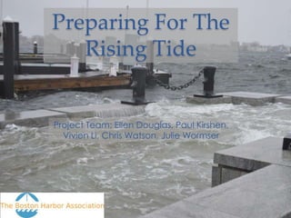
- 1. Preparing For The Rising Tide Project Team: Ellen Douglas, Paul Kirshen, Vivien Li, Chris Watson, Julie Wormser
- 2. Preparing For The Rising Tide • Maps Boston’s vulnerability to coastal flooding • Encourages public and private property owners to know and decrease their risks • Provides case studies with vulnerability assessments and preparedness plans.
- 5. Casino Pier, Seaside Heights Photo: Reuters
- 7. Breezy Point
- 9. Why Coastal Flooding Happens • “Wicked high tides” during full & new moons and/or • Storm surges and/or • Sea level rise
- 10. Boston New York
- 11. Boston New York
- 12. Storm Surge (feet) 100-, 500- and 1,000-year Surges New York City + Boston Harbor 12 10 8 6 4 2 0 New York City Boston Harbor 100 500 1000 Probability of Storm Surge (years)
- 15. Projected Sea Level Rise • Used range of “likely” to “possible” estimated sea level rise for planning • 2050: 1-2 ft. increase • 2100: 3-6 ft. increase • Estimates keep going up, not down. Source: IPCC September 2013
- 16. Today’s High Tide + 2.5 ft.
- 17. Today’s High Tide + 5.0 ft. Could High Daily flood Current Annual Tide by 2100 nearly 7% of 100-Year Flood by 2050 Boston Flood
- 18. What Floods at High Tide+5?
- 19. Today’s High Tide + 7.5 ft. Could Flood Annual 100-Year Over 30% Flood by Flood around of 2050 2100 Boston
- 20. What Floods at High Tide + 7.5?
- 22. Municipal Actions: Climate Ready Boston • Completed municipal vulnerability assessment; • Preparing project review guidelines for new developments; • Developing wetlands ordinance; • Distributed homeowner flood protection information; • 2014 updated Climate Action Plan will focus on preparedness.
- 23. Private Sector Actions • Need to develop vulnerability assessments and time-phased preparedness plans. • Need to incorporate these plans into regular maintenance schedules. • Need to work with public agencies and utilities to protect infrastructure.
- 25. What is vulnerable now?
- 26. When will there be flooding?
- 27. “Living With Water” • Favor “resilience” over “resistance” where possible. • Elevate vulnerable resources, pair with floodable areas. • Favor flood control solutions that enhance livability.
- 28. Spaulding Rehab Hospital Mechanical, electrical and emergency services on roof out of harm’s way Key floors above 2085 High Estimate 100 Year Flood Operable windows keyed open in event of systems failure Critical patient programs above ground floor
- 29. Living With Water: Seoul, South Korea Cheong Gye Cheon Channel
- 30. Living With Water: Seoul, South Korea Han River
- 31. More Ideas
- 32. Summary of Findings • Today’s 100-year flood could be 2050’s annual flood and 2100’s high tide. • Property owners need to develop time-phased preparedness plans • Policy makers need to help property owners overcome barriers, help when private action is insufficient.
Editor's Notes
- Preparing for the Rising Tide is a report about increasing Boston’s resiliency to potential flooding and preparing for the future of climate change
- Its about improving our ability to rebuild and recover quickly and efficiently so that we are prepared for the changing climate, and the extreme weather events it will bring. Such as Superstorm Sandy, which was 3 times the size of an average hurricane when it hit the East Coast last October.
- Its about rethinking and redesigning critical infrastructure so that entire communities are not cut off from the rest of us when disasters occur. Highway 12 is the main artery on the Outer Banks and, other than a growing ferry system, is the only way to reach the mainland.
- Its about protecting our cultural icons so they can be enjoyed by future generations. The Jet Star Roller Coaster was built on Casino Pier in 1960 and was a favorite of Jersey Shore tourists for over 50 years.
- Its about improving the infrastructure of our commercial and financial centers so that future storms and floods do not cripple our ability to move people or conduct business. Hurricane Sandy left parts of Manhattan without power for up to a week, stripping the city of its natural hustle and bustle.
- But most importantly, its about us, and about where we live. Its about developing and implementing smart and common-sense preparedness plans that are cost-effective, inclusive and flexible so we can move forward in the face of climate change, we can live with extreme weather, and we can protect who and what we love.
- This map shows flooding 2.5 ft. above the average high tide. This scenario is currently limited to minor flooding of streets, buildings and infrastructures near the waterfront.It is also roughly equivalent to the flooding Boston experienced during the mid-day high tide on October 29th, about 5 ½ hours before Sandy’s maximum storm surge arrived. Unlike in New York, where Sandy’s storm surge arrived during a full-moon high tide, the surge arrived in Boston very near low tide. To an onlooker standing near the waterfront, Sandy’s storm surge probably looked similar to another daily high tide. There’s roughly an 8 foot difference between high and low tide in Boston, so Sandy’s approximate 9-foot storm surge was largely swallowed up by the outgoing tide.However, had the surge arrived during high tide, look to New York as an example of what could have happened. The flooding would have been much more severe.AND NEMO! Both cases at Low Tide.
- This map shows a few events that are all roughly equivalent.Today’s High Tide plus 5ft.Hurricane Sandy’s flooding had it hit at high tideThe flooding from an annual storm by 2050The twice daily high tide by 2100Repeat that – The flooding from today’s 100 year storm, could happen twice a day by 2100.There is widespread flooding through South Boston and along the waterfronts of East Boston and Downtown. Flood waters are actually reaching through Quincy Market and up to Government Center. Morrissey Blvd. is flooded as well, completely cutting off access to UMass Boston.MHHW +5 – 6.6% of Boston65% of Seaport Innovation District20% of South Boston15% of the North End, East Boston10% of Downtown
- Picture Series:Innovation DistrictBayside Expo at UMass BostonFort Point ChannelGillette World Shaving HeadquartersCharlestown Navy Yard (USS Constitution)Flooding thru Quincy Market toward Govt. CenterLarge Properties at +5 ft.Charlestown Navy Yard, UMass Boston Bayside Expo Center, Gillette HeadquartersHistorical Districts60% Seaport Innovation District20% South Boston15% North End, East Boston10% Downtown thru Quincy Market
- Picture Series:Logan AirportConley TerminalNE AquariumSouthie (shown on St. Patrick’s Day)Eastie (shown on last year’s Columbus Day Parade)Large Properties at +7.5 ft.Logan, Conley Terminal, NE Aquarium, Convention CenterHistorical Districts80% East Boston60% South Boston, Charlestown, North End50% Allston/Brighton, Downtown90% Fenway, Back Bay, South End40% Beacon Hill, Longwood Medical
- From the Mayor’s Press Releasehttp://www.cityofboston.gov/news/default.aspx?id=5959
- For Boston to start putting the rhetoric and the reports into action, we are encouraging property owners and public agencies to conduct “vulnerability assessments” of buildings and infrastructures. They’re common-sense appraisals of how a building or infrastructure is prepared to handle severe weather and flooding under current conditions and how easily it can be adapted to changing and uncertain future conditions. Our report contains case studies and vulnerability assessments for a two areas of Boston – the Boston Marriott Hotel and the area surrounding UMass Boston. The preparedness plans we developed for our report are designed to be implemented over time as sea level increases. Phased planning are linked to sea level elevation thresholds, not time, which means they can be managed more effectively and can adjust for future uncertainty.
- Map of Marriott
- Regional Plans – The goal is for individual property owners to understand the specific vulnerabilities affecting their buildings or structures and take the steps necessary to mitigate those. At a certain point, however, the flood waters begin to affect the entire region, by limiting or cutting off access for example. In these instances, it is essential for groups of owners, say around Long Wharf, to develop a collective plan that can keep their buildings available and accessible during flood events. Soft measures such as floodable channels or hard measures such as parapet walls are examples of how flood planning can be adapted on a “neighborhood level.”
- Robustness with Flexibility – managing risk for something so unpredictable, expensive and potentially destructive as coastal flooding requires effective preparedness plans that can meet any future condition (are robust) and are able to change over time as new concerns arise (are flexible).Solutions should extend beyond flood control and across individual properties to include other benefits as well. Co-Benefit solutions incorporate flood-resiliency with other aspects of life, such as waterfront parks that can channel flood waters, or “floodable zones” along piers that are capable of taking on water during extra high tides. Co-benefit is about finding ways we can live with water without it taking away from our daily lives, or having major flood events costing high sums.Cities seeking to prevent flooding have built walls to keep water out. History, however, is riddled with failed dams and levees that have devastated entire communities. Resistance measures have struggled in the fight against nature. Instead, increasing resilience, or the ability for our city to recover quickly and inexpensively.
- The Spaulding Rehabilitation Hospital in the Charlestown Navy Yard is a great example of how climate change adaptation can be implemented in building management and the overall design of the property. Important mechanical, electrical and emergency services are located on the roof; key floors are located above 2085 100-year flood levels; critical patient programs are above the ground floor; surrounding property contains “floodable” landscaping.
- Floating pavilion in RotterdamIn the Rijnhaven in Rotterdam, a new, eye-catching structure has been erected: a complex consisting of three floating half-spheres. The structure is 12 metres tall, with a total floor area the size of four tennis courts, and is fully relocatable.ZandmotorThe Sand Motor is an innovative method for coastal protection. The Sand Motor (also known as Sand Engine) is a huge volume of sand that has been applied along the coast of Zuid-Holland at TerHeijde in 2011. Wind, waves and currents will spread the sand naturally along the coast of Zuid-Holland. Water plazas in RotterdamThese are plazas constructed below grade where excess rainwater from the surrounding area can be collected and stored temporarily. This will relieve the pressure on the urban water system and prevent flooding in the neighbourhood. Valencian beach boardwalk in Benidorm , Spain beautiful Valencian beach in Benidorm is backed by a OAB-designed boardwalk that also protects the avenue behind it from waves.