IG Route 66 Special Issue, vol. 1 - MRTraska, pt. 1
1. Illinois Geographical Society
uC",ION
,<-O~
~.•?'
Lake
Michigan
I
r
I nnl
r-----
I
I
I
I
I
I
I
I
I
I
I
I ( g! / WIll ! ! i !
I. i i ill
I
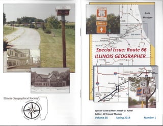
'Special Issue: Route 6~
ILLINOIS GEOGRAPHER 1
Cre"H'II ,,~ I
r
Special Guest Editor: Joseph D. Kubal
Editor: Jill Freund Thomas
Volume S6 Number 1Spring 2014
- J
2. The Illinois Geographical Society
The Illinois Geographical Society is an organization devoted to the
advancement and dissemination of geographic knowledge at all levels of
learning. Membership is open to any individual or institution with an interest ln
geography. Annual dues are $25.00 for individual members other than student
or retirees. $10.00 for students, $15.00 for retirees, and $25.00 for lnstitutlonnl
members. A supporting membership of $50.00 and a life membership of
$250.00 are available.
The Illinois Geographer is the official refereed journal of the Society. It I
published twice a year in spring and fall, and distributed to all member .•.
Editorial offices are at the Department of Geography-Geology, illinois 'it.lli
University, Normal, IL. Statements of opinion and fact by authors of nr tll hI •• 1111e1
book reviews do not necessarily reflect the official position of th(' ~()d(ty
Contributors should consult the directions provided on the lnsldt; hilI k IIIVIII
Address communications about membership, back issues, n<hhl1',O,IIII1I1
and other IGS matters to Susan Holderread, IGS Central ornUl Ill! 1111111,(.1111111 II ,. I
below). E-mail: holders@newtrier.k12.iI.us Back Issues om ilvlllhihlulIl ·,1111111.""
Executive Council Officers 2013-2014
President: Susan Holderread ('14)
New Trier High School
385 Winnetka Avenue
Winnetka, IL 60093
('111)
.dliJi)1
Normal, II II 1/(, 1
Secretary: Gregory Sherwin ('15)
Adlai E. Stevenson High School
Lincolnshire,IL 60069
Treasurer: Lon I:nlny (' I',)
Pekin Public '>('hlllll, 1/1111
501 Wllshlnl{l()l1 '>1111111
Pekin, IL 61554
Editor: Jill Freund Thomas ('14)
Department of Geography-Geology
Illinois State University
Normal, IL 61790-4400
Assistant Editor: Keith Scull
Sherman, IL 62684
Cartographer: Christopher Sutton
Western Illinois University
Macomb, IL 61455
Additional Members of Executive Council
Michael Sublett ('14) Tallia Del Bianco ('14)
Veronica Mormino ('15) Joseph Kubal ('15)
Ani Thompson-Smith ('1
Amy Bloom ('15)
Illinois Geographer
I Volume 56 Fall 2014 Number 1 I
Special Edition: Route 66
CONTENTS
Introduction and Forward:
Joseph D. Kubal, Special Guest Editor 1
Articles:
Why Route 66? The Indelible Appeal of America's Classic Road
Trip for Foreign and Domestic Travelers (part one)
Maria R. Traska . . . . . . . . . . . . . . . . . . . . . . . . . . . . . . . .. 4
The International Appeal of Route 66
John A. Jakie & Keith A. Sculle 18
A Case Study in Tourism: Towanda's Historic Route 66 Parkway Students,
Teachers, and Community Volunteers Preserve a Piece of the Mother Road
Fred Walk 24
A Case Study: Sprague's Super Service: Saving a Route 66 Icon
Terri Ryburn 31
Heritage Corridor Convention & Visitors Bureau Helps Preserve, Promote
Route 66
Robert Navarro. . . . . . . . . . . . . . . . . . . . . . . . . . . . . . . . .. 41
Book Reviews:
Markku Henriksson Route 66: A Road to America's Landscape,
History and Culture
Peter B. Dedek 51
John A. Jakie and Keith A. Sculle The Garage: Automobility
and Building Innovation in America's Early Auto Age
Ross M. Mullner. . . . . . . . . . . . . . . . . . . . . . . . . . . . . . . .. 54
3.
4. Mississippi, the East Coast to the Gulf Coast through the heart of the
continent, there would be no Route 66 as we know it. Downstaters will
hate hearing that, given how much they blame metro Chicago for
dominating state politics and sucking up most of the state's funding
(even though the metropolis also provides most of the state's tax base),
but it's true: take away Lake Michigan, the portage and Chicago, and
Illinois becomes ... just another Kansas or Nebraska. A landlocked rural
state with no major metropolis that draws in transportation, enterprise,
people, culture, jobs and money. Yes: Chicago is the big reason for
Route 66. There are excellent reasons the eastern terminus is there and
not elsewhere.
Actually, there are three reasons for Route 66, Chicago being the first
and greatest. The second reason is: Los Angeles. It wasn't just that the
nation needed a road to the West Coast. It had a few of those, though
they weren't very reliable. Specifically, it needed one from the country's
central transportation hub, Chicago, to southern California - one that
would stay open all year, instead of being closed during the winter as
many others were in the higher parts of the Rockies further north. Los
Angeles in 1920 was nowhere near as large or as fast growing as
Chicago, but it was no longer a sleepy little village founded by the
Spanish. It had oil, it had the budding movie industry - much of which
was abandoning New York and Chicago for a warmer climate and year-
round filming - and L.A., too, was growing rapidly. To connect these
two cities, the West Coast with the Third Coast, with a road that served
the growing tide of automobiles and trucks was a commercial necessity.
Sure, there was an overall need for road building and that new grid of
highways - especially in the West, where there were scarcely any roads
at all and rail was the only true connection to the rest of the country. But
this road, which would cross so many others through eight states, this
road would be special.
Without Chicago, there might or might not have been another route that
connected the Midwest to the West Coast; but had there been another, it
need not have started in Illinois, or even in St. Louis - it could have just
as easily started in Kansas City and continued through Wichita to
Albuquerque and thence to Los Angeles. And then it probably wouldn't
have become the iconic road that it did. And that leads us to the next
point.
The third reason is: Cyrus Avery, with the assistance of his junior man
John M. Page, and B.H. Piepmeier, with whom Avery and Page were
meeting on April 30, 1926 in Springfield, Missouri. It's true that
5
Avery's fellow entrepreneur and business acquaintance, John Woodruff
of Missouri, helped promote the idea of the angled southern route to
California; but it was Avery and Piepmeier, with help from Page, who
got it done through the Joint Board. All three were state highway
officials: Page was Oklahoma's chief highway engineer, and Avery was
head of the highway department and Page's chief; Piepmeier was
Avery's counterpart in Missouri. They were also members of the
American Association of State Highway Officials (AASHO), which in
November 1924 had called upon the U.S. Secretary of Agriculture to
form a Joint Board on Interstate Highways that would create and
promote "a system of numbering and marking highways of interstate
character." Avery and Piepmeier had both been appointed to the Joint
Board, as had other state highway chiefs from across the country; but
more important, both men were members of the board's Committee of
Five. That select quintet - together with engineer E.W. James, chief of
the federal Bureau of Public Roads' Division of Design - was charged
with developing the numbering plan for the system of interstate routes
that the Joint Board had created. They would number and thereby name
the new routes, eclipsing the named auto trails in the process.
Avery and Piepmeier were the two main supporters ofthat curving line
between Chicago and L.A. Nobody on the Joint Board disputed the need
for this southern route. All the major east-west cross-country routes
proposed were two-digit numbers ending in zero; their north-south
Figure 2: Original 1926 path of U.S. Route 66 was 2,448 miles long, but the total
changed with later alignments as highway was gradually detoured around cities' and
towns' main streets - a sometimes bitter irony for a road that began its life as the
Main Street ofAmerica, connecting the main streets of many towns across eight
states. (Map courtesy of National Park Service, U.S. Dept. of the Interior)
6
5. counterparts were odd-numbered and ended in 1. But in the center of the
map, in a place where there ought to be a line numbered 60 from
Virginia through the Appalachians and ending in California, there was
instead a line marked 62 - and it ended in Springfield, Missouri. The
number 60, in contrast, was emblazoned on Avery's swooping arc. The
Joint Board recognized that this angled road would cross many of the
transcontinental routes and therefore would inevitably be one of the most
heavily traveled routes in the system. Still, the numbering would cause
trouble.
The Joint Board completed its work in August of 1925 and sent its report
and the proposed map of routes to the Secretary of Agriculture; in
November, E.W. James reported on it at AASHO's next annual meeting,
in Detroit. Maps of the network were distributed to state highway
agencies through members of the Joint Board's regional groups, in the
hopes that they would limit the states' temptation to add roads (that
failed). Any adjustments to the proposed routes would be made by
AASHO's executive committee, on which both Piepmeier and Avery
served, before the system was approved. But the moment the maps were
released, the howling began.
Gov. William J. Fields of Kentucky, a good roads promoter, was a quick
and vehement critic; his state's prestige was at stake. A road he had
championed, the National Roosevelt Midland Trail, was not only
partially dismembered across more than one federal route as well as
stripped of its name, but it ended in Missouri and wasn't even a major
route with a zero. Worse, Kentucky was also denied a major north-south
route because the Dixie Highway had been split. That meant a potential
loss of travelers. Fields was incensed, and he knew who to blame:
Chicago. Not only did the Committee of Five have Avery and
Piepmeier, it had a third Midwesterner, Frank Sheets of Illinois, who also
happened to be AASHO president in 1925. Gov. Fields thought he
smelled clout and conspiracy (he was wrong).
Furious, Fields announced on December 8, 1925 that Kentucky would
ignore the route numbers. "Chicago influence is written all over the
map. All east and west traffic is routed north of the Ohio," he charged.
"The north and south roads, too, are gauged for Chicago benefit and that
of the northwest alone .... I will use every means in my power to fight
this." (Remember that after the Louisiana Purchase, Illinois had been
considered part of the 'northwest' territories; evidently, Fields still
thought that was the case.)
7
The embarrassing truth was that Kentucky's own delegate, State
Highway Engineer E,N. Todd, had been at the regional meeting in
Chicago when Kentucky's main routes had been identified, and he'd had
no objections. Indeed, he thought the named trails were outmoded,
archaic holdovers from a past era that deserved to die (he was right, but
that was inconvenient). Worse, Todd had agreed to the numbering plan
at AASHO's last meeting in Detroit. Even worse, had he wanted to
protest the proposed routes - and he didn't - he wouldn't have been able
to vote against them because the state hadn't paid its $200 annual dues to
AASHO.
The debate went on for months. Proposals and counter proposals were
rejected by either Piepmeier, Fields or both, with Avery siding with
Piepmeier. By April 1926, it was the last matter left to be decided by the
AASHO's executive committee, which had resolved 79 complaints about
the route plan during its previous annual meeting and would handle more
than 60 additional potential adjustments between then and the next
meeting in November.
The pressure was on to settle the matter. Without that, the Bureau of
Public Roads couldn't respond to the public demand for maps of the new
system. That was why Avery and Page were in Springfield with
Piepmeier on April 30th: they had to find some resolution to the
dilemma, and fast. And that was when Page - the minor player whose
role is usually overlooked -- cleverly noticed that among the still unused
route numbers was 66. What about that? Avery and Piepmeier, who
decided 66 had a nicely memorable ring to it, seized on it and
immediately telegraphed Chief MacDonald: "We prefer 66 to 62."
Kentucky agreed. And that was that.
This is why some people say that Route 66 was born that day in
Springfield, Missouri; but in truth, it was a christening before the birth.
The route's path had been conceived months earlier, but simply agreeing
on a name didn't bring it into existence. Avery, Piepmeier and Page
were three godfathers still awaiting the arrival of the godchild. Unless
the AASHO members approved the proposed federal highway system at
the next annual meeting, all that work would go for naught. As in zero.
Aborted.
The trail associations certainly would have preferred that. They wailed
about how cold, soulless numbers would displace hallowed historic
names, deleting all the romance from the roads. The truth was that most
8
6. of those named trails weren't all that historic, and they weren't so
romantic. By 1920, the vast majority of named trails (a few hundred)
were barely 10 to 15 years old, invented during the 1900s and 1910s, and
their 'romance' was mostly hype. They were auto roads that had been
created on paper by private groups, who then solicited funds from
merchants along those paths and promised to promote the trails to
travelers. True, a small handful were based on actual historic stagecoach
roads or wagon trails, such as the Cumberland Trail, the Oregon Trail,
the Chisholm Trail, the Santa Fe Trail and EI Camino Real; but most
auto trails had no particular logic to them, save to favor the merchants
who could be galled into supporting them.
Unsurprisingly, the named auto trails were typically not the most direct
routes to wherever automobile drivers wanted to go. Most trail groups
didn't do much beyond trying to create publicity. They were primarily
formed to make money for their originators and commercial supporters,
although some were also helpful to drivers. However, too many trail
associations were fly-by-night operators who promised much, then
pocketed the money and vanished. Most did little, if anything, to
physically improve the trails. Even the best known group, the Lincoln
Highway Association, conceded that traveling down the auto trails was
still a "sporting proposition" - in other words, at best they were a chore
and at worst, an abysmal hardship.
It was precisely because the trail associations had failed the public once
too often that state highway officials couldn't wait to dump them. There
was also the fact that named trails were too difficult for travelers to
follow, highways all over the country were in terrible shape, many
Western states were still too sparsely populated to have a tax base that
could support public improvements, and the federal government was the
only entity in a position to put together and oversee a truly national
network of reliable roads. Free-marketers, please note: privatization had
failed miserably in providing infrastructure, a public necessity for the
general welfare of the citizenry - and the states had to turn to the federal
government to provide what the capitalists would not, because the latter
were busy making money, which, after all, is their natural reason for
being. What delicious irony. And what all of that did was to
demonstrate the need for more federal involvement in road building.
Particularly west of the Mississippi, all but a handful of auto trails were
dirt roads, and some were so crude or in such disrepair as to be truly
perilous to travel. The new federal routes would not only strip these
9 10
roads of their names and the trail associations of their power, it would
help the states replace the dirt trails with paved roads - not just with
macadam, a kind of layered crushed rock that was okay for horse-drawn
buggies but murder for motor vehicles, which quickly destroyed it, but
with something more heavy duty, like concrete, that could stand up to
heavier vehicles and steady traffic. Moreover, the Bureau of Public
Roads would assist the states not only with money but with expertise: it
would provide and disseminate research that would help build better,
more durable roads. No wonder state engineers couldn't be rid of the
auto trails fast enough.
That was why on November 11, 1926 at its annual meeting in Pinehurst,
North Carolina, the members of the AASHO approved the U.S.
Numbered Highway System, better known as the U.S. Route System.
The executive committee had made 132 changes in routing or
numbering; the final system size had expanded to a total 96,626 miles,
nearly double what the Joint Board had proposed. Just as important,
AASHO had also approved a uniform system of traffic signage and
standardized colors, which would help guide travelers on the nation's
roads - resulting in the road signs weze-use today - as well as a
distinctive shield sign for the new U.S. Route System.
Meanwhile, even before the Joint Board had met, Frank Sheets of Illinois
had been a prolific road builder in his state, using mostly funds from
state bond issues plus a bit of
the federal aid available during
the early decades of the 20th
century - and one of the major
roads he had completely paved
was the old stagecoach road
from Chicago to St. Louis, later
known as the Pontiac Trail and
by 1924 known as SBI 4 or IL
Route 4. IL 4 connected to
,~ •••
_ ••..••••••.•.•••.•,._ ••M'_k_"'__ ••• •
_,DMlfIooI ••••• III •••.•••••.• otL •••• ;.l916b<lOi<i6_ @I>"f•• h •••• """""..-:Illloil .••••••••,•••••.••.• l.fJ»~~~ 6·
:.=:~:.;:.:r~~!'l!6~~~ <,I
.
Figure 3: A map of Historic Route
66 in Illinois is seen on the back of
an information hub installed by the
Illinois Route 66 Scenic Byway.
(Photo J.D. Kubal. 2013.
7. Ogden Avenue near Berwyn and Lyons and proceeded southwest
through Bloomington-Normal, Springfield, and Edwardsville before
ending on a bridge across the Mississippi River to st. Louis. U.S. Route
66 was overlaid onto two major Chicago thoroughfares - Jackson
Boulevard and Ogden, which in places was a de facto boulevard several
lanes wide - and IL 4. Because Chicago was Route 66's eastern
terminus, Route 66 was born there.
On November 11, 1926, the day the route system was approved, Route
66 was alive and kicking and open for business, starting at Jackson
Boulevard and Michigan Avenue and headed west. By the end of the
year, only 800 miles of the route in eight states was paved - and half of
those were in Illinois, where the route was 100 percent complete from
the start. It was a smashing achievement - of which the state could be
duly proud, thanks to Sheets - and a pointed example to the western
states of what they still needed to accomplish.
Why did people travel Route 66?
So, then: what attracts people to historic Route 66? To answer that, we
should examine what brought them to U.S. Route 66 in the first place.
The first and most obvious reason was that unless people wanted to take
the train and be bound by railroad schedules, Route 66 was the most
practical alternative for getting from Chicago to Los Angeles and points
in between, some of which weren't well served by rail. Better weather
and better pavement were two big incentives. Even though it took 12
years for construction to be completed all along the rest of route, Illinois
gave drivers a real, concrete example of what they might find elsewhere
on the route once it was completely paved. Meanwhile, the route was
already largely in place in Missouri, and farmers from Kansas, Missouri
and Illinois could use it to get their grain and produce to market in
Chicago.
Make no mistake: the route system wasn't devised primarily for leisure
travelers. Neither the states nor the federal government would have
spent that much money on infrastructure for pleasure drives - they spent
it for commerce first and foremost. Rail traffic couldn't handle all ofthe
freight demand, and the number of trucks on the road had increased
significantly by 1920. Trucking was competing with rail as an efficient
way of moving goods, especially on a local and regional basis. Tourism
was a secondary concern, despite the lobbying efforts of the bicyclists,
the Good Roads movement, and the offended Gov. Fields.
11
So: the trucks took to the new routes because they had to, for practical
reasons. Individual tourists also took to the new routes, not just to drive
on a better road surface and be free of the congestion of the cities, but
also to be free of the railroads, their costs, and their limitations. People
today underestimate just how much the American public during the
1890s and early 1900s truly despised the railroads and the post-Civil War
robber barons who ran them. Americans considered the railroad owners
a necessary evil at best and devils incarnate at worst and didn't like being
beholden to them. The automobile, then, seemed to ordinary people like
a wonderful solution: no longer bound by rail routes and train schedules,
they could drive wherever and whenever they wanted, assuming there
was a road going there. Once there was a good road in the direction they
wished to go and it turned out to be reliable, drivers flocked to it. And
once there was regular car traffic on a road, the services that drivers
would need - gas, auto service and parts, food, lodging - also sprang up
as local operators saw a chance to make a little money.
But why would tourists choose Route 66 in particular? Because Cyrus
Avery sold them on it. Ifhe's known today as the father of Route 66, it's
less because of what he did to push for its creation than what he did after
it was born. Once the route system had been established, Avery's pet
project was still far from realized. Now the real work began - bringing
travelers and their dollars to the new route, so that the rest of the road
could be built. There was only one thing to do: sell the hell out of Route
66.
WHt fOO",. 'fl,Q""W~f Ml Otijlo'Htl <'4W.t>H _ClUff
12
Avery immediately formed
the U.S. Highway 66
Association, based in Tulsa,
to promote Route 66 and get
it completely paved. The trail
names faded soon enough,
Figure 4: The U.S. Highway
66 Association, organized by
Cyrus Avery, distributed
thousands of brochures like
this one as part of its
advertising campaign to
popularize U.S. Route 66
during the 1920s through
1960s.
8. and the route system had sounded a death knell for the trail associations;
but Avery followed their example and began to aggressively market the
route. The difference between the trail groups and Avery was that Avery
had something real to sell, and he promoted it in every way that he could.
For example: when in 1928 C.C. Pyle, the flamboyant sports promoter
and agent for athletes such as football player Red Grange, organized the
Great American Foot Race (dubbed the 'Bunion Derby' by clever
commentators), a cross-country marathon that would travel all of Route
66, starting in Los Angeles, Avery supported it. The benefit to Route
66? At every town where the runners stopped for the night, they were
met by various national celebrities, and the race garnered considerable
coverage in the press. Avery used advertising, too, in magazines,
newspapers and brochures and on billboards.
Route 66 was just as much a commercial highway as the rest of the route
system, but it was never marketed that way. The rest ofthe system might
have been a workaday blue collar road, but Route 66 was a prom queen:
lovely and full of promise. From the start, Avery made much of the
impressive landscapes to be seen along the route - not just the big cities
of Chicago and St. Louis, or the Illinois prairie and rolling hills of
Missouri, but also Meramec Caverns and the great Mississippi River; the
Indian lands and oil fields of Oklahoma; the grasslands of northern
Texas; the mesas, missions, mountains and pueblos of New Mexico; the
petrified forest, painted deserts, Meteor Crater and Grand Canyon in
Arizona; and the Mohave Desert and Joshua trees of southeastern
California.
And then there was Celebrity. Pizzazz. Glitter. The dawn of the movie
age during the early 20th century brought with it movie stars and film
fans, and the fans wanted to see Los Angeles because that was where the
movie business was now centralized and, thus, where the stars lived.
Moreover, unless the celebrities took the California Limited (later the
Super Chief, which debuted in 1936), those same stars also had to drive
down Route 66 - and if a traveler was very lucky, he or she might get to
stay at the same motel or inn where, perchance, Buster Keaton, or Mary
Astor, or Clark Gable and Carole Lombard had stayed. Such a thrill.
Route 66 was thus sexy in a way that other roads could never match.
You can be sure Avery worked that angle, too.
In Illinois, there was an additional reason for choosing Route 66. Illinois
drivers already knew about IL 4, and there were already some traveler's
13
services established along the suburban and rural sections of the route.
More would be established as the traffic grew.
One example in the greater Chicago area was White Fence Farm in
suburban Romeoville, still a popular restaurant today. It had been
opened during the early 1920s by Stuyvesant 'Jack' Peabody, the
Peabody Coal Company CEO and heir, who owned a thoroughbred horse
farm across Joliet Road from the restaurant. Although he lived in the
city, Jack Peabody frequently had weekend guests and visitors at the
farm, typically fellow horse owners and breeders (his farm also boarded
and trained horses for other owners, and there was a full-sized timing
track on the south side of Bluff Road, so that Jack and his friends could
Figure 5: An aerial view of White Fence Farm, shot in 1939, shows the restaurant
property on the west side of Joliet Road/U.S. Route 66 (above) and the paddock and
horse barn of Stuyvesant 'Jack' Peabody's thoroughbred horse farm, Arrow Brook
Farm, on the east side of the highway (below). (Photo courtesy of the Illinois Digital
Archive)
judge their horses' speed and fitness for racing in relative privacy, away
from potential rivals' eyes).
Peabody needed a place large enough to feed all those guests, so he
opened a farmhouse-style restaurant on 12 acres that he owned across the
road. He was also a businessman, however, and figured that people
would enjoy really good, simple food in a pretty farm setting. He was
proven right: White Fence Farm quickly became a popular dining spot
14
9. with locals and travelers alike, attracting more than 40,000 guests during
its first four months of operation with its wholesome menu of beefsteak
hamburgers, sandwiches, ice cream and other dairy products made from
local Guernsey milk. By the time Route 66 was official, the restaurant
was already well established and gaining fame; for example, it was a
favorite of famed restaurant critic and travel writer Duncan Hines, who
reviewed it several times over the years. The word spread: White Fence
Farm became a welcome stop on the road to St. Louis and beyond. Nor
was the Farm the only well-known stop in Illinois.
III
Use ofthe full range of mass media was key to publicizing Route 66.
Avery's efforts through the U.S. Highway 66 Association were critical
during the first 13 years of Route 66's existence. Radio gradually
became a more important communications medium through the late
1920s and 1930s, and it, too, became a factor in publicizing Rou~ ~~4.
The publication ofJohn Steinbeck's novel The Grapes ofWratJyfn.ifi't1
quick translation to the silver screen that same year further cemented the
image of Route 66 in the public mind. After WW II, most Americans
still had never seen the natural wonders of the Western U.S., and Route
66 caught the public's imagination. Post-war automobile advertising
encouraged Americans to "See the U.S.A. in your Chevrolet" and
promoted the idea of auto travel, as did 'road' books such as Jack
Kerouac's On The Road and Steinbeck's Travels With Charley. Newly
prosperous Americans responded and took to the road with relish.
But the greatest publicity was undoubtedly provided by popular music
recordings and television. Bobby Troup's 1946 tune "Get Your Kicks
On Route 66," actually written on the route as he and his wife drove to
Los Angeles so that he could begin working in the music industry there,
was recorded by Nat 'King' Cole's trio less than two weeks after Troup
arrived in L.A. and became an instant hit on the pop charts, spawning
hundreds of other recordings over the years by other artists. By the time
writer and producer Stirling Silliphant's television drama series Route 66
debuted in 1960 on CBS, Route 66's popularity had peaked, and it had
blossomed into that most American of all road trips. It had become an
icon and a dream trip - one that didn't fade when the route was
decommissioned during the 1980s.
15
Maria R. Traska is an independent journalist, author, policy analyst and
blogger who is currently at work on The Curious Traveler's Guide to
Route 66 in Metro Chicago. She is also the editor and major contributor
to the CuriousTraveler66 blog and is developing Curious Traveler Tours,
a specialized guided tour service that will highlight the northernmost
section of Illinois Route 66 between Chicago and Joliet.
Selected Bibliography
Avrami, Erica, et aI., Route 66: The Road Ahead (symposium report), World
Monument Fund, New York: December 2013 (ISBN-I0: 0-9858943-5-0, ISBN-
13: 978-0-9858943-5-1)
C.C. Pyle biography, Great America Foot Race website, last accessed October
2014 at: http://archive.itvs.orglfootrace/progress/ccpyle.htm
Cyrus Avery biography, University of Virginia website, accessed June 2014 at:
http://xroads.virginia.edu!~UG02/camey/avery.html
Cyrus Avery entry, Wikipedia; last accessed October 2014 at:
http:// en.wikipedia.orglwiki/Cyrus _Avery
C.C. Pyle entry, Wikipedia; accessed June 2014 at:
http://en.wikipedia.orglwiki/C._C.]yle
Hobbs, Allyson, "Bicycling," Encyclopedia of Chicago online; accessed June
2014 at: http://encyclopedia.chicagohistory.orglpages/136.html
Listokin, David, et aI., Route 66 Economic Impact Study, three volumes, Center
for Urban Policy Research, Rutgers University, New Brunswick, NJ: 2012
(ISBN-I0 0-9841732-3-4, ISBN-13 978-0-9841732-3-5
Loerzel, Robert, "In 1890s Chicago, bicycles were all the rage," Chicago
Tribune, May 3,2014; last accessed October 2013 at:
http://articles.chicagotribune.com/20 14-05-0 3/news/ct -bicycle-craze- flashback-
0427-20140503 _1_ bicycles-bikes-cyclists
Marriott, Paul Daniel, "Roads Designed For Pleasure: A Brief History of the
Origins of Scenic Driving and Automobile Touring in the United States (Part
1)," Journal For America's Byways, Vol. 1, No.1, June 2011, America's
Byways Resource Center, Duluth, MN; pp. 4-25
Marriott, Paul Daniel, "Roads Designed For Pleasure: A Brief History of the
Origins of Scenic Driving and Automobile Touring in the United States (Part
16
10. 2)," Journal For America's Byways, Vol. 1, No.2, October 2011, America's
Byways Resource Center, Duluth, MN; pp. 28-51
Overwhelmed America: Why Don'! We Use Our Paid Leave? (survey report
PDF), Travel Effect report card, August 2014, U.S. Travel Association,
downloaded from: http://www.TravelEffect.com/
PIous, F.K., "Why do Europeans tour Illinois? To see our old-fashioned travel
culture," Midwest High Speed Rail website, guest blog posted November 7,
2011; accessed September 2014 at: http://www.midwesthsr.org/why-do-
europeans-tour-ilIinois-see-our-old-fashioned-travel-culture
Press release: "Route 66, Midwest culture charm international tourists, study
finds," University of Illinois at Urbana-Champaign, October 21,2013; accessed
August 2014 at:
http://news.illinois.edulnewsI1311021route _66_ZhuoweiHuang_ Bruce Wicks.ht
ml
Ray, Rebecca, Sanes, MilIa and Schmitt, John, No-Vacation Nation Revisited
(survey report), Center for Economic Policy and Research, Washington, DC:
May 2013; http://www.cepr.netl
U.S. Highway 66 Association entry, Wikipedia; accessed October 2014 at:
http://en. wikipedia.orglwikiIU .S._Highway _66_ Association
Vogel, Andrew (Kutztown State University), "Hamlin Garland's Roads, the
Good Roads Movement, and the Ambivalent Reform of America's Geographic
Imagination," Studies in American Naturalism, Winter 2010. Vol. 5, No.2,
pp.II-132
Weingroff, Richard S., A Vast System of Interconnected Highways: Before the
Interstates (PDF), downloaded from the USDOT Federal Highway
Administration website at: http://www.ihwa.dot.gov/infrastructure/
Weingroff, Richard S., "Ask the Rambler: Why Do People Like to Drive for
Pleasure?" USDOT Federal Highway Administration website; accessed July
2014 at: http://www.ihwa.dot.gov/infrastructure/scenic.cfm
Weingroff, Richard S., "From Names to Numbers - The Origins of the U.S.
Numbered Highway System," USDOT Federal Highway Administration
website; accessed June 2014 at:
http://www.ihwa.dot.gov/infrastructure/numbers.cfm
17 18
The International Appeal of Route 66
John A. JakIe and Keith A. Sculle
Over the past several decades, America's Route 66 has resonated
strongly overseas, not just with auto and motorcycle enthusiasts, but with
the general public as well. In the United States today.the nation's
highway and roadside history - at least from the 1926s through the 1950s
-loads on this one roadjransformed into a kind of cultural memory.,
Celebrated is the freedom of the open road when Americans relished
escape into the transient world of motoring, not just to see their country
close up, but in ways that are fundamentally uninhibited. On the
American roadside, individuals could shed many of the inhibitions of
home, seek highly personalized experiences, and then return home to
normal routines, remaining largely anonymous throughout. It was an
important kind of freedom. It spoke of liberation.
But what of Europeans?
There's good reason to wonder about European visitors' interest in Route
66. A 2011 Route 66 Economic Impact Study conducted by Rutgers
University found that survey respondents - who were queried on the
route, by the way - included travelers from all 50 states and 40 foreign
countries. Foreign visitors made up 15.3 percent of respondents, but the
real figure could have been even higher because the survey form was
printed in English only. The majority of foreign visitors among the
respondents were either Canadian or European. Of the European-based
respondents, most came from the United Kingdom, Germany and the
Netherlands. Visitors/respondents who came the furthest distance were
from Australia and New Zealand.
So what tempts Europeans to visit Route 66? If it's simply the desire for
a road trip or a fast road, there's always the Autobahn. No, it's the
particular freedom of the road, the unique experiences and the specific
landscape here - which is so much bigger than anywhere west of Russia.
Europeans have endured more restrictions at home, more so than
Americans, especially Eastern Europeans who were trapped behind the
Iron Curtain before it fell in 1989. Certainly, the experience of the open
road was much different in Europe, where one ran into a frontier or
border crossing in a matter of hours by car or train and the highways
enabled one to travel but offered much less in the way of intervening