1. Hokkaido
Island
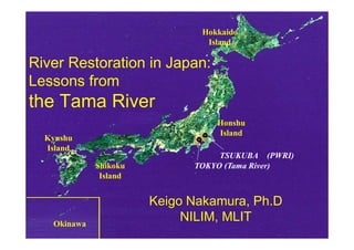
River Restoration in Japan:
Lessons from
the Tama River
Honshu
Island
Kyushu
Island
TSUKUBA (PWRI)
Shikoku TOKYO (Tama River)
Island
Keigo Nakamura, Ph.D
Okinawa
NILIM, MLIT
2. Contents
Japanese nature and rivers
River restoration in Japan
River restoration in the Tama River
3. General Characteristics of Japan
Japan’s total area: 377,815 km2 (Ger.357,000km2)
Total Population: 127,740,000 (2006)
Mountains (Forest) account for about 71% of
Japan’s total land area.
The islands of Japan lie in the temperate zone and
northeast end of the monsoon area.
The annual average rainfall is 1,700 mm/year.
Earthquakes and Volcanoes
4. Topography
Geography of Rivers
Rhine River
Longitudinally steep
Joganji River
High Sediment yield
Abe River Shinano River
Elevation (m) Roire River
1,000 Joganji River
Abe River Tone River
800 Colorado River
Chikugo River
600
Yoshino River Seine River
400
Kitakami River Mekong River
200
0
0 200 400 600 800 1,000 1,200km
Distance from river mouth (km)
7. 75% of Japanese Assets on the
Floodplain
FP
10
50 FP 75
FP
Area Population Assets
8. Anthropogenic Impacts
Anthropogenic Impacts on
Rivers are enormous (Yoshimura. et al)
23.5 % of river banks are artificial
2,675 dams (>15 m) have been constructed
http://www.hakkenden.net/hokuriku/a-
toyama/anabatoyama.htm
9. Not only safe, but also nature
Number of
Nos. of victimes and restoration works
10000
Restoration
1000 victims due to
100 flood has
10
Victims of decreased in the
flood
1
last 50 years.
1945 1955 1965 1975 1985 1995
Nos. of victims due to flood, sediment,
River restoration
and volcanic disaster
Nos. of Nature-oriented river works increases since
1990
11. History of River Environment
~1960s economic growth and pollution
1970s countermeasure for Pollution
:Basic Law for Environmental Pollution
Control was enacted after Minamata
disease, Yokkaichi asthma, etc.
1980s Dawn for river environment
1990
Nature-oriented river works
12. River Restoration is rapidly
increasing since 1990.
Accumulative number of river restoration projects
30000
Over 28,000 projects
20000 (~37,000 in the US)
10000
0
91
92
93
94
95
96
97
98
99
00
01
19
19
19
19
19
19
19
19
19
20
20
13. Agenda for river restoration
Balance flood control and conservation
Loss of wetland in watershed (60%)
Stable flow regime, loss of dynamics
Loss of gravel river bed (sediment yield)
Loss of Ecological network (e.g. fishway,
reconnection with paddy fields)
24. River Ecology Research Group
Interdisciplinary association of ecologists,
civil engineers, and river managers
founded by MLIT (river authority) in 1995
Study at six rivers: Tama, Chikuma, Kizu,
Kita, Shibetsu, and Iwaki rivers
25. The Society of Ecology and Civil
engineering
Academic society established in 1997 to
support applied and practical studies
Journal “Ecology and Civil Engineering”
Keynote in 2006
28. Outline of the Tama River
Length: 136km
Basin area: 1,249 km2
Source: Mt. Kasatori, 1,941 m
Population: 4,400,000
Visitors: 22,000,000 per year
Over 200 NGO groups
29. Tama River is a top runner for
River Environment in Japan
NGO for the Tama River environment was
founded in 1970.
River env. division was established in the
Tama River authority in 1975.
Tama Riv. Env. Management Plan was
published in 1980.
30. River Ecology Research started
at the Nagata area in 1995.
Nagata area
Slope: 1/330
Sediment: 35 mm
Q=2m3/s
MHQ=620 m3/s
gravel-bed river on
the alluvial fan
Photo: Keihin river office
31. Research Group stimulated the
restoration project.
Research group started meeting with citizens
since 1997.
People realized the necessity of restoring
gravel-bed river though the meeting.
Gravel-bed river restoration also fitted the needs
of river authorities for flood control.
Discussion has started for the restoration in
1999.
38. Irreversible impact of gravel mining
at the incised reach
160
Sediment fills
Time interval between lines: 96 years
Riverbed elevation in 1923
only upstream of
Average bed elevation (m)
150
624 years
140 Ozaku weir
48 years
Nagata area
Hamura weir Kabe district No recovery with
130
Nagata
district Narrow
section
the incised channel
120
Groundsill
(Hattori et al. 2003)
110
50 52 54 56 58 60 62
Longitudinal distance (km)
→ Channel widening is necessary for restoration
to reduce the tractive force.
39. Sediment supply to restore
the fluvial system (Hattori et al. 2003)
Shields number at the Top bar Bar
Shields Number at the Topofof Bar
Shields Number atthe top ofBar
116 0.14
0.14
116
116 Water Level atat AverageAnnual
Water Level atAverage Annual
0.14
Riverbed Slope Changes
Shields Number atat thetop ofofbar
Water Level Average Annual
Maximum Discharge
Maximum Discharge
Maximum Discharge 0.12 1/350→1/250
Shields number the Top
115
115 0.12
115 Before
Before 0.12
Critical Value of
Critical Value ofof
Just After
Just After Critical Value
Excavation
Excavation Common Reed Destruction
Common Reed Destruction
Excavation
Excavation 0.1 Common Reed Destruction
0.1
Elevation (m)
114
Elevation (m)
114
114 0.1
Excavation +
113
113
113 Increase of 0.08
0.08
0.08
Riverbed Excavated Area
Excavated Area Channel Widening
112
112
112 Slope Bar
Bar
Bar 0.06
0.06
0.06
Before Excavation
Before Excavation
Before Excavation
Just After Excavation
111
111
111 Riverbed Slope Changes 0.04
0.04
0.04 ExcavationExcavation of
Just After + Incarease
1/350→1/250 Riverbed Slope
110
110
110 0.02
0.02
00
0 50
50
50 100
100
100 150
150
150 0.022 4 6 8 10
Transversal distance Left Levee(m)
Transversal Point on (m) Levee(m)
Distance From the Starting distance (m) Levee(m)
Distance From the Starting Point on Left
Distance From the Starting Point on Left
22 44 66 88 10
10
Transversal distance (m) Occurrence period (year) (year)
Return Probability
Occurrence period (year)
Return
Occurrence Probability (year)
Probability (year)
Sediment supply is necessary to sustain gravel bed
41. Outline of the restoration
A工区
B工区
C工区
D工区 E工区
400m
Sediment supply River widening
1.7 km upstream Vegetation removal
(~21,000 m2)
42. Enlarged gravel river bed
Photos: Fukushima M, PWRI
2001 Sep 20 2002 Jul 5 2003 Aug 25
2004 Aug 4 2005 Jul 22 2006 Jul 28
43. Results: Gravel-bed restoration
Gravel-
Increased the number of plover
(Charadrius placidus), floodplain
grasshopper, gravel-bed plants (e.g. Aster
Kantoensis), benthic fishes.
Mitigation of river incision
44. Decision-
Decision-making processes
Interdisciplinary
Elicitation 1995-
research group
meeting, seminar
Demand Citizen 1997-
Tama River
Decision
Authority
Committee for
Strategy 1999-
restoration
consultation
Tama River
Implementations 2001-
Authority
47. Scientist should explain their
research results to local people.
Scientific and accurate information gives
great effect for decision making process.
Importance of sharing information and
enlightenment
48. Scientist should give quantitative
estimation as much as possible.
Gravel augmentation and that volume was
decided by large scale experiment.
River widening was decided based on the
calculation.
49. Scientist should publish the
results to multiple readers.
Books for citizens Reports for specialists
50. Thank you for your attention !
Nishizawa Valley in Yamanashi Pref.